SlideShare una empresa de Scribd logo
1 de 37
Descargar para leer sin conexión
Diverse Opportunities to Compile and Share Maps:
Lessons Learned through the Esri User Conference
               blah, blah blah…
               blah blah, blah


               Aileen Buckley, Alex Yule,
             Andrew Skinner, and Craig McCabe
                 Esri Mapping Center Team
                      @mappingcenter
The UC 2010 Map Extravaganza!


      Aileen Buckley, Alex Yule,
    Andrew Skinner, and Craig McCabe
        Esri Mapping Center Team
             @mappingcenter
Let’s start at the very beginning…
A plethora of maps…

•   Print                            • Online
        Pocket agenda maps            •   Map services
                                             p
        Large-format agenda maps
                f
                                                 • Cached map service for
        Education UC and Homeland                 each floor level
         Security Summit maps
                                                 • Integration with topo
        Lunch map p                               basemap service
        Image map*
                                       •   Application
        Hotel map**
                                               Room and Route Finder
        Hallway maps**
                                                 • Room finding functionality
        Downtown San Diego map**
         D     t     S  Di      **
                                                 • Routing service
                                                 • Bells and whistles
         * in production               •   iPhone (via ArcGIS.com)
         ** for 2011


                                                        Mapping Center Team
Why bother?
                                                          5
                                                          5”


                                     Persistent and temporary features/events


                                                                                Superflous detail
3”


                  Illegible labels                                                       Detail for
                                                                                      inaccessible
                                                                                            areas


      Illegible icons
More evidence against the state…
                                            11”


                                 Symbols not in legend
   8.5”


          Symbols not the same                           Colors not in legend
          size as in legend
Our solution…
Our solution…   Replace with different graphic
                from Andrew
A closer look…

      Numbers for persistent features/         Letters for temporary features/
                               events                                  events
                                                                                             Symbols explained in legend
                                                                                               y       p            g
                                                                                             (legend continued on second
                                                                                             page)


                                                                      No superflous detail


                                                                                                      Inaccessible areas


                              Legible labels

Legible icons
A closer look…
A plethora of maps…

•   Print                            • Online
        Pocket agenda maps            •   Map services
                                             p
        Large-format agenda maps
                f
                                                 • Cached map service for
        Education UC and Homeland                 each floor level
         Security Summit maps
                                                 • Integration with topo
        Lunch map p                               basemap service
        Image map*
                                       •   Application
        Hotel map**
                                               Room and Route Finder
        Hallway maps**
                                                 • Room finding functionality
        Downtown San Diego map**
         D     t     S  Di      **
                                                 • Routing service
                                                 • Bells and whistles
         * in production               •   iPhone (via ArcGIS.com)
         ** for 2011


                                                        Mapping Center Team
Old
• 3D (disorienting)
• Non-cartographic
• S h
  Schematic routes
           ti    t


New
• 2D
• Cartographic
       g p
• “Natural-walk” routes


                          Mapping Center Team
Demo: http://uc2010.esri.com/map
CAD → GIS
            CAD


                  Features


                             Attributes
Multiple buildings
    Marriott Hotel

                     San Diego Convention Center


                                                   Hilton Hotel
Multiple floor levels
         Level 1


                   Level 2 - Lobby


                                     Level 3


                                               Level 4
Multiple scales
        1:4,500


                  1:2,257
                  1:2 257


                            1:1,128
Making a Web map with ArcGIS Server


                         ArcGIS
                          Server
                                          Web
                                         Clients


Geodatabase   ArcMap
                          Map
                         Service
                                        ArcGIS
                                        Desktop
                                        Clients


                           Map
                       Service URL
The application

• Map functionality
     High quality
      High-quality cartography
     Locator map
     Legend
     Room levell toggle
      R      l    t    l
     Rich interactive Ux
• Room finding
             g
• Routing between rooms
   Humanized routes
   H
    Handicap-accessible option
       di            ibl  ti
   Route time estimates
Demo: http://uc2010.esri.com/map
Application

• Services
      8 Map Services
        •   1 per floor for UC maps (4)
        •   Labels
        •   Topo basemap
        •   Additions to topo basemap (hotels)
        •   Locator map
      1 Geoprocessing Service
        • Running off cartographic-quality 3D network
• Built with Flex 3, ArcGIS API for Flex 2
      Room finding
Old Network

• Routes to
  center of rooms
• Straight-line
  schematics
• Missing route
  segments
Building the new network…
Creating curved paths


                        Set arc endpoints
Set arc tangency
Densify!
Checking
connectivity
Routing Task
Network checker script
Viewable in ArcGIS for iOS
App flow

•   Rudimentary de-coupled, event-driven architecture, some
    model/controller/command elements
•   Classes
        Route C
               Command
                     d
          •   A command class to build, issue and handle the results from our magical gpp task
        StopsManager
          •   Parses the route segments into “stops” to display in the RouteNavigator using Floor/Building
              combinations
        MapViewController
          •   Listens for MapView events and responds by setting the map extent and active floor layer
        DrawRouteCommand
          •   Handles drawing the route segments on the proper floors, as well as route symbology (start, end floor
              transition points)
        FindRoomCommand
          •   Waits for a FindRoomEvent then zooms the map to the room passed by event data
                          FindRoomEvent,                                         event.data
        FloorManager
          •   Responds to FloorChangeEvents by setting the current floor and fading the overlay layer out and in to
              hide load delays
•   Components
        FloorChooser
        Legend
        LocatorMap
        RouteChooser
          •   Where you input your desired route or room to find
        RouteNavigator
                  g
          •   Displays the route “stops”
                                                                         …blah, blah, blah
Future work

• Link to conference agenda/personal scheduler
• Enhanced network
    Map of exhibitor space
    Exterior space (downtown San Diego)
    Time-sensitive routing
    Adding amenities

• Mobile client


                                           Mapping Center Team
Future work

• Link to conference agenda/personal scheduler
• Enhanced network
    Map of exhibitor space
    Exterior space (downtown San Diego)
    Time-sensitive routing
    Adding amenities

• Mobile client


                                           Mapping Center Team
Demo: http://uc2010.esri.com/map

Más contenido relacionado

Similar a Diverse Opportunities to Compile and Share Maps

Augmented Reality: A New Geovisualisation Method for GIS
Augmented Reality: A New Geovisualisation Method for GISAugmented Reality: A New Geovisualisation Method for GIS
Augmented Reality: A New Geovisualisation Method for GISSung Hyun Jang
 
Pactices of GPS/GIS in/for rural development
Pactices of GPS/GIS in/for rural developmentPactices of GPS/GIS in/for rural development
Pactices of GPS/GIS in/for rural developmentTakahiro Miyoshi
 
Geography in 21st century
Geography in 21st centuryGeography in 21st century
Geography in 21st centuryMani Singh
 
Gisruk2013 addy edit2
Gisruk2013 addy edit2Gisruk2013 addy edit2
Gisruk2013 addy edit2Addy Pope
 
Working with arcgis online
Working with arcgis onlineWorking with arcgis online
Working with arcgis onlinezmmin383
 
What's my geometry?
What's my geometry?What's my geometry?
What's my geometry?guest936551b
 
Arc gis desktop_and_geoprocessing
Arc gis desktop_and_geoprocessingArc gis desktop_and_geoprocessing
Arc gis desktop_and_geoprocessingEsri
 
2012 GISCO Track, Emerging Technologies for Field Data Capture, Bill Timmins
2012 GISCO Track, Emerging Technologies for Field Data Capture, Bill Timmins2012 GISCO Track, Emerging Technologies for Field Data Capture, Bill Timmins
2012 GISCO Track, Emerging Technologies for Field Data Capture, Bill TimminsGIS in the Rockies
 
Lightbox Product Roundtable
Lightbox Product RoundtableLightbox Product Roundtable
Lightbox Product RoundtableEDR
 
Vikas Arora - Microsoft Bing Maps - Locate. Integrate. Innovate. - Geomob May...
Vikas Arora - Microsoft Bing Maps - Locate. Integrate. Innovate. - Geomob May...Vikas Arora - Microsoft Bing Maps - Locate. Integrate. Innovate. - Geomob May...
Vikas Arora - Microsoft Bing Maps - Locate. Integrate. Innovate. - Geomob May...GeomobLDN
 
OrangeNXT - High accuracy mapping from videos for efficient fiber optic cable...
OrangeNXT - High accuracy mapping from videos for efficient fiber optic cable...OrangeNXT - High accuracy mapping from videos for efficient fiber optic cable...
OrangeNXT - High accuracy mapping from videos for efficient fiber optic cable...BigDataExpo
 
Publishing on ArcGIS Mobile
Publishing on ArcGIS MobilePublishing on ArcGIS Mobile
Publishing on ArcGIS MobileEsri
 
Automatic Typographic Maps
Automatic Typographic MapsAutomatic Typographic Maps
Automatic Typographic MapsNiklas Elmqvist
 
Second Life 9th Birthday: Making Virtual Learning Spaces A Reality
Second Life 9th Birthday: Making Virtual Learning Spaces A RealitySecond Life 9th Birthday: Making Virtual Learning Spaces A Reality
Second Life 9th Birthday: Making Virtual Learning Spaces A RealityE S
 
GIS- Lecture 6
GIS- Lecture 6GIS- Lecture 6
GIS- Lecture 6sorbi
 
What is GIS
What is GISWhat is GIS
What is GISEsri
 
Data Visualization
Data VisualizationData Visualization
Data Visualizationgzargary
 
Arno Aaldijk - LBS: Bridging the gap from vision to sustainable business
Arno Aaldijk - LBS: Bridging the gap from vision to sustainable businessArno Aaldijk - LBS: Bridging the gap from vision to sustainable business
Arno Aaldijk - LBS: Bridging the gap from vision to sustainable businessMobile Monday Amsterdam
 

Similar a Diverse Opportunities to Compile and Share Maps (20)

Augmented Reality: A New Geovisualisation Method for GIS
Augmented Reality: A New Geovisualisation Method for GISAugmented Reality: A New Geovisualisation Method for GIS
Augmented Reality: A New Geovisualisation Method for GIS
 
2011 ArcGIS 10 Land Records Seminar
2011 ArcGIS 10 Land Records Seminar2011 ArcGIS 10 Land Records Seminar
2011 ArcGIS 10 Land Records Seminar
 
Pactices of GPS/GIS in/for rural development
Pactices of GPS/GIS in/for rural developmentPactices of GPS/GIS in/for rural development
Pactices of GPS/GIS in/for rural development
 
Geography in 21st century
Geography in 21st centuryGeography in 21st century
Geography in 21st century
 
Gisruk2013 addy edit2
Gisruk2013 addy edit2Gisruk2013 addy edit2
Gisruk2013 addy edit2
 
Working with arcgis online
Working with arcgis onlineWorking with arcgis online
Working with arcgis online
 
What's my geometry?
What's my geometry?What's my geometry?
What's my geometry?
 
Arc gis desktop_and_geoprocessing
Arc gis desktop_and_geoprocessingArc gis desktop_and_geoprocessing
Arc gis desktop_and_geoprocessing
 
2012 GISCO Track, Emerging Technologies for Field Data Capture, Bill Timmins
2012 GISCO Track, Emerging Technologies for Field Data Capture, Bill Timmins2012 GISCO Track, Emerging Technologies for Field Data Capture, Bill Timmins
2012 GISCO Track, Emerging Technologies for Field Data Capture, Bill Timmins
 
Lightbox Product Roundtable
Lightbox Product RoundtableLightbox Product Roundtable
Lightbox Product Roundtable
 
Vikas Arora - Microsoft Bing Maps - Locate. Integrate. Innovate. - Geomob May...
Vikas Arora - Microsoft Bing Maps - Locate. Integrate. Innovate. - Geomob May...Vikas Arora - Microsoft Bing Maps - Locate. Integrate. Innovate. - Geomob May...
Vikas Arora - Microsoft Bing Maps - Locate. Integrate. Innovate. - Geomob May...
 
Hawaii Pacific GIS Conference 2012: Esri ArcGIS Online - ArcGIS Online
Hawaii Pacific GIS Conference 2012: Esri ArcGIS Online - ArcGIS OnlineHawaii Pacific GIS Conference 2012: Esri ArcGIS Online - ArcGIS Online
Hawaii Pacific GIS Conference 2012: Esri ArcGIS Online - ArcGIS Online
 
OrangeNXT - High accuracy mapping from videos for efficient fiber optic cable...
OrangeNXT - High accuracy mapping from videos for efficient fiber optic cable...OrangeNXT - High accuracy mapping from videos for efficient fiber optic cable...
OrangeNXT - High accuracy mapping from videos for efficient fiber optic cable...
 
Publishing on ArcGIS Mobile
Publishing on ArcGIS MobilePublishing on ArcGIS Mobile
Publishing on ArcGIS Mobile
 
Automatic Typographic Maps
Automatic Typographic MapsAutomatic Typographic Maps
Automatic Typographic Maps
 
Second Life 9th Birthday: Making Virtual Learning Spaces A Reality
Second Life 9th Birthday: Making Virtual Learning Spaces A RealitySecond Life 9th Birthday: Making Virtual Learning Spaces A Reality
Second Life 9th Birthday: Making Virtual Learning Spaces A Reality
 
GIS- Lecture 6
GIS- Lecture 6GIS- Lecture 6
GIS- Lecture 6
 
What is GIS
What is GISWhat is GIS
What is GIS
 
Data Visualization
Data VisualizationData Visualization
Data Visualization
 
Arno Aaldijk - LBS: Bridging the gap from vision to sustainable business
Arno Aaldijk - LBS: Bridging the gap from vision to sustainable businessArno Aaldijk - LBS: Bridging the gap from vision to sustainable business
Arno Aaldijk - LBS: Bridging the gap from vision to sustainable business
 

Diverse Opportunities to Compile and Share Maps

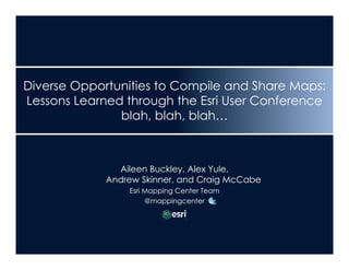
  • 1. Diverse Opportunities to Compile and Share Maps: Lessons Learned through the Esri User Conference blah, blah blah… blah blah, blah Aileen Buckley, Alex Yule, Andrew Skinner, and Craig McCabe Esri Mapping Center Team @mappingcenter
  • 2. The UC 2010 Map Extravaganza! Aileen Buckley, Alex Yule, Andrew Skinner, and Craig McCabe Esri Mapping Center Team @mappingcenter
  • 3. Let’s start at the very beginning…
  • 4.
  • 5. A plethora of maps… • Print • Online  Pocket agenda maps • Map services p  Large-format agenda maps f • Cached map service for  Education UC and Homeland each floor level Security Summit maps • Integration with topo  Lunch map p basemap service  Image map* • Application  Hotel map**  Room and Route Finder  Hallway maps** • Room finding functionality  Downtown San Diego map** D t S Di ** • Routing service • Bells and whistles * in production • iPhone (via ArcGIS.com) ** for 2011 Mapping Center Team
  • 6. A plethora of maps… • Print • Online  Pocket agenda maps • Map services p  Large-format agenda maps f • Cached map service for  Education UC and Homeland each floor level Security Summit maps • Integration with topo  Lunch map p basemap service  Image map* • Application  Hotel map**  Room and Route Finder  Hallway maps** • Room finding functionality  Downtown San Diego map** D t S Di ** • Routing service • Bells and whistles * in production • iPhone (via ArcGIS.com) ** for 2011 Mapping Center Team
  • 7. Why bother? 5 5” Persistent and temporary features/events Superflous detail 3” Illegible labels Detail for inaccessible areas Illegible icons
  • 8. More evidence against the state… 11” Symbols not in legend 8.5” Symbols not the same Colors not in legend size as in legend
  • 10. Our solution… Replace with different graphic from Andrew
  • 11. A closer look… Numbers for persistent features/ Letters for temporary features/ events events Symbols explained in legend y p g (legend continued on second page) No superflous detail Inaccessible areas Legible labels Legible icons
  • 13. A plethora of maps… • Print • Online  Pocket agenda maps • Map services p  Large-format agenda maps f • Cached map service for  Education UC and Homeland each floor level Security Summit maps • Integration with topo  Lunch map p basemap service  Image map* • Application  Hotel map**  Room and Route Finder  Hallway maps** • Room finding functionality  Downtown San Diego map** D t S Di ** • Routing service • Bells and whistles * in production • iPhone (via ArcGIS.com) ** for 2011 Mapping Center Team
  • 14. Old • 3D (disorienting) • Non-cartographic • S h Schematic routes ti t New • 2D • Cartographic g p • “Natural-walk” routes Mapping Center Team
  • 16. CAD → GIS CAD Features Attributes
  • 17. Multiple buildings Marriott Hotel San Diego Convention Center Hilton Hotel
  • 18. Multiple floor levels Level 1 Level 2 - Lobby Level 3 Level 4
  • 19. Multiple scales 1:4,500 1:2,257 1:2 257 1:1,128
  • 20. Making a Web map with ArcGIS Server ArcGIS Server Web Clients Geodatabase ArcMap Map Service ArcGIS Desktop Clients Map Service URL
  • 21. The application • Map functionality  High quality High-quality cartography  Locator map  Legend  Room levell toggle R l t l  Rich interactive Ux • Room finding g • Routing between rooms  Humanized routes  H Handicap-accessible option di ibl ti  Route time estimates
  • 23. Application • Services  8 Map Services • 1 per floor for UC maps (4) • Labels • Topo basemap • Additions to topo basemap (hotels) • Locator map  1 Geoprocessing Service • Running off cartographic-quality 3D network • Built with Flex 3, ArcGIS API for Flex 2  Room finding
  • 24. Old Network • Routes to center of rooms • Straight-line schematics • Missing route segments
  • 25. Building the new network…
  • 26. Creating curved paths Set arc endpoints
  • 33.
  • 34. App flow • Rudimentary de-coupled, event-driven architecture, some model/controller/command elements • Classes  Route C Command d • A command class to build, issue and handle the results from our magical gpp task  StopsManager • Parses the route segments into “stops” to display in the RouteNavigator using Floor/Building combinations  MapViewController • Listens for MapView events and responds by setting the map extent and active floor layer  DrawRouteCommand • Handles drawing the route segments on the proper floors, as well as route symbology (start, end floor transition points)  FindRoomCommand • Waits for a FindRoomEvent then zooms the map to the room passed by event data FindRoomEvent, event.data  FloorManager • Responds to FloorChangeEvents by setting the current floor and fading the overlay layer out and in to hide load delays • Components  FloorChooser  Legend  LocatorMap  RouteChooser • Where you input your desired route or room to find  RouteNavigator g • Displays the route “stops” …blah, blah, blah
  • 35. Future work • Link to conference agenda/personal scheduler • Enhanced network  Map of exhibitor space  Exterior space (downtown San Diego)  Time-sensitive routing  Adding amenities • Mobile client Mapping Center Team
  • 36. Future work • Link to conference agenda/personal scheduler • Enhanced network  Map of exhibitor space  Exterior space (downtown San Diego)  Time-sensitive routing  Adding amenities • Mobile client Mapping Center Team