Protecting Riparian Areas: Farmland Management Strategies
•
1 recomendación•952 vistas

Protecting Riparian Areas: Farmland Management Strategies

Recomendados
Recomendados
Más contenido relacionado
La actualidad más candente
La actualidad más candente (19)
Destacado
Similar a Protecting Riparian Areas: Farmland Management Strategies
Similar a Protecting Riparian Areas: Farmland Management Strategies (20)
Más de ElisaMendelsohn
Más de ElisaMendelsohn (20)
Último
Último (20)
Protecting Riparian Areas: Farmland Management Strategies
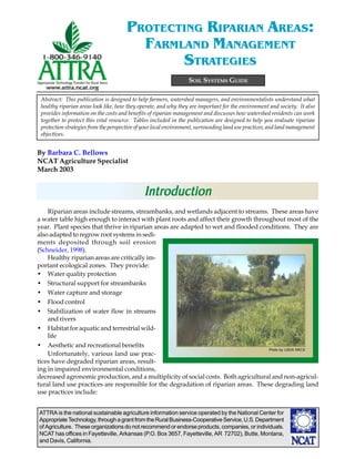
- 1. PROTECTING RIPARIAN AREAS: FARMLAND MANAGEMENT STRATEGIES SOIL SYSTEMS GUIDE Abstract: This publication is designed to help farmers, watershed managers, and environmentalists understand what healthy riparian areas look like, how they operate, and why they are important for the environment and society. It also provides information on the costs and benefits of riparian management and discusses how watershed residents can work together to protect this vital resource. Tables included in the publication are designed to help you evaluate riparian protection strategies from the perspective of your local environment, surrounding land use practices, and land management objectives. By Barbara C. Bellows NCAT Agriculture Specialist March 2003 Introduction Introduction Riparian areas include streams, streambanks, and wetlands adjacent to streams. These areas have a water table high enough to interact with plant roots and affect their growth throughout most of the year. Plant species that thrive in riparian areas are adapted to wet and flooded conditions. They are also adapted to regrow root systems in sedi- ments deposited through soil erosion (Schneider, 1998). Healthy riparian areas are critically im- portant ecological zones. They provide: • Water quality protection • Structural support for streambanks • Water capture and storage • Flood control • Stabilization of water flow in streams and rivers • Habitat for aquatic and terrestrial wild- life • Aesthetic and recreational benefits Photo by USDA NRCS Unfortunately, various land use prac- tices have degraded riparian areas, result- ing in impaired environmental conditions, decreased agronomic production, and a multiplicity of social costs. Both agricultural and non-agricul- tural land use practices are responsible for the degradation of riparian areas. These degrading land use practices include: ATTRA is the national sustainable agriculture information service operated by the National Center for Appropriate Technology, through a grant from the Rural Business-Cooperative Service, U.S. Department of Agriculture. These organizations do not recommend or endorse products, companies, or individuals. NCAT has offices in Fayetteville, Arkansas (P.O. Box 3657, Fayetteville, AR 72702), Butte, Montana, and Davis, California.
- 2. Table of Contents Introduction ................................................................................ 1 Upland Land Management and Riparian Health ............................... 3 What do Riparian Areas Look Like?................................................ 5 Water and Sediment Capture by Riparian Areas............................... 6 Table 1. Vegetation Indicators for Riparian Areas........................ 8 Water Decontamination by Riparian Soils ....................................... 9 Table 2. Soil Indicators for Riparian Areas ............................... 10 Riparian Areas and Habitat Preservation ....................................... 11 Table 3. Streambank and Channel Indicators............................ 12 Land Management Practices to Protect Riparian Areas ................... 13 Table 4. Indicators of Aquatic and Riparian Wildlife ................. 14 Community Watershed Collaboration to Protect Riparian Areas ...... 16 Summary .................................................................................. 17 References ................................................................................ 17 Appendix 1: Impacts of Local Ecology on Riparian ........................ Characteristics................................................................... 22 Table A.1. Effect of Stream Order on Natural Riparian .................. Characteristics................................................................... 23 Table A.2. Effect of Rainfall and Temperature on Riparian.............. Characteristics................................................................... 24 Appendix 2: Guidelines for Riparian Area Revegetation ............. 27 Appendix 3: Limited Ability of Riparian Areas to Control Phosphorus Movement into Streams...................................................... 29 Appendix 4: Recommended Buffer Widths ............................... 30 Appendix 5: Economic Costs and Benefits of Riparian Buffer .......... Protection ......................................................................... 32 Table A.3. Incentive Programs for Riparian Protection .............. 34 PAGE 2 //PROTECTING RIPARIAN AREAS: FARMLAND MANAGEMENT STRATEGIES
- 3. • Artificial stream widening and straightening Water moves across the landscape in two • Road and building construction close to ways: as groundwater flow and as runoff. Sub- streams surface or groundwater flow is water that has soaked into the soil and travels underground • Replacement of wooded or grassy areas with through pores in the soil. Runoff is water that roads, houses, and parking lots resulting in moves over the surface of the soil. When increased runoff into streams groundwater or runoff water moves, it absorbs • Unrestricted grazing or loitering of livestock nutrients or contaminants and transports them in or near streams into riparian areas and potentially into streams. • Crop production activities including plowing, Runoff water can also transport eroded soil par- planting, and fertilizer, manure, and pesticide ticles. applications close to streams Groundwater flow . In most undisturbed watersheds, a majority of the water flows into This publication is designed to assist farm- riparian areas and streams as groundwater ers, ranchers, watershed managers, homeowners, rather than as runoff. As rain falls or snow and community members in understanding the melts, leaves and other plant residues on the soil importance of riparian areas and guide them in surface catch this water. Pores created by grow- implementing land management practices to im- ing plants, decaying plant roots, and animal prove riparian health. Tables included provide burrows help the water seep into the soil (Cohen, tools to monitor the conditions of riparian areas 1997). Once it seeps into the soil, the resulting during land restoration processes. groundwater moves relatively slowly under- ground through soil particles until it reaches ri- parian areas and associated streams. Attached appendices provide detailed infor- mation on subjects addressed in this publi- cation. Above ground vegetation traps sediment and pollutants Fertilizer and pesticide residue Land Upland Land Flood water level Management and Stream water level Riparian Health Runoff reaches stream carrying little sediment, pesticide and fertilizer residue, Residue from making it healthier for Water flows from upland areas through ri- fertilizer and plant and pesticides are parian areas and eventually into streams. trapped by animal life Healthy riparian areas are able to absorb, hold, root systems and use much of the water that flows off from healthy upland areas. Healthy riparian areas Healthy streambank vegetation are also able to chemically and biologically bind Plants in riparian areas filter ground and surface or detoxify many contaminants contained in water moving into streams. this water. However, if upland areas are de- graded or covered with roads, parking lots, and (from Huel, 1998. ©Agriculture and Agri-Food Canada) rooftops that do not allow the water to seep into the soil, even the healthiest riparian area will Runoff is favored when rain falls faster than be unable to absorb and filter large volumes of the ground can absorb it. Water cannot be effec- water, nutrients, and contaminants flowing tively absorbed when soils: through it. Therefore, the first step in riparian • Are compacted at the surface protection is ensuring that land management practices across the watershed conserve soil and • Are bare, so that the impact of rain drops on water resources. the soil forms a surface crust //PROTECTING RIPARIAN AREAS: FARMLAND MANAGEMENT STRATEGIES PAGE 3
- 4. • Have pores that have become plugged by water and groundwater can also absorb nutri- eroded sediments ents or become contaminated with pesticides or • Have a clay texture that does not allow for pathogens in the soil. Streams are polluted when rapid water movement into the soil contaminated water is able to move directly into them. • Are hydrophobic or have a surface crust, typical of many arid or semi-arid soils (Fed- erosion Impact of runoff and erosion on ripar- ripar- eral Interagency Stream Restoration Working ian areas. Under healthy watershed conditions Group, 2001). water infiltration across the landscape results Runoff is also heavy when the soil does not in minimal runoff and erosion reaching ripar- have the capacity to hold additional rainwater ian areas. Healthy riparian areas have a dense or snowmelt entering the soil. This occurs when: • Soils have been replaced by im- permeable surfaces such as roads, parking lots, or rooftops and insufficient natural or arti- ficial wetlands are present to capture water not able to be ab- sorbed by soil • Soils are rocky or have an impen- etrable stony layer close to the surface • Soils are thin because the topsoil has been eroded off • Soils have a compacted layer of “pan” within their profile that Runoff from poorly vegetated areas carries eroded acts as a barrier to downward sediments into streams water movement • Groundwater levels are high • Rain keeps falling on soils that are already saturated growth of vegetation that catches any eroded sediment and prevents it from entering streams. They also have a diversity of plants that facilitate water infiltration and take up many nutrients car- Stream flashing ried into riparian areas by runoff and groundwa- ter. Riparian areas also have a unique soil envi- When runoff is heavy, such as following an ronment that provides favorable conditions for intense storm or a rapid snowmelt, stream the chemical and biological degradation of many levels can rise rapidly, often to flood stage. soil contaminants. This rise in water levels is often very short However, when upland watershed condi- term, lasting only a day or two, after which tions are degraded, heavy runoff can flow over water levels decrease dramatically. The rapid or through riparian plants and move directly rise and fall of water levels caused by runoff into river channels. Severe erosion in upland is referred to as stream flashing. areas can degrade riparian areas by burying plants under sediments. Fine sediments brought in by erosion can degrade stream habitat by fill- water. Contaminant movement by water. Run- ing in stream pools, altering the shape of stream off water flowing over the soil surface can pick channels, and covering rocky stream bottoms, up and erode soil sediments. These sediments thereby eliminating important food producing, may carry nutrients, pathogens, pesticides, and shelter and spawning areas (Wohl and Caline, other contaminants, depending on the land-use 1996). Runoff and erosion also bring in seeds of practices in the area they came from. Both runoff non-native or non-riparian plant species. Inva- PAGE 4 //PROTECTING RIPARIAN AREAS: FARMLAND MANAGEMENT STRATEGIES
- 5. sive and non water-loving plant species can re- • A thick growth of vegetation, representing duce habitat for native species and lower the wa- a diversity of grasses, forbs, shrubs, and trees, ter table by crowding out more functional and covers the streambanks and provides shade palatable riparian species. They can also create a over the stream fire risk by increasing fuel loads (Allen et al, 2000). • Except where streams cut through rocky ter- As runoff and erosion from upland areas con- rain, land surrounding streambanks re- tinue to destroy the integrity of riparian areas, mains wet throughout most of the year streamside areas loose their ability to buffer and • Streambanks are more vertical than flat- protect streams, resulting in damage to aquatic tened out habitat, increased costs for treating drinking wa- ter, and loss of aesthetic appeal. • Streamflow levels vary only moderately throughout the year Soil and water conservation practices. Water infiltration is enhanced by land-use prac- • Stream water is relatively clear but contains tices that provide coverage of the soil surface leaves, twigs, or logs from streambanks that with vegetation or residues throughout the year. create pools and other habitat for fish and Conservation tillage, contour farming, cover other aquatic organisms cropping, agroforestry, and rotational grazing • A diversity of fish, aquatic life, mammals, are all practices that protect soil quality while and birds live in and around riparian areas promoting water flow into the soil. For more information on these soil and water conserva- Appendix 1 describes regional differences in tion practices, please see the following ATTRA the structures and functions of riparian areas. publications: Sustainable Soil Management Conservation Tillage Degraded riparian areas. In contrast, de- graded riparian areas have some or all of the Pursuing Conservation Tillage for Organic Crop following characteristics: Production • Patchy or scrubby plant growth with bare Rye as a Cover Crop ground showing in many places Protecting Water Quality on Organic Farms • Vegetation dominated by upland plants in- cluding noxious weeds Sustainable Pasture Management • Soil that is compacted, shows rills or gullies, Rotational Grazing or has bare trails and pathways along the Nutrient Cycling in Pastures streambanks • Streambanks that are eroded, severely un- dercut, or sloughing What do Riparian Areas • Streams that flood regularly in the spring and become dry during the summer Like? Look Like? • Streamwater that is muddy or murky and may contain toxic levels of various nutrients or contaminants Healthy riparian areas. Characteristics of • Few mammals or birds living or feeding in healthy riparian areas differ across the country the area and across the landscape. In mountainous or hilly areas, streams run through rocky gorges • Limited numbers and diversity of fish and with scattered trees growing out of the thin soil. other aquatic species In prairie landscapes, streams flow through These characteristics of degraded riparian thick, silty soil, with banks covered by reeds, areas reflect their inability to protect water qual- sedges, and willows. Despite these local differ- ity, stabilize water quantity, and provide criti- ences, healthy riparian areas have certain simi- cal habitat for both land animals and aquatic larities: species. //PROTECTING RIPARIAN AREAS: FARMLAND MANAGEMENT STRATEGIES PAGE 5
- 6. Water and Sediment Plants in the first band are water-loving and have deep, strong roots that stabilize streambanks against erosion (Clark, 1998). Plants in the sec- Capture by Riparian ond and third bands catch water and facilitate its absorption. They also take up nutrients trans- Areas ported into the area by runoff and groundwater and provide habitat for terrestrial animals. If land Riparian areas protect water quality by cap- management practices reduce the riparian zones turing, storing, and treating water that flows to only one or two of these bands, some or all of through their soils. A thick growth of diverse the environmental and habitat benefits of these vegetation, plant residues covering the soil sur- areas will be lost. The first zone is both the most face, and porous, non-compacted soil facilitate ecologically important and requires the greatest water capture. High streambanks with high protection against degradation. water tables provide water storage capacity. Vigorously growing plants take up nutrients transported into riparian areas, while active popu- lations of both aerobic and anaerobic soil organ- isms degrade many contaminants that flow into these areas. Chemicals in soil minerals and soil organic matter also capture or facilitate biologi- cal detoxification of contaminants. Understand- ing these components of healthy riparian areas Photo by USDA NRCS can help guide land management practices that protect riparian areas and water quality. Structure of riparian vegetation. Healthy riparian vegetation captures water and facilitates water infiltration into the soil. Riparian areas that Trees, brush, and grasses protect include a diversity of plant species are most ef- streambanks against erosion and water fective in slowing the flow of water and storing it quality degradation for future use. These species are not arranged in a random manner. Rather, they are organized in The dominance of water-loving plant species a natural structure consisting of three roughly in the first zone serves as an indicator of riparian parallel ecosystem bands, each consisting of spe- health. These plants are critical for promoting cies adapted to survive in the specific moisture water recharge and increasing water table height regime of that area and able to perform specific (Martin and Chambers, 2001). It is not essential ecological functions: for native plant species to dominate in riparian • The first band of vegetation, found at the edge areas for these areas to provide environmental of the water, consists of deep-rooted sedges benefits. But water-loving plants that provide and rushes. functions similar to native species need to be • The second band of vegetation, found in the present. However, water-tolerant exotic species wet ground near the edge of the bank, con- — such as leafy spurge, purple loosestrife, or sists of shrubs, trees, moisture loving grasses, salt cedar —grow very aggressively and over- and water-tolerant broad-leaved plants (Huel, whelm species that are native to the area and 1998). more palatable to wildlife and livestock. In this • The drier third band of vegetation, found way, exotic species decrease the ability of ripar- where the riparian zone merges into the up- ian areas to maintain high water table levels, re- lands, includes a mixture of riparian and tain streambank stability, provide forage to live- upland plant species (Huel, 1998). stock, and support wildlife habitat (Huel, 1998). PAGE 6 //PROTECTING RIPARIAN AREAS: FARMLAND MANAGEMENT STRATEGIES
- 7. The importance of water-loving plants in riparian areas In the past, land management programs implemented in some arid areas recommended clearing native, water-loving plants from riparian areas in order to reduce water-use competition and en- courage the production of agronomic crops or forage grasses. However, the removal of these plants eliminated many of the ecological benefits provided by riparian areas, including stream stabilization, shading, and wildlife habitat (NRC, 2002). As a result, farmers and ranchers along these unprotected streams lost land to streambank erosion and were faced with greater challenges in reducing non-point source pollution. Streambank stabilization. A diversity of plants work together to hold streambank soils in place and protect them from erosion and undercutting by floodwaters, transported woody debris, or ice jams. The deep, penetrating roots of sedges, rushes, grasses, and other herbaceous plants provide structural support for streambanks, while the thicker, harder roots of woody plants protect streambanks against bank scouring by floods and ice jams (Winward, 2000). Photos by D. Redhege, Kerr Center for Sustainable Agriculture An eroded streambank that recovered when it was protected from grazing and allowed to become stabilized by vegetation When riparian areas restore themselves natu- The types of vegetation that naturally domi- rally — following a fire, for instance —woody nate in riparian areas differ across locations. species are often the first plants to become es- Grassy vegetation is more important for hold- tablished. These woody plants stabilize stream ing together streambanks developed from sedi- channels against the forces of erosion while nur- ments, while trees and shrubs dominate on the turing the growth of water-loving grasses, sedges, steep, rocky banks of more rapidly moving and rushes, and forbs (Elmore and Beschta, 2000). narrower headwater streams (Sovell et al., 2000). The herbaceous plants then stabilize streambanks However, water-tolerant or water-loving plants with their thick, deep roots, while their stems are more effective for holding streambanks in trap sediments carried by runoff water and place than are plants more adapted to upland stream-scouring floodwater. conditions, because they have deeper and stron- //PROTECTING RIPARIAN AREAS: FARMLAND MANAGEMENT STRATEGIES PAGE 7
- 8. Table 1. Vegetation Indicators for Riparian Areas Healthy Riparian Areas Moderately Degraded Riparian Areas Degraded Riparian Areas PAGE 8 Indicator • effective water infiltration Environmental • effective capture of sediments Function of • vegetation provides some but not all • vegetation present ineffective in providing • structural support of streambanks most environmental functions of riparian environmental functions Plants • reduces stream velocity during floods areas • shade for reducing water loss and moderating temperatures • habitat for wildlife, birds, and aquatic species • predominantly native, water-loving riparian • some non-native plant species and • only non-native species Plant Species noxious weeds • noxious or invasive weeds present vegetation • small number of plant species Diversity • combination of sedges, rushes, grasses, • presence of some drought-tolerent vegetation, similar to that in adjacent • trees and shrubs are absent herbacous plants, shrubs and trees • presence of predominantly drought-tolerent upland areas vegetation, similar to that in adjacent upland areas Diversity of • both young and mature trees and shrubs are • few young trees and shrubs present • reduced plant establishment and survival Plant Ages present • some dead or decadent plants present • all trees are old and in poor health Plant Vigor and • healthy plant growth and reproduction • capability to produce seeds or tillers is • capability to produce seed or tillers is • plant growth exceeds 80% of potential somewhat limited severely limited Reproduction production • plant growth is 30-80% of potential • plant growth is poor, less than 30% of production potential production • diversity of plant species and plant ages • grazing has removed all of the palatable Palatable • moderate decrease in percentage of vegetation provides palatable vegetation throughout the palable plant species present Vegetation growing season • palatable species of shrubs and trees are • some browsing on palatable tree heavily browsed • trees have an open or park-like appearance species • willows and other palatable tree species have a “mushroom-like” appearance • full vegetation coverage throughout the year • sparse vegetation coverage, especially • bare soil over a large percentage of the soil during the dry season surface spring Plant and Litter • litter layer present particularly during winter and • litter layer thinner than expected for • litter layer largely absent Cover • provides woody debris that serves as shelter for location • limited amount of woody debris added to fish and habitat for aquatic insects • reduced amount of woody debris added stream flow to stream flow Plant Litter • only small size litter is displaced • litter is concentrated around rocks, tree • uniform distribution of litter trunks, and other obstructions Movement and • plants remain standing following heavy rainfalls • scattered concentration of litter near or snowmelts obstructions • plants are flattened by heavy flows of runoff Plant Lodging • flattening of grasses in isolated areas water following rainstorms or snowmelts Width of • riparian vegetation at least two channel widths • natural vegetation extends the width of • natural vegetation less than a third of width Riparian Area on each side of stream half the channel on either side of stream of the channel on each side of stream Sources: Belsky et al., 1999; Federal Interagency Stream Restoration Working Group, 2001; Hillard, C. and S. Reedyk. 2000; Naiman et al., 1992; Huel, 1998; Prichard, 1998; Renwick and Eden, 1999; //PROTECTING RIPARIAN AREAS: FARMLAND MANAGEMENT STRATEGIES Winward, 2000.
- 9. ger root systems. For example, Kentucky blue- channels (Platts, 1990, Ohmart, 1996). Water grass (Poa pratensis) and redtop (Agrostis tables rise simultaneously in riparian areas as stolonifera) provide good livestock forage, but streambanks build up, water absorption is in- their root systems are not deep enough to stabi- creased, and water loss through evaporation de- lize streambank sediments (Winward, 2000). creases. Under healthy riparian conditions, wa- Thus, these plants often serve as indicators of ter tables rise until they reach the height of disturbed or degraded riparian areas. Similarly, plants’ root zone on the former flood plains trees that are not water tolerant do not develop (Elmore and Beschta, 2000). These riparian soils as extensive root systems in riparian areas as do remain wet throughout most of the year. water tolerant species. As a result, these trees Water recharge. The large water storage ca- are unable to effectively stabilize streambanks pacity of riparian areas buffers the movement and are likely to be undercut and fall into streams. of water from upland areas into streams. In- stead of allowing water to flow directly into streams following a rainstorm or snowmelt, For guidelines on how to revegetate degraded healthy riparian areas hold and store water. riparian areas, please see Appendix 2. Throughout the year, this water seeps slowly into adjacent streams, providing water recharge and moderating stream flow. Table 1 provides a list of indicators that com- Flood control. The ability of the porous, well- pare vegetation characteristics in healthy ripar- aggregated streambank soils to store vast quan- ian areas to those in degraded areas. tities of water also decreases the potential for Water storage within streambanks . flooding. In addition, plants growing in ripar- Healthy riparian areas that are well-vegetated ian areas control flooding by daily taking up and have highly permeable soils and high stream transpiring thousands of gallons of water per banks. They have a water table that extends acre (Elmore and Beschta, 2000). If water levels underground and outward from the do reach flood stage, streambank vegetation sta- streambanks and provides a large amount of bilizes streambanks and helps prevent streams groundwater storage (Prichard, 1998). In con- from widening or changing course. trast, degraded riparian areas have a low wa- Table 2 (next page) compares streambank and ter table, sloping banks, and wide, shallow channel conditions in healthy and degraded ri- streams, with limited storage capacity. parian areas. A riparian area with a diversity of vegeta- tion is able to trap 80 to 90% of the sediments transported from fields (Naiman and Decamps, Water Decontamination 1997). The new sediments, along with lush plant growth, facilitates both water infiltration into by Riparian Soils riparian soils and increased water storage. As vegetation grows, its stems and roots collect Riparian areas contain a combination of wet more soil, while its leaves shade the soil and and dry soil zones that facilitate a variety of bio- protect it against water loss through evapora- logical and chemical reactions. These reactions tion. The seasonal death and decomposition of reduce the availability of some nutrients and de- plants provides additional organic matter to the crease the toxicity of some contaminants soil and further facilitates water infiltration and (Edwards, 2000). The presence of slowly decom- storage. Organic matter holds water like a posing plant residues in these wet soils further sponge and stimulates the growth of soil organ- facilitates water purification processes. Some isms involved in the formation soil aggregates organic matter particles have a high ability to and enhancing soil porosity. chemically capture and hold many potential con- Streambank build-up. Sediment trapping by taminants, while others serve as sources of food riparian vegetation increases the height of and energy for soil organisms involved in con- streambanks, particularly along low-gradient taminant detoxification (Cohen, 1997). //PROTECTING RIPARIAN AREAS: FARMLAND MANAGEMENT STRATEGIES PAGE 9
- 10. Table 2. Soil Indicators for Riparian Areas Indicator Healthy Riparian Areas Moderately Degraded Riparian Areas Degraded Riparian Areas PAGE 10 • soil covered by growing plants and plant • soil organic matter content somewhat • low soil fertility and low concentration of Organic matter residues throughout the year reduced organic matter • organic matter has accumulated in the soil • some loss of topsoil • soil is bare in many areas profile • moderate levels of soil biological activity • limited topsoil • high soil biological activity • soil patches bare of vegetation • limited soil biological activity • topsoils are deep • relatively high removal of residues from • limited return of plant residues to the soil • soils are well aggregated soil system system • moderate to poor soil aggregation • soils are sticky or grainy, not well aggregated Diverse • peat builds up in riparian areas because area • organic matter decomposes rapidly • moderate decomposition of organic is too wet or organic matter remains microbial undecomposed because areas are too dry • effective loss of nitrogen through denitrification matter community • good soil aggregation by microbial slimes • ineffective denitrification structure • poor soil aggregation • soil is somewhat hard, especially during Minimal • soil is soft, high organic matter content the dry season • soil is hard compaction • good water infiltration • water infiltration is limited in some areas • little or no soil oggregation • good soil aggregation • plants have difficulty getting water and • little or no water infitration • healthy plant growth nutrients from the soil • some loss of vegetation coverage • numerous areas bare of vegetation Good • vegetation coverage over the soil surface • some runoff, erosion, or ponding of • loss of soil aggregation infiltration • good soil aggregation water observed • soil is compacted • relatively thick topsoil • soil compaction on surface or within • runoff and erosion observed even following profile light to moderate storms • good water infiltration • infiltration is somewhat restricted • infiltration is restricted Limited runoff • deep topsoil with good water holding capacity • water holding capacity of soil is • high soil surface compaction • high amount of organic matter in soil and good somewhat limited • limited water holding capacity of soil soil aggregation • some soil compaction or relatively high water table Limited • complete vegetation cover over the soil surface • some small rills present • rills and gullies present • no indication of soil movement • water becomes muddy only after heavy • soil is scoured where water flows over the erosion surface • stream is not muddied by runoff water rains • soil build up behind rocks • stream is muddied by runoff water Sources: Belsky et al., 1999; Federal Interagency Stream Restoration Working Group, 2001; Naiman et al., 1992; Prichard, 1998; Renwick and Eden, 1999; Winward, 2000. //PROTECTING RIPARIAN AREAS: FARMLAND MANAGEMENT STRATEGIES
- 11. Detoxification of contaminants. Ripar- ian soils have a high concentration of peat, a par- The hyporheic zone. Healthy riparian soils tially decomposed organic material formed un- have a unique ecological zone composed of der primarily anaerobic conditions. Under wet, water-saturated oxygen-poor soils adjacent anaerobic conditions organic materials decom- to soils that are drier and oxygen-rich. Re- pose more slowly than under aerobic conditions, ferred to as the hyporheic zone, this transi- since many more decomposing soil organisms tion area between aerobic and anaerobic con- require oxygen than thrive without it. Peat is a ditions promotes biological transformations, highly reactive material that has the ability to cap- such as denitrification and pesticide detoxifi- ture and hold many chemicals—nutrients, pesti- cation, and chemical transformations that in- cides, heavy metals, and other contaminants— fluence the availability of phosphorus and iron that flow off the uplands and into riparian areas (Cohen, 1997). (Cohen, 1997). Other microorganisms found in the aerobic Denitrification occurs when soil organisms and anaerobic areas of the riparian zone are able that grow under aerobic conditions transform to degrade toxic contaminants such as pesti- organic nitrogen into nitrate, followed by the cides. Habitat competition by other soil micro- transformation of nitrate into atmospheric ni- organisms decreases populations of human and trogen by bacteria that thrive under anaerobic animal pathogens, such as E. coli, conditions. This process is important environ- cryptosporidium, or giardia, that may be trans- mentally when the amount of nitrogen moving ported into streams from septic systems or ma- across the watershed into riparian areas is nure piles (Stehman et al., 1996). greater than the amount that can be used for Table 3 (next page) compares soil charac- riparian plant growth. The overapplication of teristics in healthy riparian areas to those in de- nitrogen-containing fertilizers and manure on graded areas. agricultural and residential landscapes is the primary source of nitrogen pollution of water- Riparian Areas and ways. The amount of nitrogen entering streams is reduced when riparian areas are able to cap- Habitat Preser vation Preservation ture and remove nitrogen from runoff water. Riparian areas provide food and habitat for a Natural riparian forests can denitrify and re- diversity of soil, aquatic, and terrestrial organ- lease 25 to 35 pounds of nitrogen per acre per isms. A multistoried plant canopy of annual year (Cole, 1981). and perennial grasses and forbs, as well as juve- Phosphorus availability . Overapplication nile and mature shrubs and trees, provides a of fertilizer and manure can also overload the varied aboveground habitat for birds and wild- soil with phosphorus. Iron, aluminum, and life and a belowground habitat for burrowing calcium in the soil can bind excess phosphorus. animals and soil organisms. Exposed roots and In flooded soils, iron binds less phosphorus than irregular streambanks provide breeding areas it does in drier, aerobic soils. This decreased for many aquatic species, as well as habitat for binding ability increases the availability of phos- algae and macroinvertebrates that are used as phorus both for plant uptake and for movement food by fish and other aquatic life. In addition, into surface water (Green and Kaufman, 1989). overhanging branches of riparian trees and Since riparian areas have a limited ability to hold sloughed off residues of riparian plants provide excess phosphorus, they are relatively ineffec- aquatic life with shade and habitat. tive in protecting streams against poor phospho- Aquatic habitat . Healthy riparian areas rus management practices on upland areas. protect fish habitat by minimizing the movement Thus, good upland management is necessary to of eroded sediments into streams. Heavy silt protect against phosphorus pollution. loads disrupt reproductive behavior and destroy feeding and spawing areas for many aquatic For additional information on the ability of ri- species (Thompson, 1984). For example, trout parian areas to control phosphorus move- require gravel for reproduction and egg laying, ment into streams, please see Appendix 3. while various gamefish need relatively clear //PROTECTING RIPARIAN AREAS: FARMLAND MANAGEMENT STRATEGIES PAGE 11
- 12. Table 3. Streambank and Channel Indicators Indicator Healthy Riparian Areas Moderately Degraded Riparian Areas Degraded Riparian Areas PAGE 12 • some streambank erosion • streambanks are high Streambank • banks are at elevation of active flood plain • some deep rooted riparian plants • bends eroded by flowing water Stability • little or no streambank erosion replaced by more shallow rooted or • plant roots either not present or uable to hold • many strong, fine roots hold streambank in woody plant species banks against scouring place • trees are falling into stream Stream • channel is relatively narrow • channel is wider than under natural • channel is shallow and wide • banks are relatively straight with deep undercut conditions • banks are laid back Channel Shape that provides shade for aquatic species • banks are broken down in isolated areas • banks are trampled where livestock enter the • stream has pools and meanders • some loss of pools and meanders water to drink or cross the stream • loss of pools and meanders • relatively frequent occurrence of riffles • occassional riffles • water is generally flat • distance between riffles is no more than 7 • bottom contours provide some aquatic • if riffles are present, they are shallow and times the measurement of the width of the habitat provide poor aquatic habitat Frequency of stream • distance between riffles is no more than • distance between riffles is greater than 20 Riffles 20 times the measurement of the width times the measurement of the width of the of the stream stream • water table remains high and stable throughout • water table is not at bankful level • water table is low or varies greatly throughout the year • soil surface may dry out during the dry the year Riparian Water • water loving vegetation predominates season • drought tolerant or upland vegetation has Table • riparian area provides an interface between wet • some drought tolerent upland plants replaced riparian vegetation and dry environments present in the riparian zone • water table is too low to facilitate chemical and biological interactions between wet and dry conditions • stream has not been subject to channelization, • some channelization present, usually in • extensive channelization, especially in urban stream alteration, or dredging areas of bridges or in urban areas areas Channel • evidence of dredging or channelization • banks shored with gabion or cement Alternation having occurred over 20 years ago • instream habitat greatly altered or removed • drainage outlets from agricultural lands entirely Sources: Belsky et al., 1999; Federal Interagency Stream Restoration Working Group, 2001; Huel, 1998; Naiman et al., 1992; Prichard, 1998; Renwick and Eden, 1999; Winward, 2000. //PROTECTING RIPARIAN AREAS: FARMLAND MANAGEMENT STRATEGIES
- 13. water to see prey and detect visual clues used in for food outside of these areas. Other bird spe- their social and reproductive behavior (Cohen, cies prefer nesting in riparian areas even if they 1997). can nest elsewhere. However, degradation of The ability of riparian areas to stabilize riparian areas reduces populations of these spe- stream flow levels throughout the year is also cies (Bureau of Land Management and Partners critical to the survival of many fish and other in Flight, 2000). aquatic species. Fish need enough water in streams to navigate and find food. If a stream Appendix 4 provides guidelines for adequate becomes polluted, decreasing water levels may buffer widths to meet various environmental concentrate pollutants to levels that are too toxic objectives. for fish. High water levels caused by stream flashing can rapidly increase water tempera- tures, which can be fatal to some fish and other Riparian vegetation growth, soil fertility and aquatic organisms. Stable water levels provide porosity, water quality, and stream flow condi- the moderate water temperatures required for tions all affect the ability of fish and wildlife to the growth of fish and the aquatic organisms thrive in streams and their associated riparian that they use for food (Wenger, 1999; Cohen, areas. Table 4 compares habitat conditions pro- 1997). vided by healthy riparian areas to those of de- Large woody debris that falls into streams graded areas. traps sediments and creates pools that provide protected, shaded habitats for aquatic species L and Management (Stuart et al., 1994). For trout, vegetation cover provides food and places to hide from preda- Protect Practices to Protect tors (Burgess, 1985). For many aquatic organ- isms, leaves, twigs, and insects falling from over- hanging trees are an important food source Riparian Areas (Hillard and Reedyk, 2000). In naturally forested Key components of riparian protection are areas, retaining at least 50% of the tree canopy is maintaining good soil and water conservation critical for providing moderated temperatures re- practices across the landscape and preserving, quired for good fish habitat (Whitaker-Hoagland, as much as possible, the integrity of the three 1998). natural riparian zones. Specific land manage- ment practices that protect riparian areas in- errestrial Ter restrial wildlife habitat. Riparian ar- clude: eas are the main source of moisture for plants and wildlife within watersheds, especially in • Maintaining a vegetative cover over the soil arid regions or during the dry season in more throughout the year temperate climates. Riparian areas with a high • Minimizing animal trampling or vehicle traf- density and diversity of foliage, both vertically fic on wet soils and horizontally, can provide habitat and food • Avoiding overuse of fertilizers or manure for a diversity of birds and other terrestrial wild- that may be transported into riparian areas life, including many endangered and threatened species (NRCS/RCA, • Avoiding applying or dis- 1996). Many animals posing of toxic chemicals on also use these moist ar- soils eas as travel corridors be- • Protecting against loss of tween feeding areas plant diversity and vitality in (Henry et al., 1999). riparian areas Many bird species • Protecting against the es- depend on riparian areas tablishment of exotic or non for food, shelter, and water-loving species in riparian nesting sites. Some bird species require riparian areas areas for nesting, al- Photo by USDA NRCS • Avoiding practices that ar- though they may forage tificially alter stream flow //PROTECTING RIPARIAN AREAS: FARMLAND MANAGEMENT STRATEGIES PAGE 13
- 14. Table 4. Indicators of Aquatic and Riparian Wildlife Indicator Healthy Riparian Areas Moderately Degraded Riparian Areas Degraded Riparian Areas PAGE 14 • adequate water supply and quantity throughout • streams dry up during the dry season Water quality the year • water tables fluctuate throughout the • presence of mancroinvertebrate indicators of and quantity • presence of macroinvertebrate indicators of year poor water quality good water quality such as caddis flies and • some contaminants present in the • water contains toxic levels of sediments, mayflies water pesticides, heavy metals, or nutrients • water contains few contaminant such as • excessive aquatic weed growth in streams pesticides, heavy metals, or excess nutrients • stream temperatures are high • some reduction in streamside vegetation • lack of streamside vegetation Water • streamside vegetation cools streams • decrease in the availability of aquatic • low dissoloved oxygen levels Temperature • undercut streambanks provide shade species used for food • cool water aquatic species replaced by warm • presence of aquatic species used for fish food water species • lack of aquatic species to provide food for fish • loss of stream pools Stream Pools • numerous both deep and shallow stream pools • decrease in stream pools • low amounts of woody debris due to loss of • woody debris present to form pools • woody vegetation replaced by trees • complex channel structures herbaceous vegetation • channel straightening or modification to simplify channel structure Sediment • low amount of sediments in streams • stream muddy looking because of sediment Load • water is clear or tea colored • sediment levels in streams increasing load • floating algal mats or scum may be present • natural concentrations of nutrients and • nutrient and pathogen levels somewhat • high concentrations of nutriets and pathogens Nutrient and pathogens from wildlife in area Pathogen elevated in water • little or no evidence of livestock access to • manure present but not concentrated • extensive amounts of manure on banks and in Concentration streams on or near streambanks streams • native plant communities are dominant • some non-native species are present • non-native species are dominant vegetation vegetation • land is used for grazing or other • land is grazed or mowed while waterfowl are • land use delayed until chicks have left the nest agricultural uses each year nesting Waterfowl • land is rested for several years to allow for Habitat • land is insufficiently rested to provide • vegetation regrowth does not provide sufficient homing, larger clutches, and earlier nesting vegetation cover for nesting cover for nesting • sufficient blocks of land are protected to provide corridors of movement and foraging continued on page 15 //PROTECTING RIPARIAN AREAS: FARMLAND MANAGEMENT STRATEGIES
- 15. Table 4. Indicators of Aquatic and Riparian Wildlife (cont’d.) Indicator Healthy Riparian Areas Moderately Degraded Riparian Areas Degraded Riparian Areas • fish cover provided by woody debris, overhanging vegetation, bank cobbles, pools, • decrease in the types of fish cover • little or no fish cover provided riffles, and undercut banks available • water contaminated by sediments and Fish Habitat • water temperatures moderated by vegetation • some soil loss and pollution pollution cover • water levels are unstable • streams are ephemeral • minimal soil loss and pollution • good supply of aquatic insect species for fish to eat Insect and • habitat provided by woody fine debris, • decrease in the amount of habitat sites • few or no habitat sites present Invertebrate submerged logs, leaf packs, undercut banks available Habitat and cobbles Mammal • trails, tracks, feeding areas, and resting areas Diversity are present Macro- • predominately pollution intolerent species such • predominantly moderately tolerent • if macroinvertebrates are present, invertebrate as caddisflies, mayflies, stoneflies and riffle species such as damsel flies, predominantly pollution tolerant species such Diversity beetles dragonflies, aquatic sowbugs, blackfish as midges, craneflies, horseflies, leeches, and crayfish aquatic earthworms, and tubificid worms • presence of bird nests • decreasing presence of obligate bird • species that are obligate dependent on riparian species • lack of bird nest Bird Diversity areas are present, for example Common • presence of riparian dependent bird • if birds are present, species are similar to Yellowthrout, Song Sparrow, and Willow species such as goldfinch, bank upland areas Flycatcher swallow, grosbeak, or red-headed woodpecker • predominance of native species • native species are not present Fish Diversity • pollution intolerent species, such as trout, • pollution tolerent species such as carp //PROTECTING RIPARIAN AREAS: FARMLAND MANAGEMENT STRATEGIES small mouth bass and sunfish are present predominate Sources: Belsky et al., 1999; Bureau of Land Management and Partners in Flight, 2000; Federal Interagency Stream Restoration Working Group, 2001; Huel, 1998; Mosley et al., 1998; Prichard, 1998; Sovell et al., 2000; Winward, 2000. PAGE 15
- 16. Watershed Community Watershed water pollution and riparian degradation. Mean- while, those involved in implementing good wa- tershed and riparian management practices of- Collaboration to Protect Protect ten go unnoticed and under-compensated. Why is this so? Most watershed and riparian Riparian Areas degradation is non-point source pollution, which by definition means that it is difficult to identify specific land use practices responsible for this Watershed councils lay the cultural founda- pollution. Secondly, good upland and riparian tions for a lasting way of life. They establish grazing management practices in one part of the the tradition of responsible speech, of civil watershed cannot, in most cases, compensate for democracy, and of making decisions based poor land management practices in other parts on factual information and well-articulated val- of the watershed. Thirdly, and possibly most ues. They embody the long-term perspec- importantly, land users who implement soil and tive of sustainability, seeking not quick fixes water conservation practices often are asked to but deeper understanding and new alterna- bear the costs of implementing changes while tives. obtaining few of the benefits. This disparity be- tween those who pay and those who benefit of- Alan T. During (quoted in Wood et al.,1997) ten discourages farmers and other landowners from implementing soil conservation and ripar- Farmers, ranchers, and conservationists of- ian management practices. ten become embroiled in debates over the use of riparian areas. If you are a farmer or rancher, you may be concerned about the loss of access For more information on the economic costs to grazing land and watering areas as well as and benefits of riparian buffer protection, costs associated with management practices, please see Appendix 5. such as the installation and maintenance of fences. If you are a conservationist or environ- The Bureau of Land Management, the U.S. mentalist, you may be concerned about the loss Forest Service, and the Natural Resources Con- of habitat for birds, wildlife, and aquatic spe- servation Service understand that programs de- cies that depend on this diverse and fragile eco- signed to promote soil and water conservation system. If you are a downstream water user, practices are often contentious. In their joint you are no doubt concerned about the contami- letter announcing the initiation of a program to nation of drinking and recreational waters with help restore riparian areas (PLF, 2002), the agen- nutrients, pathogens, and pesticides. cies state that riparian restoration: Pinpointing sources and causes of riparian degradation and the associated degradation of will not happen by regulation, changes in the water quality is very contentious. Farmers and law, more money, or any of the normal ranchers often assert that livestock grazing in bureaucratic approaches. It will only occur riparian areas cause less damage than construc- through the integration of ecological, eco- tion activities, septic tanks, and industrial dis- nomic, and social factors and participation of charges. Conservationists often counter this as- affected interests. sertion by contending that agriculture is the pri- For watershed and riparian management mary source of nonpoint pollution in many ar- programs to be effective, they should include eas, and they maintain that excluding agricul- the following elements (Wood et al., 1997): tural practices from riparian areas is the best • Active involvement by community members method for protecting wildlife habitat and wa- from across the watershed who represent a ter quality. broad array of perspectives and problems To work together in restoring riparian ar- eas, community members need to understand • Collaborative identification of program ob- that riparian areas are only protected if all land jectives, such as protecting high value re- users across the watershed work together. Get- sources and solving problems that most ting this cooperation is often difficult since wa- threaten the sustainability of the watershed tershed users can easily blame others for causing • Education and outreach PAGE 16 //PROTECTING RIPARIAN AREAS: FARMLAND MANAGEMENT STRATEGIES
- 17. • Community access to and sharing of factual on a set of sustainable land management objec- information on watershed economic, envi- tives. ronmental, and social conditions • Willingness to discuss and address critical but often contentious resource issues such as References population growth, overconsumption, en- Allen, Mike, Cathy Walker, and Luke Pen. dangered species, and pollution 2000. Wetlands and Weeds. Water Notes • Willingness to examine and implement long- for Wetlands Management. Water and term ecological solutions to watershed prob- Rivers Commission. Government of lems rather than look to “technological Western Australia. Accessed at: <http:// quick-fixes” www.wrc.wa.gov.au/public/WaterNotes • Willingness of landowners and land man- /pdf/1.pdf> agers to work together to develop a water- Alexander, S.V. 1993. Effective education shed or regional level coordinated approach programs change behavior—Lessons to watershed management that will address learned from the Nonpoint Source Pro- upstream-downstream concerns and the gram. p. 337–351. In: Riparian Ecosys- need for management practices to be coor- tems in the Humid U.S.: Functions, Values dinated throughout the watershed to pro- and Management. National Association of tect aquatic environments and provide con- Conservation Districts. Washington, D.C. tinuous corridors for wildlife movement • Baseline assessments and on-going monitor- Belsky, A.J., A. Matzke, and S. Uselman. 1999. ing of watershed and riparian conditions Survey of livestock influences on stream and riparian ecosystems in the western • A combination of positive incentives (eco- United States. Journal of Soil and Water nomic, personal values, prestige) and disin- Conservation. Vol. 54, No. 1. p. 419–431. centives (regulations and policies) motivate involvement more than either one or the Berton, V. 1998. Ten Years of SARE. Sustain- other alone (Alexander, 1993). able Agiculture Research and Education Program, CREES, U.S. Department of Agriculture. Washington, D.C. p. 82–83. Summar y Summary Briggs, M. 1993. Evaluating degraded riparian ecosystems to determine the potential There is much scientific literature to docu- effectiveness of revegetation. In: B.A. ment the importance of watershed and ripar- Roundy, E. D. McArthur, J.S. Haley, and ian management practices to the preservation D.K Mann. 1995. Proceedings: Wildland of water quality, riparian vegetation, and the Shrub and Arid Land Restoration Sympo- wildlife of riparian and aquatic areas. How- sium. General Technical Report INT-GTR- ever, for farmers to be willing and able to ad- 315. U.S. Department of Agriculture, equately protect these vulnerable environments, Forest Service, Intermountain Research these environmental benefits need to be balanced Station, Ogden, UT. with economic benefits that farmers, ranchers, Bureau of Land Management and Partners in and other landowners may obtain from chang- Flight. 2000. Birds as indicators of ripar- ing their land management practices. Down- ian vegetation condition in the western stream water users—including people who U.S. The Aurora Project. Accessed at: drink, cook, and bathe with water, people who <http://www.mtnvisions.com/Aurora/ use lakes and streams to boat, swim, and fish, monitor.html>. and people who gain property value from the proximity of their home to a lake or river—also Burgess, S.A. 1985. Some effects of stream need to be willing to place a value on clean water habitat improvement on the aquatic and and protected riparian habitats. As all commu- riparian community of a small mountain nity members become aware of the multiple ben- stream. p. 223–246. In: J.A. Gore (ed.) efits provided by good watershed management, The restoration of rivers and streams. they can work together to develop a consensus Butterworth Publishers, Boston, MA. //PROTECTING RIPARIAN AREAS: FARMLAND MANAGEMENT STRATEGIES PAGE 17
- 18. Clark, E.A. 1998. Landscape variables affecting tices. Part 653 of the National Engineering livestock impacts on water quaity in the Handbook. USDA-Natural Resources humid temperate zone. Canadian Journal Conservation Service. Accessed at: of Plant Sciences, Vol. 78. p. 181–190. <http://www.usda.gov/ stream_restoration/newtofc.htm>. Cohen, R. 1997. Fact Sheets: Functions and Values of Riparian Areas. Massachusetts Gebhardt, K.A., C. Bohn, S. Jensen, and W.S. Department of Fisheries, Wildlife and Platts. 1989. Use of hydrology in riparian Environmental Law Enforcement. classification. p. 53–60. In: R.E. Acessed at: <http://www.state.ma.us/ Gresswell, B.A. Barton, and J.L. Kershner dfwele/river/rivfstoc.htm>. (eds.) Practical Approaches to Riparian Resource Management: An Education Cole, D.W. 1981. Nitrogen upatake and trans- Workshop. U.S. Bureau of Land Man- location by forest ecosystems. p. 219–232. agement, Billings, MT. In: F.E. Clark and T. Rosswall (eds.) Terrestrial Nitrogen Cycles. Ecological Green, D.M., and J.B. Kauffman. 1989. Nutri- Bulletin. Vol. 33. ent cycling at the land-water interface: The importance of the riparian zone. In: R.E. CRJC. 2001. Riparian Buffers for the Connecti- Gresswell, B.A. Barton, and J.L. Kershner cut River Watershed. Connecticut River (eds.) Practical Approaches to Riparian Joint Commission. Accessed at: <http:// Resource Management: An Education www.crjc.org>. Workshop. U.S. Bureau of Land Manage- ment. Billings, MT. p. 61–68. Dillaha, T.A., J.H. Sherrard, D. Lee, S. Mostaghimi, and V.O. Shanholtz. 1988. Gilliam, J.W. 1994. Riparian wetlands and Evaluation of vegetated filter strips as a water quality. Journal of Environmental best management practice for feedlots. Quality. Vol. 23. p. 896–900. Journal of the Water Pollution Control Henery, A.C., Jr., D.A. Hosack, C.W. Johnson, Federation, Vol. 60. p. 1231–1238. D. Rol, and G. Bentrup. 1999. Conserva- Edwards, R. 2000. The Hidden River in Ripar- tion corridors in the United States: Ben- ian Areas. p. 103–104. In: Summit 2000: efits and planning guidelines. Journal of Washington Private Forests Forum. Soil and Water Conservation. Vol. 54, No. University of Washington, College of 4. p. 645–650. Forest Resources. Seattle, WA. Elec- Hillard, C., and S. Reedyk. 2000. Riparian tronic Proceedings. Accessed at: <http:// Area Management. Water Quality Mat- www.cfr.washington.edu/outreach/ ters. April. Agriculture and Agri-Food summit/proceedings.html>. Canada. Accessed at: <http:// www.agr.gc.ca/pfra/water/facts/ Elmore, W. 1992. Riparian responses to grazing ripariane.pdf>. practices. In: R.J. Naiman (ed.) Water- shed Management: Balancing Huel, D. 1998. Streambank Stewardship: A Sustainability and Environmental Change. Saskatchewan Riparian Project. Springer-Verlag. New York. Saskatchewan Wetland Conservation Corporation. Regina,Saskatchewan. Elmore, W., and R.L. Beschta. 2000. Riparian Accessed at: <http://www.wetland.sk.ca Areas: Perceptions in Management. /pdfs/landowner/streamstew_FULL Aurora Project. A production of the .pdf>. Bureau of Land Management and the U.S. Department of Interior. Accessed Lentz, R. 1998. Cattle, grass, and streams: Can at: <http://www.mtnvisions.com/ they exist together as a sustainable ecosys- Aurora/percepmn.html>. tem? North Central Region SARE 1998 Annual Report. Project FNC97-177. Ac- Federal Interagency Stream Restoration Work- cessed at: <http://www.sare.org/ ing Group. 2001. Stream Corridor Resto- projects/san_db_viewer.asp?id=459>. ration: Principles, Processes, and Prac- PAGE 18 //PROTECTING RIPARIAN AREAS: FARMLAND MANAGEMENT STRATEGIES