SlideShare una empresa de Scribd logo
1 de 7
International Journal of Engineering Inventions
e-ISSN: 2278-7461, p-ISBN: 2319-6491
Volume 2, Issue 4 (February 2013) PP: 19-25
www.ijeijournal.com P a g e | 19
Geophysical Investigation of Groundwater Potential in
Ahmadu Bello University (Abu) Farm Area
Baba Adama Oleka1
, Benson Shadrach Jatau2
, Fadele S.I.3
1,2,3
Department of Geology and Mining, Nasarawa State University, Keffi,
Hydrogeophysical investigation was carried out in Ahmadu Bello University Farm Area. The results obtain from
the field were converted to response curves; depth of penetration of current to layers, resistivities, thicknesses,
and groundwater potential were deduced. Water potential in the area shows three unit of water system at various
depths (10 meter. 42 meter, and 82 meter). The apparent resistivity values ranges from as low as 29 ohm meter
to as high as 25,027 ohm meter. This is an indication that some area might be clay formation while other areas
are highly consolidated. IXID curve modeling of the area reveal 6–7 lithologic sequences with various
thicknesses consisting of Top soil, Sandy clay, Fine to Medium sand, Coarse sand, Weathered Basement,
Fractured Basement, and Fresh Basement. Water bearing zones are within the third to sixth lithologic layer; this
is due to the moderate resistivity values obtain. The lithostratigraphy controls the occurrence, type, and
behaviour of the aquifer units in the area. Three aquifer systems were demarcated from the lithologic sequences:
Soft Overburden Aquifer, Weathered Aquifer, and Structural Controlled Aquifer. The three aquifer unit flows
through a ground channel to River Shika. The Soft Overburden Aquifer towards the Kubanni Dam was divided
to three members; Fine grained sand, Medium grained sand, and Coarse grained sand. The groundwater in the
members flows towards the Kubanni Reservoirs. Their water level varies with regional rainfall as input and
output (recharge and evaporation). The three aquifer type (Soft Overburden, Weathered, and Fractured Aquifer)
of the area depict
varied water potential form one spot to another.
Keywords:- lithostratigraphy, Soft Overdurden, Weathered Basement, Fractured Basement, and Fresh
Basement.
I. INTRODUCTION
Ahmadu Bello University Zaria (ABU) is facing serious water challenges. For the water available in
various parts of ABU to be properly harness and to serve for now and the future generations, hydrogeophysical
investigation was carried out in Ahmadu Bello University Farm Lake drainage basin to determine its
groundwater potentials. The Farm Lake is situated in Samaru, a residential district in Zaria, Kaduna State,
Nigeria. Loss to evaporation in the Farm Lake is 194,560m3
/a. Water level in the Lake varies with regional
rainfall. Volume of rainfall over the drainage Basins is 12,569,037m3
/d and the rate of erosion is 0.56 mm/m2
/a
(Adama, 2007). The sub-lake (Bomo Lake) serves as sediment trap to the Farm Lake (Figs. 1 and 2). The study
area is bounded with Longitudes and Latitudes 110
12’ 25.4”N, 70
35’ 44.6”E and 110
12’ 20.3”N, 70
35’ 41.5”E
Fig. 1: Satellite image showing the study area
Geophysical Investigation of Groundwater Potential in Ahmadu Bello University…
www.ijeijournal.com P a g e | 20
II. GEOLOGY OF THE STUDY AREA
The area under study is underlain by Precambrain rocks of the Nigerian Basement Complex.
Groundwater localization within the Basement Complex occurs either in the weathered mantle or in the
fracturing, fissuring and jointing systems of the bedrock (Jones, 1985; Ako and Olorunfemi, 1989; Olayinka and
Olorunfemi, 1992). These unconsolidated materials are known to reflect some dominant hydrologic properties,
and the highest groundwater yield in Basement Complex area are found in areas of thick overburden overlying
fractured zones and are characterized by relatively low resistivity (Aderinto, 1986; Olorunniwo and Olorunfemi,
1987; Olorunfemi and Fasuyi, 1993).
III. DATA COLLECTION
The methods of data collection include; literature review, topographical, geological, geophysical,
hydrological, hydrogeological, lithologic observation, field survey using traditional and Geographic Information
System (GIS). The geophysical survey was carried out along transverses (Fig. 3) using Campus Ohmega
Resistivity Meter from Allied Associate Geophysical Limited Serial number 0070. It is a compact, one box unit
consisting of the transmitter and the receiver integrated circuiting boards with digital display. The curves were
interpreted based on the principle ‘that all points of maxima, minima, and inflection indicate the existence of
boundaries’. The fresh rock is indicated wherever the resistivity valves trend to infinity (Telford et al, 1976).
The fresh bedrock resistivity exceeds 1000m, but where it is fractured and saturated the resisitivity reduces to
less than 1000m (Olayinka and Olorunfemi 1992).
Figure 2: Map showing drainage of the three Ahmadu Bello University Zaria impounding reservoir: Kubanni,
Bomo and ABUfarm Lakes. The black stars symbols are the VES points.
Figure 3: Sampling points(sounding locations) in the study area along and around the transverse lines
IV. FIELD CURVES
The apparent resistivities obtained were plotted against electrode spacing (AB/2) and the field curves
were produced on a log graph sheet. The sounding curves were evaluated using IXID processing
package(2004). The field curves were subjected to series of curves matching with the numerous curves in the
package and the software automatically selects curves with models that suit the apparent resistivity values or
Geophysical Investigation of Groundwater Potential in Ahmadu Bello University…
www.ijeijournal.com P a g e | 21
field curves. The package displays the interpreted curve matching and model data showing the number of
lithologies intercepted, corresponding thicknesses, depth to basement, and the apparent resisitivities value of the
lithologies at each sounding point.
V. DATA ANALYSIS
The interpreted result reveals six to seven lithologic layers with their thicknesses, apparent resistivities,
depths, sub-terranean lateral extent, probable depths of the overburden, weathered, basement, and geologic
structure as may influence groundwater condition. (Figs. 4 ,5 and 6).
VI. APPARENT RESISTIVITY MAPS
From the analysis of the interpreted data, the total depth to basement is between 10 m to 82 m, shallow
in some places and deeper in other areas with varying apparent resistivity values. Low resistivity values indicate
the presence of water in a formation, too low or high of it may not favour the flow of groundwater as is
attributed to clayey formation or dry consolidated formation which acts as aquiclude and aquitard (Telford et al,
1976).
Fig. 4: Map of depth of overburden aquifer of the ABU farm lake
Fig. 5: Map of the depth of weathered aquifer of the ABU farm lake
Apparent resistivity map were produce at various intervals. This is to actually see the trend of the
different formation and water potential in the basin. Different resistivity values have been assigned to particular
type of formation in different literatures; this could be due to the different conditions at which they were
measured. Moderate resistivity values are obtainable in good aquiferous zones. The clayey sand-sand layer has a
high sand content which increases the resistivity value, and perhaps the hydraulic conductivity and
transmissivity (Odusanya and Amadi, 1990). The sand clay layer with high clay content imposes some confining
characteristics on the aquifer zone (Dan Hassan and Olorunfemi 1990). A high degree of saturation may be
responsible for the low range of resistivity. Resistivity map therefore, link areas with similar potentials which
also show the flow direction.
Fig. 6: Basement Topography of the ABU farm Lake
Geophysical Investigation of Groundwater Potential in Ahmadu Bello University…
www.ijeijournal.com P a g e | 22
The resistivity at various depths is an indication of highly potential zone. The groundwater depth from
the map shows a good groundwater potential spread over the area. This conforms to the undulating nature of the
topography. At sounding point 13, 27, and 28 which correspond to depth 36 m, 38 m and 45 m the groundwater
flow directions is shown. At these depths the groundwater flows away from the study area
(Fig.7).
Fig.7: Piezometric map of the ABU farm lake showing groundwater flow direction
Fig.8:Iso-resistivity map of the structurally controlled aquifer.
VII. THICKNESS OF THE OVERBURDEN
Hand-dug wells in the Farm Lake area were used for the lithologic and geologic studying of the
subsurface. Thickness of the Overburden of the Farm Lake is divided into: the top layer, overburden, and
weathered. The true groundwater table resistivity differs from the ground surface water table. The ground
surface water table is being influenced by the topography of the ground which gives the surface water body in
the area. Figs. 8 and 9 shows areas of intersections of Basement and Ground surface which is refer as spring
(groundwater discharge points).
Fig. 9: 3-D of the overburden aquifer of the ABU farm lake
VIII. DEPTH TO BASEMENT MAP
Depth to basement shows areas with thicker overburden and probably aquifer which implies more
water potential. VES point 8, 26, and 19 have a depth to basement ranging between 0 m to 82 m which are the
deepest area, this is followed by VES point 13 ranging between 0 m to 47 m. VES point 19 show a depth range
Geophysical Investigation of Groundwater Potential in Ahmadu Bello University…
www.ijeijournal.com P a g e | 23
between 0 to 82 m. Depth to Basement gives the topography of the basement of the place. The Farm Lake
bedrock topography shows that the aquifer is structurally controlled. (Figs. 10, 11, 12, 13, and 14)
Fig.10: Iso-resistivity map of the structurally controlled aquifer
Fig.11: 3-Dof the total depth to basement of the ABU farm lake
Fig. 12: Geoelectric section showing the inferred lithologies of the VES stations for A – B, C – D, AND E – F
of the ABU farm lake area
Fig.13: Hydrogeological correlation of the Boreholes in the study area (Baba,2007).
Geophysical Investigation of Groundwater Potential in Ahmadu Bello University…
www.ijeijournal.com P a g e | 24
Fig.14: Hydrogeological cross-section of the study area. Explanations: 1-Water table; 2–Anthropogene and
Eolian silt; 3- Upper, Fine grained Member of the older alluvial aquifer; 4– Middle, coarse grained Member of
the older alluvial aquifer; 5–Lower, Fine grained Member of the older alluvial aquifer; 6–Saprolite;7–
Precambrian, crystalline undifferentiated (Baba, 2007).
IX. RESULTS OF THE WORK
A total of twenty nine (29) sounding points were established in the basin. The water bearing units with
considerable thickness is exposed in some part of the basin giving rise to springs in wet season and sometimes in
dry season depending on the volume of the water stored in the aquifer. From the result of the interpreted data
using the apparent resistivity and thickness, the basin is a groundwater potential area although the groundwater
flows away from the Farm Lake basin into the bigger basin which is the Shika River through ground channel.
The entire area shows 6 to 7 lithologic layers of various thicknesses which consist of Top Soil, Sandy Clay, Fine
to Medium Sand, Coarse Sand, Weathered Basement, Fractured Basement, and Fresh Basement. Different
aquifer unit and type were identified namely; Overburden, Weathered, and Structural Controlled Aquifer. The
Overburden Aquifer is the major aquifer unit, thickness, and resistivity value obtained at these unit shows that
the area has a good permeability and porosity. The apparent resistivity maps shows area with same water
potential. The lithostratigraphy of the basin is controlled be the occurrence, type, and behaviour of the aquifer
unit. The maps of the resistivity of the Basement, Top layer, True Aquifer, Overburden Aquifer, Weathered
Aquifer, and Structurally Controlled Aquifer were plotted. The maps of the depth to the Basement, Weathered
Aquifer, Overburden Aquifer, True Aquifer, Top layer, and Structurally Controlled Aquifer of the Farm Lake
were determined. The hydro geological correction, hydro geological cross section, and the geoelectrical section
show the inferred lithologies of the VES stations of the Farm Lake area, depth to water table, and aquifer
thickness. The geoelectric data for the sections A – B, C – D, and E – F are shown in Table 1.
Table 1: Geoelectric section data for VES Stations A – B, C – D, AND E - F
Geoelectric data for A – B Geoelectric data for C – D Geoelectric data for E –
F
VES station 10 VES station 24 VES station 6
Resistivity
(Ω)
Thickness
(m)
Depth
(m)
Resistivity
(Ω)
Thickness
(m)
Depth
(m)
Resistivity
(Ω)
Thickness
(m)
Depth
(m)
105.44 1.0920 1.0920 106.71 1.9203 1.9203 53.778 4.8517 4.8517
247.37 17.770 18.862 273.89 29.417 31.337 34.035 2.6275 7.4793
106.38 15.421 34.283 127.60 18.915 50.253 236.10 4.6592 12.138
327.94 21.269 55.552 982.27 - - 1346.2 - -
1529.7 - - - - - - - -
VES station 16 VES station 7 VES station 27
186.08 2.7359 2.7359 90.565 3.2377 3.2377 95.108 0.80381 0.80381
1312.1 3.9463 6.6822 58.467 4.9296 8.1673 254.12 4.0919 4.8957
103.96 17.147 23.829 98.795 8.0480 16.215 190.46 6.7656 11.661
776.74 - - 80.163 11.256 27.471 465.16 9.0089 20.670
- - - 10470 - - 307.73 25.163 45.833
- - - - - - 1888.0 - -
VES station 15 VES station 12 VES station 29
Geophysical Investigation of Groundwater Potential in Ahmadu Bello University…
www.ijeijournal.com P a g e | 25
145.74 0.44213 0.44213 180.90 0.60530 0.60530 297.86 3.3112 3.3112
79.301 7.4281 7.8702 25.489 0.86581 1.4711 105.56 4.3725 7.6837
113.20 21.560 29.430 392.61 2.5816 4.0527 226.94 9.6911 17.375
2623.3 - - 40.811 6.0199 10.073 263.12 9.0860 26.461
- - - 674.65 7.3302 17.403 244.82 12.943 39.403
- - - 14168 - - 1193.5 - -
- - - VES station 14 - - -
- - - 53.778 4.8517 4.8517 - - -
- - - 34.035 2.6275 7.4793 - - -
- - - 236.10 4.6592 12.138 - - -
- - - 1346.2 - - - - -
X. CONCLUSION
Estimation of groundwater resources requires data on aquifer water level fluctuation and changes in
water elevation with time. This work provide basis of understanding groundwater potential of the study area
using the basin resistivity, thickness, and aquifer characteristics. To achieve optimal environmental balance in
protecting groundwater and surface water there should be reservoir operating plan especially for multipurpose
reservoirs. Therefore integrated approach is important in solving water problems. IXID curve modeling of the
area reveal 6–7 lithologic sequences with various thicknesses consisting of Top soil, Sandy clay, Fine to
Medium sand, Coarse sand, Weathered Basement, Fractured Basement, and Fresh Basement were delineated at
subsurface. Water bearing zones are within the third to sixth lithologic layer; this is due to the moderate
resistivity values obtain. The lithostratigraphy controls the occurrence, type, and behaviour of the aquifer units
in the area. Three aquifer systems were demarcated from the lithologic sequences: Soft Overburden Aquifer,
Weathered Aquifer, and Structural Controlled Aquifer. The three aquifer unit flows through a ground channel to
River Shika.
REFERENCES
1) Aderinto, A. 1986, Estimation of aquifer transmissivity in the Basement Complex using Dar Zarrok
parameters. Unpublished M.Sc. Thesis. Department of Geology, university of Ibadan pp 50-60.
2) Ako, B. D. and Olorunfemi M.O.1989, Geoelectrical survey for groundwater in the newer basalts of
Jos, plateau state. Journal of Mining and Geology 25, pp. 247-250
3) Baba, A. 2007,Surface and Groundwater Availability in Ahmadu Bello UniversityMain Campus
Samaru, Zaria. Unpublished Master’s thesis submitted to the Department of Geology Ahmadu Bello
University.
4) Dan Haassan and Olurunfemi, M.O. 1999. Hydro-geophysical investigation of a basement terrain in
north-central part of Kaduna state, Nigeria. Journal of Mining and Geology, Vol. 35(2) pp. 189-206.
5) IXD Inversion 2004. D.C resisstivity Data interpretation software copyright Interpex Ltd P.O.Box 837
golden Colorado 80402
6) Jones, M. J. 1985. The weathered zones aquifers of Basement Complex area of African. Quarterly
Journal of Engineering Geology, London Vol. 18, pp. 35-45
7) Odusanya B.O. and Amadi, U.M.P. 1990. An empirical resisitivity model for predicting shadow
groundwater occurrence in the Basement Complex. Water Resources Journal of Nigeria association of
Hydrogeologist 2, pp. 77-87.
8) Olayinka, A.I. and Olorufemi, M.O. 1992, Determination of geoelectrical characteristics in Okene
area and implication for borehole siting. Journal of Mining and Geology 28, pp. 403-412.
9) Olurunniwo, M.A. and Olorunfemi, 1987. Geophysical investigation for ground water in
Precambrian terrains: A case history from Ikare, South-western Nigeria. Journal of African earth
sciences 6, pp. 787-796.
10) Olurunfemi, M.O. and Fasuyi, S.A. 1993. Aquifer types and the geoeletric hydrogeologic
characteristics of part of the central basement terrain of Nigeria (Niger State). Journal of Africa earth
science 16, pp.309-317.
11) Telford, W. M., Geldart, L.P., Sheriff, R. C., and Keys D. E., 1976, Applied Geophysics. Cambridge
University press London 860p.

Más contenido relacionado

La actualidad más candente

Integrated Geophysical Studies Over Parts of Central Cross River State for th...
Integrated Geophysical Studies Over Parts of Central Cross River State for th...Integrated Geophysical Studies Over Parts of Central Cross River State for th...
Integrated Geophysical Studies Over Parts of Central Cross River State for th...iosrjce
 
Bv31291295
Bv31291295Bv31291295
Bv31291295IJMER
 
Mapping of Aquifer Contamination Using Geoelectric Methods at a Municipal Sol...
Mapping of Aquifer Contamination Using Geoelectric Methods at a Municipal Sol...Mapping of Aquifer Contamination Using Geoelectric Methods at a Municipal Sol...
Mapping of Aquifer Contamination Using Geoelectric Methods at a Municipal Sol...iosrjce
 
Integrated Geophysical Investigation of a Suspected Spring in Igbokoran, Ikar...
Integrated Geophysical Investigation of a Suspected Spring in Igbokoran, Ikar...Integrated Geophysical Investigation of a Suspected Spring in Igbokoran, Ikar...
Integrated Geophysical Investigation of a Suspected Spring in Igbokoran, Ikar...iosrjce
 
H03503045055
H03503045055H03503045055
H03503045055theijes
 
Detection of shallow Aquifers Using Vertical Electrical Sounding in Abua Town...
Detection of shallow Aquifers Using Vertical Electrical Sounding in Abua Town...Detection of shallow Aquifers Using Vertical Electrical Sounding in Abua Town...
Detection of shallow Aquifers Using Vertical Electrical Sounding in Abua Town...Associate Professor in VSB Coimbatore
 
Geoelectrical and Hydrochemical Assessment of Groundwater for Potability in E...
Geoelectrical and Hydrochemical Assessment of Groundwater for Potability in E...Geoelectrical and Hydrochemical Assessment of Groundwater for Potability in E...
Geoelectrical and Hydrochemical Assessment of Groundwater for Potability in E...Premier Publishers
 
Ebong groundwater assessment aws
Ebong groundwater assessment awsEbong groundwater assessment aws
Ebong groundwater assessment awsEbong Dickson
 
Integrated Geophysical and Geotechnical Evaluation of Foundation Failure in P...
Integrated Geophysical and Geotechnical Evaluation of Foundation Failure in P...Integrated Geophysical and Geotechnical Evaluation of Foundation Failure in P...
Integrated Geophysical and Geotechnical Evaluation of Foundation Failure in P...inventionjournals
 
Geo Environmental Investigation of Abuad Dumpsite, Southwestern Nigeria
Geo Environmental Investigation of Abuad Dumpsite, Southwestern NigeriaGeo Environmental Investigation of Abuad Dumpsite, Southwestern Nigeria
Geo Environmental Investigation of Abuad Dumpsite, Southwestern NigeriaIJERA Editor
 
Subsurface Sedimentary Thickness and Structural types of Formations in Imo St...
Subsurface Sedimentary Thickness and Structural types of Formations in Imo St...Subsurface Sedimentary Thickness and Structural types of Formations in Imo St...
Subsurface Sedimentary Thickness and Structural types of Formations in Imo St...IIJSRJournal
 
The International Journal of Engineering and Science (The IJES)
The International Journal of Engineering and Science (The IJES)The International Journal of Engineering and Science (The IJES)
The International Journal of Engineering and Science (The IJES)theijes
 
Interpretation of Structural Terrace of Sheets: 303, 304 and 305 using Geophy...
Interpretation of Structural Terrace of Sheets: 303, 304 and 305 using Geophy...Interpretation of Structural Terrace of Sheets: 303, 304 and 305 using Geophy...
Interpretation of Structural Terrace of Sheets: 303, 304 and 305 using Geophy...IIJSRJournal
 
Site Investigation of Subsurface Lithology of Ignatius Ajuru University of Ed...
Site Investigation of Subsurface Lithology of Ignatius Ajuru University of Ed...Site Investigation of Subsurface Lithology of Ignatius Ajuru University of Ed...
Site Investigation of Subsurface Lithology of Ignatius Ajuru University of Ed...Associate Professor in VSB Coimbatore
 
Subsurface 2D Image Analyses of the Uyangha Basement Area, South-Eastern Nigeria
Subsurface 2D Image Analyses of the Uyangha Basement Area, South-Eastern NigeriaSubsurface 2D Image Analyses of the Uyangha Basement Area, South-Eastern Nigeria
Subsurface 2D Image Analyses of the Uyangha Basement Area, South-Eastern NigeriaIOSR Journals
 
Application of Electrical Resistivity Tomography for Soil Competence Study in...
Application of Electrical Resistivity Tomography for Soil Competence Study in...Application of Electrical Resistivity Tomography for Soil Competence Study in...
Application of Electrical Resistivity Tomography for Soil Competence Study in...IIJSRJournal
 
Bot deptlecture20110310(1small)
Bot deptlecture20110310(1small)Bot deptlecture20110310(1small)
Bot deptlecture20110310(1small)Edie Barbour
 

La actualidad más candente (20)

Integrated Geophysical Studies Over Parts of Central Cross River State for th...
Integrated Geophysical Studies Over Parts of Central Cross River State for th...Integrated Geophysical Studies Over Parts of Central Cross River State for th...
Integrated Geophysical Studies Over Parts of Central Cross River State for th...
 
Bv31291295
Bv31291295Bv31291295
Bv31291295
 
Mapping of Aquifer Contamination Using Geoelectric Methods at a Municipal Sol...
Mapping of Aquifer Contamination Using Geoelectric Methods at a Municipal Sol...Mapping of Aquifer Contamination Using Geoelectric Methods at a Municipal Sol...
Mapping of Aquifer Contamination Using Geoelectric Methods at a Municipal Sol...
 
Integrated Geophysical Investigation of a Suspected Spring in Igbokoran, Ikar...
Integrated Geophysical Investigation of a Suspected Spring in Igbokoran, Ikar...Integrated Geophysical Investigation of a Suspected Spring in Igbokoran, Ikar...
Integrated Geophysical Investigation of a Suspected Spring in Igbokoran, Ikar...
 
H03503045055
H03503045055H03503045055
H03503045055
 
Detection of shallow Aquifers Using Vertical Electrical Sounding in Abua Town...
Detection of shallow Aquifers Using Vertical Electrical Sounding in Abua Town...Detection of shallow Aquifers Using Vertical Electrical Sounding in Abua Town...
Detection of shallow Aquifers Using Vertical Electrical Sounding in Abua Town...
 
Geoelectrical and Hydrochemical Assessment of Groundwater for Potability in E...
Geoelectrical and Hydrochemical Assessment of Groundwater for Potability in E...Geoelectrical and Hydrochemical Assessment of Groundwater for Potability in E...
Geoelectrical and Hydrochemical Assessment of Groundwater for Potability in E...
 
Variations in Groundwater Flow Potential in Parts of Imo State, Niger Delta ...
Variations in Groundwater Flow Potential in Parts of Imo State,  Niger Delta ...Variations in Groundwater Flow Potential in Parts of Imo State,  Niger Delta ...
Variations in Groundwater Flow Potential in Parts of Imo State, Niger Delta ...
 
Ebong groundwater assessment aws
Ebong groundwater assessment awsEbong groundwater assessment aws
Ebong groundwater assessment aws
 
Integrated Geophysical and Geotechnical Evaluation of Foundation Failure in P...
Integrated Geophysical and Geotechnical Evaluation of Foundation Failure in P...Integrated Geophysical and Geotechnical Evaluation of Foundation Failure in P...
Integrated Geophysical and Geotechnical Evaluation of Foundation Failure in P...
 
Geo Environmental Investigation of Abuad Dumpsite, Southwestern Nigeria
Geo Environmental Investigation of Abuad Dumpsite, Southwestern NigeriaGeo Environmental Investigation of Abuad Dumpsite, Southwestern Nigeria
Geo Environmental Investigation of Abuad Dumpsite, Southwestern Nigeria
 
Subsurface Sedimentary Thickness and Structural types of Formations in Imo St...
Subsurface Sedimentary Thickness and Structural types of Formations in Imo St...Subsurface Sedimentary Thickness and Structural types of Formations in Imo St...
Subsurface Sedimentary Thickness and Structural types of Formations in Imo St...
 
Rmz 59-4 3
Rmz 59-4 3Rmz 59-4 3
Rmz 59-4 3
 
The International Journal of Engineering and Science (The IJES)
The International Journal of Engineering and Science (The IJES)The International Journal of Engineering and Science (The IJES)
The International Journal of Engineering and Science (The IJES)
 
Interpretation of Structural Terrace of Sheets: 303, 304 and 305 using Geophy...
Interpretation of Structural Terrace of Sheets: 303, 304 and 305 using Geophy...Interpretation of Structural Terrace of Sheets: 303, 304 and 305 using Geophy...
Interpretation of Structural Terrace of Sheets: 303, 304 and 305 using Geophy...
 
Site Investigation of Subsurface Lithology of Ignatius Ajuru University of Ed...
Site Investigation of Subsurface Lithology of Ignatius Ajuru University of Ed...Site Investigation of Subsurface Lithology of Ignatius Ajuru University of Ed...
Site Investigation of Subsurface Lithology of Ignatius Ajuru University of Ed...
 
Subsurface 2D Image Analyses of the Uyangha Basement Area, South-Eastern Nigeria
Subsurface 2D Image Analyses of the Uyangha Basement Area, South-Eastern NigeriaSubsurface 2D Image Analyses of the Uyangha Basement Area, South-Eastern Nigeria
Subsurface 2D Image Analyses of the Uyangha Basement Area, South-Eastern Nigeria
 
Application of Electrical Resistivity Tomography for Soil Competence Study in...
Application of Electrical Resistivity Tomography for Soil Competence Study in...Application of Electrical Resistivity Tomography for Soil Competence Study in...
Application of Electrical Resistivity Tomography for Soil Competence Study in...
 
Bot deptlecture20110310(1small)
Bot deptlecture20110310(1small)Bot deptlecture20110310(1small)
Bot deptlecture20110310(1small)
 
Gp2512011210
Gp2512011210Gp2512011210
Gp2512011210
 

Similar a Geophysical Investigation of Groundwater Potential in Ahmadu Bello University (Abu) Farm Area

F021203036039
F021203036039F021203036039
F021203036039theijes
 
The application of geoelectrical surveys in delineating
The application of geoelectrical surveys in delineatingThe application of geoelectrical surveys in delineating
The application of geoelectrical surveys in delineatingoilandgas24
 
Delineation of Groundwater Potential Zones through Electrical Resistivity Par...
Delineation of Groundwater Potential Zones through Electrical Resistivity Par...Delineation of Groundwater Potential Zones through Electrical Resistivity Par...
Delineation of Groundwater Potential Zones through Electrical Resistivity Par...iosrjce
 
EUNICE PRESENTATION.pptx
EUNICE PRESENTATION.pptxEUNICE PRESENTATION.pptx
EUNICE PRESENTATION.pptxElvisIghodalo
 
G012645256.iosr jmce p1
G012645256.iosr jmce p1G012645256.iosr jmce p1
G012645256.iosr jmce p1IOSR Journals
 
G012645256.iosr jmce p1
G012645256.iosr jmce p1G012645256.iosr jmce p1
G012645256.iosr jmce p1IOSR Journals
 
Determination of Thickness of Aquifer with Vertical Electrical Sounding
Determination of Thickness of Aquifer with Vertical Electrical Sounding Determination of Thickness of Aquifer with Vertical Electrical Sounding
Determination of Thickness of Aquifer with Vertical Electrical Sounding iosrjce
 
Evaluation of sub-soil geo-electric properties in a proposed power sub-statio...
Evaluation of sub-soil geo-electric properties in a proposed power sub-statio...Evaluation of sub-soil geo-electric properties in a proposed power sub-statio...
Evaluation of sub-soil geo-electric properties in a proposed power sub-statio...IJERA Editor
 
Groundwater prospecting and Aquifer Delineation using Vertical Electrical Sou...
Groundwater prospecting and Aquifer Delineation using Vertical Electrical Sou...Groundwater prospecting and Aquifer Delineation using Vertical Electrical Sou...
Groundwater prospecting and Aquifer Delineation using Vertical Electrical Sou...iosrjce
 
Application of resistivity sounding in environmental studies
Application of resistivity sounding in environmental studiesApplication of resistivity sounding in environmental studies
Application of resistivity sounding in environmental studiesAlexander Decker
 
Resistivity Imaging of Shallow Sediments within University of Maiduguri Campu...
Resistivity Imaging of Shallow Sediments within University of Maiduguri Campu...Resistivity Imaging of Shallow Sediments within University of Maiduguri Campu...
Resistivity Imaging of Shallow Sediments within University of Maiduguri Campu...iosrjce
 
Application Of Resistivity For Groundwater, Hydrogeology and Pollution Research
Application Of Resistivity For Groundwater, Hydrogeology and Pollution ResearchApplication Of Resistivity For Groundwater, Hydrogeology and Pollution Research
Application Of Resistivity For Groundwater, Hydrogeology and Pollution ResearchOmokpariolaElshalom
 
Electrical Resistivity Survey Forground Water At Eye Zheba Village, Off Bida ...
Electrical Resistivity Survey Forground Water At Eye Zheba Village, Off Bida ...Electrical Resistivity Survey Forground Water At Eye Zheba Village, Off Bida ...
Electrical Resistivity Survey Forground Water At Eye Zheba Village, Off Bida ...iosrjce
 
Research Inventy : International Journal of Engineering and Science
Research Inventy : International Journal of Engineering and ScienceResearch Inventy : International Journal of Engineering and Science
Research Inventy : International Journal of Engineering and Scienceinventy
 
Evaluation of Heterogeneous Aquifers in Crystalline Rocks from Resistivity So...
Evaluation of Heterogeneous Aquifers in Crystalline Rocks from Resistivity So...Evaluation of Heterogeneous Aquifers in Crystalline Rocks from Resistivity So...
Evaluation of Heterogeneous Aquifers in Crystalline Rocks from Resistivity So...theijes
 

Similar a Geophysical Investigation of Groundwater Potential in Ahmadu Bello University (Abu) Farm Area (20)

Identification of Groundwater Prospective Zones Using Geoelectrical and Elec...
Identification of Groundwater Prospective Zones Using  Geoelectrical and Elec...Identification of Groundwater Prospective Zones Using  Geoelectrical and Elec...
Identification of Groundwater Prospective Zones Using Geoelectrical and Elec...
 
F021203036039
F021203036039F021203036039
F021203036039
 
The application of geoelectrical surveys in delineating
The application of geoelectrical surveys in delineatingThe application of geoelectrical surveys in delineating
The application of geoelectrical surveys in delineating
 
Delineation of Groundwater Potential Zones through Electrical Resistivity Par...
Delineation of Groundwater Potential Zones through Electrical Resistivity Par...Delineation of Groundwater Potential Zones through Electrical Resistivity Par...
Delineation of Groundwater Potential Zones through Electrical Resistivity Par...
 
EUNICE PRESENTATION.pptx
EUNICE PRESENTATION.pptxEUNICE PRESENTATION.pptx
EUNICE PRESENTATION.pptx
 
G012645256.iosr jmce p1
G012645256.iosr jmce p1G012645256.iosr jmce p1
G012645256.iosr jmce p1
 
G012645256.iosr jmce p1
G012645256.iosr jmce p1G012645256.iosr jmce p1
G012645256.iosr jmce p1
 
Determination of Thickness of Aquifer with Vertical Electrical Sounding
Determination of Thickness of Aquifer with Vertical Electrical Sounding Determination of Thickness of Aquifer with Vertical Electrical Sounding
Determination of Thickness of Aquifer with Vertical Electrical Sounding
 
Evaluation of sub-soil geo-electric properties in a proposed power sub-statio...
Evaluation of sub-soil geo-electric properties in a proposed power sub-statio...Evaluation of sub-soil geo-electric properties in a proposed power sub-statio...
Evaluation of sub-soil geo-electric properties in a proposed power sub-statio...
 
Gh2511431153
Gh2511431153Gh2511431153
Gh2511431153
 
Gh2511431153
Gh2511431153Gh2511431153
Gh2511431153
 
FELIX PROJECT
FELIX PROJECTFELIX PROJECT
FELIX PROJECT
 
Groundwater prospecting and Aquifer Delineation using Vertical Electrical Sou...
Groundwater prospecting and Aquifer Delineation using Vertical Electrical Sou...Groundwater prospecting and Aquifer Delineation using Vertical Electrical Sou...
Groundwater prospecting and Aquifer Delineation using Vertical Electrical Sou...
 
Application of resistivity sounding in environmental studies
Application of resistivity sounding in environmental studiesApplication of resistivity sounding in environmental studies
Application of resistivity sounding in environmental studies
 
Resistivity Imaging of Shallow Sediments within University of Maiduguri Campu...
Resistivity Imaging of Shallow Sediments within University of Maiduguri Campu...Resistivity Imaging of Shallow Sediments within University of Maiduguri Campu...
Resistivity Imaging of Shallow Sediments within University of Maiduguri Campu...
 
Application Of Resistivity For Groundwater, Hydrogeology and Pollution Research
Application Of Resistivity For Groundwater, Hydrogeology and Pollution ResearchApplication Of Resistivity For Groundwater, Hydrogeology and Pollution Research
Application Of Resistivity For Groundwater, Hydrogeology and Pollution Research
 
Electrical Resistivity Survey Forground Water At Eye Zheba Village, Off Bida ...
Electrical Resistivity Survey Forground Water At Eye Zheba Village, Off Bida ...Electrical Resistivity Survey Forground Water At Eye Zheba Village, Off Bida ...
Electrical Resistivity Survey Forground Water At Eye Zheba Village, Off Bida ...
 
Research Inventy : International Journal of Engineering and Science
Research Inventy : International Journal of Engineering and ScienceResearch Inventy : International Journal of Engineering and Science
Research Inventy : International Journal of Engineering and Science
 
Liquefaction hazard mapping
Liquefaction hazard mappingLiquefaction hazard mapping
Liquefaction hazard mapping
 
Evaluation of Heterogeneous Aquifers in Crystalline Rocks from Resistivity So...
Evaluation of Heterogeneous Aquifers in Crystalline Rocks from Resistivity So...Evaluation of Heterogeneous Aquifers in Crystalline Rocks from Resistivity So...
Evaluation of Heterogeneous Aquifers in Crystalline Rocks from Resistivity So...
 

Más de International Journal of Engineering Inventions www.ijeijournal.com

Más de International Journal of Engineering Inventions www.ijeijournal.com (20)

H04124548
H04124548H04124548
H04124548
 
G04123844
G04123844G04123844
G04123844
 
F04123137
F04123137F04123137
F04123137
 
E04122330
E04122330E04122330
E04122330
 
C04121115
C04121115C04121115
C04121115
 
B04120610
B04120610B04120610
B04120610
 
A04120105
A04120105A04120105
A04120105
 
F04113640
F04113640F04113640
F04113640
 
E04112135
E04112135E04112135
E04112135
 
D04111520
D04111520D04111520
D04111520
 
C04111114
C04111114C04111114
C04111114
 
B04110710
B04110710B04110710
B04110710
 
A04110106
A04110106A04110106
A04110106
 
I04105358
I04105358I04105358
I04105358
 
H04104952
H04104952H04104952
H04104952
 
G04103948
G04103948G04103948
G04103948
 
F04103138
F04103138F04103138
F04103138
 
E04102330
E04102330E04102330
E04102330
 
D04101822
D04101822D04101822
D04101822
 
C04101217
C04101217C04101217
C04101217
 

Último

2024: Domino Containers - The Next Step. News from the Domino Container commu...
2024: Domino Containers - The Next Step. News from the Domino Container commu...2024: Domino Containers - The Next Step. News from the Domino Container commu...
2024: Domino Containers - The Next Step. News from the Domino Container commu...Martijn de Jong
 
GenAI Risks & Security Meetup 01052024.pdf
GenAI Risks & Security Meetup 01052024.pdfGenAI Risks & Security Meetup 01052024.pdf
GenAI Risks & Security Meetup 01052024.pdflior mazor
 
Real Time Object Detection Using Open CV
Real Time Object Detection Using Open CVReal Time Object Detection Using Open CV
Real Time Object Detection Using Open CVKhem
 
HTML Injection Attacks: Impact and Mitigation Strategies
HTML Injection Attacks: Impact and Mitigation StrategiesHTML Injection Attacks: Impact and Mitigation Strategies
HTML Injection Attacks: Impact and Mitigation StrategiesBoston Institute of Analytics
 
A Domino Admins Adventures (Engage 2024)
A Domino Admins Adventures (Engage 2024)A Domino Admins Adventures (Engage 2024)
A Domino Admins Adventures (Engage 2024)Gabriella Davis
 
Partners Life - Insurer Innovation Award 2024
Partners Life - Insurer Innovation Award 2024Partners Life - Insurer Innovation Award 2024
Partners Life - Insurer Innovation Award 2024The Digital Insurer
 
Strategies for Landing an Oracle DBA Job as a Fresher
Strategies for Landing an Oracle DBA Job as a FresherStrategies for Landing an Oracle DBA Job as a Fresher
Strategies for Landing an Oracle DBA Job as a FresherRemote DBA Services
 
Boost Fertility New Invention Ups Success Rates.pdf
Boost Fertility New Invention Ups Success Rates.pdfBoost Fertility New Invention Ups Success Rates.pdf
Boost Fertility New Invention Ups Success Rates.pdfsudhanshuwaghmare1
 
Boost PC performance: How more available memory can improve productivity
Boost PC performance: How more available memory can improve productivityBoost PC performance: How more available memory can improve productivity
Boost PC performance: How more available memory can improve productivityPrincipled Technologies
 
Apidays Singapore 2024 - Building Digital Trust in a Digital Economy by Veron...
Apidays Singapore 2024 - Building Digital Trust in a Digital Economy by Veron...Apidays Singapore 2024 - Building Digital Trust in a Digital Economy by Veron...
Apidays Singapore 2024 - Building Digital Trust in a Digital Economy by Veron...apidays
 
TrustArc Webinar - Unlock the Power of AI-Driven Data Discovery
TrustArc Webinar - Unlock the Power of AI-Driven Data DiscoveryTrustArc Webinar - Unlock the Power of AI-Driven Data Discovery
TrustArc Webinar - Unlock the Power of AI-Driven Data DiscoveryTrustArc
 
Artificial Intelligence Chap.5 : Uncertainty
Artificial Intelligence Chap.5 : UncertaintyArtificial Intelligence Chap.5 : Uncertainty
Artificial Intelligence Chap.5 : UncertaintyKhushali Kathiriya
 
Top 5 Benefits OF Using Muvi Live Paywall For Live Streams
Top 5 Benefits OF Using Muvi Live Paywall For Live StreamsTop 5 Benefits OF Using Muvi Live Paywall For Live Streams
Top 5 Benefits OF Using Muvi Live Paywall For Live StreamsRoshan Dwivedi
 
Repurposing LNG terminals for Hydrogen Ammonia: Feasibility and Cost Saving
Repurposing LNG terminals for Hydrogen Ammonia: Feasibility and Cost SavingRepurposing LNG terminals for Hydrogen Ammonia: Feasibility and Cost Saving
Repurposing LNG terminals for Hydrogen Ammonia: Feasibility and Cost SavingEdi Saputra
 
Strategize a Smooth Tenant-to-tenant Migration and Copilot Takeoff
Strategize a Smooth Tenant-to-tenant Migration and Copilot TakeoffStrategize a Smooth Tenant-to-tenant Migration and Copilot Takeoff
Strategize a Smooth Tenant-to-tenant Migration and Copilot Takeoffsammart93
 
TrustArc Webinar - Stay Ahead of US State Data Privacy Law Developments
TrustArc Webinar - Stay Ahead of US State Data Privacy Law DevelopmentsTrustArc Webinar - Stay Ahead of US State Data Privacy Law Developments
TrustArc Webinar - Stay Ahead of US State Data Privacy Law DevelopmentsTrustArc
 
Cloud Frontiers: A Deep Dive into Serverless Spatial Data and FME
Cloud Frontiers:  A Deep Dive into Serverless Spatial Data and FMECloud Frontiers:  A Deep Dive into Serverless Spatial Data and FME
Cloud Frontiers: A Deep Dive into Serverless Spatial Data and FMESafe Software
 
Apidays New York 2024 - The Good, the Bad and the Governed by David O'Neill, ...
Apidays New York 2024 - The Good, the Bad and the Governed by David O'Neill, ...Apidays New York 2024 - The Good, the Bad and the Governed by David O'Neill, ...
Apidays New York 2024 - The Good, the Bad and the Governed by David O'Neill, ...apidays
 
presentation ICT roal in 21st century education
presentation ICT roal in 21st century educationpresentation ICT roal in 21st century education
presentation ICT roal in 21st century educationjfdjdjcjdnsjd
 

Último (20)

2024: Domino Containers - The Next Step. News from the Domino Container commu...
2024: Domino Containers - The Next Step. News from the Domino Container commu...2024: Domino Containers - The Next Step. News from the Domino Container commu...
2024: Domino Containers - The Next Step. News from the Domino Container commu...
 
GenAI Risks & Security Meetup 01052024.pdf
GenAI Risks & Security Meetup 01052024.pdfGenAI Risks & Security Meetup 01052024.pdf
GenAI Risks & Security Meetup 01052024.pdf
 
+971581248768>> SAFE AND ORIGINAL ABORTION PILLS FOR SALE IN DUBAI AND ABUDHA...
+971581248768>> SAFE AND ORIGINAL ABORTION PILLS FOR SALE IN DUBAI AND ABUDHA...+971581248768>> SAFE AND ORIGINAL ABORTION PILLS FOR SALE IN DUBAI AND ABUDHA...
+971581248768>> SAFE AND ORIGINAL ABORTION PILLS FOR SALE IN DUBAI AND ABUDHA...
 
Real Time Object Detection Using Open CV
Real Time Object Detection Using Open CVReal Time Object Detection Using Open CV
Real Time Object Detection Using Open CV
 
HTML Injection Attacks: Impact and Mitigation Strategies
HTML Injection Attacks: Impact and Mitigation StrategiesHTML Injection Attacks: Impact and Mitigation Strategies
HTML Injection Attacks: Impact and Mitigation Strategies
 
A Domino Admins Adventures (Engage 2024)
A Domino Admins Adventures (Engage 2024)A Domino Admins Adventures (Engage 2024)
A Domino Admins Adventures (Engage 2024)
 
Partners Life - Insurer Innovation Award 2024
Partners Life - Insurer Innovation Award 2024Partners Life - Insurer Innovation Award 2024
Partners Life - Insurer Innovation Award 2024
 
Strategies for Landing an Oracle DBA Job as a Fresher
Strategies for Landing an Oracle DBA Job as a FresherStrategies for Landing an Oracle DBA Job as a Fresher
Strategies for Landing an Oracle DBA Job as a Fresher
 
Boost Fertility New Invention Ups Success Rates.pdf
Boost Fertility New Invention Ups Success Rates.pdfBoost Fertility New Invention Ups Success Rates.pdf
Boost Fertility New Invention Ups Success Rates.pdf
 
Boost PC performance: How more available memory can improve productivity
Boost PC performance: How more available memory can improve productivityBoost PC performance: How more available memory can improve productivity
Boost PC performance: How more available memory can improve productivity
 
Apidays Singapore 2024 - Building Digital Trust in a Digital Economy by Veron...
Apidays Singapore 2024 - Building Digital Trust in a Digital Economy by Veron...Apidays Singapore 2024 - Building Digital Trust in a Digital Economy by Veron...
Apidays Singapore 2024 - Building Digital Trust in a Digital Economy by Veron...
 
TrustArc Webinar - Unlock the Power of AI-Driven Data Discovery
TrustArc Webinar - Unlock the Power of AI-Driven Data DiscoveryTrustArc Webinar - Unlock the Power of AI-Driven Data Discovery
TrustArc Webinar - Unlock the Power of AI-Driven Data Discovery
 
Artificial Intelligence Chap.5 : Uncertainty
Artificial Intelligence Chap.5 : UncertaintyArtificial Intelligence Chap.5 : Uncertainty
Artificial Intelligence Chap.5 : Uncertainty
 
Top 5 Benefits OF Using Muvi Live Paywall For Live Streams
Top 5 Benefits OF Using Muvi Live Paywall For Live StreamsTop 5 Benefits OF Using Muvi Live Paywall For Live Streams
Top 5 Benefits OF Using Muvi Live Paywall For Live Streams
 
Repurposing LNG terminals for Hydrogen Ammonia: Feasibility and Cost Saving
Repurposing LNG terminals for Hydrogen Ammonia: Feasibility and Cost SavingRepurposing LNG terminals for Hydrogen Ammonia: Feasibility and Cost Saving
Repurposing LNG terminals for Hydrogen Ammonia: Feasibility and Cost Saving
 
Strategize a Smooth Tenant-to-tenant Migration and Copilot Takeoff
Strategize a Smooth Tenant-to-tenant Migration and Copilot TakeoffStrategize a Smooth Tenant-to-tenant Migration and Copilot Takeoff
Strategize a Smooth Tenant-to-tenant Migration and Copilot Takeoff
 
TrustArc Webinar - Stay Ahead of US State Data Privacy Law Developments
TrustArc Webinar - Stay Ahead of US State Data Privacy Law DevelopmentsTrustArc Webinar - Stay Ahead of US State Data Privacy Law Developments
TrustArc Webinar - Stay Ahead of US State Data Privacy Law Developments
 
Cloud Frontiers: A Deep Dive into Serverless Spatial Data and FME
Cloud Frontiers:  A Deep Dive into Serverless Spatial Data and FMECloud Frontiers:  A Deep Dive into Serverless Spatial Data and FME
Cloud Frontiers: A Deep Dive into Serverless Spatial Data and FME
 
Apidays New York 2024 - The Good, the Bad and the Governed by David O'Neill, ...
Apidays New York 2024 - The Good, the Bad and the Governed by David O'Neill, ...Apidays New York 2024 - The Good, the Bad and the Governed by David O'Neill, ...
Apidays New York 2024 - The Good, the Bad and the Governed by David O'Neill, ...
 
presentation ICT roal in 21st century education
presentation ICT roal in 21st century educationpresentation ICT roal in 21st century education
presentation ICT roal in 21st century education
 

Geophysical Investigation of Groundwater Potential in Ahmadu Bello University (Abu) Farm Area

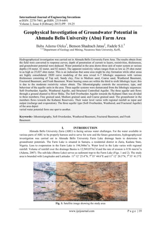
  • 1. International Journal of Engineering Inventions e-ISSN: 2278-7461, p-ISBN: 2319-6491 Volume 2, Issue 4 (February 2013) PP: 19-25 www.ijeijournal.com P a g e | 19 Geophysical Investigation of Groundwater Potential in Ahmadu Bello University (Abu) Farm Area Baba Adama Oleka1 , Benson Shadrach Jatau2 , Fadele S.I.3 1,2,3 Department of Geology and Mining, Nasarawa State University, Keffi, Hydrogeophysical investigation was carried out in Ahmadu Bello University Farm Area. The results obtain from the field were converted to response curves; depth of penetration of current to layers, resistivities, thicknesses, and groundwater potential were deduced. Water potential in the area shows three unit of water system at various depths (10 meter. 42 meter, and 82 meter). The apparent resistivity values ranges from as low as 29 ohm meter to as high as 25,027 ohm meter. This is an indication that some area might be clay formation while other areas are highly consolidated. IXID curve modeling of the area reveal 6–7 lithologic sequences with various thicknesses consisting of Top soil, Sandy clay, Fine to Medium sand, Coarse sand, Weathered Basement, Fractured Basement, and Fresh Basement. Water bearing zones are within the third to sixth lithologic layer; this is due to the moderate resistivity values obtain. The lithostratigraphy controls the occurrence, type, and behaviour of the aquifer units in the area. Three aquifer systems were demarcated from the lithologic sequences: Soft Overburden Aquifer, Weathered Aquifer, and Structural Controlled Aquifer. The three aquifer unit flows through a ground channel to River Shika. The Soft Overburden Aquifer towards the Kubanni Dam was divided to three members; Fine grained sand, Medium grained sand, and Coarse grained sand. The groundwater in the members flows towards the Kubanni Reservoirs. Their water level varies with regional rainfall as input and output (recharge and evaporation). The three aquifer type (Soft Overburden, Weathered, and Fractured Aquifer) of the area depict varied water potential form one spot to another. Keywords:- lithostratigraphy, Soft Overdurden, Weathered Basement, Fractured Basement, and Fresh Basement. I. INTRODUCTION Ahmadu Bello University Zaria (ABU) is facing serious water challenges. For the water available in various parts of ABU to be properly harness and to serve for now and the future generations, hydrogeophysical investigation was carried out in Ahmadu Bello University Farm Lake drainage basin to determine its groundwater potentials. The Farm Lake is situated in Samaru, a residential district in Zaria, Kaduna State, Nigeria. Loss to evaporation in the Farm Lake is 194,560m3 /a. Water level in the Lake varies with regional rainfall. Volume of rainfall over the drainage Basins is 12,569,037m3 /d and the rate of erosion is 0.56 mm/m2 /a (Adama, 2007). The sub-lake (Bomo Lake) serves as sediment trap to the Farm Lake (Figs. 1 and 2). The study area is bounded with Longitudes and Latitudes 110 12’ 25.4”N, 70 35’ 44.6”E and 110 12’ 20.3”N, 70 35’ 41.5”E Fig. 1: Satellite image showing the study area
  • 2. Geophysical Investigation of Groundwater Potential in Ahmadu Bello University… www.ijeijournal.com P a g e | 20 II. GEOLOGY OF THE STUDY AREA The area under study is underlain by Precambrain rocks of the Nigerian Basement Complex. Groundwater localization within the Basement Complex occurs either in the weathered mantle or in the fracturing, fissuring and jointing systems of the bedrock (Jones, 1985; Ako and Olorunfemi, 1989; Olayinka and Olorunfemi, 1992). These unconsolidated materials are known to reflect some dominant hydrologic properties, and the highest groundwater yield in Basement Complex area are found in areas of thick overburden overlying fractured zones and are characterized by relatively low resistivity (Aderinto, 1986; Olorunniwo and Olorunfemi, 1987; Olorunfemi and Fasuyi, 1993). III. DATA COLLECTION The methods of data collection include; literature review, topographical, geological, geophysical, hydrological, hydrogeological, lithologic observation, field survey using traditional and Geographic Information System (GIS). The geophysical survey was carried out along transverses (Fig. 3) using Campus Ohmega Resistivity Meter from Allied Associate Geophysical Limited Serial number 0070. It is a compact, one box unit consisting of the transmitter and the receiver integrated circuiting boards with digital display. The curves were interpreted based on the principle ‘that all points of maxima, minima, and inflection indicate the existence of boundaries’. The fresh rock is indicated wherever the resistivity valves trend to infinity (Telford et al, 1976). The fresh bedrock resistivity exceeds 1000m, but where it is fractured and saturated the resisitivity reduces to less than 1000m (Olayinka and Olorunfemi 1992). Figure 2: Map showing drainage of the three Ahmadu Bello University Zaria impounding reservoir: Kubanni, Bomo and ABUfarm Lakes. The black stars symbols are the VES points. Figure 3: Sampling points(sounding locations) in the study area along and around the transverse lines IV. FIELD CURVES The apparent resistivities obtained were plotted against electrode spacing (AB/2) and the field curves were produced on a log graph sheet. The sounding curves were evaluated using IXID processing package(2004). The field curves were subjected to series of curves matching with the numerous curves in the package and the software automatically selects curves with models that suit the apparent resistivity values or
  • 3. Geophysical Investigation of Groundwater Potential in Ahmadu Bello University… www.ijeijournal.com P a g e | 21 field curves. The package displays the interpreted curve matching and model data showing the number of lithologies intercepted, corresponding thicknesses, depth to basement, and the apparent resisitivities value of the lithologies at each sounding point. V. DATA ANALYSIS The interpreted result reveals six to seven lithologic layers with their thicknesses, apparent resistivities, depths, sub-terranean lateral extent, probable depths of the overburden, weathered, basement, and geologic structure as may influence groundwater condition. (Figs. 4 ,5 and 6). VI. APPARENT RESISTIVITY MAPS From the analysis of the interpreted data, the total depth to basement is between 10 m to 82 m, shallow in some places and deeper in other areas with varying apparent resistivity values. Low resistivity values indicate the presence of water in a formation, too low or high of it may not favour the flow of groundwater as is attributed to clayey formation or dry consolidated formation which acts as aquiclude and aquitard (Telford et al, 1976). Fig. 4: Map of depth of overburden aquifer of the ABU farm lake Fig. 5: Map of the depth of weathered aquifer of the ABU farm lake Apparent resistivity map were produce at various intervals. This is to actually see the trend of the different formation and water potential in the basin. Different resistivity values have been assigned to particular type of formation in different literatures; this could be due to the different conditions at which they were measured. Moderate resistivity values are obtainable in good aquiferous zones. The clayey sand-sand layer has a high sand content which increases the resistivity value, and perhaps the hydraulic conductivity and transmissivity (Odusanya and Amadi, 1990). The sand clay layer with high clay content imposes some confining characteristics on the aquifer zone (Dan Hassan and Olorunfemi 1990). A high degree of saturation may be responsible for the low range of resistivity. Resistivity map therefore, link areas with similar potentials which also show the flow direction. Fig. 6: Basement Topography of the ABU farm Lake
  • 4. Geophysical Investigation of Groundwater Potential in Ahmadu Bello University… www.ijeijournal.com P a g e | 22 The resistivity at various depths is an indication of highly potential zone. The groundwater depth from the map shows a good groundwater potential spread over the area. This conforms to the undulating nature of the topography. At sounding point 13, 27, and 28 which correspond to depth 36 m, 38 m and 45 m the groundwater flow directions is shown. At these depths the groundwater flows away from the study area (Fig.7). Fig.7: Piezometric map of the ABU farm lake showing groundwater flow direction Fig.8:Iso-resistivity map of the structurally controlled aquifer. VII. THICKNESS OF THE OVERBURDEN Hand-dug wells in the Farm Lake area were used for the lithologic and geologic studying of the subsurface. Thickness of the Overburden of the Farm Lake is divided into: the top layer, overburden, and weathered. The true groundwater table resistivity differs from the ground surface water table. The ground surface water table is being influenced by the topography of the ground which gives the surface water body in the area. Figs. 8 and 9 shows areas of intersections of Basement and Ground surface which is refer as spring (groundwater discharge points). Fig. 9: 3-D of the overburden aquifer of the ABU farm lake VIII. DEPTH TO BASEMENT MAP Depth to basement shows areas with thicker overburden and probably aquifer which implies more water potential. VES point 8, 26, and 19 have a depth to basement ranging between 0 m to 82 m which are the deepest area, this is followed by VES point 13 ranging between 0 m to 47 m. VES point 19 show a depth range
  • 5. Geophysical Investigation of Groundwater Potential in Ahmadu Bello University… www.ijeijournal.com P a g e | 23 between 0 to 82 m. Depth to Basement gives the topography of the basement of the place. The Farm Lake bedrock topography shows that the aquifer is structurally controlled. (Figs. 10, 11, 12, 13, and 14) Fig.10: Iso-resistivity map of the structurally controlled aquifer Fig.11: 3-Dof the total depth to basement of the ABU farm lake Fig. 12: Geoelectric section showing the inferred lithologies of the VES stations for A – B, C – D, AND E – F of the ABU farm lake area Fig.13: Hydrogeological correlation of the Boreholes in the study area (Baba,2007).
  • 6. Geophysical Investigation of Groundwater Potential in Ahmadu Bello University… www.ijeijournal.com P a g e | 24 Fig.14: Hydrogeological cross-section of the study area. Explanations: 1-Water table; 2–Anthropogene and Eolian silt; 3- Upper, Fine grained Member of the older alluvial aquifer; 4– Middle, coarse grained Member of the older alluvial aquifer; 5–Lower, Fine grained Member of the older alluvial aquifer; 6–Saprolite;7– Precambrian, crystalline undifferentiated (Baba, 2007). IX. RESULTS OF THE WORK A total of twenty nine (29) sounding points were established in the basin. The water bearing units with considerable thickness is exposed in some part of the basin giving rise to springs in wet season and sometimes in dry season depending on the volume of the water stored in the aquifer. From the result of the interpreted data using the apparent resistivity and thickness, the basin is a groundwater potential area although the groundwater flows away from the Farm Lake basin into the bigger basin which is the Shika River through ground channel. The entire area shows 6 to 7 lithologic layers of various thicknesses which consist of Top Soil, Sandy Clay, Fine to Medium Sand, Coarse Sand, Weathered Basement, Fractured Basement, and Fresh Basement. Different aquifer unit and type were identified namely; Overburden, Weathered, and Structural Controlled Aquifer. The Overburden Aquifer is the major aquifer unit, thickness, and resistivity value obtained at these unit shows that the area has a good permeability and porosity. The apparent resistivity maps shows area with same water potential. The lithostratigraphy of the basin is controlled be the occurrence, type, and behaviour of the aquifer unit. The maps of the resistivity of the Basement, Top layer, True Aquifer, Overburden Aquifer, Weathered Aquifer, and Structurally Controlled Aquifer were plotted. The maps of the depth to the Basement, Weathered Aquifer, Overburden Aquifer, True Aquifer, Top layer, and Structurally Controlled Aquifer of the Farm Lake were determined. The hydro geological correction, hydro geological cross section, and the geoelectrical section show the inferred lithologies of the VES stations of the Farm Lake area, depth to water table, and aquifer thickness. The geoelectric data for the sections A – B, C – D, and E – F are shown in Table 1. Table 1: Geoelectric section data for VES Stations A – B, C – D, AND E - F Geoelectric data for A – B Geoelectric data for C – D Geoelectric data for E – F VES station 10 VES station 24 VES station 6 Resistivity (Ω) Thickness (m) Depth (m) Resistivity (Ω) Thickness (m) Depth (m) Resistivity (Ω) Thickness (m) Depth (m) 105.44 1.0920 1.0920 106.71 1.9203 1.9203 53.778 4.8517 4.8517 247.37 17.770 18.862 273.89 29.417 31.337 34.035 2.6275 7.4793 106.38 15.421 34.283 127.60 18.915 50.253 236.10 4.6592 12.138 327.94 21.269 55.552 982.27 - - 1346.2 - - 1529.7 - - - - - - - - VES station 16 VES station 7 VES station 27 186.08 2.7359 2.7359 90.565 3.2377 3.2377 95.108 0.80381 0.80381 1312.1 3.9463 6.6822 58.467 4.9296 8.1673 254.12 4.0919 4.8957 103.96 17.147 23.829 98.795 8.0480 16.215 190.46 6.7656 11.661 776.74 - - 80.163 11.256 27.471 465.16 9.0089 20.670 - - - 10470 - - 307.73 25.163 45.833 - - - - - - 1888.0 - - VES station 15 VES station 12 VES station 29
  • 7. Geophysical Investigation of Groundwater Potential in Ahmadu Bello University… www.ijeijournal.com P a g e | 25 145.74 0.44213 0.44213 180.90 0.60530 0.60530 297.86 3.3112 3.3112 79.301 7.4281 7.8702 25.489 0.86581 1.4711 105.56 4.3725 7.6837 113.20 21.560 29.430 392.61 2.5816 4.0527 226.94 9.6911 17.375 2623.3 - - 40.811 6.0199 10.073 263.12 9.0860 26.461 - - - 674.65 7.3302 17.403 244.82 12.943 39.403 - - - 14168 - - 1193.5 - - - - - VES station 14 - - - - - - 53.778 4.8517 4.8517 - - - - - - 34.035 2.6275 7.4793 - - - - - - 236.10 4.6592 12.138 - - - - - - 1346.2 - - - - - X. CONCLUSION Estimation of groundwater resources requires data on aquifer water level fluctuation and changes in water elevation with time. This work provide basis of understanding groundwater potential of the study area using the basin resistivity, thickness, and aquifer characteristics. To achieve optimal environmental balance in protecting groundwater and surface water there should be reservoir operating plan especially for multipurpose reservoirs. Therefore integrated approach is important in solving water problems. IXID curve modeling of the area reveal 6–7 lithologic sequences with various thicknesses consisting of Top soil, Sandy clay, Fine to Medium sand, Coarse sand, Weathered Basement, Fractured Basement, and Fresh Basement were delineated at subsurface. Water bearing zones are within the third to sixth lithologic layer; this is due to the moderate resistivity values obtain. The lithostratigraphy controls the occurrence, type, and behaviour of the aquifer units in the area. Three aquifer systems were demarcated from the lithologic sequences: Soft Overburden Aquifer, Weathered Aquifer, and Structural Controlled Aquifer. The three aquifer unit flows through a ground channel to River Shika. REFERENCES 1) Aderinto, A. 1986, Estimation of aquifer transmissivity in the Basement Complex using Dar Zarrok parameters. Unpublished M.Sc. Thesis. Department of Geology, university of Ibadan pp 50-60. 2) Ako, B. D. and Olorunfemi M.O.1989, Geoelectrical survey for groundwater in the newer basalts of Jos, plateau state. Journal of Mining and Geology 25, pp. 247-250 3) Baba, A. 2007,Surface and Groundwater Availability in Ahmadu Bello UniversityMain Campus Samaru, Zaria. Unpublished Master’s thesis submitted to the Department of Geology Ahmadu Bello University. 4) Dan Haassan and Olurunfemi, M.O. 1999. Hydro-geophysical investigation of a basement terrain in north-central part of Kaduna state, Nigeria. Journal of Mining and Geology, Vol. 35(2) pp. 189-206. 5) IXD Inversion 2004. D.C resisstivity Data interpretation software copyright Interpex Ltd P.O.Box 837 golden Colorado 80402 6) Jones, M. J. 1985. The weathered zones aquifers of Basement Complex area of African. Quarterly Journal of Engineering Geology, London Vol. 18, pp. 35-45 7) Odusanya B.O. and Amadi, U.M.P. 1990. An empirical resisitivity model for predicting shadow groundwater occurrence in the Basement Complex. Water Resources Journal of Nigeria association of Hydrogeologist 2, pp. 77-87. 8) Olayinka, A.I. and Olorufemi, M.O. 1992, Determination of geoelectrical characteristics in Okene area and implication for borehole siting. Journal of Mining and Geology 28, pp. 403-412. 9) Olurunniwo, M.A. and Olorunfemi, 1987. Geophysical investigation for ground water in Precambrian terrains: A case history from Ikare, South-western Nigeria. Journal of African earth sciences 6, pp. 787-796. 10) Olurunfemi, M.O. and Fasuyi, S.A. 1993. Aquifer types and the geoeletric hydrogeologic characteristics of part of the central basement terrain of Nigeria (Niger State). Journal of Africa earth science 16, pp.309-317. 11) Telford, W. M., Geldart, L.P., Sheriff, R. C., and Keys D. E., 1976, Applied Geophysics. Cambridge University press London 860p.