This is the paper that was presented during the NESS Conference in 2011 in Stockholm Sweden by Daniela Patti.
For further information please contact d.patti@cetit.at
General Principles of Intellectual Property: Concepts of Intellectual Proper...
Ness2011 daniela patti paper
1. URBAN-RURAL TYPOLOGIES FOR EUROPEAN CITIES
Towards the Peri-Urban Landscape
Daniela Patti
(MSc Arch. Daniela Patti, researcher CEIT Alanova,
Concorde Business Park 2/F, A-2320 Schwechat, Austria, d.patti@ceit.at)
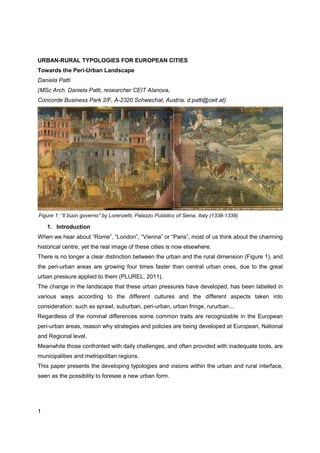
Figure 1: “Il buon governo” by Lorenzetti, Palazzo Pubblico of Siena, Italy (1338-1339)
1. Introduction
When we hear about “Rome”, “London”, “Vienna” or “Paris”, most of us think about the charming
historical centre, yet the real image of these cities is now elsewhere.
There is no longer a clear distinction between the urban and the rural dimension (Figure 1), and
the peri-urban areas are growing four times faster than central urban ones, due to the great
urban pressure applied to them (PLUREL, 2011).
The change in the landscape that these urban pressures have developed, has been labelled in
various ways according to the different cultures and the different aspects taken into
consideration: such as sprawl, suburban, peri-urban, urban fringe, rururban...
Regardless of the nominal differences some common traits are recognizable in the European
peri-urban areas, reason why strategies and policies are being developed at European, National
and Regional level.
Meanwhile those confronted with daily challenges, and often provided with inadequate tools, are
municipalities and metropolitan regions.
This paper presents the developing typologies and visions within the urban and rural interface,
seen as the possibility to foresee a new urban form.
1
2. 1. Peri-urban is where it’s happening
Sprawl historically developed in the United States due to the large use of the automobiles
(Ingersoll, 2006), yet less known is that European urban areas have expanded, since the mid
1950s, on average by 78%, whereas their population has grown only by 33% (EEA, 2006), and
still continue with an expansion rate between 0.4 and 0.7% per year (PLUREL, 2011), as
illustrated in figure 2.
Figure 2 Graph showing estimated loss of agricultural land in 20 EU countries due to urbanization
between 1990 and 2000 based on an analysis of CORINE Land Cover Data (EEA)
In order to properly define the object in discussion, some basic definitions are necessary,
especially as in Europe, due to the linguistic, cultural and legal fragmentation, the same
phenomenon has taken different names, such as “sprawl” by planners, “rururban”, “urban
fringe”, and “peri-urban landscape” by landscape architects, as during the European Landscape
Convention (2000) there was a focus on the need to manage and plan landscapes in all its
declinations.
The reason why this new urban form is getting more attention in the last years is because
between 1990 and 2000 the growth of the urban areas and the associated infrastructures
throughout Europe consumed more than 8000 km² – equivalent to the entire territory of the state
of Luxembourg (EEA, 2006).
Regardless of the various definitions, the physical manifestation is clear, as it consists of highly
pressured areas in the urban-rural interface, where due to urban development the landscape is
2
3. rapidly and drastically changing, which implies a series of consequences from an economic,
social and environmental point of view.
The common features to peri-urban areas are (Gallent, Bianconi, Anderson, 2006):
− Low density population (50 inh/km² and with a soil leverage of 30-50%)
− Agricultural surface (often with small allotments)
− Industrial facilities (often light industry)
− Large scale facilities (shopping centres, waste facilities, energy plants...)
− Great mobility infrastructure (rings, motorways, airports...)
Figure 3: Urban Atlas Rome, Vienna and Malmö (EEA, 2010)
3
4. These characteristics are common to all peri-urban areas, although there are different forces
that depend on whether the metropolitan system is monocentric or polycentric, weather it is a
capital city, and obviously on the planning culture of the Country, as it has been studied that
there are three main regions in Europe, as regards to the types of cities: the Southern area, with
a compact city with recent sprawling; the Central-Eastern area, more compact; the North-
western area, with a relatively homogeneous urbanization in all the territory, also considered
“anti-urban” (URBS PANDENS, 2005), as presented in Figure 3.
2. The urban and the rural perspective
The urban area is growing, even if not proportionally to its demography, and peri-urban fringes
are getting more and more attention.
In order to understand what happens in the peri-urban areas, one must first look individually at
its interfaces.
The urban interface
This increasing tendency among European urban inhabitants, of moving towards the suburbs, is
developing a great cost to the expenses of the community.
Low density settlements necessarily need to have a series of infrastructures, from roads to
water and electricity, but also public transport, which are publicly paid (Carruthers Ulfarsson,
2003).
From an environmental perspective the damages are various: the large use of the car and the
great emission of CO², the increasing soil cover which limits the water drainage, to only mention
a few of them (EEA, 2006).
This is why there is an increasing approach towards densification strategies within the urban
fabric by using voids, brownfieds and other ex-industrial land, adding floors on rooftops and so
on.
The rural interface
Food security is one of the first priorities for the EU, but there is a critical interface between
agriculture and peri-urban land-use change.
The new Common Agricultural Policy (CAP) is expected to be in vigour by 2013, and it is
expected to further promote the inter-linkage between the agricultural production and the urban
consumption (PLUREL, 2011).
4
5. Interestingly enough for the first time the CAP will take into account also the urban and peri-
urban land with agricultural use, as potential areas for the production bio products, increasingly
under demand.
3. The current condition of the peri-urban areas
Researches on sustainability have improved very much in the last years, yet the limit still seems
to be in the implementation.
There is a recognized problem that public administration’s structure is often not fully up to date,
compatible and easily adaptable to match the contemporary requirements of sustainability.
Due to the increasing urban sprawl, the European Union has started many initiatives to tackle
this problem.
Although EU policies and guidelines are essential to form a vision for the future development of
urban regions, they do not provide practical tools.
The assessment phase has two components, an analytical phase, such as the Sprawl Report
(EEA, 2006) and the monitoring and mapping of the existent, such as the CORINE Land Cover,
and a strategic one, such as the many policies that have been developed in order to tackle
specific environmental challenges from a National down to municipal scale.
A useful tool recently developed by the European Environmental Agency (EEA) is the Urban
Atlas (EEA, 2006), that offers a comparable map of all European urban regions (Figure 3).
From policies such as the Energy 2020, to the Typologies developed within the ESPON
research, much has been done on a National and Regional level.
Among the Typologies developed by ESPON there is an Urban-Rural Typology for the NUTS 3
regions (which are roughly comparable to provinces), which has been an important step towards
the recognition and definition of the challenge, yet still remain on a scale beyond the municipal
one.
The reason why it is commonly agreed that the identification of a typology is a useful tool to
tackle the peri-urban issues, is because this enables all actors involved to both analyse the
situation and prepare ad-hoc strategies, although policies are presently failing to address the
peri-urban areas at a municipal and metropolitan scale.
4. Some future scenarios
5
6. Over the past years there have been some relevant bottom-up small scale approaches that
have implemented environmentally viable projects combined with solidarity economy strategies
(Miller, 2004).
There are increasingly cooperatives involved in peri-urban faming and agriculture,
neighbourhoods promoting waste management and recycling, districts implementing water
treatment, only to list a few of them.
Clearly a new urban vision is taking shape, unlike the utopian approaches of the previous
decades, the new vision confronts itself with the existing condition and not a provocation on a
tabula rasa, but a cooperative approach towards the surrounding environment (Figure 5).
On the other hand in comparison to the great peri-urban vision formulated by Howard, the peri-
urban condition is not any longer a containment ring for the urban expansion, but a
multifunctional landscape that serves both its interfaces, the urban and the rural one (Figure 4).
Figure 4, 5: Garden City Concept by E.Howard (1902); “Monumento continuo“ by Superstudio (1969)
If we consider that the ongoing densification strategies in Europe should limit drastically the
urban expansion, then still we will be left with the existing peri-urban areas that have the
potential of defining a permeable border to the city, rich in functions and in environmental
potential, taking part of the urban metabolism (SUME, 2010).
The areas in this regards with the biggest potential are the many voids left within the
discontinuous peri-urban fabric. These could create a network for leisure parks and tourism,
agriculture, and environmental facilities.
6
7. Figure 6: SNAP (Sustainable Neighbourhood Retrofit Action Plan): County Court Neighbourhood,
Bramton, Ontario
Therefore on the one hand these voids can take part of the urban metabolism, by hosting
facilities for the recycling of water, cultivation of food, production of energy and provision of
green infrastructures to the inhabitants; on the other hand they can promote local occupation
thanks to local initiatives of communities, and therefore also feed the local economy (Figure 6 ).
Figure 7: PGT (Governmental Plan for the Territory), Milan, Italy, by LAND (2007)
7
8. The variety of activities, from businesses to leisure ones, are slowly being interpreted by public
administrations as a network, where environmental, social and economic issues collaborate
hand in hand. The rural, the peri-urban and the urban realm of cities are looked at in their unity,
which offers a new range of perspectives (Figure 7).
5. Conclusion
The 21st century city is being built within the peri-urban areas and therefore it needs a unitary
vision that understands the city as a whole, with the urban, the peri-urban and the rural areas,
that cooperate with one another.
A vision must go hand in hand with strategies to implement it, and to do so the current effort in
defining typologies must go down to the municipal and metropolitan level as these are the
scales in which the urban territory is daily planned, both in bottom-up and top-down efforts.
8
9. References
Carruthers, John I; Ulfarsson, Gudmundur F: Environment and Planning B: Planning and
Design, volume 30, pages 503-522 (2003)
EEA: Urban sprawl - Europe’s ignored environmental challenge (2006)
ESDP (European Spatial Development Policy) Report, Potsdam, May 1999
http://ec.europa.eu/regional_policy/sources/docoffic/official/reports/som_en.htm
European Landscape Convention, Florence (2000)
Gallent, Nick; Bianconi, Marco; Anderson Johan: “Planning on the Edge: The Context for
Planning at the Rural-Urban Fringe”, ROUTLEDGE CHAPMAN & HALL (2006 )
Howard, Ebeneezer: “To-Morrow: A Peaceful Path to Real Reform“ (1902)
Ingersoll, Richard: “Sprawltown: Looking for the City on its Edges” (2006)
Miller, Ethan: Solidarity Economics: Strategies for Building New Economies From the Bottom-
Up and the Inside-Out (2004)
PLUREL synthesis report: Peri-urbanisation in Europe: “Towards European policies to sustain
Urban Rural Future”, Editors: A. Piorr, J. Ravetz, I. Tosics. Publisher: University of
Copenhagen/Academic Books Life Sciences (2011)
SNAP (Sustainable Neighbourhood Retrofit Action Plan):
http://www.sustainableneighbourhoods.ca/
SUME Project: Deliverable 4.2, October 2010.
URBS PANDENS: Detailed report (2005)
http://www.pik-potsdam.de/urbs/projekt/DetailedReport.pdf
9