Okanagan Waterwise: Assessment of Water Management and Global Warming
•
1 recomendación•1,204 vistas

Okanagan Waterwise: Assessment of Water Management and Global Warming

Recomendados
Recomendados
Más contenido relacionado
La actualidad más candente
La actualidad más candente (13)
Destacado
Destacado (20)
Similar a Okanagan Waterwise: Assessment of Water Management and Global Warming
Similar a Okanagan Waterwise: Assessment of Water Management and Global Warming (20)
Más de Fiona9864
Más de Fiona9864 (20)
Último
Último (20)
Okanagan Waterwise: Assessment of Water Management and Global Warming
- 1. Participatory Integrated Assessment of Water Management and Climate Change in the Okanagan Basin, British Columbia FINAL REPORT Edited by STEWART COHEN AND TINA NEALE Adaptation & Impacts Research Division, Environment Canada
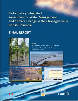
- 2. This report may be cited as: Cohen, S., and T. Neale, eds. 2006. Participatory Integrated Assessment of Water Management and Climate Change in the Okanagan Basin, British Columbia. Vancouver: Environment Canada and University of British Columbia. Individual chapters may be cited by the chapter authors. For example, Langsdale, S., A. Beall, J. Carmichael, S. Cohen, and C. Forster. 2006. Exploring Water Resources Futures with a System Dynamics Model. In Participatory Integrated Assessment of Water Management and Climate Change in the Okanagan Basin, British Columbia, edited by S. Cohen and T. Neale. Vancouver: Environment Canada and University of British Columbia. An electronic version of this report is available at the following web site: http://www.ires.ubc.ca/aird/ ISBN No.: 0-662-41999-5 Cat. No.: En56-209/2006E Cover Photo Captions Clockwise from top left: 1. Drip irrigation and mulching, Pacific Agri-Food Research Centre, Summerland, BC (Tina Neale) 2. Installation of water intake at Okanagan Lake, Penticton BC. (Bob Hrasko) 3. Systems model output screen, Okanagan Lake stage scenarios (see Figure F.17). 4. View across Okanagan Lake near Ellison Provincial Park (Wendy Merritt).
- 3. Participatory Integrated Assessment of Water Management and Climate Change in the Okanagan Basin, British Columbia FINAL REPORT Edited by STEWART COHEN AND TINA NEALE
- 4. NOTICE TO READERS Previous reports published in this research series are: Cohen, S., and T. Kulkarni, eds. 2001. Water Management & Climate Change in the Okanagan Basin. Vancouver: Environment Canada & University of British Columbia. Cohen, S., and T. Neale, eds. 2003. Expanding the Dialogue on Climate Change & Water Management in the Okanagan Basin, British Columbia. Interim Report, January 1, 2002 to March 31, 2003. Vancouver: Environment Canada and University of British Columbia. Cohen, S., D. Neilsen, and R. Welbourn, eds. 2004. Expanding the Dialogue on Climate Change & Water Management in the Okanagan Basin, British Columbia. Final Report, January 1, 2002-June 30, 2004. Vancouver: Environment Canada, Agriculture and Agri- Food Canada & University of British Columbia. Several manuscripts from the 2004 study have been published in refereed journals, or are in press. These are: Cohen, S.J., D. Neilsen, S. Smith, T. Neale, B. Taylor, M. Barton, W. Merritt, Y. Alila, P. Shepherd, R. McNeill, J. Tansey, and J. Carmichael. 2006. Learning with local help: Expanding the dialogue on climate change and water management in the Okanagan region, British Columbia, Canada. Climatic Change. 75:331-358. Merritt W., Y. Alila, M. Barton, B. Taylor, S. Cohen and D. Neilsen. 2006. Hydrologic response to scenarios of climate change in subwatersheds of the Okanagan Basin, British Columbia. Journal of Hydrology. 326, 79-108. Neilsen, D., Smith, C. A. S., Frank, G., Koch, W., Alila, Y., Merritt, W., Taylor, W. G., Barton, M., Hall, J. W. and Cohen, S. J. 2006. Potential impacts of climate change on water availability for crops in the Okanagan Basin, British Columbia. Canadian Journal of Soil Science. 86:921-936. Shepherd, P J. Tansey, and H. Dowlatabadi. 2006. Context matters: the political landscape of ., adaptation in the Okanagan. Climatic Change. 78:31-62. Papers from the 2006 study are still in preparation, and will be submitted for review later this year. Opinions expressed in this report are those of the authors and not necessarily those of Environment Canada, University of British Columbia, Natural Resources Canada, or any collaborating agencies.
- 5. STUDY TEAM NAME AFFILIATION Allyson Beall Program in Environmental Science and Regional Planning, Washington State University Jeff Carmichael Institute for Resources, Environment & Sustainability, University of British Columbia Stewart Cohen (P.I.) Adaptation & Impacts Research Division, Environment Canada Institute for Resources, Environment & Sustainability, University of British Columbia Craig Forster College of Architecture & Planning, University of Utah Bob Hrasko Agua Consulting Inc. Stacy Langsdale Institute for Resources, Environment & Sustainability, University of British Columbia Roger McNeill Environment Canada, Pacific and Yukon Region Tina Neale Adaptation & Impacts Research Division, Environment Canada Institute for Resources, Environment & Sustainability, University of British Columbia Natasha Schorb School of Community and Regional Planning, University of British Columbia Jodie Siu Smart Growth on the Ground, Smart Growth British Columbia James Tansey Institute for Resources, Environment & Sustainability, University of British Columbia For further information, please contact Stewart Cohen at stewart.cohen@ec.gc.ca Stacy Langsdale (left) facilitating model building break-out group at the second model building workshop, April 15, 2005, Kelowna BC.
- 6. Table of Contents Notice to Readers d Study Team e Table of Contents g List of Figures k List of Tables p List of Boxes q Acknowledgements r Executive Summary i Sommaire Executif viii 1.0 Introduction 1 1.1 Project History and Need for Further Research 1 1.2 Study Objectives and Structure of this Report 4 2.0 Urban Water Futures: Exploring Development, Management and Climate Change Impacts on Urban Water Demand 7 2.1 Case studies 8 2.2 Methodology 8 2.2.1 Scenario Inputs 10 2.3 Results 16 2.3.1 Climate Change, Dwelling and DSM Scenarios 16 2.3.2 Supply – Demand Comparison 31 2.4 Conclusions and Recommendations 34 2.4.1 Population Growth 34 2.4.2 Housing Patterns 34 2.4.3 Climate Change 34 2.4.4 Demand Side Management 35 2.4.5 Data Gaps and Quality 35 2.4.6 Other Research and Future Directions 35 3.0 Costs of Adaptation Measures 37 3.1 Supply Side Options for Adaptation 37 3.1.1 Groundwater Development 37 3.1.2 Upstream Storage (Watershed Development) 40 3.1.3 Mainstem Pumping 41 3.1.4 Impact of Water Treatment on Costs 42 3.1.5 Demand Side Adaptation Options 42 3.2 Impact of Water Treatment on Costs 44 3.3 Summary of Case Studies for Water Adaptation 46 FINAL REPORT | g
- 7. 3.4 Local Water Management versus Okanagan Wide Adaptation Strategies 46 4.0 Shared Learning through Group Model Building 49 4.1 Introduction 49 4.1.1 Objectives 49 4.1.2 Previous work 49 4.2 Methodology 50 4.2.1 Participatory Integrated Assessment 50 4.2.2 System Dynamics 50 4.2.3 Related Work 51 4.3 The Group Model Building Process 51 4.3.1 Workshop 1 52 4.3.2 Workshop 2 54 4.3.3 Workshop 3 56 4.3.4 Round of Meetings 57 4.3.5 Workshop 4 57 4.3.6 Workshop 5 58 4.4 Results 58 4.5 Discussion 63 4.5.1 Lessons Learned 63 4.5.2 Did This Process Make a Difference? 64 5.0 A System Dynamics Model for Exploring Water Resources Futures 65 5.1 Introduction 65 5.2 Project History 65 5.3 Methodology 66 5.3.1 Participatory Modelling 66 5.3.2 System Dynamics 66 5.4 Description of the Model and the Actual System 66 5.4.1 Model Components 67 5.4.2 Dynamics of the System 69 5.5 Results 72 5.5.1 Adaptation 79 5.6 Discussion 79 5.7 Conclusions and Remarks 80 6.0 Residential Policy, Planning and Design – Incorporating Climate Change into Long-Term Sustainability in Oliver 81 6.1 Introduction to the Partnership 81 6.2 Incorporating Climate Change into Smart Growth on the Ground in Oliver 82 6.3 Results of the Work 83 6.3.1 The Charrette 83 6.3.2 Charrette Team Recommendations 83 6.3.3 Listing of Web Sites on Oliver Design Process 84 7.0 Agricultural Policy 85 7.1 Study Aim & Rationale 85 7.2 Origins of Multiple Risk 85 7.2.1 Early History of the Wine Industry 85 h | Participatory Integrated Assessment of Water Management and Climate Change in the Okanagan Basin, British Columbia
- 8. 7.2.2 Land Pressures 86 7.2.3 Trade Liberalization 86 7.2.4 State of the Industry 86 7.3 The Climate Change Adaptation Process 87 7.3.1 Autonomous Adaptation to Risk 87 7.3.2 Risk Perception 87 7.3.3 Adaptive Capacity in a Multiple Risk Environment 87 7.3.4 Support for Policy Intervention 88 7.4 Methods 88 7.4.1 Survey Instrument Choice and Design 88 7.4.2 Subject Recruitment and Success 88 7.4.3 Interview Structure and Analysis 90 7.5 Results 90 7.5.1 Demographic and Business Characteristics of Study Participants 90 7.5.2 Water Source & Management Profile 92 7.5.3 Balancing Multiple Risks in Pursuit of Profitability 96 7.5.4 Perceptions of Water Shortage Risk 97 7.5.5 Policy Development 100 7.6 Analysis 102 7.6.1 Risk Perception: Implications for Adaptation 102 7.6.2 Managing Multiple Risks 103 7.6.3 Implications for Water Management 105 7.7 Policy Considerations 106 7.7.1 Policy Recommendations 106 7.7.2 Institutional Change 107 7.8 Future Uncertainty 107 7.8.1 Need for a Cautionary Approach 108 7.9 Conclusions 108 8.0 Lessons Learned and Moving On 109 Bibliography 113 Appendix A. Groundwater Development 119 A.1 Introduction 119 A.2 Groundwater Opportunities 119 A.2.1 Role of Groundwater 119 A.3 Water Use and System Integration 120 A.4 Groundwater Risks 121 A.5 Regulatory Issues - Approvals 122 A.6 Typical Steps for Groundwater Development 123 A.7 Costing Considerations 124 A.7.1 Drilling Costs 125 A.7.2 Pumping Costs 127 Appendix B. Case Study Detail Project Sheets 131 Appendix C. Model Process 133 C.1 Okanagan Timeline Created by Workshop 1 Participants on February 22, 2005 133 C.2 Diagrams Created by Participants in Workshop 2, April 15, 2005 136 FINAL REPORT | i
- 9. C.3 Worksheet: Setting the Course Discussion Guide 138 C.4 Pre and Post Evaluation Form, Workshop 5 139 C.4.1 Workshop 5 Pre-Evaluation 139 C.4.2 Workshop 5 Post-Evaluation 140 Appendix D. Model Quick User Guide 141 Appendix E. Model Level Documentation 143 E.1 Water Supply Sources 143 E.1.1 Climate Change Scenarios 143 E.1.2 Hydrologic Scenarios 143 E.1.3 Diversions from Adjacent Basins 144 E.1.4 Groundwater 145 E.1.5 Return Flows to Uplands 145 E.2 Water Demands 145 E.2.1 Population Growth Calculations 145 E.2.2 Converting Regional District Populations to Populations Using Each Water Source 147 E.2.3 Calculating Residential Water Use 149 E.2.4 Residential Demand Side Management Strategies 150 E.2.5 Agricultural Demand 150 E.2.6 Conservation Flow Requirements in Tributaries to Okanagan Lake 153 E.2.7 Fish Flow Requirements in South End 155 E.3 Water Balance Calculations 155 E.3.1 Uplands Hydrology Sector 155 E.3.2 Upland Storage Outflow Calculations Sector 157 E.3.3 Uplands Demand Reductions for Shortages Sector 159 E.3.4 Uplands Demand Allocations Sector 161 E.3.5 Uplands Allocation Summary Sector 161 E.3.6 Valley Hydrology Sector 162 E.3.7 Okanagan Lake Condition Sector 162 E.3.8 Valley Diversion Tracker Sector 162 E.3.9 Okanagan Lake Dam Operation Sector 162 E.3.10 South End Hydrology Sector 163 Appendix F Model Output . 165 F.1 Summary of Base Case, 1961-1990 165 F.2 Summary of Two Scenarios without Adaptation, 2010-2039 and 2040-2069 165 F.3 Demand Side Management (DSM) and Urban Densification Portfolio 169 F.4 Supplemental Use of Okanagan Lake 172 F.5 Managing for Sockeye 177 F.6 Combinations of Response Options 177 j | Participatory Integrated Assessment of Water Management and Climate Change in the Okanagan Basin, British Columbia
- 10. List of Figures Figure 1.1: Evolution of Okanagan Study Framework. 2 Figure 1.2: Projected changes in annual flow and crop water demand for Trout Creek (Neilsen et al., 2004, 2006). The vertical and horizontal lines indicate existing supply and demand thresholds. The HadCM3-A2 scenario represents projected changes in climate simulated by theHadCM3 global climate model using the A2 scenario of rapid growth in global emissions of greenhouse gases obtained from the Intergovernmental Panel on Climate Change (see Taylor and Barton, 2004). 4 Figure 2.1: Daily domestic water use for the City of Penticton 1998 to 2003. 10 Figure 2.2: Monthly domestic water use for the City of Penticton vs. mean maximum daily temperature for temperatures above and below the threshold temperature of 12°C. 11 Figure 2.3: Relationship between mean monthly maximum daily temperature and monthly outdoor water use per dwelling in Penticton during the irrigation season 1998-2003. 13 Figure 2.4: Annual water demand for the City of Kelowna with current preferences, current DSM and medium population growth for the 2001-2069 period. The figure shows demand without climate change and with six climate change scenarios. 17 Figure 2.5: Comparison of annual water use for current preferences (CP) and smart growth (SG) scenarios for the City of Kelowna for all population growth scenarios with current DSM and CGCM2-A2. 18 Figure 2.6: Impact of demand side management on annual water use for the City of Kelowna in the current preferences medium population growth scenario and CGCM2-A2 climate change. 19 Figure 2.7: City of Kelowna annual water use in the “best-case” (smart growth, combined demand side management, CGCM2-B2) and “worst-case” (current preferences, current demand side management and HadCM3-A21) scenarios for all population growth scenarios. 19 Figure 2.8: Contributions of DSM, smart growth and climate change to the difference between the best- and worst-case high population growth scenarios for two sets of intermediate scenarios for the City of Kelowna. The specific scenarios (best-case, worst-case and two intermediate scenarios) represented by each of the numbered lines are presented in Table 2.7. Note that this does not include comparison with base case climate (i.e. no climate change). 20 Figure 2.9: Percentage contributions to the difference between the high growth best- and worst-case scenarios of DSM, smart growth and climate change for two sets of intermediate scenarios in 2069 for the City of Kelowna. Note that this does not include comparison with base case climate (i.e. no climate change). 21 Figure 2.10: Annual water demand for the City of Penticton with current preferences, current DSM and medium population growth for the 2001 to 2069 period. The figure shows demand without climate change and with six climate change scenarios. 22 Figure 2.11: Comparison of annual water use for current preferences and smart growth dwelling scenarios for the City of Penticton for all population growth scenarios, CGCM2-A2 climate change and current DSM. 23 Figure 2.12: Impact of demand side management on annual water use for the City of Penticton in the current preferences medium population growth scenario and CGCM2-A2 climate change. 24 Figure 2.13: City of Penticton annual water use in the “best-case” (smart growth, combined demand side management, CGCM2-B2) and “worst-case” (current preferences, current demand side management and HadCM3-A22) scenarios for all population growth scenarios. 25 Figure 2.14: Contributions of DSM, smart growth and climate change to the difference between the best- and worst-case high population growth scenarios for two sets of intermediate scenarios for the City of Penticton. The specific scenarios (best-case, worst-case and two intermediate scenarios) represented by each of the numbered lines are presented in Table 2.7. Note that this does not include comparison with base case climate (i.e. no climate change). 25 FINAL REPORT | k
- 11. Figure 2.15: Percentage contributions to the difference between the high growth best- and worst-case scenarios of DSM, smart growth and climate change for two sets of intermediate scenarios in 2069 for the City of Penticton. Note that this does not include comparison with base case climate (i.e. no climate change). 26 Figure 2.16: Annual water demand for the Town of Oliver with current preferences, current DSM and medium population growth for the 2001-2069 period. The figure shows demand without climate change and with six climate change scenarios. 27 Figure 2.17: Comparison of annual water use for current preferences and smart growth dwelling scenarios for the Town of Oliver for all population growth scenarios with current DSM and CGCM2-A2. 28 Figure 2.18: Impact of demand side management options on annual water use for the Town of Oliver. 29 Figure 2.19: Town of Oliver annual water use in the “best-case” (smart growth, combined demand side management, CGCM2-B2) and “worst-case” (current preferences, current demand side management and HadCM3-A21) scenarios for all population growth scenarios. 29 Figure 2.20: Contributions of DSM, smart growth and climate change to the difference between the best- and worst-case high population growth scenarios for two sets of intermediate scenarios for the Town of Oliver. The specific scenarios (best-case, worst-case and two intermediate scenarios) represented by each of the numbered lines are presented in Table 2.7. Note that this does not include comparison with base case climate (i.e. no climate change). 30 Figure 2.21: Percentage contributions to the difference between the high growth best- and worst-case scenarios of DSM, smart growth and climate change for two sets of intermediate scenarios in 2069 for the Town of Oliver. Note that this does not include comparison with base case climate (i.e. no climate change). 30 Figure 2.22: City of Kelowna annual licensed domestic and ICI allocation and demand comparison for best- (low population growth, CGCM2-B2, smart growth housing and combined DSM) and worst-case (high population growth, HadCM3-A2, current preferences housing and current DSM) scenarios. 31 Figure 2.23: City of Penticton annual licensed domestic and agricultural allocation and demand comparison for best- (low population growth, CGCM2-B2, smart growth housing and combined DSM) and worst-case (high population growth, HadCM3-A2, current preferences housing and current DSM) scenarios. Historic demand includes 2001 domestic demand and average 1961 to 1990 modeled crop water demand. 32 Figure 4.1: Initial representation of Okanagan water resources in STELLA™, used to motivate discussion in Workshop 2. This image was printed in the centre of poster sized sheets for the group work. 54 Figure 4.2: Comparison of responses by event to the evaluation question: Do you feel this model is a legitimate and relevant tool to explore long-term water management in the Okanagan? 60 Figure 4.3: Percent attendance of all participants at all six events, categorized by affiliation. Plotted as (a) total number of people, and (b) weighted by the number of events each person attended. 61 Figure 4.4: Percent attendance of all participants at all six events, categorized by role in Okanagan. Plotted as (a) total number of people, and (b) weighted by the number of events each person attended. 61 Figure 4.5: Percent attendance of those people who attended three or more of the six events, categorized by affiliation. Plotted as (a) total number of people, and (b) weighted by the number of events each person attended. 62 Figure 4.6: Percent attendance of those people who attended three or more of the six events, categorized by role in the Okanagan. Plotted as (a) total number of people, and (b) weighted by the number of events each person attended. 62 Figure 4.7: Distribution of attendance throughout process according to role in the Okanagan, as shown for each event. 63 l | Participatory Integrated Assessment of Water Management and Climate Change in the Okanagan Basin, British Columbia
- 12. Figure 5.1: Okanagan Basin Map, showing location in British Columbia in inset. From (Cohen et al. 2006). 67 Figure 5.2: Upland, Valley and South End areas are outlined. 68 Figure 5.3: Causal Loop Diagram of Okanagan Basin water resources system, showing which components are not included in the model, and those that are only present through user-selected options. 71 Figure 5.4: Population in Okanagan by Regional District, with major events that increased growth rates indicated. 73 Figure 5.5: Average year inflow to Okanagan Lake compared to total demand with (yellow) and without (orange) residential adaptation for historic, 2020s and 2050s periods and with Hadley A2 climate change. The lower boundaries of the shaded areas represent low population growth and the upper boundaries represent rapid population growth. 73 Figure 5.6: Okanagan basin demand profile under Hadley A2 climate change scenario and rapid population growth. 30-year average. 74 Figure 5.7: Okanagan basin demand profile under Hadley A2 climate change scenario and slow population growth. 30-year average. 74 Figure 5.8: Dry year inflow to Okanagan Lake (average of the 10 driest years) compared to total demand with (yellow) and without (orange) residential adaptation for historic, 2020s and 2050s periods and with Hadley A2 climate change. The lower boundaries of the shaded areas represent low population growth and the upper boundaries represent rapid population growth. 75 Figure 5.9: Okanagan basin demand profile under Hadley A2 climate change scenario and rapid population growth. Average of 10 driest years in each 30-year period. 75 Figure 5.10: Okanagan basin demand profile under Hadley A2 climate change scenario and slow population growth. Average of 10 driest years in each 30-year period. 76 Figure 5.11: 30-year average annual supply-demand hydrographs for the Historic/Base Case (1961-1990). 76 Figure 5.12: 30-year average annual supply-demand hydrographs for the 2020s simulation. 77 Figure 5.13: 30-year average annual supply-demand hydrographs for the 2050s simulation. 77 Figure 5.14: Okanagan basin demand profile under Hadley A2 climate change scenario and rapid population growth with residential adaptation (corresponding to Figure 5.6). 30-year average. 78 Figure 5.15: Okanagan basin demand profile under Hadley A2 climate change scenario and slow population growth with adaptation (corresponding to Figures 5.7). 30-year average. 78 Figure 7.1: Number of years that the respondent’s family has been farming in the Okanagan. 91 Figure 7.2: Pros of overhead irrigation identified by its practitioners. 93 Figure 7.3: Cons of overhead irrigation identified by its practitioners. 94 Figure 7.4: Pros and cons of drip irrigation identified by its practitioners. 94 Figure 7.5: What is the trade-off associated with investing in water efficiency? 95 Figure 7.6: Responses to the question: Through my current system of water provision, I have enough water to irrigate during peak times and whenever I need it during the growing season. 98 Figure 7.7: Perceptions of the change in volume of water in the basin’s hydrological system and its availability for personal supply between 2006 and 2031. 99 Figure 7.8: Distribution of responses to the question: Are there any external/policy incentives for you to conserve water on your property? 99 Figure 7.9: Distribution of respondents’ preferences for the agency or partnership they most strongly support to lead development and implementation of an agricultural water conservation policy. 100 Figure A.1: Groundwater Drilling Cost Curves. 125 Figure A.2: Pump and Motor Cost Curve. 128 Figure A.3: Operational Pumping Costs. 128 Figure C.1: Sketch created by Group 1. 136 Figure C.2: Sketch created by Group 2. 137 Figure C.3: Sketch created by Group 3. 138 FINAL REPORT | m
- 13. Figure E.1: Two year hydrograph of aggregated flow in upland streams, showing shift from base case (1981-82), to a decreased, earlier peak in Hadley A2 – 2020’s (2030-31) and Hadley A2 – 2050’s (2060-61). 144 Figure E.2: STELLA component for treatment of groundwater in the Upland sector. 145 Figure E.3: Exponential growth in the STELLA language. 147 Figure E.4: Comparison of crop water demand [m] for seven major water purveyors in the Uplands during the first two years of the historic scenario (1961-62). 151 Figure E.5: Comparison of crop water demand [m] for the three different water source types. Note the increasing trend from Uplands down to the warmer South End. 151 Figure E.6: Comparison of crop water demand rates [m] for the four categories of crops in the Uplands. 152 Figure E.7: Comparison of Pasture crop water demand scenarios. Note increasing trend from historic base case to 2020’s and 2050’s. 152 Figure E.8: Modeled standard conservation targets shown with five years of varying hydrologic conditions (1978 – flood; 1979-80 – drought; 1981-82 – average). 154 Figure E.9: Conservation targets with modifications. Conservation target is no more than 50% of inflows. Greatest reductions are in drought years (1979-80). 154 Figure E.10: Instream flow targets for Sockeye in Okanagan River near Oliver over a 12-month period (Jan – Dec). 155 Figure E.11: Main components of the Uplands Hydrology Sector, where the water balance for this region is calculated. 156 Figure E.12: UL Reservoir Storage Target ranges as a percentage of the total capacity. These targets help direct management decisions for releasing (summer) and filling (during spring freshet). 157 Figure E.13: Spill Rules Factor rule curve. 158 Figure E.14: UL Cutoff Rules Factor, as a function of the UL Cutoff Ratio. 158 Figure E.15: Residential Outdoor Restrictions Factor defined as a function of the UL Supply Demand Balance Ratio. 159 Figure E.16: Residential Indoor Restrictions Factor defined as a function of the UL Supply Demand Balance Ratio. 160 Figure E.17: Agriculture Restrictions Factor defined as a function of the UL Supply Demand Balance Ratio. 160 Figure E.18: Supply and Demand balance calculation for the Valley Sector. 162 Figure E.19: Supply Demand Balance calculation for the South End Region. 163 Figure F.1: 1961-1990 base case summary of basin population, inflow, water demand and Okanagan Lake stage. 166 Figure F.2: Basin summary for 2010-2039 scenario with no adaptation (same indicators as in Figure F .1). 166 Figure F.3: Upland agricultural supply-demand balance, 2010-2039 (red), no adaptation, compared with 1961-1990 base case (blue). 167 Figure F.4: Uplands residential outdoor supply-demand balance, 2010-2039 scenario (red) compared with 1961-1990 base case (blue). 167 Figure F.5: Uplands residential indoor supply-demand balance, 2010-2039 scenario (red) compared with 1961-1990 base case (blue). Similar format as in Figure E.4. 168 Figure F.6: Basin summary for 2040-2069 scenario (same indicators as in Figure F .1). 168 Figure F.7: Upland agricultural supply-demand balance, 2040-2069 (red), no adaptation, compared with 1961-1990 base case (blue). 169 Figure F.8: Uplands residential outdoor supply-demand balance, 2040-2069 scenario (red) compared with 1961-1990 base case (blue). 170 Figure F.9: Uplands residential indoor supply-demand balance, 2040-2069 scenario (red) compared with 1961-1990 base case (blue). 170 Figure F.10: Uplands agricultural supply-demand balance, 2010-2039 scenario with DSM portfolio (red) compared with 2010-2039 no-adaptation case (blue). 171 n | Participatory Integrated Assessment of Water Management and Climate Change in the Okanagan Basin, British Columbia
- 14. Figure F.11: Uplands residential outdoor supply-demand balance, 2010-2039 scenario with DSM portfolio (red) compared with no-adaptation case (blue). 171 Figure F.12: Uplands residential indoor supply-demand balance, 2010-2039 scenario with DSM portfolio (red) compared with no-adaptation case (blue). 172 Figure F.13: Uplands agricultural supply-demand balance, 2040-2069 scenario with DSM portfolio (red) compared with 2040-2069 no-adaptation case (blue). 173 Figure F.14: Uplands residential outdoor supply-demand balance, 2040-2069 scenario with DSM portfolio (red) compared with no-adaptation case (blue). 173 Figure F.15: Uplands residential indoor supply-demand balance, 2040-2069 scenario with DSM portfolio (red) compared with no-adaptation case (blue). 174 Figure F.16: Okanagan Lake stage, 2010-2039 scenario with supplemental withdrawals from Okanagan Lake (red) compared with no-adaptation case (blue). 174 Figure F.17: Okanagan Lake stage, 2040-2069 scenario with supplemental withdrawals from Okanagan Lake (red) compared with no-adaptation case (blue). 175 Figure F.18: Valley outflow, 2040-2069 scenario with supplemental withdrawals from Okanagan Lake (red) compared with no-adaptation case (blue). 175 Figure F.19: Upland residential indoor supply-demand balance, 2040-2069 scenario with supplemental withdrawals from Okanagan Lake (red) compared with no-adaptation case (blue). 176 Figure F.20: Upland instream needs supply-demand balance, 2040-2069 scenario with supplemental withdrawals from Okanagan Lake (red) compared with no-adaptation case (blue). 176 Figure F.21: Valley outflows, 2010-2039 scenario with system managed for sockeye (red) compared with no-adaptation case (blue). 178 Figure F.22: Okanagan Lake stage, 2010-2039 scenario with system managed for sockeye (red) compared with no-adaptation case (blue). 178 Figure F.23: Valley outflows, 2040-2069 scenario with system managed for sockeye (red) compared with no-adaptation case (blue). 179 Figure F.24: Okanagan Lake stage, 2040-2069 scenario with system managed for sockeye (red) compared with no-adaptation case (blue). 179 Figure F.25: Uplands agriculture supply-demand balance, 2010-2039, with system managed for sockeye AND Okanagan Lake supplemental use (red) compared with no-adaptation (blue). 180 Figure F.26: Okanagan Lake stage, 2010-2039 with system managed for sockeye AND Okanagan Lake supplemental use (red) compared with no-adaptation case (blue). 180 Figure F.27: Okanagan Lake stage, 2040-2069 with system managed for sockeye AND Okanagan Lake supplemental use (red) compared with no-adaptation case (blue). 181 Figure F.28: Upland in-stream flow needs, 2040-2069 with system managed for sockeye AND Okanagan Lake supplemental use (red) compared with no-adaptation case (blue). 181 Figure F.29: South End outflow, 2040-2069 with system managed for sockeye AND Okanagan Lake supplemental use (red) compared with no-adaptation case (blue). 182 Figure F.30: Uplands residential indoor supply-demand balance, 2010-2039, with DSM AND Okanagan Lake supplemental use (red) compared with no-adaptation (blue). 182 Figure F.31: Uplands residential outdoor supply-demand balance, 2040-2069, with DSM AND Okanagan Lake supplemental use (red) compared with no-adaptation (blue). 183 Figure F.32: Okanagan Lake stage, 2040-2069 with DSM AND Okanagan Lake supplemental use (red) compared with no-adaptation case (blue). 183 Figure F.33: Uplands in-stream needs, 2040-2069 with DSM AND Okanagan Lake supplemental use (red) compared with no-adaptation case (blue). 184 Figure F.34: Valley outflows, 2040-2069 with DSM AND Okanagan Lake supplemental use (red) compared with no-adaptation case (blue). 184 FINAL REPORT | o
- 15. Figure F.35: Uplands agricultural supply-demand balance, 2040-2069 with DSM AND sockeye management (red) compared with no-adaptation case (blue). 185 Figure F.36: Uplands residential indoor supply-demand balance, 2040-2069 with DSM AND sockeye management (red) compared with no-adaptation case (blue). 185 Figure F.37: Okanagan Lake stage, 2040-2069 with DSM AND sockeye management (red) compared with no-adaptation case (blue). 186 Figure F.38: Uplands in-stream needs, 2040-2069 with DSM AND sockeye management (red) compared with no-adaptation case (blue). 186 Figure F.39: Valley outflow, 2040-2069 with DSM AND sockeye management (red) compared with no-adaptation case (blue). 187 List of Tables Table 2.1: Case study attributes. 8 Table 2.2: Case study population growth scenarios comparing 2069 population to the 2001 Census population. 11 Table 2.3: Number of dwellings in 2069 in smart growth and current preferences dwelling scenarios for all three population growth scenarios for each case study. 12 Table 2.4: Annual indoor and outdoor water use per dwelling type and per capita and regression statistics for mean maximum daily temperature and outdoor water use per dwelling. 14 Table 2.5: Indoor and outdoor water savings used in DSM scenarios. 16 Table 2.6: Comparison of per capita and per dwelling water use projections for the City of Kelowna. Water use is presented in ML. 17 Table 2.7: Progression from best-case to worst-case for orders 1 and 2 shown in Figures 4.5, 4.11 and 4.17. 21 Table 2.8: Comparison of per capita and per dwelling water use projections for Penticton. 23 Table 2.9: Comparison of per capita and per dwelling water use projections for the Town of Oliver. 27 Table 2.10: Domestic water demand scenarios and number of scenarios exceeding the City of Penticton’s licensed domestic allocation of 14,485.25ML. 33 Table 3.1: Water Sources for Major Water Utilities. 38 Table 3.2: Typical Wells for Major Utilities in the Okanagan Basin. 39 Table 3.3: Parameters Related to Reservoir Storage Water Quality. 40 Table 3.4: Summary of reservoir storage costs. 41 Table 3.5: Mainstem pumping projects. 41 Table 3.6: Water Treatment Process Costs. 42 Table 3.7: Conservation project summary. 43 Table 3.8: Domestic water rates. SFE = Single Family Equivalent. 44 Table 3.9: Water treatment process costs (repeated from Table 3.6). 44 Table 3.10: Recent and proposed projects for water supply, water conservation and water treatment. 45 Table 4.1: Summary of Events in Group Model Building Process. 51 Table 4.2: Description of Workshop 1. 52 Table 4.3: Description of Workshop 2. 54 Table 4.4: Research questions that participants want the model to be able to answer. 55 Table 4.5: Description of Workshop 3. 56 Table 4.6: Description of the Round of Meetings and Workshop 4. 57 Table 4.7: Description of Workshop 5. 58 Table 4.8: Number of responses to the post-workshop evaluation question “Have your perceptions of future water availability in the basin changed due to this exercise? 60 Table 4.9: Average values of responses on pre- and post-evaluations, for the question: “How well do you understand the model’s structure?” 60 Table 5.1: Adaptation and policy options included in the model on the user interface. 70 p | Participatory Integrated Assessment of Water Management and Climate Change in the Okanagan Basin, British Columbia
- 16. Table 7.1: Interview recruitment success rates in each of the study communities. 90 Table 7.2: Participant distribution by business type and location. 90 Table 7.3: Land-use before establishment of the current vineyard. 91 Table 7.4: Summary of water consumption trends (per acre) since 1996. 92 Table 7.5: Types of irrigation systems in place. 92 Table 7.6: Decisions growers can make to mitigate the impact of these risks. 97 Table 7.7: Pros and cons of water metering as identified by producers. 101 Table A.1: Drilling Costs. 126 Table A.2: Well Development Qualifiers. 127 Table A.3: Pumping and Water Treatment Operational Cost Summary. 129 Table E.1: Current population data for Regional Districts, and the portion of the population served by Okanagan Basin water sources. 146 Table E.2: Comparison of historic populations and those simulated by the model using calculated growth rates from the historic to the present. 147 Table E.3: Historic and Projected Annual Population Growth Rates [%] by Regional District. 147 Table E.4: Division of residential water use according to water source. 148 Table E.5: Linear relation parameters correlating outdoor water use to daily max temperature. 149 Table E.6: Reprint of Table 3.3 from Neale (2005), p 47. Also Table 2.5 this text, Chapter 2. 150 Table E.7: Conservation flow target structure. 153 List of Boxes Box 4.1: The following list was generated by participants at Workshop 1, February 2005. 53 Box 7.1: The process of autonomous adaptation to risk. 89 Box 7.2: Risks and challenges that affect growers’ ability to maintain the profitability of their businesses. 96 Box 7.3: The interactions of producer-identified risks and their implications for water demand. 104 FINAL REPORT | q
- 17. Acknowledgements T his study is a follow-up to earlier research projects, cited as Cohen and Kulkarni (2001) and Cohen et al.(2004) (see Chapter 1.0). The authors of this report are members of a collaborative research team, some of whom also contributed to these earlier publications. This project was made possible with financial support from the Government of Canada’s Climate Change Impacts and Adaptation Program (Project A846). The authors would also like to acknowledge support and cooperation from: Environment Canada, Smart Growth on the Ground, University of British Columbia, and BC Ministry of Environment. We would also like to thank Denise Neilsen and Grace Frank from Agriculture and Agri-Food Canada, and Wendy Merritt from Australian National University, who assisted with data transfer from their components (see Cohen et al. 2004) to this study. The group-based model building process, led by Stacy Langsdale, was a crucial component of this research effort. We would like to express our appreciation to Jeff Carmichael, Craig Forster, Brian Symonds, Allyson Beall, Barbara Lence and Jessica Durfee, for their advice and participation in the design of this year-long process of interactive workshops and dialogue. We would like to acknowledge and thank the following individuals who participated in this process, and helped to shape the structure and content of the model: Diana Allen, Des Anderson, Greg Armour, Darryl Arsenault, Jeptha Ball, Lorraine Bennest, Vicki Carmichael, Kristi Carter, Al Cotsworth, Corui Davis, Anne Davidson, Don Degan, Shannon Denny, Rod Drennen, Phil Epp, Don Guild, Brian Guy, Leah Hartley, Rob Hawes, Robert Hobson, Bob Hrasko, Nelson Jatel, Mary Jane Jojic, Stephen Juch, Jessica Klein, Steve Losso, James MacDonald, Deana Machin, Lloyd Manchester, Wenda Mason, Don McKee, Rick McKelvey, Siobhan Murphy, Denise Neilsen, Tim Palmer, Toby Pike, Barbara Pryce, Steve Rowe, Gord Shandler, Tom Siddon, John Slater, Ron Smith, Mike Stamhuis, Brian Symonds, Sonia Talwar, Jillian Tamblyn, Ted van der Gulik, Peter Waterman, Mark Watt, Adam Wei, Bruce Wilson, and Howie Wright. The study on agricultural practices, contributed by Natasha Schorb, benefited from the participation of growers from the Regional District of Okanagan-Similkameen. We would like to thank James Tansey and Tim McDaniels for their advice, and to acknowledge the growers for generously giving their time and effort to be interviewed. The study on residential water demand, contributed by Tina Neale, required detailed water use data from a number of communities. We would like to thank the staff of the City of Kelowna water utility, City of Penticton and Town of Oliver for providing this data and assisting with its interpretation and use for this research. The authors would like to thank the reviewer, Jim Bruce, for his thoughtful comments on this report. r | Participatory Integrated Assessment of Water Management and Climate Change in the Okanagan Basin, British Columbia
- 18. Executive Summary T his is the final report of the study, “Participatory Integrated Assessment of Water Management and Climate Change in the Okanagan Basin, British Columbia.” This study was made possible with financial support from the Government of Canada’s Climate Change Impacts and Adaptation Program (project A846). The research activity described in this report is a collaborative, interdisciplinary effort involving researchers from Environment Canada, Smart Growth on the Ground, the University of British Columbia, and the BC Ministry of Environment, as well as many local partners and researchers from Agriculture and Agri-Food Canada and Australian National University, who participated in our 2002-2004 study. Previous research on climate change and Okanagan water resources since 1997 has provided a potential damage report. Impacts on water supply and water demand have been described, and a dialogue on adaptation options and challenges has been initiated. This study offers a participatory integrated assessment (PIA) of the Okanagan water system’s response to climate change. The goal of the PIA is to expand the dialogue on implications of adaptation choices for water management to include domestic and agriculture uses and in-stream conservation flows, for the basin as a whole as well as for particular sub-regions. This has been accomplished through collaboration with ongoing studies in these areas, and builds on the results of earlier work. The major components of this study are: 1. Residential water demand: developing future demand scenarios for residential users, factoring in population growth and adaptation options; 2. Adaptation costs: expanding the inventory of various supply and demand management measures and incorporating water treatment costs; 3. Decision support model: building a system model, using a group-based process with local experts, which enables learning on impacts of climate and population changes, and the effects of implementation of various adaptation measures; 4. Adaptation policy – residential design: bringing climate change into community design through Smart Growth on the Ground’s process for creating a water-smart community plan in the Town of Oliver and surrounding area; 5. Adaptation policy – agricultural water use: exploring growers’ views on regional water policy. Residential Water Demand Previous studies in the Okanagan Basin have found that average daily residential water use in the region is highly variable, ranging from approximately 470 to 789 litres per capita per day (Lpcd). Drought year residential water use in the Lakeview Irrigation District has been FINAL REPORT | i
- 19. estimated as high as 1,370 Lpcd. When compared to and 115-360% in the 2050s. The maximum increase in municipal water use across Canada, water use in the water use determined in the current preferences Okanagan is relatively high. housing scenarios, without the impacts of climate change or additional DSM, ranged from 163% in the The Okanagan has experienced dramatic population low growth scenario to 570% in the high growth growth, from approximately 210,000 in 1986 to scenario. 310,000 in 2001. The population is expected to continue to grow, reaching nearly 450,000 by 2031. The climate change impact on water use in the 2020s This increase in population and associated development ranged from approximately 6% to 10%. The climate will result in increased municipal water demands. change impact became more pronounced in the 2050s Planning for future municipal water demands must take increasing water use by 10 to 19%. When combined into account not only the future population of the with population and current preferences dwelling region, but also urban development patterns, and growth, the climate change impact on water use was changes in water demand resulting from a warming magnified. This is due to the increased number of climate. ground-oriented dwellings and hence, increased outdoor water use. In the high population growth Building on earlier work reported in the 2004 study, scenario, the combined effects of climate change and three case studies were chosen for this research: the population growth increased water use between 111 Town of Oliver, City of Penticton and City of Kelowna and 119% in the 2020s and 407 to 446% in the 2050s water utility. This study was a multi-attribute analysis over the 2001 baseline. This was 12 to 21% more than that used scenarios, constructed with available data, to population growth alone in the 2020s and 45 to 86% explore the combined impacts of population growth, more in the 2050s. residential form, climate change and demand side management on municipal water demand. The The implication for climate change in water scenarios approach aimed to create depictions of future management planning is that annual water demands water demand that were plausible given a range of predicted without climate change occur several years development, climate change and water management earlier in the climate change scenarios. For example, in trends that could occur in the future. Scenarios of the 2030 to 2039 period, annual water demand with future water demand for each case study were “average” climate change occurred approximately four calculated in a spreadsheet model at annual time steps years earlier than in the no climate change scenario. In for the period 2001 to 2069, corresponding with the the 2040 to 2059 period, this increased to an average of 2020s and 2050s periods typical of climate change six years earlier. scenarios. A combined DSM portfolio, including public education, Three scenarios of population growth (low, medium metering with increasing block rate tariffs, xeriscaping and high) were defined for each case study based on and high-efficiency appliances, was assessed in several population growth projections published in available scenarios. For climate change scenarios, residential planning documents. “Current preferences” and “smart water use increased by only 2 to 5% in the 2020s and growth” housing scenarios were defined as lower and 81 to 92% in the 2050s, compared with 2001. With higher density development patterns. The six climate low population growth, 2020s water use was actually change scenarios developed in the 2004 study were reduced below 2001 levels by 10 to 13% in the 2020s applied to determine the impacts of climate change on and increased only 24 to 32% in the 2050s. With high outdoor residential water use. A literature search was population growth, 2020s average water use increased conducted to compile a list of residential demand side by 20 to 24% and 2050s use by 165 to 182%. Similar management (DSM) options along with their expected savings were reported for the Penticton and Oliver case water savings. The information was then used to define studies. seven DSM options for testing in the water demand The untapped potential of demand side management in scenarios. DSM options were selected to reflect a range the Okanagan region offers significant flexibility in of possible water savings approaches including dealing with changing supply and demand regimes economic incentives, educational programs, and without impacting quality of life for water users. In the mechanical or technological solutions. scenarios, DSM resulted in dramatic reductions in water For Kelowna, population and dwelling demand growth use, even in the cases where demand management in the current preferences scenario accounted for programs were already in place. Water metering can average increases in water use by 41-99% in the 2020s significantly reduce demand, but the combined effects ii | Participatory Integrated Assessment of Water Management and Climate Change in the Okanagan Basin, British Columbia
- 20. of full retrofits and xeriscaping would reduce water use $3200 per ML depending on the height required for far more than metering. pumping, the length of intake pump required and the ability to use existing balancing reservoirs versus new It is also important to note that DSM measures have construction. In this study, some newer projects costs’ benefits beyond water use efficiency to the overall have been determined, and these range from $114/ML sustainability of the Okanagan. Demand management to $1375/ML, however, the lower cost projects only reduces the sensitivity of water management systems to present costs for the lake intake pipe portion and do external influences such as climate change and not include conveyance costs, and none of these studies development patterns. Regardless of what the future include reservoir or water treatment costs. Since the brings in terms of climate change and population quality of mainstem water is often better than the growth, demand management is relevant to the present quality upstream, water treatment costs can also be and represents a “no regrets” option for dealing with a lower. Given the possibility of significant new variety of concerns. mainstem pumping developments, it is worth considering some of the micro and macro scale Adaptation Costs issues. For example, if service is required more than The focus of this component was on measures that 130 metres above the lake, an additional pumping individual utilities could undertake to adapt to the station may be required. changing hydrology of the basin and to increased water When calculating the costs of any supply side demands due to climate warming. These measures, adaptation options, the costs of water treatment should aimed at increasing the reliability of the system’s water also be considered. In most supply options, the costs supply to meet its needs, are not conceptually new and of treating the water are at least as great as the costs the engineering and management issues are well of developing the supply. The various filtration understood. technologies, often required to meet regulatory Historically, developers of new water supply have relied standards, range from $2,700 to over $5,000 per ML on surface water in the Okanagan, concentrating first treated. UV disinfection and clarification have a much on gravity fed systems from upstream storage and lower cost range. As a result, water treatment costs subsequently on pumped water from the mainstem become even more important in adaptation decisions. system when tributary storage was not adequate. Previous work on DSM options outlined the range Groundwater development followed, but mostly as a of costs of a number of options including public secondary or small local source of supply. All of the education, irrigation scheduling, high efficiency major communities, with the exception of Osoyoos rely irrigation systems, leak detection and domestic water primarily on surface water as their main supply. metering. Irrigation scheduling ($400 – 700 per ML) Groundwater development costs can be relatively low and public education ($700 per ML) were the two compared to other alternatives. A recent development lowest cost options. Leak detection and high efficiency by the Glenmore-Ellison Improvement District irrigation systems were in the $1200 to $1400 cost illustrates the cost effectiveness of groundwater. The range, while costs of domestic metering ranged from well, currently under construction, has an estimated $1500 to $2200 per ML saved. Costs for each of the capital cost of $258,000 with an annual supply of 1200 various measures varied based on assumptions about megalitres (ML), resulting in a per-unit cost of $206 /ML. the size and location of the system. This represents an extremely low cost compared to Data from recent conservation case examples is other options. However, problems exist that will affect available for the central Okanagan including the Black the use of this option in the future. Mountain Irrigation District (BMID), the South East Upstream storage is another supply option. Costs are Kelowna Irrigation District (SEKID) and the City of dependant on site specific factors and vary considerably Kelowna. The cost of the meters in SEKID is about from project to project. Dam height is particularly $450 per ML. A proposed domestic metering program important, resulting in more stringent construction by SEKID would have a higher cost of about $2500 per requirements and higher costs. Costs of recent storage ML saved. At BMID, the cost per ML saved is estimated projects range from $418/ML to $4988/ML. to be approximately $600 for the agricultural metering. The City of Kelowna implemented a domestic metering Mainstem pumping, including pumping from Okanagan program in 1996-97 which included a public education Lake, has a probable cost range of about $800 to component. This program resulted in a 20 percent FINAL REPORT | iii
- 21. reduction in water use by domestic users. The costs Participants provided a wealth of ideas about the per ML saved are approximately $2000. Okanagan system, particularly in the areas of hydrology, imported water, instream flow, water quality, land use Water conservation will often be a first choice option (Agricultural Land Reserve), forestry, population & for individual utilities given its cost advantages, urban , development, residential water use, and crop particularly when considering the cost of water water demand. treatment for new supply sources. Despite the cost advantages, conservation efforts by individual utilities The software used in the construction of this model may not be sufficient to meet the joint challenges of was the stock and flow STELLA™ software. population growth and climate change. The potential Participants became familiar with STELLA™ through a 20-30% water savings from conservation by municipalities year-long series of workshops and individual sessions. may represent only a few years of growth in demand Previous research conducted on climate change and from increasing population. The larger absolute gains hydrologic scenarios, and crop water demand and achievable through agricultural metering will take residential demand, served as an important foundation longer to implement. Utilities are thus forced to look for the model. However, the participants provided the at options for developing new supplies. information to link what these scenarios mean to the Okanagan context. The software became the medium There are a few upstream storage developments in the for expressing these linkages. Because the participants proposal stage, which are advantageous from both a did not actually create the model code themselves, basin wide and an individual utility’s perspective. The generating a feeling of ownership and trust in the more cost effective upstream storage sites have already model was challenging. The workshops provided the been developed, limiting further development by best opportunity for education about the model municipalities and irrigation districts. Given the cost through hands-on interaction and dialogue with the advantages, utilities will be looking to develop modeling team. groundwater supplies where feasible. The long-term significance of this participatory Decision Support Model modeling process to policy development cannot be measured during the timeframe of this phase of the The purpose of this component was to assist the project. Since we do not have a control group, we may Okanagan water resources community in incorporating never be able to measure what changed as a result of climate change in their planning and policy our efforts. Regardless, we are optimistic that the development and to evaluate their water resources in a process did make a difference to the participants, who system context. This was done through a Participatory were quite positive about the experience. Throughout Integrated Assessment (PIA) process centered on the the process, participants recommended that this work development of a System Dynamics model. The study be shared with a wider community, particularly to did not only focus on climate change, but on a wide elected officials and the public. range of issues co-defined by the participants and researchers. The products of this process are: (1) A Only one climate scenario was tested in this version of shared learning experience for the participants and the the model: Hadley A2. Of the six scenarios evaluated research team; and (2) The resulting simulation model, in the 2004 study, Hadley A2 is a moderate to worst a decision support tool for increasing knowledge about climate scenario depending on the evaluation criteria the system, and for exploring plausible future scenarios and the period of interest. Based on this climate and adaptation opportunities. scenario, and a range of regional population growth scenarios, model results show that without interventions, Participants in the group model building process were regional water demands will not be met in the future. recruited by invitation, with the intention of achieving Demand will exceed supply by the 2050s, and as early a diverse and balanced representation of the various as the 2020s in relatively dry years. Aggressive organizations and responsibilities related to water implementation of residential conservation measures resources management in the Okanagan Basin. could reduce total demand in the 2050’s by about Affiliations included First Nations, Federal, Provincial 8-12% (low growth and high population growth (BC), Regional District, and Local Governments; scenarios, respectively). In any event, this is not Environmental Non-Governmental Organizations; enough on its own to offset the supply-demand gap. Academia; Irrigation Districts; Agricultural Association (BC Fruit Growers Association); Consultancy; and The components of supply and demand respond Local Initiative (The Okanagan Partnership). differently to the stressors of population growth and iv | Participatory Integrated Assessment of Water Management and Climate Change in the Okanagan Basin, British Columbia
- 22. climate change. According to the Hadley A2 scenario (SGOG) is a unique initiative, helping BC communities that was built into the model, natural flow into the to plan and implement more sustainable forms of urban basin from precipitation will decrease from historic growth. rates, more gradually in the 2020’s by about 5%, then In 2005/2006, the Oliver BC region was the focus of more drastically in the 2050’s, by about 21%. At the SGOG work. The SGOG partners formed links with same time, agricultural demand across the basin will the Participatory Integrated Assessment team to gain increase with climate change. Residential demand will experience in connecting climate change research and increase with climate change as well; however, urban design within an ongoing SGOG design process residential demand appears to be more sensitive to taking place in Oliver. growth rate than climate change, within the range of growth rates tested. Instream ecosystem demand rates A key activity in the SGOG process is a Design are more challenging to define. In this work, they are Charrette. A charrette is an intensive, multi- based on established policies. Since these policies stakeholder design event. Citizens, elected officials, allow adjustments to the requirement during low flow government staff, and other experts are brought years, the instream flow demand level appears to together with professional designers. In a collaborative decrease with climate change. This is a result of the atmosphere, charrette team members undertake an increased incidence of low flow years, and does not “illustrated brainstorm.” The team created land use, reflect the actual needs of the ecosystem in warmer transportation, urban design, and other design plans climates. for the particular geographic area under study. The design brief included a target of a 38% reduction in Aggregating these three needs, the total average residential water use by 2041. The team was also demand is 79-82% of total inflow in the 2020’s, and encouraged to explore “greener” building standards to 82-113% of total inflow in the 2050’s. Low values in conserve water. The charrette team made a number the range correspond to slow residential growth and the of recommendations on water management and actions upper values correspond to rapid population growth. to address climate change, including “thickening” Aggressive implementation of residential adaptation (increasing residential density), xeriscaping, greening measures can at least partially compensate for the of streets and buildings, and expanded use of residential increase in demand due to the population expansion. water saving devices. Additional conservation measures in the agricultural sector will also help to offset the increase in demand due to climate change; however, the combination of all Adaptation – agriculture of these conservation policies may not be sufficient to The goal of this component was to improve maintain the level of system reliability that was understanding of both the process of autonomous experienced in the 1961-1990 simulation period. adaptation to climate change and the factors that must Supplemental use of Okanagan Lake would be of be considered in the development of agricultural water benefit to meeting future agricultural and residential policy in the Okanagan. To accomplish this goal, this user demands. However, system performance for study explored the ways in which Okanagan wine-grape meeting future instream flow requirements significantly growers use water and are likely to respond to future deteriorates, and Okanagan Lake levels would decline. scarcity. Understanding how grape-growers make This indicates that on its own, additional withdrawal decisions to manage multiple risks and how actions from Okanagan Lake would lead to mining of the lake taken to mitigate one risk affect exposure to others is and increased risks to aquatic ecosystems. This does an integral part of understanding the types of not mean that supplemental use of the lake should be adaptations farmers do and will make, and the policy rejected as a possible adaptation option. If used in initiatives they are willing to support. conjunction with DSM, overall system performance Information on growers’ views on current and future could improve. water use were obtained through interviews in the South Okanagan. Previous research has indicated that Adaptation—residential design wine-grape growers in the South Okanagan are more vulnerable to climate change and more dependent on One approach to design and implementation of water to manage risk than those in the central or adaptation responses, within the context of local and northern parts of the region. Growers were interviewed regional development, is a process known as “Smart in January 2006 using a semi-structured questionnaire Growth”, being promoted by Smart Growth on the with a mix of open and closed questions, designed to Ground (SGOG). Smart Growth on the Ground FINAL REPORT | v
- 23. facilitate comparison between responses and provide variable, and prone to extremes. Growers voiced mixed growers with the flexibility to answer unpredictably. opinions about the implications of climate variability for basin supply. Four individuals suggested that Examination of operators’ choice of irrigation climate patterns are cyclical and that today’s warming technology indicates that there is a preference for trend will have cooled somewhat by 2031. In this irrigation systems which allow the grower to strictly scenario, water supply will remain the same in the control water application to the vines. A majority use future. Others believe that a diminished snowpack is drip, or drip in combination with overhead sprinklers. indicative of climate warming, either on a short-term or Overhead irrigation is generally perceived to be less a long-term scale, and will probably reduce basin water efficient than other technologies. The most supply further by 2031. widely perceived benefit of using a drip system is the ability to grow a very high quality grape. Deficit Agricultural adaptation research indicates that irrigation is easy to practice because the system is adaptation to climate change occurs in an environment highly controlled. A majority of respondents characterized by multiple stressors, and farmers commented that the most effective way to increase confront difficult trade-offs in their attempt to profit margins is to focus on grape quality through maximize diverse objectives. Since climate change is deficit irrigation. only one of numerous challenges managed by farmers, anticipatory adaptation policy should address existing Warmer summer and winter temperatures are perceived problems without compromising the ability of farmers as an advantage from an industry perspective because to manage other risks. they are associated with a northward shift in the geographic extent of grape-growing in the valley. Warmer winter temperatures might also be a benefit if the Lessons and Moving On incidence of ‘extreme’ cold events (below -30 Celsius) As the Okanagan grapples with its water resource decreases because this would minimize vine damage. challenges, there will be important questions regarding However, growers in this study expressed concern future demands and how these demands may be shaped about increased temperature variability because in the by various forces. Our quantitative research has focused autumn and spring, vines are very sensitive to frost on climate change itself, and has included population events immediately preceded by mild temperatures. growth scenarios, but we have not explicitly considered Warmer temperatures were also associated with (or modeled) alternative development pathways. Our declining snowpack but growers were uncertain if qualitative dialogue-based studies have offered some this would be offset by greater precipitation at other insights into the interplay between recent climate times of year. experiences and responses by individuals and Other risks identified by producers include decision- institutions. We conclude, not surprisingly, that future making by local, provincial and federal governments, climate change can expose some vulnerability, selling through the liquor distribution branch, exacerbate existing risks, and possibly create new risks increasing regulation of wineries, escalating urban-rural as well as new opportunities. However, we also need to conflict, and local land development planning. Some ask questions about the potential effects of individuals mentioned climate extremes and variability development paths themselves. as a big risk they face. These risks are associated with Moving beyond the climate change “damage report” extreme cold, mild weather that increases vulnerability requires an approach that explicitly integrates climate to spring and fall frost, excess moisture and pests. Risks change response and sustainable development associated with climate change and water shortage were initiatives. Our study may have originated as an identified by only a small number of respondents. assessment of climate change impacts on water Growers’ perceptions of the future of their personal resources, but impacts on water supply and demand water source and that of the basin system are widely have considerable implications for regional variable. Notably, individuals’ perceptions of their development. In addition, this is not a one-way street. personal water security are less related to their Development choices will also affect the water supply- philosophies about hydrologic change than to their demand balance. Some development choices could level of personal control over their water supply. Many exacerbate climate-related water problems, while others of those with greater than ten years in the valley could ameliorate them. But what are the practical commented that snowpack has decreased steadily in the aspects of a long-term sustainable development last ten to fifteen years and climate is warmer, more pathway for the Okanagan? How would this pathway vi | Participatory Integrated Assessment of Water Management and Climate Change in the Okanagan Basin, British Columbia
- 24. incorporate potential climate change impacts and adaptation without inadvertently creating new vulnerabilities? The Adaptation and Impacts Research Division of Environment Canada and the Institute for Resources, Environment and Sustainability at the University of British Columbia are collaborating to propose a research strategy to address the linkages between global climate change and regional sustainable development. The project, referred to as AMSD (Adaptation- Mitigation-Sustainable Development), employs an integrative approach in which the focus is on potential synergies of response measures, and on defining the response capacity of regions to address these challenges. The niche of the proposed Okanagan AMSD case study would be the explicit linkage of climate change response measures and regional development actions. The study would be looking for synergies that would be mutually beneficial to achieving both objectives of enhancing sustainability and reducing climate-related vulnerability. The Okanagan case study would begin with water resource issues, building on past and ongoing research, but with the goal of extending this to the exploration of alternate development paths already being considered within the region. FINAL REPORT | vii