
Recomendados
Recomendados
Más contenido relacionado
La actualidad más candente
La actualidad más candente (20)
Destacado
Destacado (15)
Similar a Buckles_research
Similar a Buckles_research (20)
Buckles_research
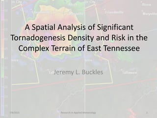
- 1. A Spatial Analysis of Significant Tornadogenesis Density and Risk in the Complex Terrain of East Tennessee Jeremy L. Buckles 7/8/2015 Research in Applied Meteorology 1
- 2. Goals of Project • Analyze risk of tornado formation within 25 miles of a point. • A detailed, local climatology of tornado formation can assist with future research projects. • This can also assist emergency managers and planners. • Could potentially aid warning operations. 7/8/2015 Research in Applied Meteorology 2
- 3. Previous Research • Davies-Jones (1984) first really explored the role of Storm-Relative Helicity (SRH)—a representation of streamwise vorticity— in rotation of supercells. • SRH shown to be an important factor in significant tornado development (Rasmussen and Blanchard, 1998) 7/8/2015 Research in Applied Meteorology 3
- 4. Previous Research – SRH • Rasmussen (2003) and Thompson, et al. (2003) verified that boundary layer inflow was indicative of tornado producing supercells. • Thompson, et al. (2007) – effective inflow layer (generally lowest 2km). Figure 11 from Thompson, et al. (2003) showing 0-1km SRH and associated tornado events. 7/8/2015 Research in Applied Meteorology 4
- 5. Importance of Effective Inflow Layer • Helicity within the effective inflow layer (approx. lowest 2 km) is extremely important as shown by Thompson, et al. (2007). • ESRH discriminates even better than 0-1 km or 0-3 km helicity. • Terrain features such as mountains or valleys can block or even accelerate flow. • Could mountains disrupt effective inflow? 7/8/2015 Research in Applied Meteorology 5
- 6. East Tennessee Regional Terrain 7/8/2015 Research in Applied Meteorology 6
- 7. Local East Tennessee Research • Concannon et al. (2000) – Tornado Risk decreased from west to east across the Tennessee Valley. • Gaffin and Parker (2006) – climatological assessment of synoptic conditions favorable to significant tornadoes in the Southern Appalachians. • Schneider (2009), Gaffin and Hotz (2011), and Gaffin (2012) identified environments where terrain likely influenced tornadogenesis. • Gaffin (2012) noted instances of tornadogenesis around mountain valleys. 7/8/2015 Research in Applied Meteorology 7
- 8. April 27, 2011 Tornado Tracks Credit: Image is Figure 3 from Gaffin (2012)7/8/2015 Research in Applied Meteorology 8
- 9. Purpose in Tornadogenesis Climatology Research • Hypothesis: If terrain led to tornado formation in one instance, there should be a climatological record of similar events. • Test it! – Kernel Density Analysis – Statistical Tests • Standardized Anomalies • Quantiles (Percentile Rank) Credit: Image is Figure 4 from Gaffin (2012) 7/8/2015 Research in Applied Meteorology 9
- 10. Past Density Studies • Tornado density research is not new. • Thom (1963) identified the probability of a tornado striking a point in the United States on a 1° x 1° grid. • More recently, spatial analysis of tornadoes has been conducted by Boruff et al. (2003), Ashley (2007), and Dixon et al. (2011). • No studies involving high-resolution analysis of tornado start points around the East Tennessee region. 7/8/2015 Research in Applied Meteorology 10
- 11. Methodology • Data Collection – Tornado database has inherent biases: • Spatial & Temporal Biases (Doswell and Burgess, 1988) – Different Verification Measures – Modern communication – Population Variability – Technological enhancements to radar • 1880s: MacFarlane (1884) noted evidence of unrecorded tornadoes because the lack of verification. – Grazulis (2001): Over past 100 years, tornado frequency has increased, but number of EF2+ tornadoes have remained nearly constant. • Greatest increase was in weak EF-0 and EF-1 tornadoes. • Likely due to higher population and better verification. 7/8/2015 Research in Applied Meteorology 11
- 12. Methodology – Data Collection • Data Collection – Tornado Database – Dixon, et al. (2011) noted there is some subjectivity to determining a dataset as long as it is well-reasoned and acceptable for the application. – Dataset for this research focuses on EF-2 or greater tornadoes within the NWS Morristown, TN county warning area (CWA). – No method removes all biases. 7/8/2015 Research in Applied Meteorology 12
- 13. Data Used • EF-2+ tornado reports from 9 NWS Databases adjacent to and including NWS Morristown. – Data from adjacent offices used to reduce boundary error. – Includes: • SPC (1950-2014) • Grazulis (1877-1950) – 1124 Reports Used • 8 excluded for obvious bad data – Plotted at Equator • 91 points in MRX CWA # of Torn MRX HUN OHX LMK JKL RLX RNK GSP FFC F2-F5 91 165 215 189 50 32 35 109 238 -4 -1 -3 7/8/2015 Research in Applied Meteorology 13
- 14. Methodology - Analysis • Kernel Density Estimation (KDE) – Density for discrete data; Interpolation for continuous data – Widely-used, standard method for spatial data analysis (Dixon et al. 2011). – Used by Brooks et al. (2003), Boruff et al. (2003), Ashley (2007), and Dixon et al. (2011). – Previous research shows that kernel function is much less important than kernel radius (Silverman 1986). Credit: ArcGIS 10.1 Help: How Kernel Density Works 7/8/2015 Research in Applied Meteorology 14
- 15. Methodology – Kernel Density Estimation • Kernel Density Estimation (KDE) – KDE Function: ArcGIS uses a quadratic function based on Silverman (1986, p.76, equation 4.5). – KDE Radius: 40.2336 km or 25 miles – Output Grid: 1609.344 meters or 1 mile • Allows a smooth, detailed output which will show small-scale variation in density distribution – Resulting output is a continuous grid of point density with units /km2. 7/8/2015 Research in Applied Meteorology 15
- 16. Tornado Start Point Density 7/8/2015 Research in Applied Meteorology 16
- 17. Narrow to Region of Interest • Output grid is basically risk/km at each point. – Interested in risk within 25 miles of a point. – Must sum density within 25 cells around each cell. • Next, extract cells only within the NWS Morristown CWA for analysis. – MRX CWA polygon shapefile used as a mask. 7/8/2015 Research in Applied Meteorology 17
- 18. Tornado Start Point Summed Density 7/8/2015 Research in Applied Meteorology 18
- 19. Statistics for MRX Region Histogram Classification Statistics 7/8/2015 Research in Applied Meteorology 19
- 20. Analysis - Statistics • The goal is to find areas of anomalously high tornadogenesis density. • Standardized anomalies are useful in climatology and give a good estimate of whether values are significantly above or below the mean. • Quantiles - percentile rank is useful for showing where values rank in relation to the median of the data. 7/8/2015 Research in Applied Meteorology 20
- 21. Standardized Anomalies • Standardized Anomalies Found by: Ν−𝑋 𝜎 ; where N is value of a point, 𝑋 is the mean, and 𝜎 is the standard deviation. • Result can be positive or negative with the mean having a standardized anomaly of zero (0). – For each data point, result shows how many standard deviations above or below the mean. 7/8/2015 Research in Applied Meteorology 21
- 22. Tornado Density Standardized Anomalies 7/8/2015 Research in Applied Meteorology 22
- 23. Quantiles • Percentile positions within the ranked data. – Median is the 50th percentile. – Calculated: ; where, 𝑥 𝑛 is value at percentile being calculated, 𝑝 is percentile of interest, and 𝑥 𝑛+1is value one place above 𝑥 𝑛. – Gives good analysis of spread of the data. – Can show regions in the tails of the data. • Based on histogram, this is a right/positive skewed dataset (mean>median). ))(1( 1 nnnp xxpxx 7/8/2015 Research in Applied Meteorology 23
- 24. Tornado Density Percentile Ranks 7/8/2015 Research in Applied Meteorology 24
- 25. Results and Conclusions • Highest risk of tornadogenesis is across the southern Tennessee valley. • There is a higher risk of tornadogenesis near and to the northeast of the French Broad River Valley. – No definitive conclusions can be made about the cause of this. – However, it does lend some additional credence to results from Gaffin (2012). • There is historical instances of tornadogenesis near terrain features like large river valleys. 7/8/2015 Research in Applied Meteorology 25
- 26. Conclusions • Recent Vortex II research by Markowski, et al. (2012) showed that helicity is very important to mid-level rotation. – However, tornadogenesis is a product of microscale baroclinic zones and rear flank downdraft internal surges (RFDIS). • Could explain higher tornadogenesis upstream of river valley as storm rotation strengthened. – Again, no definitive conclusion can be made on the cause. 7/8/2015 Research in Applied Meteorology 26
- 27. Ideas for Future Research • Mesoscale & microscale modeling studies on terrain impacts: – Boundary Layer Flow – Helicity – Microscale density gradients within storms and around terrain – Possible vortex stretching • Computing power and microscale resolution is a large obstacle. • Similar local density climatology studies in other regions can assist emergency management, emergency planning, and potentially operations. 7/8/2015 Research in Applied Meteorology 27
- 28. Questions? 7/8/2015 Research in Applied Meteorology 28