SlideShare una empresa de Scribd logo
1 de 30
ACEAS 2014 Phenocam workshop, North Stradbroke Island, Australia
Possibilities for phenological research using digital
image archives: options beyond canopy greenness
© NASA
March 12, 2014
Oliver Sonnentag, PhD
Université de Montréal
2Talk outline
• Canopy greenness
• Digital camera and image format choice for canopy greenness
• Beyond canopy greenness: CIE Y
• Beyond canopy greenness: digital cover photography (DCP)
• Beyond canopy greenness: texture
• Beyond canopy greenness: snow cover
• Summary and conclusions
3Canopy greenness vs. field observations
(Jacobs et al., 2002, ACM GIS; Sonnentag et al., 2012, Agricultural and Forest Meteorology)
3Canopy greenness vs. field observations
http://phenocam.sr.unh.edu/
(Jacobs et al., 2002, ACM GIS; Sonnentag et al., 2012, Agricultural and Forest Meteorology)
3Canopy greenness vs. field observations
http://phenocam.sr.unh.edu/
http://amos1.cse.wustl.edu
(Jacobs et al., 2002, ACM GIS; Sonnentag et al., 2012, Agricultural and Forest Meteorology)
4Digital repeat photography options
There are many options …
4Digital repeat photography options
There are many options …
5Digital camera choice for canopy greenness
Digital camera choice might not be of major importance for canopy greenness.
(Sonnentag et al., 2012, Agricultural and Forest Meteorology)
6Image format choice for canopy greenness
(Sonnentag et al., 2012, Agricultural and Forest Meteorology; Verhoeven, 2010, International Journal of Remote Sensing)
Digital image format choice might not be of major importance for canopy greenness.
7Beyond canopy greenness: CIE Y
(Sonnentag et al., 2011, Agricultural and Forest Meteorology)
7Beyond canopy greenness: CIE Y
(Sonnentag et al., 2011, Agricultural and Forest Meteorology)
Digital camera and image format
choice might be of secondary
importance?
8Beyond canopy greenness: DCP I
(Pekin and Macfarlane, 2010, Remote Sensing)
8Beyond canopy greenness: DCP I
with:
φ =1− ff / fc
Lt = − fc ln(φ)/k
k = G(θ)/cos(θ)
Crown porosity:
Plant area index:
Clumping index:
(Pekin and Macfarlane, 2010, Remote Sensing)
9Beyond canopy greenness: DCP II
(Ryu et al., 2012, Remote Sensing of Environment)
9Beyond canopy greenness: DCP II
Time lapse photography
for DCP LAI phenology:
“good” quality digital
images from consumer-
grade point-and-shoot
digital camera (e.g., Canon
A-series)
(Ryu et al., 2012, Remote Sensing of Environment)
10Beyond canopy greenness: DCP II
(Macfarlane et al., in review, Agricultural and Forest Meteorology)
10Beyond canopy greenness: DCP II
(Macfarlane et al., in review, Agricultural and Forest Meteorology)
Digital image format choice might be of fundamental importance for DCP.
11Beyond canopy greenness: DCP IV
At view angle of 57.5°:
(Baret et al., 2010, Agricultural and Forest Meteorology; Liu et al., 2010, Agricultural and Forest Meteorology)
11Beyond canopy greenness: DCP IV
At view angle of 57.5°:
At view angle of 0° (nadir):
(Baret et al., 2010, Agricultural and Forest Meteorology; Liu et al., 2010, Agricultural and Forest Meteorology)
12Beyond canopy greenness: DCP V
LAI=1.02 LAI=1.55
12Beyond canopy greenness: DCP V
• Background color heterogeneity (forest: blue sky; crops: bare soil)
• Sphagnum color highly variable depending on species and wetness
• Differential phenologies: Sphagnum vs. vascular plants
• Very short dwarf/shrub canopy: almost no vertical stratification
LAI=1.02 LAI=1.55
13Beyond canopy greenness: texture
(Proulx et al., 2008, Ecological Informatics; Proulx et al., 2009, Ecological Informatics)
13Beyond canopy greenness: texture
(Proulx et al., 2008, Ecological Informatics; Proulx et al., 2009, Ecological Informatics)
14Eddy covariance along a permafrost gradient
1000 km
15NWT: snowmelt 2013
16NWT: snowmelt 2013
Havikpak Creek (boreal forest; cont. permaf.)Trail Valley Creek (tundra; cont. permaf.)
17
(Hinkler et al., 2002; International Journal of Remote Sensing)
Beyond canopy greenness: snow cover
18Summary and conclusions
• Digital camera and image format choice might be of secondary importance for
monitoring vegetation status based on canopy greenness.
• Upward- and downward-looking digital cameras allow for the estimation of leaf
area index and clumping based on gap-fraction theory for which especially digital
image format choice might matter.
• Image texture and snow cover are promising approaches to make use of
growing digital image archives for which digital camera and image format choice
might be important.
19Acknowledgements
• Andrew Richardson (Harvard University, USA)
• Dennis Baldocchi (University of California, Berkeley, USA)
• Matthias Peichl (Swedish Agricultural University, Sweden)
• Youngryel Ryu (Seoul National University, South Korea)
• Craig Macfarlane (CSIRO, Australia)
• Philip Marsh (Wilfried Laurier University, Canada)
• William Quinton (Wilfried Laurier University, Canada)
• Jennifer Baltzer (Wilfrid Laurier University, Canada)
Funding was provided by USGS, NSF, DOE (all USA) and CFI, FQRNT
and NSERC (all Canada).
THANKS!
© NASA
oliver.sonnentag@umontreal.ca

Más contenido relacionado

La actualidad más candente

2013APRU_NO40-abstract-mobilePIV_YangYaoYu
2013APRU_NO40-abstract-mobilePIV_YangYaoYu2013APRU_NO40-abstract-mobilePIV_YangYaoYu
2013APRU_NO40-abstract-mobilePIV_YangYaoYuYao-Yu Yang
 
Radar speckle reduction and derived texture measures for land cover/use class...
Radar speckle reduction and derived texture measures for land cover/use class...Radar speckle reduction and derived texture measures for land cover/use class...
Radar speckle reduction and derived texture measures for land cover/use class...rsmahabir
 
SFScon21 - Daniel Frisinghelli - The Cost of Traditional Machine Learning and...
SFScon21 - Daniel Frisinghelli - The Cost of Traditional Machine Learning and...SFScon21 - Daniel Frisinghelli - The Cost of Traditional Machine Learning and...
SFScon21 - Daniel Frisinghelli - The Cost of Traditional Machine Learning and...South Tyrol Free Software Conference
 
Automatic Animal Detection - UAVs in Environmental Research Conference
Automatic Animal Detection - UAVs in Environmental Research ConferenceAutomatic Animal Detection - UAVs in Environmental Research Conference
Automatic Animal Detection - UAVs in Environmental Research ConferenceCamiel R. Verschoor
 
study and analysis of hy si data in 400 to 500
study and analysis of hy si data in 400 to 500study and analysis of hy si data in 400 to 500
study and analysis of hy si data in 400 to 500IJAEMSJORNAL
 
Big Data, Data and Information Mining for Earth Observation
Big Data, Data and Information Mining for Earth ObservationBig Data, Data and Information Mining for Earth Observation
Big Data, Data and Information Mining for Earth ObservationPier Giorgio Marchetti
 
kellndorfer_WE3.T05.4.pptx
kellndorfer_WE3.T05.4.pptxkellndorfer_WE3.T05.4.pptx
kellndorfer_WE3.T05.4.pptxgrssieee
 
Big data from space technology 150611 @ spaceops 2015
Big data from space technology 150611 @ spaceops 2015Big data from space technology 150611 @ spaceops 2015
Big data from space technology 150611 @ spaceops 2015Pier Giorgio Marchetti
 
The Role of Lidar Intensity Data in Interpreting Archaeological Landscapes
The Role of Lidar Intensity Data in Interpreting Archaeological LandscapesThe Role of Lidar Intensity Data in Interpreting Archaeological Landscapes
The Role of Lidar Intensity Data in Interpreting Archaeological LandscapesKeith Challis
 
Isprsarchives xl-7-w3-897-2015
Isprsarchives xl-7-w3-897-2015Isprsarchives xl-7-w3-897-2015
Isprsarchives xl-7-w3-897-2015bayrmgl
 
Separability Analysis of Integrated Spaceborne Radar and Optical Data: Sudan ...
Separability Analysis of Integrated Spaceborne Radar and Optical Data: Sudan ...Separability Analysis of Integrated Spaceborne Radar and Optical Data: Sudan ...
Separability Analysis of Integrated Spaceborne Radar and Optical Data: Sudan ...rsmahabir
 
How can drone data be used in modelling?
How can drone data be used in modelling?How can drone data be used in modelling?
How can drone data be used in modelling?ARDC
 
A Survey of Normalized Deference Vegetative Index (NDVI) and Crop water Stres...
A Survey of Normalized Deference Vegetative Index (NDVI) and Crop water Stres...A Survey of Normalized Deference Vegetative Index (NDVI) and Crop water Stres...
A Survey of Normalized Deference Vegetative Index (NDVI) and Crop water Stres...Alex Charles, E.I.T
 
Air quality challenges and business opportunities in China: Fusion of environ...
Air quality challenges and business opportunities in China: Fusion of environ...Air quality challenges and business opportunities in China: Fusion of environ...
Air quality challenges and business opportunities in China: Fusion of environ...CLIC Innovation Ltd
 
e-SOTER Regional pilot platform as EU contribution to a Global Soil Observing...
e-SOTER Regional pilot platform as EU contribution to a Global Soil Observing...e-SOTER Regional pilot platform as EU contribution to a Global Soil Observing...
e-SOTER Regional pilot platform as EU contribution to a Global Soil Observing...FAO
 
Mumma_Radar_Lab_Posters
Mumma_Radar_Lab_PostersMumma_Radar_Lab_Posters
Mumma_Radar_Lab_PostersDr. Ali Nassib
 

La actualidad más candente (20)

2013APRU_NO40-abstract-mobilePIV_YangYaoYu
2013APRU_NO40-abstract-mobilePIV_YangYaoYu2013APRU_NO40-abstract-mobilePIV_YangYaoYu
2013APRU_NO40-abstract-mobilePIV_YangYaoYu
 
Radar speckle reduction and derived texture measures for land cover/use class...
Radar speckle reduction and derived texture measures for land cover/use class...Radar speckle reduction and derived texture measures for land cover/use class...
Radar speckle reduction and derived texture measures for land cover/use class...
 
SFScon21 - Daniel Frisinghelli - The Cost of Traditional Machine Learning and...
SFScon21 - Daniel Frisinghelli - The Cost of Traditional Machine Learning and...SFScon21 - Daniel Frisinghelli - The Cost of Traditional Machine Learning and...
SFScon21 - Daniel Frisinghelli - The Cost of Traditional Machine Learning and...
 
Automatic Animal Detection - UAVs in Environmental Research Conference
Automatic Animal Detection - UAVs in Environmental Research ConferenceAutomatic Animal Detection - UAVs in Environmental Research Conference
Automatic Animal Detection - UAVs in Environmental Research Conference
 
study and analysis of hy si data in 400 to 500
study and analysis of hy si data in 400 to 500study and analysis of hy si data in 400 to 500
study and analysis of hy si data in 400 to 500
 
Big Data, Data and Information Mining for Earth Observation
Big Data, Data and Information Mining for Earth ObservationBig Data, Data and Information Mining for Earth Observation
Big Data, Data and Information Mining for Earth Observation
 
kellndorfer_WE3.T05.4.pptx
kellndorfer_WE3.T05.4.pptxkellndorfer_WE3.T05.4.pptx
kellndorfer_WE3.T05.4.pptx
 
Big data from space technology 150611 @ spaceops 2015
Big data from space technology 150611 @ spaceops 2015Big data from space technology 150611 @ spaceops 2015
Big data from space technology 150611 @ spaceops 2015
 
LiDAR Technology & IT’s Application on Forestry
LiDAR Technology & IT’s Application on ForestryLiDAR Technology & IT’s Application on Forestry
LiDAR Technology & IT’s Application on Forestry
 
In sar 1-1-2011
In sar 1-1-2011In sar 1-1-2011
In sar 1-1-2011
 
The Role of Lidar Intensity Data in Interpreting Archaeological Landscapes
The Role of Lidar Intensity Data in Interpreting Archaeological LandscapesThe Role of Lidar Intensity Data in Interpreting Archaeological Landscapes
The Role of Lidar Intensity Data in Interpreting Archaeological Landscapes
 
Isprsarchives xl-7-w3-897-2015
Isprsarchives xl-7-w3-897-2015Isprsarchives xl-7-w3-897-2015
Isprsarchives xl-7-w3-897-2015
 
Separability Analysis of Integrated Spaceborne Radar and Optical Data: Sudan ...
Separability Analysis of Integrated Spaceborne Radar and Optical Data: Sudan ...Separability Analysis of Integrated Spaceborne Radar and Optical Data: Sudan ...
Separability Analysis of Integrated Spaceborne Radar and Optical Data: Sudan ...
 
Nature Conservation Drones
Nature Conservation DronesNature Conservation Drones
Nature Conservation Drones
 
How can drone data be used in modelling?
How can drone data be used in modelling?How can drone data be used in modelling?
How can drone data be used in modelling?
 
A Survey of Normalized Deference Vegetative Index (NDVI) and Crop water Stres...
A Survey of Normalized Deference Vegetative Index (NDVI) and Crop water Stres...A Survey of Normalized Deference Vegetative Index (NDVI) and Crop water Stres...
A Survey of Normalized Deference Vegetative Index (NDVI) and Crop water Stres...
 
Study on the LandCover Classification using UAV Imagery
Study on the LandCover Classification using UAV ImageryStudy on the LandCover Classification using UAV Imagery
Study on the LandCover Classification using UAV Imagery
 
Air quality challenges and business opportunities in China: Fusion of environ...
Air quality challenges and business opportunities in China: Fusion of environ...Air quality challenges and business opportunities in China: Fusion of environ...
Air quality challenges and business opportunities in China: Fusion of environ...
 
e-SOTER Regional pilot platform as EU contribution to a Global Soil Observing...
e-SOTER Regional pilot platform as EU contribution to a Global Soil Observing...e-SOTER Regional pilot platform as EU contribution to a Global Soil Observing...
e-SOTER Regional pilot platform as EU contribution to a Global Soil Observing...
 
Mumma_Radar_Lab_Posters
Mumma_Radar_Lab_PostersMumma_Radar_Lab_Posters
Mumma_Radar_Lab_Posters
 

Destacado

Practica 2 curriculum
Practica 2 curriculumPractica 2 curriculum
Practica 2 curriculummagisterio94
 
Prof. Michael Raupach "Synthesis in science and society" ACEAS Grand 2014 part A
Prof. Michael Raupach "Synthesis in science and society" ACEAS Grand 2014 part AProf. Michael Raupach "Synthesis in science and society" ACEAS Grand 2014 part A
Prof. Michael Raupach "Synthesis in science and society" ACEAS Grand 2014 part Aaceas13tern
 
Ian Grant_An improved satellite-based long record of Australian vegetation dy...
Ian Grant_An improved satellite-based long record of Australian vegetation dy...Ian Grant_An improved satellite-based long record of Australian vegetation dy...
Ian Grant_An improved satellite-based long record of Australian vegetation dy...TERN Australia
 

Destacado (7)

Seguimiento Flujos Carbono Estacion Laguna Seca
Seguimiento Flujos Carbono Estacion Laguna SecaSeguimiento Flujos Carbono Estacion Laguna Seca
Seguimiento Flujos Carbono Estacion Laguna Seca
 
Practica 2 curriculum
Practica 2 curriculumPractica 2 curriculum
Practica 2 curriculum
 
Jor cord int_nov2012_03_c_bollullos_rest_post_incendio
Jor cord int_nov2012_03_c_bollullos_rest_post_incendioJor cord int_nov2012_03_c_bollullos_rest_post_incendio
Jor cord int_nov2012_03_c_bollullos_rest_post_incendio
 
Ficha 1
Ficha 1Ficha 1
Ficha 1
 
Prof. Michael Raupach "Synthesis in science and society" ACEAS Grand 2014 part A
Prof. Michael Raupach "Synthesis in science and society" ACEAS Grand 2014 part AProf. Michael Raupach "Synthesis in science and society" ACEAS Grand 2014 part A
Prof. Michael Raupach "Synthesis in science and society" ACEAS Grand 2014 part A
 
Ian Grant_An improved satellite-based long record of Australian vegetation dy...
Ian Grant_An improved satellite-based long record of Australian vegetation dy...Ian Grant_An improved satellite-based long record of Australian vegetation dy...
Ian Grant_An improved satellite-based long record of Australian vegetation dy...
 
Joint GWP CEE/DMCSEE training: Overview of Agricultural Meteorology in WMO by...
Joint GWP CEE/DMCSEE training: Overview of Agricultural Meteorology in WMO by...Joint GWP CEE/DMCSEE training: Overview of Agricultural Meteorology in WMO by...
Joint GWP CEE/DMCSEE training: Overview of Agricultural Meteorology in WMO by...
 

Similar a Sonnentag phenocams 2014

An evaluation of Radarsat-2 individual and combined image dates for land use/...
An evaluation of Radarsat-2 individual and combined image dates for land use/...An evaluation of Radarsat-2 individual and combined image dates for land use/...
An evaluation of Radarsat-2 individual and combined image dates for land use/...rsmahabir
 
Kim_WE3_T05_2.pptx
Kim_WE3_T05_2.pptxKim_WE3_T05_2.pptx
Kim_WE3_T05_2.pptxgrssieee
 
Alexander vega 2019_iop_conf._ser.__mater._sci._eng._603_022010
Alexander vega 2019_iop_conf._ser.__mater._sci._eng._603_022010Alexander vega 2019_iop_conf._ser.__mater._sci._eng._603_022010
Alexander vega 2019_iop_conf._ser.__mater._sci._eng._603_022010jalexvega
 
Copernicus Land Moniotring Service Portfolio
Copernicus Land Moniotring Service PortfolioCopernicus Land Moniotring Service Portfolio
Copernicus Land Moniotring Service PortfolioCLMS
 
Comparing canopy density measurement from UAV and hemispherical photography: ...
Comparing canopy density measurement from UAV and hemispherical photography: ...Comparing canopy density measurement from UAV and hemispherical photography: ...
Comparing canopy density measurement from UAV and hemispherical photography: ...IJECEIAES
 
FR1.L09.2 - ONBOARD RADAR PROCESSING CONCEPTS FOR THE DESDYNI MISSION
FR1.L09.2 - ONBOARD RADAR PROCESSING CONCEPTS FOR THE DESDYNI MISSIONFR1.L09.2 - ONBOARD RADAR PROCESSING CONCEPTS FOR THE DESDYNI MISSION
FR1.L09.2 - ONBOARD RADAR PROCESSING CONCEPTS FOR THE DESDYNI MISSIONgrssieee
 
Use of UAS for Hydrological Monitoring
Use of UAS for Hydrological MonitoringUse of UAS for Hydrological Monitoring
Use of UAS for Hydrological MonitoringSalvatore Manfreda
 
PhD defence - Steven Vanonckelen
PhD defence - Steven VanonckelenPhD defence - Steven Vanonckelen
PhD defence - Steven VanonckelenSteven Vanonckelen
 
Radar and optical remote sensing data evaluation and fusion; a case study for...
Radar and optical remote sensing data evaluation and fusion; a case study for...Radar and optical remote sensing data evaluation and fusion; a case study for...
Radar and optical remote sensing data evaluation and fusion; a case study for...rsmahabir
 
INTEGRATING REMOTE SENSING, SPATIAL ANALYSIS AND CERTAINTY FACTOR MODEL FOR W...
INTEGRATING REMOTE SENSING, SPATIAL ANALYSIS AND CERTAINTY FACTOR MODEL FOR W...INTEGRATING REMOTE SENSING, SPATIAL ANALYSIS AND CERTAINTY FACTOR MODEL FOR W...
INTEGRATING REMOTE SENSING, SPATIAL ANALYSIS AND CERTAINTY FACTOR MODEL FOR W...grssieee
 
1st Technical Meeting - WP2
1st Technical Meeting - WP21st Technical Meeting - WP2
1st Technical Meeting - WP2SLOPE Project
 
3178_IGARSS11.ppt
3178_IGARSS11.ppt3178_IGARSS11.ppt
3178_IGARSS11.pptgrssieee
 
Collection and Interpretation of Remote Sensing Data, Kasper Johansen, Univer...
Collection and Interpretation of Remote Sensing Data, Kasper Johansen, Univer...Collection and Interpretation of Remote Sensing Data, Kasper Johansen, Univer...
Collection and Interpretation of Remote Sensing Data, Kasper Johansen, Univer...becnicholas
 
Mangrove Vegetation Mapping Using Sentinel-2A Imagery Based on Google Earth E...
Mangrove Vegetation Mapping Using Sentinel-2A Imagery Based on Google Earth E...Mangrove Vegetation Mapping Using Sentinel-2A Imagery Based on Google Earth E...
Mangrove Vegetation Mapping Using Sentinel-2A Imagery Based on Google Earth E...Luhur Moekti Prayogo
 
Drought Assessment + Impacts: A Preview
Drought Assessment + Impacts: A PreviewDrought Assessment + Impacts: A Preview
Drought Assessment + Impacts: A PreviewJenkins Macedo
 
121117 eedss briefing_nasa_epa
121117 eedss briefing_nasa_epa121117 eedss briefing_nasa_epa
121117 eedss briefing_nasa_epaRudolf Husar
 
WETLAND MAPPING USING RS AND GIS
WETLAND MAPPING USING RS AND GISWETLAND MAPPING USING RS AND GIS
WETLAND MAPPING USING RS AND GISAbhiram Kanigolla
 
Weather factor landslide hazard
Weather factor landslide hazardWeather factor landslide hazard
Weather factor landslide hazardAlfonso Crisci
 
OverviewofGCOM.pdf
OverviewofGCOM.pdfOverviewofGCOM.pdf
OverviewofGCOM.pdfgrssieee
 
DRONES FOR ENVIRONMENTAL MONITORING
DRONES FOR ENVIRONMENTAL MONITORINGDRONES FOR ENVIRONMENTAL MONITORING
DRONES FOR ENVIRONMENTAL MONITORINGSalvatore Manfreda
 

Similar a Sonnentag phenocams 2014 (20)

An evaluation of Radarsat-2 individual and combined image dates for land use/...
An evaluation of Radarsat-2 individual and combined image dates for land use/...An evaluation of Radarsat-2 individual and combined image dates for land use/...
An evaluation of Radarsat-2 individual and combined image dates for land use/...
 
Kim_WE3_T05_2.pptx
Kim_WE3_T05_2.pptxKim_WE3_T05_2.pptx
Kim_WE3_T05_2.pptx
 
Alexander vega 2019_iop_conf._ser.__mater._sci._eng._603_022010
Alexander vega 2019_iop_conf._ser.__mater._sci._eng._603_022010Alexander vega 2019_iop_conf._ser.__mater._sci._eng._603_022010
Alexander vega 2019_iop_conf._ser.__mater._sci._eng._603_022010
 
Copernicus Land Moniotring Service Portfolio
Copernicus Land Moniotring Service PortfolioCopernicus Land Moniotring Service Portfolio
Copernicus Land Moniotring Service Portfolio
 
Comparing canopy density measurement from UAV and hemispherical photography: ...
Comparing canopy density measurement from UAV and hemispherical photography: ...Comparing canopy density measurement from UAV and hemispherical photography: ...
Comparing canopy density measurement from UAV and hemispherical photography: ...
 
FR1.L09.2 - ONBOARD RADAR PROCESSING CONCEPTS FOR THE DESDYNI MISSION
FR1.L09.2 - ONBOARD RADAR PROCESSING CONCEPTS FOR THE DESDYNI MISSIONFR1.L09.2 - ONBOARD RADAR PROCESSING CONCEPTS FOR THE DESDYNI MISSION
FR1.L09.2 - ONBOARD RADAR PROCESSING CONCEPTS FOR THE DESDYNI MISSION
 
Use of UAS for Hydrological Monitoring
Use of UAS for Hydrological MonitoringUse of UAS for Hydrological Monitoring
Use of UAS for Hydrological Monitoring
 
PhD defence - Steven Vanonckelen
PhD defence - Steven VanonckelenPhD defence - Steven Vanonckelen
PhD defence - Steven Vanonckelen
 
Radar and optical remote sensing data evaluation and fusion; a case study for...
Radar and optical remote sensing data evaluation and fusion; a case study for...Radar and optical remote sensing data evaluation and fusion; a case study for...
Radar and optical remote sensing data evaluation and fusion; a case study for...
 
INTEGRATING REMOTE SENSING, SPATIAL ANALYSIS AND CERTAINTY FACTOR MODEL FOR W...
INTEGRATING REMOTE SENSING, SPATIAL ANALYSIS AND CERTAINTY FACTOR MODEL FOR W...INTEGRATING REMOTE SENSING, SPATIAL ANALYSIS AND CERTAINTY FACTOR MODEL FOR W...
INTEGRATING REMOTE SENSING, SPATIAL ANALYSIS AND CERTAINTY FACTOR MODEL FOR W...
 
1st Technical Meeting - WP2
1st Technical Meeting - WP21st Technical Meeting - WP2
1st Technical Meeting - WP2
 
3178_IGARSS11.ppt
3178_IGARSS11.ppt3178_IGARSS11.ppt
3178_IGARSS11.ppt
 
Collection and Interpretation of Remote Sensing Data, Kasper Johansen, Univer...
Collection and Interpretation of Remote Sensing Data, Kasper Johansen, Univer...Collection and Interpretation of Remote Sensing Data, Kasper Johansen, Univer...
Collection and Interpretation of Remote Sensing Data, Kasper Johansen, Univer...
 
Mangrove Vegetation Mapping Using Sentinel-2A Imagery Based on Google Earth E...
Mangrove Vegetation Mapping Using Sentinel-2A Imagery Based on Google Earth E...Mangrove Vegetation Mapping Using Sentinel-2A Imagery Based on Google Earth E...
Mangrove Vegetation Mapping Using Sentinel-2A Imagery Based on Google Earth E...
 
Drought Assessment + Impacts: A Preview
Drought Assessment + Impacts: A PreviewDrought Assessment + Impacts: A Preview
Drought Assessment + Impacts: A Preview
 
121117 eedss briefing_nasa_epa
121117 eedss briefing_nasa_epa121117 eedss briefing_nasa_epa
121117 eedss briefing_nasa_epa
 
WETLAND MAPPING USING RS AND GIS
WETLAND MAPPING USING RS AND GISWETLAND MAPPING USING RS AND GIS
WETLAND MAPPING USING RS AND GIS
 
Weather factor landslide hazard
Weather factor landslide hazardWeather factor landslide hazard
Weather factor landslide hazard
 
OverviewofGCOM.pdf
OverviewofGCOM.pdfOverviewofGCOM.pdf
OverviewofGCOM.pdf
 
DRONES FOR ENVIRONMENTAL MONITORING
DRONES FOR ENVIRONMENTAL MONITORINGDRONES FOR ENVIRONMENTAL MONITORING
DRONES FOR ENVIRONMENTAL MONITORING
 

Más de aceas13tern

Risk assessment of Australian ecosystems. Dr Emma Burns. ACEAS Grand 2014
Risk assessment of Australian ecosystems. Dr Emma Burns. ACEAS Grand 2014Risk assessment of Australian ecosystems. Dr Emma Burns. ACEAS Grand 2014
Risk assessment of Australian ecosystems. Dr Emma Burns. ACEAS Grand 2014aceas13tern
 
Australian seagrass habitats: condition and threats, James Udy, ACEAS Grand 2014
Australian seagrass habitats: condition and threats, James Udy, ACEAS Grand 2014Australian seagrass habitats: condition and threats, James Udy, ACEAS Grand 2014
Australian seagrass habitats: condition and threats, James Udy, ACEAS Grand 2014aceas13tern
 
Developing an Australian phenology monitoring network, Tim Brown, ACEAS Grand...
Developing an Australian phenology monitoring network, Tim Brown, ACEAS Grand...Developing an Australian phenology monitoring network, Tim Brown, ACEAS Grand...
Developing an Australian phenology monitoring network, Tim Brown, ACEAS Grand...aceas13tern
 
Vast lands and variable data: patterns and processes of mammal decline. Chris...
Vast lands and variable data: patterns and processes of mammal decline. Chris...Vast lands and variable data: patterns and processes of mammal decline. Chris...
Vast lands and variable data: patterns and processes of mammal decline. Chris...aceas13tern
 
Unifying principles for modelling, Brad Evans, ACEAS Grand 2014
Unifying principles for modelling, Brad Evans, ACEAS Grand 2014Unifying principles for modelling, Brad Evans, ACEAS Grand 2014
Unifying principles for modelling, Brad Evans, ACEAS Grand 2014aceas13tern
 
SPatially Explicit Data Discovery, Extraction and Evaluation Services (SPEDDE...
SPatially Explicit Data Discovery, Extraction and Evaluation Services (SPEDDE...SPatially Explicit Data Discovery, Extraction and Evaluation Services (SPEDDE...
SPatially Explicit Data Discovery, Extraction and Evaluation Services (SPEDDE...aceas13tern
 
Ecosystem services and livelihood opportunities, Jeremy Russell-Smith, ACEAS ...
Ecosystem services and livelihood opportunities, Jeremy Russell-Smith, ACEAS ...Ecosystem services and livelihood opportunities, Jeremy Russell-Smith, ACEAS ...
Ecosystem services and livelihood opportunities, Jeremy Russell-Smith, ACEAS ...aceas13tern
 
Local to national, Dr Lee Belbin, ACEAS Grand 2014
Local to national, Dr Lee Belbin, ACEAS Grand 2014Local to national, Dr Lee Belbin, ACEAS Grand 2014
Local to national, Dr Lee Belbin, ACEAS Grand 2014aceas13tern
 
Interactive Games to Value and Manage Ecosystem Services. Prof. Bob Costanza....
Interactive Games to Value and Manage Ecosystem Services. Prof. Bob Costanza....Interactive Games to Value and Manage Ecosystem Services. Prof. Bob Costanza....
Interactive Games to Value and Manage Ecosystem Services. Prof. Bob Costanza....aceas13tern
 
ACEAS rationale, organisation and status. A. Specht, ACEAS Grand 2014
ACEAS rationale, organisation and status. A. Specht, ACEAS Grand 2014ACEAS rationale, organisation and status. A. Specht, ACEAS Grand 2014
ACEAS rationale, organisation and status. A. Specht, ACEAS Grand 2014aceas13tern
 
Extinction of Northern Quoll. Euan Ritchie ACEAS Grand 2014
Extinction of Northern Quoll. Euan Ritchie ACEAS Grand 2014Extinction of Northern Quoll. Euan Ritchie ACEAS Grand 2014
Extinction of Northern Quoll. Euan Ritchie ACEAS Grand 2014aceas13tern
 
Avifaunal disarray Ralph MacNally ACEAS Grand 2014
Avifaunal disarray Ralph MacNally ACEAS Grand 2014Avifaunal disarray Ralph MacNally ACEAS Grand 2014
Avifaunal disarray Ralph MacNally ACEAS Grand 2014aceas13tern
 
Andrew Treloar, overview of ACEAS Data Workflow, ACEAS Grand 2014
Andrew Treloar, overview of ACEAS Data Workflow, ACEAS Grand 2014Andrew Treloar, overview of ACEAS Data Workflow, ACEAS Grand 2014
Andrew Treloar, overview of ACEAS Data Workflow, ACEAS Grand 2014aceas13tern
 
Transformation of Australia’s vegetated landscapes. Richard Thackway ACEAS Gr...
Transformation of Australia’s vegetated landscapes. Richard Thackway ACEAS Gr...Transformation of Australia’s vegetated landscapes. Richard Thackway ACEAS Gr...
Transformation of Australia’s vegetated landscapes. Richard Thackway ACEAS Gr...aceas13tern
 
Drought-induced mortality. Pat Mitchell, ACEAS Grand 2014
Drought-induced mortality. Pat Mitchell, ACEAS Grand 2014Drought-induced mortality. Pat Mitchell, ACEAS Grand 2014
Drought-induced mortality. Pat Mitchell, ACEAS Grand 2014aceas13tern
 
Australian seagrass habitats. Kathryn McMahon, ACEAS Grand 2014
Australian seagrass habitats. Kathryn McMahon, ACEAS Grand 2014Australian seagrass habitats. Kathryn McMahon, ACEAS Grand 2014
Australian seagrass habitats. Kathryn McMahon, ACEAS Grand 2014aceas13tern
 
Animal telemetry, Ross Dwyer ACEAS Grand 2014
Animal telemetry, Ross Dwyer ACEAS Grand 2014Animal telemetry, Ross Dwyer ACEAS Grand 2014
Animal telemetry, Ross Dwyer ACEAS Grand 2014aceas13tern
 
Productivity and freshwater fish abundance. Jian Yen. ACEAS Grand 2014
Productivity and freshwater fish abundance. Jian Yen. ACEAS Grand 2014Productivity and freshwater fish abundance. Jian Yen. ACEAS Grand 2014
Productivity and freshwater fish abundance. Jian Yen. ACEAS Grand 2014aceas13tern
 
Indigenous bio cultural knowledge ACEAS Grand 2014 Locke and Clark
Indigenous bio cultural knowledge ACEAS Grand 2014 Locke and ClarkIndigenous bio cultural knowledge ACEAS Grand 2014 Locke and Clark
Indigenous bio cultural knowledge ACEAS Grand 2014 Locke and Clarkaceas13tern
 
Adaptation pathways for aquatic plants. Patrick Driver ACEAS Grand 2014
Adaptation pathways for aquatic plants. Patrick Driver ACEAS Grand 2014Adaptation pathways for aquatic plants. Patrick Driver ACEAS Grand 2014
Adaptation pathways for aquatic plants. Patrick Driver ACEAS Grand 2014aceas13tern
 

Más de aceas13tern (20)

Risk assessment of Australian ecosystems. Dr Emma Burns. ACEAS Grand 2014
Risk assessment of Australian ecosystems. Dr Emma Burns. ACEAS Grand 2014Risk assessment of Australian ecosystems. Dr Emma Burns. ACEAS Grand 2014
Risk assessment of Australian ecosystems. Dr Emma Burns. ACEAS Grand 2014
 
Australian seagrass habitats: condition and threats, James Udy, ACEAS Grand 2014
Australian seagrass habitats: condition and threats, James Udy, ACEAS Grand 2014Australian seagrass habitats: condition and threats, James Udy, ACEAS Grand 2014
Australian seagrass habitats: condition and threats, James Udy, ACEAS Grand 2014
 
Developing an Australian phenology monitoring network, Tim Brown, ACEAS Grand...
Developing an Australian phenology monitoring network, Tim Brown, ACEAS Grand...Developing an Australian phenology monitoring network, Tim Brown, ACEAS Grand...
Developing an Australian phenology monitoring network, Tim Brown, ACEAS Grand...
 
Vast lands and variable data: patterns and processes of mammal decline. Chris...
Vast lands and variable data: patterns and processes of mammal decline. Chris...Vast lands and variable data: patterns and processes of mammal decline. Chris...
Vast lands and variable data: patterns and processes of mammal decline. Chris...
 
Unifying principles for modelling, Brad Evans, ACEAS Grand 2014
Unifying principles for modelling, Brad Evans, ACEAS Grand 2014Unifying principles for modelling, Brad Evans, ACEAS Grand 2014
Unifying principles for modelling, Brad Evans, ACEAS Grand 2014
 
SPatially Explicit Data Discovery, Extraction and Evaluation Services (SPEDDE...
SPatially Explicit Data Discovery, Extraction and Evaluation Services (SPEDDE...SPatially Explicit Data Discovery, Extraction and Evaluation Services (SPEDDE...
SPatially Explicit Data Discovery, Extraction and Evaluation Services (SPEDDE...
 
Ecosystem services and livelihood opportunities, Jeremy Russell-Smith, ACEAS ...
Ecosystem services and livelihood opportunities, Jeremy Russell-Smith, ACEAS ...Ecosystem services and livelihood opportunities, Jeremy Russell-Smith, ACEAS ...
Ecosystem services and livelihood opportunities, Jeremy Russell-Smith, ACEAS ...
 
Local to national, Dr Lee Belbin, ACEAS Grand 2014
Local to national, Dr Lee Belbin, ACEAS Grand 2014Local to national, Dr Lee Belbin, ACEAS Grand 2014
Local to national, Dr Lee Belbin, ACEAS Grand 2014
 
Interactive Games to Value and Manage Ecosystem Services. Prof. Bob Costanza....
Interactive Games to Value and Manage Ecosystem Services. Prof. Bob Costanza....Interactive Games to Value and Manage Ecosystem Services. Prof. Bob Costanza....
Interactive Games to Value and Manage Ecosystem Services. Prof. Bob Costanza....
 
ACEAS rationale, organisation and status. A. Specht, ACEAS Grand 2014
ACEAS rationale, organisation and status. A. Specht, ACEAS Grand 2014ACEAS rationale, organisation and status. A. Specht, ACEAS Grand 2014
ACEAS rationale, organisation and status. A. Specht, ACEAS Grand 2014
 
Extinction of Northern Quoll. Euan Ritchie ACEAS Grand 2014
Extinction of Northern Quoll. Euan Ritchie ACEAS Grand 2014Extinction of Northern Quoll. Euan Ritchie ACEAS Grand 2014
Extinction of Northern Quoll. Euan Ritchie ACEAS Grand 2014
 
Avifaunal disarray Ralph MacNally ACEAS Grand 2014
Avifaunal disarray Ralph MacNally ACEAS Grand 2014Avifaunal disarray Ralph MacNally ACEAS Grand 2014
Avifaunal disarray Ralph MacNally ACEAS Grand 2014
 
Andrew Treloar, overview of ACEAS Data Workflow, ACEAS Grand 2014
Andrew Treloar, overview of ACEAS Data Workflow, ACEAS Grand 2014Andrew Treloar, overview of ACEAS Data Workflow, ACEAS Grand 2014
Andrew Treloar, overview of ACEAS Data Workflow, ACEAS Grand 2014
 
Transformation of Australia’s vegetated landscapes. Richard Thackway ACEAS Gr...
Transformation of Australia’s vegetated landscapes. Richard Thackway ACEAS Gr...Transformation of Australia’s vegetated landscapes. Richard Thackway ACEAS Gr...
Transformation of Australia’s vegetated landscapes. Richard Thackway ACEAS Gr...
 
Drought-induced mortality. Pat Mitchell, ACEAS Grand 2014
Drought-induced mortality. Pat Mitchell, ACEAS Grand 2014Drought-induced mortality. Pat Mitchell, ACEAS Grand 2014
Drought-induced mortality. Pat Mitchell, ACEAS Grand 2014
 
Australian seagrass habitats. Kathryn McMahon, ACEAS Grand 2014
Australian seagrass habitats. Kathryn McMahon, ACEAS Grand 2014Australian seagrass habitats. Kathryn McMahon, ACEAS Grand 2014
Australian seagrass habitats. Kathryn McMahon, ACEAS Grand 2014
 
Animal telemetry, Ross Dwyer ACEAS Grand 2014
Animal telemetry, Ross Dwyer ACEAS Grand 2014Animal telemetry, Ross Dwyer ACEAS Grand 2014
Animal telemetry, Ross Dwyer ACEAS Grand 2014
 
Productivity and freshwater fish abundance. Jian Yen. ACEAS Grand 2014
Productivity and freshwater fish abundance. Jian Yen. ACEAS Grand 2014Productivity and freshwater fish abundance. Jian Yen. ACEAS Grand 2014
Productivity and freshwater fish abundance. Jian Yen. ACEAS Grand 2014
 
Indigenous bio cultural knowledge ACEAS Grand 2014 Locke and Clark
Indigenous bio cultural knowledge ACEAS Grand 2014 Locke and ClarkIndigenous bio cultural knowledge ACEAS Grand 2014 Locke and Clark
Indigenous bio cultural knowledge ACEAS Grand 2014 Locke and Clark
 
Adaptation pathways for aquatic plants. Patrick Driver ACEAS Grand 2014
Adaptation pathways for aquatic plants. Patrick Driver ACEAS Grand 2014Adaptation pathways for aquatic plants. Patrick Driver ACEAS Grand 2014
Adaptation pathways for aquatic plants. Patrick Driver ACEAS Grand 2014
 

Último

The Most Excellent Way | 1 Corinthians 13
The Most Excellent Way | 1 Corinthians 13The Most Excellent Way | 1 Corinthians 13
The Most Excellent Way | 1 Corinthians 13Steve Thomason
 
Introduction to AI in Higher Education_draft.pptx
Introduction to AI in Higher Education_draft.pptxIntroduction to AI in Higher Education_draft.pptx
Introduction to AI in Higher Education_draft.pptxpboyjonauth
 
Call Girls in Dwarka Mor Delhi Contact Us 9654467111
Call Girls in Dwarka Mor Delhi Contact Us 9654467111Call Girls in Dwarka Mor Delhi Contact Us 9654467111
Call Girls in Dwarka Mor Delhi Contact Us 9654467111Sapana Sha
 
POINT- BIOCHEMISTRY SEM 2 ENZYMES UNIT 5.pptx
POINT- BIOCHEMISTRY SEM 2 ENZYMES UNIT 5.pptxPOINT- BIOCHEMISTRY SEM 2 ENZYMES UNIT 5.pptx
POINT- BIOCHEMISTRY SEM 2 ENZYMES UNIT 5.pptxSayali Powar
 
CARE OF CHILD IN INCUBATOR..........pptx
CARE OF CHILD IN INCUBATOR..........pptxCARE OF CHILD IN INCUBATOR..........pptx
CARE OF CHILD IN INCUBATOR..........pptxGaneshChakor2
 
18-04-UA_REPORT_MEDIALITERAСY_INDEX-DM_23-1-final-eng.pdf
18-04-UA_REPORT_MEDIALITERAСY_INDEX-DM_23-1-final-eng.pdf18-04-UA_REPORT_MEDIALITERAСY_INDEX-DM_23-1-final-eng.pdf
18-04-UA_REPORT_MEDIALITERAСY_INDEX-DM_23-1-final-eng.pdfssuser54595a
 
Software Engineering Methodologies (overview)
Software Engineering Methodologies (overview)Software Engineering Methodologies (overview)
Software Engineering Methodologies (overview)eniolaolutunde
 
Mastering the Unannounced Regulatory Inspection
Mastering the Unannounced Regulatory InspectionMastering the Unannounced Regulatory Inspection
Mastering the Unannounced Regulatory InspectionSafetyChain Software
 
“Oh GOSH! Reflecting on Hackteria's Collaborative Practices in a Global Do-It...
“Oh GOSH! Reflecting on Hackteria's Collaborative Practices in a Global Do-It...“Oh GOSH! Reflecting on Hackteria's Collaborative Practices in a Global Do-It...
“Oh GOSH! Reflecting on Hackteria's Collaborative Practices in a Global Do-It...Marc Dusseiller Dusjagr
 
Student login on Anyboli platform.helpin
Student login on Anyboli platform.helpinStudent login on Anyboli platform.helpin
Student login on Anyboli platform.helpinRaunakKeshri1
 
Activity 01 - Artificial Culture (1).pdf
Activity 01 - Artificial Culture (1).pdfActivity 01 - Artificial Culture (1).pdf
Activity 01 - Artificial Culture (1).pdfciinovamais
 
Nutritional Needs Presentation - HLTH 104
Nutritional Needs Presentation - HLTH 104Nutritional Needs Presentation - HLTH 104
Nutritional Needs Presentation - HLTH 104misteraugie
 
Advanced Views - Calendar View in Odoo 17
Advanced Views - Calendar View in Odoo 17Advanced Views - Calendar View in Odoo 17
Advanced Views - Calendar View in Odoo 17Celine George
 
mini mental status format.docx
mini    mental       status     format.docxmini    mental       status     format.docx
mini mental status format.docxPoojaSen20
 
Paris 2024 Olympic Geographies - an activity
Paris 2024 Olympic Geographies - an activityParis 2024 Olympic Geographies - an activity
Paris 2024 Olympic Geographies - an activityGeoBlogs
 
Organic Name Reactions for the students and aspirants of Chemistry12th.pptx
Organic Name Reactions  for the students and aspirants of Chemistry12th.pptxOrganic Name Reactions  for the students and aspirants of Chemistry12th.pptx
Organic Name Reactions for the students and aspirants of Chemistry12th.pptxVS Mahajan Coaching Centre
 
Beyond the EU: DORA and NIS 2 Directive's Global Impact
Beyond the EU: DORA and NIS 2 Directive's Global ImpactBeyond the EU: DORA and NIS 2 Directive's Global Impact
Beyond the EU: DORA and NIS 2 Directive's Global ImpactPECB
 
Introduction to ArtificiaI Intelligence in Higher Education
Introduction to ArtificiaI Intelligence in Higher EducationIntroduction to ArtificiaI Intelligence in Higher Education
Introduction to ArtificiaI Intelligence in Higher Educationpboyjonauth
 
microwave assisted reaction. General introduction
microwave assisted reaction. General introductionmicrowave assisted reaction. General introduction
microwave assisted reaction. General introductionMaksud Ahmed
 

Último (20)

The Most Excellent Way | 1 Corinthians 13
The Most Excellent Way | 1 Corinthians 13The Most Excellent Way | 1 Corinthians 13
The Most Excellent Way | 1 Corinthians 13
 
Introduction to AI in Higher Education_draft.pptx
Introduction to AI in Higher Education_draft.pptxIntroduction to AI in Higher Education_draft.pptx
Introduction to AI in Higher Education_draft.pptx
 
Call Girls in Dwarka Mor Delhi Contact Us 9654467111
Call Girls in Dwarka Mor Delhi Contact Us 9654467111Call Girls in Dwarka Mor Delhi Contact Us 9654467111
Call Girls in Dwarka Mor Delhi Contact Us 9654467111
 
POINT- BIOCHEMISTRY SEM 2 ENZYMES UNIT 5.pptx
POINT- BIOCHEMISTRY SEM 2 ENZYMES UNIT 5.pptxPOINT- BIOCHEMISTRY SEM 2 ENZYMES UNIT 5.pptx
POINT- BIOCHEMISTRY SEM 2 ENZYMES UNIT 5.pptx
 
CARE OF CHILD IN INCUBATOR..........pptx
CARE OF CHILD IN INCUBATOR..........pptxCARE OF CHILD IN INCUBATOR..........pptx
CARE OF CHILD IN INCUBATOR..........pptx
 
18-04-UA_REPORT_MEDIALITERAСY_INDEX-DM_23-1-final-eng.pdf
18-04-UA_REPORT_MEDIALITERAСY_INDEX-DM_23-1-final-eng.pdf18-04-UA_REPORT_MEDIALITERAСY_INDEX-DM_23-1-final-eng.pdf
18-04-UA_REPORT_MEDIALITERAСY_INDEX-DM_23-1-final-eng.pdf
 
Software Engineering Methodologies (overview)
Software Engineering Methodologies (overview)Software Engineering Methodologies (overview)
Software Engineering Methodologies (overview)
 
Mastering the Unannounced Regulatory Inspection
Mastering the Unannounced Regulatory InspectionMastering the Unannounced Regulatory Inspection
Mastering the Unannounced Regulatory Inspection
 
“Oh GOSH! Reflecting on Hackteria's Collaborative Practices in a Global Do-It...
“Oh GOSH! Reflecting on Hackteria's Collaborative Practices in a Global Do-It...“Oh GOSH! Reflecting on Hackteria's Collaborative Practices in a Global Do-It...
“Oh GOSH! Reflecting on Hackteria's Collaborative Practices in a Global Do-It...
 
Student login on Anyboli platform.helpin
Student login on Anyboli platform.helpinStudent login on Anyboli platform.helpin
Student login on Anyboli platform.helpin
 
TataKelola dan KamSiber Kecerdasan Buatan v022.pdf
TataKelola dan KamSiber Kecerdasan Buatan v022.pdfTataKelola dan KamSiber Kecerdasan Buatan v022.pdf
TataKelola dan KamSiber Kecerdasan Buatan v022.pdf
 
Activity 01 - Artificial Culture (1).pdf
Activity 01 - Artificial Culture (1).pdfActivity 01 - Artificial Culture (1).pdf
Activity 01 - Artificial Culture (1).pdf
 
Nutritional Needs Presentation - HLTH 104
Nutritional Needs Presentation - HLTH 104Nutritional Needs Presentation - HLTH 104
Nutritional Needs Presentation - HLTH 104
 
Advanced Views - Calendar View in Odoo 17
Advanced Views - Calendar View in Odoo 17Advanced Views - Calendar View in Odoo 17
Advanced Views - Calendar View in Odoo 17
 
mini mental status format.docx
mini    mental       status     format.docxmini    mental       status     format.docx
mini mental status format.docx
 
Paris 2024 Olympic Geographies - an activity
Paris 2024 Olympic Geographies - an activityParis 2024 Olympic Geographies - an activity
Paris 2024 Olympic Geographies - an activity
 
Organic Name Reactions for the students and aspirants of Chemistry12th.pptx
Organic Name Reactions  for the students and aspirants of Chemistry12th.pptxOrganic Name Reactions  for the students and aspirants of Chemistry12th.pptx
Organic Name Reactions for the students and aspirants of Chemistry12th.pptx
 
Beyond the EU: DORA and NIS 2 Directive's Global Impact
Beyond the EU: DORA and NIS 2 Directive's Global ImpactBeyond the EU: DORA and NIS 2 Directive's Global Impact
Beyond the EU: DORA and NIS 2 Directive's Global Impact
 
Introduction to ArtificiaI Intelligence in Higher Education
Introduction to ArtificiaI Intelligence in Higher EducationIntroduction to ArtificiaI Intelligence in Higher Education
Introduction to ArtificiaI Intelligence in Higher Education
 
microwave assisted reaction. General introduction
microwave assisted reaction. General introductionmicrowave assisted reaction. General introduction
microwave assisted reaction. General introduction
 

Sonnentag phenocams 2014

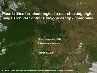
  • 1. ACEAS 2014 Phenocam workshop, North Stradbroke Island, Australia Possibilities for phenological research using digital image archives: options beyond canopy greenness © NASA March 12, 2014 Oliver Sonnentag, PhD Université de Montréal
  • 2. 2Talk outline • Canopy greenness • Digital camera and image format choice for canopy greenness • Beyond canopy greenness: CIE Y • Beyond canopy greenness: digital cover photography (DCP) • Beyond canopy greenness: texture • Beyond canopy greenness: snow cover • Summary and conclusions
  • 3. 3Canopy greenness vs. field observations (Jacobs et al., 2002, ACM GIS; Sonnentag et al., 2012, Agricultural and Forest Meteorology)
  • 4. 3Canopy greenness vs. field observations http://phenocam.sr.unh.edu/ (Jacobs et al., 2002, ACM GIS; Sonnentag et al., 2012, Agricultural and Forest Meteorology)
  • 5. 3Canopy greenness vs. field observations http://phenocam.sr.unh.edu/ http://amos1.cse.wustl.edu (Jacobs et al., 2002, ACM GIS; Sonnentag et al., 2012, Agricultural and Forest Meteorology)
  • 6. 4Digital repeat photography options There are many options …
  • 7. 4Digital repeat photography options There are many options …
  • 8. 5Digital camera choice for canopy greenness Digital camera choice might not be of major importance for canopy greenness. (Sonnentag et al., 2012, Agricultural and Forest Meteorology)
  • 9. 6Image format choice for canopy greenness (Sonnentag et al., 2012, Agricultural and Forest Meteorology; Verhoeven, 2010, International Journal of Remote Sensing) Digital image format choice might not be of major importance for canopy greenness.
  • 10. 7Beyond canopy greenness: CIE Y (Sonnentag et al., 2011, Agricultural and Forest Meteorology)
  • 11. 7Beyond canopy greenness: CIE Y (Sonnentag et al., 2011, Agricultural and Forest Meteorology) Digital camera and image format choice might be of secondary importance?
  • 12. 8Beyond canopy greenness: DCP I (Pekin and Macfarlane, 2010, Remote Sensing)
  • 13. 8Beyond canopy greenness: DCP I with: φ =1− ff / fc Lt = − fc ln(φ)/k k = G(θ)/cos(θ) Crown porosity: Plant area index: Clumping index: (Pekin and Macfarlane, 2010, Remote Sensing)
  • 14. 9Beyond canopy greenness: DCP II (Ryu et al., 2012, Remote Sensing of Environment)
  • 15. 9Beyond canopy greenness: DCP II Time lapse photography for DCP LAI phenology: “good” quality digital images from consumer- grade point-and-shoot digital camera (e.g., Canon A-series) (Ryu et al., 2012, Remote Sensing of Environment)
  • 16. 10Beyond canopy greenness: DCP II (Macfarlane et al., in review, Agricultural and Forest Meteorology)
  • 17. 10Beyond canopy greenness: DCP II (Macfarlane et al., in review, Agricultural and Forest Meteorology) Digital image format choice might be of fundamental importance for DCP.
  • 18. 11Beyond canopy greenness: DCP IV At view angle of 57.5°: (Baret et al., 2010, Agricultural and Forest Meteorology; Liu et al., 2010, Agricultural and Forest Meteorology)
  • 19. 11Beyond canopy greenness: DCP IV At view angle of 57.5°: At view angle of 0° (nadir): (Baret et al., 2010, Agricultural and Forest Meteorology; Liu et al., 2010, Agricultural and Forest Meteorology)
  • 20. 12Beyond canopy greenness: DCP V LAI=1.02 LAI=1.55
  • 21. 12Beyond canopy greenness: DCP V • Background color heterogeneity (forest: blue sky; crops: bare soil) • Sphagnum color highly variable depending on species and wetness • Differential phenologies: Sphagnum vs. vascular plants • Very short dwarf/shrub canopy: almost no vertical stratification LAI=1.02 LAI=1.55
  • 22. 13Beyond canopy greenness: texture (Proulx et al., 2008, Ecological Informatics; Proulx et al., 2009, Ecological Informatics)
  • 23. 13Beyond canopy greenness: texture (Proulx et al., 2008, Ecological Informatics; Proulx et al., 2009, Ecological Informatics)
  • 24. 14Eddy covariance along a permafrost gradient 1000 km
  • 26. 16NWT: snowmelt 2013 Havikpak Creek (boreal forest; cont. permaf.)Trail Valley Creek (tundra; cont. permaf.)
  • 27. 17 (Hinkler et al., 2002; International Journal of Remote Sensing) Beyond canopy greenness: snow cover
  • 28. 18Summary and conclusions • Digital camera and image format choice might be of secondary importance for monitoring vegetation status based on canopy greenness. • Upward- and downward-looking digital cameras allow for the estimation of leaf area index and clumping based on gap-fraction theory for which especially digital image format choice might matter. • Image texture and snow cover are promising approaches to make use of growing digital image archives for which digital camera and image format choice might be important.
  • 29. 19Acknowledgements • Andrew Richardson (Harvard University, USA) • Dennis Baldocchi (University of California, Berkeley, USA) • Matthias Peichl (Swedish Agricultural University, Sweden) • Youngryel Ryu (Seoul National University, South Korea) • Craig Macfarlane (CSIRO, Australia) • Philip Marsh (Wilfried Laurier University, Canada) • William Quinton (Wilfried Laurier University, Canada) • Jennifer Baltzer (Wilfrid Laurier University, Canada) Funding was provided by USGS, NSF, DOE (all USA) and CFI, FQRNT and NSERC (all Canada).

Notas del editor

  1. We acquired both raw images and JPEG images. We found that the optimal exposure of JPEG images varied with both gap size and gap fraction, not just gap fraction as previously assumed. We also found that it was easily possible to standardize photographic exposure during image processing by acquiring raw images in the field; thus eliminating the variation in estimated gap fraction and LAI associated with exposure variations
  2. We acquired both raw images and JPEG images. We found that the optimal exposure of JPEG images varied with both gap size and gap fraction, not just gap fraction as previously assumed. We also found that it was easily possible to standardize photographic exposure during image processing by acquiring raw images in the field; thus eliminating the variation in estimated gap fraction and LAI associated with exposure variations
  3. What color space (e.g., RGB, Lab, XYZ, etc.) and/ or color index (e.g., GLA, ExG, chromatic coordinates, etc.) can separate between “real” gaps and vascular plants?
  4. What color space (e.g., RGB, Lab, XYZ, etc.) and/ or color index (e.g., GLA, ExG, chromatic coordinates, etc.) can separate between “real” gaps and vascular plants?