SlideShare una empresa de Scribd logo
1 de 17
Descargar para leer sin conexión
UAVs: Understanding Unmanned Aerial
Systems (UAS) and Potential Applications
Doug Zeissner | Bryan Tuschhoff
Agenda
 UAV vs Drone
 System Platform Types
 Suitability & Capability
 Regulations
 Markets
 UAV Survey Pattern
 Cost Considerations/Timeframe/Turnaround
 Michael Baker’s UAS capabilities
What’s in a Name
 Unmanned Aerial System
(UAS)
Preferred terminology of the FAA. 
Aircraft
Payload 
(Camera…)
Autopilot RC Controller
Ground Station 
What’s in a Name
Types
Multi Rotors Fixed Wing
Types of UAS
Multi Rotors
 Strengths
• Vertical takeoff
• Hovering capability
• Camera gimbals
• Simple to fly manually
 Considerations
• Short flight times (<20min)
• Hard landing with fail
• Low payload weight
Fixed Wing
 Strengths
• Hand launch
• Long flight times (>40min)
• Loiter capabilities
• Soft Landing with fail
 Considerations
• No payload stabilization
• Glide to loss with fail
• Best in programmed flight
Suitability
Multi Rotors
 Video Documentation
 Bridge Inspection
 Construction Site
Monitoring (Video)
 Architectural Modeling
 Fly Through Animations
 Stack Inspections
 Tower / Pole Surveys
 Site Mapping (< 5 acres)
Fixed Wing
 Watershed, Site Mapping
(< 160 acres)
 Land Dev Mapping
 Construction Site
Monitoring (Mapping)
 Corridor Mapping
• Transportation
• Utility
 Environmental Mapping
 Agricultural Mapping
Michael Baker’s UAS
 Fixed Wing
Precision Hawk
Michael Baker’s UAS
 Multi Rotor
DJI Phantom 3
Regulations
 The FAA is beginning to allow UAS operations
 This is a two step process
 Must file a Petition For Exemption under Section 333
 Must apply for and receive a Certificate of Waiver or
Authorization (COA).
Regulations
The FAA currently requires a
Licensed Pilot as the Pilot In
Charge (PIC).
The FAA requires a Visual Observe
as well (VO).
Markets
 Utilities 
Corridor Inspection Services, Greenfield Mapping, ROW and Vegetation Encroachment, 
Substation Mapping and Wind Turbine Inspection 
 Transportation  
High Resolution Corridor Mapping, New Construction, Construction Monitoring, Visualization, 
and Modeling   
 Land Development  
Site Development, Topo Mapping, Volume Computations, Construction Monitoring, Planimetric 
Updates, Asset Inventory, and Visualization 
 Environmental  
Waste Monitoring, Spill Monitoring, Vegetation Monitoring, and Sea Grass Monitoring  
12/30/2015 13
Top view of the initial image position. The
green line follows the position of the
images in time starting from the large blue
dot.
UAV Survey Pattern
Typical Costs
 Acquisition costs
• UAS have lower operating costs when compared to
conventional aircraft
• UAS can be mobilized at a lower cost than
conventional aircraft
 Processing costs
• Mapping costs per acre are lower
• As project size increases economies of scale tip
toward conventional acquisition means…fewer
images to process over a larger area
Timeframe/Turnaround
 Due to typical UAS project size, advances in
processing technology, and depending on the
deliverable…data can be delivered much faster.
 Sample Turnaround times with out control
• Video – Real Time
• Imagery – Within Hours
• Raw Semi Globally Matched (SGM) Point Clouds and
Ortho mosaics – Under 24 Hours
• Planimetrics, Contours - * Based on project size
Michael Baker’s UAS Capabilities
 Designed for aerial mapping of small to mid
sized projects.
 Rapid deployment
 Fully backed by 75 years of mapping
experience.
 ISO certified LiDAR processing
 One stop shop includes surveying also
Questions
12/30/2015 17

Más contenido relacionado

La actualidad más candente

Flight Management System
Flight Management SystemFlight Management System
Flight Management System
Ishwar Bulbule
 

La actualidad más candente (20)

ATC Contingencies
ATC ContingenciesATC Contingencies
ATC Contingencies
 
ATC
ATCATC
ATC
 
Drone-Unmanned Aerial Vehicle
Drone-Unmanned Aerial VehicleDrone-Unmanned Aerial Vehicle
Drone-Unmanned Aerial Vehicle
 
Airport planning and design
Airport planning and designAirport planning and design
Airport planning and design
 
Ground Support Equipment
Ground Support EquipmentGround Support Equipment
Ground Support Equipment
 
Airport operation
Airport operationAirport operation
Airport operation
 
Airspace Classification
Airspace ClassificationAirspace Classification
Airspace Classification
 
UAV
UAVUAV
UAV
 
Flight Management System
Flight Management SystemFlight Management System
Flight Management System
 
Traffic Alert and collision avoidance system (TCAS)
Traffic Alert and collision avoidance system (TCAS)Traffic Alert and collision avoidance system (TCAS)
Traffic Alert and collision avoidance system (TCAS)
 
Weight & balance control
Weight & balance controlWeight & balance control
Weight & balance control
 
Air Navigation
Air NavigationAir Navigation
Air Navigation
 
Impact of Drones on Civil Engineering
Impact of Drones on Civil EngineeringImpact of Drones on Civil Engineering
Impact of Drones on Civil Engineering
 
Drones 101
Drones 101Drones 101
Drones 101
 
Avionics
AvionicsAvionics
Avionics
 
Drones and their Increasing Number of Applications
Drones and their Increasing Number of ApplicationsDrones and their Increasing Number of Applications
Drones and their Increasing Number of Applications
 
UAV (Unmanned Aerial Vehicle)
UAV (Unmanned Aerial Vehicle)UAV (Unmanned Aerial Vehicle)
UAV (Unmanned Aerial Vehicle)
 
Air Traffic Control Organization Lesson
Air Traffic Control Organization LessonAir Traffic Control Organization Lesson
Air Traffic Control Organization Lesson
 
Avionics sai
Avionics saiAvionics sai
Avionics sai
 
Take Off And Landing Performance
Take Off And Landing PerformanceTake Off And Landing Performance
Take Off And Landing Performance
 

Similar a UAVs: Understanding Unmanned Aerial Systems (UAS) and Potential Applications

The Incredible Potential of Unmanned Aerial Systems Technology...and Why You ...
The Incredible Potential of Unmanned Aerial Systems Technology...and Why You ...The Incredible Potential of Unmanned Aerial Systems Technology...and Why You ...
The Incredible Potential of Unmanned Aerial Systems Technology...and Why You ...
Northeast Arc Users Group Presentations
 
CONCEPT OF OPERATIONS: THE TRANSITION FROM CREWED TO UNCREWED UAM
CONCEPT OF OPERATIONS: THE TRANSITION FROM CREWED TO UNCREWED UAMCONCEPT OF OPERATIONS: THE TRANSITION FROM CREWED TO UNCREWED UAM
CONCEPT OF OPERATIONS: THE TRANSITION FROM CREWED TO UNCREWED UAM
iQHub
 
Olympuskpres20111118
Olympuskpres20111118Olympuskpres20111118
Olympuskpres20111118
cargouav
 

Similar a UAVs: Understanding Unmanned Aerial Systems (UAS) and Potential Applications (20)

The Incredible Potential of Unmanned Aerial Systems Technology...and Why You ...
The Incredible Potential of Unmanned Aerial Systems Technology...and Why You ...The Incredible Potential of Unmanned Aerial Systems Technology...and Why You ...
The Incredible Potential of Unmanned Aerial Systems Technology...and Why You ...
 
UAV/Drone survey and its methodology and applications
UAV/Drone survey and its methodology and applicationsUAV/Drone survey and its methodology and applications
UAV/Drone survey and its methodology and applications
 
2014 PV Reliability, Operations & Maintenance Workshop: HelioSpec by DreamQii...
2014 PV Reliability, Operations & Maintenance Workshop: HelioSpec by DreamQii...2014 PV Reliability, Operations & Maintenance Workshop: HelioSpec by DreamQii...
2014 PV Reliability, Operations & Maintenance Workshop: HelioSpec by DreamQii...
 
airsight - UAV airport pavement inspections
airsight - UAV airport pavement inspectionsairsight - UAV airport pavement inspections
airsight - UAV airport pavement inspections
 
Sensor Integration and Data Fusion from a High Definition Helicopter Mapping ...
Sensor Integration and Data Fusion from a High Definition Helicopter Mapping ...Sensor Integration and Data Fusion from a High Definition Helicopter Mapping ...
Sensor Integration and Data Fusion from a High Definition Helicopter Mapping ...
 
New ideas for trimming O&M costs
New ideas for trimming O&M costsNew ideas for trimming O&M costs
New ideas for trimming O&M costs
 
Design and planning of airport
Design and planning of airportDesign and planning of airport
Design and planning of airport
 
NDGeospatialSummit2022 - UAS Lidar Mission Planning and Applications
NDGeospatialSummit2022 - UAS Lidar Mission Planning and ApplicationsNDGeospatialSummit2022 - UAS Lidar Mission Planning and Applications
NDGeospatialSummit2022 - UAS Lidar Mission Planning and Applications
 
Presentation
PresentationPresentation
Presentation
 
CONCEPT OF OPERATIONS: THE TRANSITION FROM CREWED TO UNCREWED UAM
CONCEPT OF OPERATIONS: THE TRANSITION FROM CREWED TO UNCREWED UAMCONCEPT OF OPERATIONS: THE TRANSITION FROM CREWED TO UNCREWED UAM
CONCEPT OF OPERATIONS: THE TRANSITION FROM CREWED TO UNCREWED UAM
 
A Review on Longitudinal Control Law Design for a Small Fixed-Wing UAV
A Review on Longitudinal Control Law Design for a Small Fixed-Wing UAVA Review on Longitudinal Control Law Design for a Small Fixed-Wing UAV
A Review on Longitudinal Control Law Design for a Small Fixed-Wing UAV
 
Mekanchi - Work @ heights - Drone Services
Mekanchi - Work @ heights - Drone ServicesMekanchi - Work @ heights - Drone Services
Mekanchi - Work @ heights - Drone Services
 
Commercial Drone Best Practices: How to Incorporate Data and Job Specs
Commercial Drone Best Practices: How to Incorporate Data and Job SpecsCommercial Drone Best Practices: How to Incorporate Data and Job Specs
Commercial Drone Best Practices: How to Incorporate Data and Job Specs
 
Enhancing Pilot Ability to Perform CDA with Descriptive Waypoints
Enhancing Pilot Ability to Perform CDA with Descriptive WaypointsEnhancing Pilot Ability to Perform CDA with Descriptive Waypoints
Enhancing Pilot Ability to Perform CDA with Descriptive Waypoints
 
Vijay Persaud, Riegl
Vijay Persaud, RieglVijay Persaud, Riegl
Vijay Persaud, Riegl
 
Ipso facto drones an invaluable project management tool
Ipso facto drones   an invaluable project management toolIpso facto drones   an invaluable project management tool
Ipso facto drones an invaluable project management tool
 
ATM Concept 4D ASAS and TFM
ATM Concept 4D ASAS and TFMATM Concept 4D ASAS and TFM
ATM Concept 4D ASAS and TFM
 
Olympuskpres20111118
Olympuskpres20111118Olympuskpres20111118
Olympuskpres20111118
 
UAVmapping_11111.ppt
UAVmapping_11111.pptUAVmapping_11111.ppt
UAVmapping_11111.ppt
 
Airport Seminar - Federal Aviation Administration
Airport Seminar - Federal Aviation Administration Airport Seminar - Federal Aviation Administration
Airport Seminar - Federal Aviation Administration
 

Más de American Society of Civil Engineers, Orange County Branch

Más de American Society of Civil Engineers, Orange County Branch (20)

ASCE OC Luncheon - Sustainability in Transportation Part 2
ASCE OC Luncheon - Sustainability in Transportation Part 2ASCE OC Luncheon - Sustainability in Transportation Part 2
ASCE OC Luncheon - Sustainability in Transportation Part 2
 
ASCE OC Sustainability in Transportation Presentation Part 1
ASCE OC Sustainability in Transportation Presentation Part 1ASCE OC Sustainability in Transportation Presentation Part 1
ASCE OC Sustainability in Transportation Presentation Part 1
 
ASCE OC - EWRI: OCWD Mid-Basin Injection: Centennial Park Project
ASCE OC - EWRI: OCWD Mid-Basin Injection: Centennial Park ProjectASCE OC - EWRI: OCWD Mid-Basin Injection: Centennial Park Project
ASCE OC - EWRI: OCWD Mid-Basin Injection: Centennial Park Project
 
ASCE OC Branch - T&DI Luncheon - Delivering the State's First Diverging Diamo...
ASCE OC Branch - T&DI Luncheon - Delivering the State's First Diverging Diamo...ASCE OC Branch - T&DI Luncheon - Delivering the State's First Diverging Diamo...
ASCE OC Branch - T&DI Luncheon - Delivering the State's First Diverging Diamo...
 
ASCE OC Branch - Geo-Institute Dinner Presentation: Fundamentals of Torque Do...
ASCE OC Branch - Geo-Institute Dinner Presentation: Fundamentals of Torque Do...ASCE OC Branch - Geo-Institute Dinner Presentation: Fundamentals of Torque Do...
ASCE OC Branch - Geo-Institute Dinner Presentation: Fundamentals of Torque Do...
 
ASCE OC Geo Institute - Dinner Presentation - 08-15-2017
ASCE OC Geo Institute - Dinner Presentation - 08-15-2017ASCE OC Geo Institute - Dinner Presentation - 08-15-2017
ASCE OC Geo Institute - Dinner Presentation - 08-15-2017
 
Interaction of MSE Abutments with Superstructures under Seismic Loading
Interaction of MSE Abutments with Superstructures under Seismic LoadingInteraction of MSE Abutments with Superstructures under Seismic Loading
Interaction of MSE Abutments with Superstructures under Seismic Loading
 
Wilshire Grand Redevelopment Project
Wilshire Grand Redevelopment ProjectWilshire Grand Redevelopment Project
Wilshire Grand Redevelopment Project
 
Jessica Cassman on ENVISION 10/20/16
Jessica Cassman on ENVISION 10/20/16Jessica Cassman on ENVISION 10/20/16
Jessica Cassman on ENVISION 10/20/16
 
Beth Breitenbach on ENVISION 10/20/16
Beth Breitenbach on ENVISION 10/20/16Beth Breitenbach on ENVISION 10/20/16
Beth Breitenbach on ENVISION 10/20/16
 
Doug Sereno on ENVISION 10/20/16
Doug Sereno on ENVISION 10/20/16Doug Sereno on ENVISION 10/20/16
Doug Sereno on ENVISION 10/20/16
 
The State of Orange County's Infrastructure - 2016 Report Card
The State of Orange County's Infrastructure - 2016 Report CardThe State of Orange County's Infrastructure - 2016 Report Card
The State of Orange County's Infrastructure - 2016 Report Card
 
ASCE OC Geo-Institute Luncheon - ARTIC: Anaheim Regional Transportation Inter...
ASCE OC Geo-Institute Luncheon - ARTIC: Anaheim Regional Transportation Inter...ASCE OC Geo-Institute Luncheon - ARTIC: Anaheim Regional Transportation Inter...
ASCE OC Geo-Institute Luncheon - ARTIC: Anaheim Regional Transportation Inter...
 
Autonomous Vehicles and Reducing GHG
Autonomous Vehicles and Reducing GHGAutonomous Vehicles and Reducing GHG
Autonomous Vehicles and Reducing GHG
 
Hyperxite sponsor packet_v2.4 (4)
Hyperxite sponsor packet_v2.4 (4)Hyperxite sponsor packet_v2.4 (4)
Hyperxite sponsor packet_v2.4 (4)
 
Transforming Transportation at the Speed of Sound
Transforming Transportation at the Speed of SoundTransforming Transportation at the Speed of Sound
Transforming Transportation at the Speed of Sound
 
ASCE Seawater Desalination Project at Huntington Beach - Poseidon Water
ASCE Seawater Desalination Project at Huntington Beach - Poseidon WaterASCE Seawater Desalination Project at Huntington Beach - Poseidon Water
ASCE Seawater Desalination Project at Huntington Beach - Poseidon Water
 
Hyperxite sponsor packet_v2.4
Hyperxite sponsor packet_v2.4Hyperxite sponsor packet_v2.4
Hyperxite sponsor packet_v2.4
 
TTG Luncheon 4.6.2016 - OC Streetcar
TTG Luncheon 4.6.2016 - OC StreetcarTTG Luncheon 4.6.2016 - OC Streetcar
TTG Luncheon 4.6.2016 - OC Streetcar
 
Can a GSA be formed within a Partially Adjudicated Basin? | Brian Powell, EMWD
Can a GSA be formed within a Partially Adjudicated Basin? | Brian Powell, EMWDCan a GSA be formed within a Partially Adjudicated Basin? | Brian Powell, EMWD
Can a GSA be formed within a Partially Adjudicated Basin? | Brian Powell, EMWD
 

Último

Call Girls in South Ex (delhi) call me [🔝9953056974🔝] escort service 24X7
Call Girls in South Ex (delhi) call me [🔝9953056974🔝] escort service 24X7Call Girls in South Ex (delhi) call me [🔝9953056974🔝] escort service 24X7
Call Girls in South Ex (delhi) call me [🔝9953056974🔝] escort service 24X7
9953056974 Low Rate Call Girls In Saket, Delhi NCR
 
XXXXXXXXXXXXXXXXXXXXXXXXXXXXXXXXXXXXXXXXXXXXXXXXXXXX
XXXXXXXXXXXXXXXXXXXXXXXXXXXXXXXXXXXXXXXXXXXXXXXXXXXXXXXXXXXXXXXXXXXXXXXXXXXXXXXXXXXXXXXXXXXXXXXXXXXXXXXX
XXXXXXXXXXXXXXXXXXXXXXXXXXXXXXXXXXXXXXXXXXXXXXXXXXXX
ssuser89054b
 
Integrated Test Rig For HTFE-25 - Neometrix
Integrated Test Rig For HTFE-25 - NeometrixIntegrated Test Rig For HTFE-25 - Neometrix
Integrated Test Rig For HTFE-25 - Neometrix
Neometrix_Engineering_Pvt_Ltd
 
scipt v1.pptxcxxxxxxxxxxxxxxxxxxxxxxxxxxxxxxxxxxxxxxxxxxxxxxxxxxxxxxxxxxxxxxx...
scipt v1.pptxcxxxxxxxxxxxxxxxxxxxxxxxxxxxxxxxxxxxxxxxxxxxxxxxxxxxxxxxxxxxxxxx...scipt v1.pptxcxxxxxxxxxxxxxxxxxxxxxxxxxxxxxxxxxxxxxxxxxxxxxxxxxxxxxxxxxxxxxxx...
scipt v1.pptxcxxxxxxxxxxxxxxxxxxxxxxxxxxxxxxxxxxxxxxxxxxxxxxxxxxxxxxxxxxxxxxx...
HenryBriggs2
 

Último (20)

data_management_and _data_science_cheat_sheet.pdf
data_management_and _data_science_cheat_sheet.pdfdata_management_and _data_science_cheat_sheet.pdf
data_management_and _data_science_cheat_sheet.pdf
 
Bhubaneswar🌹Call Girls Bhubaneswar ❤Komal 9777949614 💟 Full Trusted CALL GIRL...
Bhubaneswar🌹Call Girls Bhubaneswar ❤Komal 9777949614 💟 Full Trusted CALL GIRL...Bhubaneswar🌹Call Girls Bhubaneswar ❤Komal 9777949614 💟 Full Trusted CALL GIRL...
Bhubaneswar🌹Call Girls Bhubaneswar ❤Komal 9777949614 💟 Full Trusted CALL GIRL...
 
Design For Accessibility: Getting it right from the start
Design For Accessibility: Getting it right from the startDesign For Accessibility: Getting it right from the start
Design For Accessibility: Getting it right from the start
 
Minimum and Maximum Modes of microprocessor 8086
Minimum and Maximum Modes of microprocessor 8086Minimum and Maximum Modes of microprocessor 8086
Minimum and Maximum Modes of microprocessor 8086
 
Hazard Identification (HAZID) vs. Hazard and Operability (HAZOP): A Comparati...
Hazard Identification (HAZID) vs. Hazard and Operability (HAZOP): A Comparati...Hazard Identification (HAZID) vs. Hazard and Operability (HAZOP): A Comparati...
Hazard Identification (HAZID) vs. Hazard and Operability (HAZOP): A Comparati...
 
Call Girls in South Ex (delhi) call me [🔝9953056974🔝] escort service 24X7
Call Girls in South Ex (delhi) call me [🔝9953056974🔝] escort service 24X7Call Girls in South Ex (delhi) call me [🔝9953056974🔝] escort service 24X7
Call Girls in South Ex (delhi) call me [🔝9953056974🔝] escort service 24X7
 
XXXXXXXXXXXXXXXXXXXXXXXXXXXXXXXXXXXXXXXXXXXXXXXXXXXX
XXXXXXXXXXXXXXXXXXXXXXXXXXXXXXXXXXXXXXXXXXXXXXXXXXXXXXXXXXXXXXXXXXXXXXXXXXXXXXXXXXXXXXXXXXXXXXXXXXXXXXXX
XXXXXXXXXXXXXXXXXXXXXXXXXXXXXXXXXXXXXXXXXXXXXXXXXXXX
 
AIRCANVAS[1].pdf mini project for btech students
AIRCANVAS[1].pdf mini project for btech studentsAIRCANVAS[1].pdf mini project for btech students
AIRCANVAS[1].pdf mini project for btech students
 
Computer Networks Basics of Network Devices
Computer Networks  Basics of Network DevicesComputer Networks  Basics of Network Devices
Computer Networks Basics of Network Devices
 
Air Compressor reciprocating single stage
Air Compressor reciprocating single stageAir Compressor reciprocating single stage
Air Compressor reciprocating single stage
 
Unleashing the Power of the SORA AI lastest leap
Unleashing the Power of the SORA AI lastest leapUnleashing the Power of the SORA AI lastest leap
Unleashing the Power of the SORA AI lastest leap
 
School management system project Report.pdf
School management system project Report.pdfSchool management system project Report.pdf
School management system project Report.pdf
 
Employee leave management system project.
Employee leave management system project.Employee leave management system project.
Employee leave management system project.
 
Online electricity billing project report..pdf
Online electricity billing project report..pdfOnline electricity billing project report..pdf
Online electricity billing project report..pdf
 
Integrated Test Rig For HTFE-25 - Neometrix
Integrated Test Rig For HTFE-25 - NeometrixIntegrated Test Rig For HTFE-25 - Neometrix
Integrated Test Rig For HTFE-25 - Neometrix
 
A Study of Urban Area Plan for Pabna Municipality
A Study of Urban Area Plan for Pabna MunicipalityA Study of Urban Area Plan for Pabna Municipality
A Study of Urban Area Plan for Pabna Municipality
 
scipt v1.pptxcxxxxxxxxxxxxxxxxxxxxxxxxxxxxxxxxxxxxxxxxxxxxxxxxxxxxxxxxxxxxxxx...
scipt v1.pptxcxxxxxxxxxxxxxxxxxxxxxxxxxxxxxxxxxxxxxxxxxxxxxxxxxxxxxxxxxxxxxxx...scipt v1.pptxcxxxxxxxxxxxxxxxxxxxxxxxxxxxxxxxxxxxxxxxxxxxxxxxxxxxxxxxxxxxxxxx...
scipt v1.pptxcxxxxxxxxxxxxxxxxxxxxxxxxxxxxxxxxxxxxxxxxxxxxxxxxxxxxxxxxxxxxxxx...
 
Thermal Engineering -unit - III & IV.ppt
Thermal Engineering -unit - III & IV.pptThermal Engineering -unit - III & IV.ppt
Thermal Engineering -unit - III & IV.ppt
 
Navigating Complexity: The Role of Trusted Partners and VIAS3D in Dassault Sy...
Navigating Complexity: The Role of Trusted Partners and VIAS3D in Dassault Sy...Navigating Complexity: The Role of Trusted Partners and VIAS3D in Dassault Sy...
Navigating Complexity: The Role of Trusted Partners and VIAS3D in Dassault Sy...
 
Block diagram reduction techniques in control systems.ppt
Block diagram reduction techniques in control systems.pptBlock diagram reduction techniques in control systems.ppt
Block diagram reduction techniques in control systems.ppt
 

UAVs: Understanding Unmanned Aerial Systems (UAS) and Potential Applications

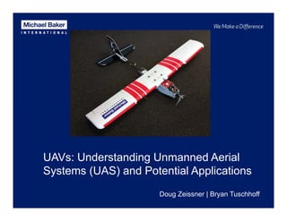
  • 1. UAVs: Understanding Unmanned Aerial Systems (UAS) and Potential Applications Doug Zeissner | Bryan Tuschhoff
  • 2. Agenda  UAV vs Drone  System Platform Types  Suitability & Capability  Regulations  Markets  UAV Survey Pattern  Cost Considerations/Timeframe/Turnaround  Michael Baker’s UAS capabilities
  • 3. What’s in a Name  Unmanned Aerial System (UAS) Preferred terminology of the FAA.  Aircraft Payload  (Camera…) Autopilot RC Controller Ground Station 
  • 6. Types of UAS Multi Rotors  Strengths • Vertical takeoff • Hovering capability • Camera gimbals • Simple to fly manually  Considerations • Short flight times (<20min) • Hard landing with fail • Low payload weight Fixed Wing  Strengths • Hand launch • Long flight times (>40min) • Loiter capabilities • Soft Landing with fail  Considerations • No payload stabilization • Glide to loss with fail • Best in programmed flight
  • 7. Suitability Multi Rotors  Video Documentation  Bridge Inspection  Construction Site Monitoring (Video)  Architectural Modeling  Fly Through Animations  Stack Inspections  Tower / Pole Surveys  Site Mapping (< 5 acres) Fixed Wing  Watershed, Site Mapping (< 160 acres)  Land Dev Mapping  Construction Site Monitoring (Mapping)  Corridor Mapping • Transportation • Utility  Environmental Mapping  Agricultural Mapping
  • 8. Michael Baker’s UAS  Fixed Wing Precision Hawk
  • 9. Michael Baker’s UAS  Multi Rotor DJI Phantom 3
  • 10. Regulations  The FAA is beginning to allow UAS operations  This is a two step process  Must file a Petition For Exemption under Section 333  Must apply for and receive a Certificate of Waiver or Authorization (COA).
  • 11. Regulations The FAA currently requires a Licensed Pilot as the Pilot In Charge (PIC). The FAA requires a Visual Observe as well (VO).
  • 12. Markets  Utilities  Corridor Inspection Services, Greenfield Mapping, ROW and Vegetation Encroachment,  Substation Mapping and Wind Turbine Inspection   Transportation   High Resolution Corridor Mapping, New Construction, Construction Monitoring, Visualization,  and Modeling     Land Development   Site Development, Topo Mapping, Volume Computations, Construction Monitoring, Planimetric  Updates, Asset Inventory, and Visualization   Environmental   Waste Monitoring, Spill Monitoring, Vegetation Monitoring, and Sea Grass Monitoring  
  • 13. 12/30/2015 13 Top view of the initial image position. The green line follows the position of the images in time starting from the large blue dot. UAV Survey Pattern
  • 14. Typical Costs  Acquisition costs • UAS have lower operating costs when compared to conventional aircraft • UAS can be mobilized at a lower cost than conventional aircraft  Processing costs • Mapping costs per acre are lower • As project size increases economies of scale tip toward conventional acquisition means…fewer images to process over a larger area
  • 15. Timeframe/Turnaround  Due to typical UAS project size, advances in processing technology, and depending on the deliverable…data can be delivered much faster.  Sample Turnaround times with out control • Video – Real Time • Imagery – Within Hours • Raw Semi Globally Matched (SGM) Point Clouds and Ortho mosaics – Under 24 Hours • Planimetrics, Contours - * Based on project size
  • 16. Michael Baker’s UAS Capabilities  Designed for aerial mapping of small to mid sized projects.  Rapid deployment  Fully backed by 75 years of mapping experience.  ISO certified LiDAR processing  One stop shop includes surveying also