SlideShare una empresa de Scribd logo
1 de 11
Descargar para leer sin conexión
Openstreetmap
You can participate


            ICRC GIS officers - 24/08/2010
            Frédéric Bonifas
            fredericbonifas@gmail.com
What OpenStreetMap needs
Aerial imagery

●   Lots of people from OSM are waiting for one
    thing : tracing over aerial imagery !
●   Identifiable data : roads, landuse, high
    structures, damaged buildings...
●   Rather fast to get vector data from these
    images
Example : Kyrgyzstan
Field data
●   People on the ground often needed for specific
    data :
    ●   Landuse and roads
    ●   Street names
    ●   Points of interest (health facilities, education,
        infrastructures...)


●   Formats :
    ●   shapefile is the best
    ●   other possibilities : kml, gpx, pictures, sketches by
        hand...
Licence questions
Aerial imagery

License agreement to allow data tracing for OSM


Two methods :
●   Public WMS, available for anyone to use (eg
    Haiti)
●   Private WMS, available on request for people
    interested in tracing (eg Kyrgyzstan, Gaza)
Points of interest

●   Personal knowledge of the reality
●   Public domain data

●   No licensed data like copyrighted paper maps
    or Google Maps

●   Example : you collect data with a GPS and then
    share it with OSM
Please ask !
Scenario

        You want a map   You have a map !


No vector data                    OSM shapefiles
  available                         available


             You share
             your data
                                  Data
                               integration
           OSM creates
              data
Conclusion


OSM has dozens of people who waiting for one
thing : mapping.

We have a lot of potential data sources.

So please ask, even now, if vector data is needed
for an area !

Más contenido relacionado

La actualidad más candente

Haiti HOT OSM éducation 15/02/2012 (FR)
Haiti HOT OSM éducation 15/02/2012 (FR)Haiti HOT OSM éducation 15/02/2012 (FR)
Haiti HOT OSM éducation 15/02/2012 (FR)
Severin Menard
 
OpenStreetMap Mapping Party - Boston
OpenStreetMap Mapping Party - BostonOpenStreetMap Mapping Party - Boston
OpenStreetMap Mapping Party - Boston
David Zwarg
 

La actualidad más candente (19)

GeoData: What's Special about Spatial?
GeoData: What's Special about Spatial?GeoData: What's Special about Spatial?
GeoData: What's Special about Spatial?
 
Earth observation for oil and gas
Earth observation for oil and gasEarth observation for oil and gas
Earth observation for oil and gas
 
OpenPlanetaryMap talk at EPSC 2017
OpenPlanetaryMap talk at EPSC 2017OpenPlanetaryMap talk at EPSC 2017
OpenPlanetaryMap talk at EPSC 2017
 
Haiti HOT OSM éducation 15/02/2012 (FR)
Haiti HOT OSM éducation 15/02/2012 (FR)Haiti HOT OSM éducation 15/02/2012 (FR)
Haiti HOT OSM éducation 15/02/2012 (FR)
 
OSM HOT SBTF 2013_03_16
OSM HOT SBTF 2013_03_16OSM HOT SBTF 2013_03_16
OSM HOT SBTF 2013_03_16
 
JRC, GHA Live presentation: Maps, GISs and SDIs
JRC, GHA Live presentation: Maps, GISs and SDIsJRC, GHA Live presentation: Maps, GISs and SDIs
JRC, GHA Live presentation: Maps, GISs and SDIs
 
Geovisualisation of flows: New approaches to map an interdependent world
Geovisualisation of flows: New approaches to map an interdependent worldGeovisualisation of flows: New approaches to map an interdependent world
Geovisualisation of flows: New approaches to map an interdependent world
 
GIS as tool for cultural heritage management
GIS as tool for cultural heritage managementGIS as tool for cultural heritage management
GIS as tool for cultural heritage management
 
Greening the Concrete Jungle
Greening the Concrete Jungle Greening the Concrete Jungle
Greening the Concrete Jungle
 
OpenStreetMap Mapping Party - Boston
OpenStreetMap Mapping Party - BostonOpenStreetMap Mapping Party - Boston
OpenStreetMap Mapping Party - Boston
 
GeoSEO and Map Series - Discovery Integrated With Geographical Search in Map ...
GeoSEO and Map Series - Discovery Integrated With Geographical Search in Map ...GeoSEO and Map Series - Discovery Integrated With Geographical Search in Map ...
GeoSEO and Map Series - Discovery Integrated With Geographical Search in Map ...
 
A Survey of Procedural Methods for Terrain Modelling
A Survey of Procedural Methods for Terrain ModellingA Survey of Procedural Methods for Terrain Modelling
A Survey of Procedural Methods for Terrain Modelling
 
Business Models for Small Satellite Missions (2017)
Business Models for Small Satellite Missions (2017)Business Models for Small Satellite Missions (2017)
Business Models for Small Satellite Missions (2017)
 
Work of the Humanitarian OpenStreetMap Team (HOT) in Haiti March-June 2010
Work of the Humanitarian OpenStreetMap Team (HOT) in Haiti March-June 2010Work of the Humanitarian OpenStreetMap Team (HOT) in Haiti March-June 2010
Work of the Humanitarian OpenStreetMap Team (HOT) in Haiti March-June 2010
 
INTRODUCTION TO GIS
INTRODUCTION TO GISINTRODUCTION TO GIS
INTRODUCTION TO GIS
 
The past is a different county: they map things differently there: Mapping an...
The past is a different county: they map things differently there: Mapping an...The past is a different county: they map things differently there: Mapping an...
The past is a different county: they map things differently there: Mapping an...
 
Asia Pacific Map Powerpoint Templates and Background
Asia Pacific Map Powerpoint Templates and BackgroundAsia Pacific Map Powerpoint Templates and Background
Asia Pacific Map Powerpoint Templates and Background
 
Visualising Urban Geographies - Stuart Nichol
Visualising Urban Geographies - Stuart NicholVisualising Urban Geographies - Stuart Nichol
Visualising Urban Geographies - Stuart Nichol
 
Spatial Information for Bicycling Research
Spatial Information for Bicycling ResearchSpatial Information for Bicycling Research
Spatial Information for Bicycling Research
 

Destacado

Présentation OpenStreetMap - AITF 2010
Présentation OpenStreetMap - AITF 2010Présentation OpenStreetMap - AITF 2010
Présentation OpenStreetMap - AITF 2010
Frédéric Bonifas
 

Destacado (7)

Présentation OpenStreetMap - AITF 2010
Présentation OpenStreetMap - AITF 2010Présentation OpenStreetMap - AITF 2010
Présentation OpenStreetMap - AITF 2010
 
2 contributing
2 contributing2 contributing
2 contributing
 
1 general
1 general1 general
1 general
 
3 using
3 using3 using
3 using
 
4 hot
4 hot4 hot
4 hot
 
Lightning Talk #9: How UX and Data Storytelling Can Shape Policy by Mika Aldaba
Lightning Talk #9: How UX and Data Storytelling Can Shape Policy by Mika AldabaLightning Talk #9: How UX and Data Storytelling Can Shape Policy by Mika Aldaba
Lightning Talk #9: How UX and Data Storytelling Can Shape Policy by Mika Aldaba
 
Succession “Losers”: What Happens to Executives Passed Over for the CEO Job?
Succession “Losers”: What Happens to Executives Passed Over for the CEO Job? Succession “Losers”: What Happens to Executives Passed Over for the CEO Job?
Succession “Losers”: What Happens to Executives Passed Over for the CEO Job?
 

Similar a 5 youcanhelp

Eurosha kenya pres_osm_en_20121031
Eurosha kenya pres_osm_en_20121031Eurosha kenya pres_osm_en_20121031
Eurosha kenya pres_osm_en_20121031
Severin Menard
 
Talk: "Using Open Data and Crowdsourcing to develop CycleStreets"
Talk: "Using Open Data and Crowdsourcing to develop CycleStreets"Talk: "Using Open Data and Crowdsourcing to develop CycleStreets"
Talk: "Using Open Data and Crowdsourcing to develop CycleStreets"
CycleStreets
 

Similar a 5 youcanhelp (20)

OpenStreetMap and CycleStreets: collaborative map-making and cartography in t...
OpenStreetMap and CycleStreets: collaborative map-making and cartography in t...OpenStreetMap and CycleStreets: collaborative map-making and cartography in t...
OpenStreetMap and CycleStreets: collaborative map-making and cartography in t...
 
Humanitarian OpenStreetMap Team [H.O.T.] Training for SBTF
Humanitarian OpenStreetMap Team [H.O.T.] Training for SBTFHumanitarian OpenStreetMap Team [H.O.T.] Training for SBTF
Humanitarian OpenStreetMap Team [H.O.T.] Training for SBTF
 
OpenStreetMap Support for Humanitarian Community
OpenStreetMap Support for Humanitarian CommunityOpenStreetMap Support for Humanitarian Community
OpenStreetMap Support for Humanitarian Community
 
Eurosha kenya pres_osm_en_20121031
Eurosha kenya pres_osm_en_20121031Eurosha kenya pres_osm_en_20121031
Eurosha kenya pres_osm_en_20121031
 
Talk: "Using Open Data and Crowdsourcing to develop CycleStreets"
Talk: "Using Open Data and Crowdsourcing to develop CycleStreets"Talk: "Using Open Data and Crowdsourcing to develop CycleStreets"
Talk: "Using Open Data and Crowdsourcing to develop CycleStreets"
 
Build with live location data
Build with live location dataBuild with live location data
Build with live location data
 
Two's a Crowd: Jerry Clough @ Open Addresses Symposium
Two's a Crowd: Jerry Clough @ Open Addresses SymposiumTwo's a Crowd: Jerry Clough @ Open Addresses Symposium
Two's a Crowd: Jerry Clough @ Open Addresses Symposium
 
Two's a Crowd: Crowdsourcing Addresses for OpenStreetMap in the UK
Two's a Crowd: Crowdsourcing Addresses for OpenStreetMap in the UKTwo's a Crowd: Crowdsourcing Addresses for OpenStreetMap in the UK
Two's a Crowd: Crowdsourcing Addresses for OpenStreetMap in the UK
 
Besfort Guri - OS Geo Live
Besfort Guri - OS Geo LiveBesfort Guri - OS Geo Live
Besfort Guri - OS Geo Live
 
Crowdsource the Map! And Intro to OpenStreetMap - Sargent McDonald
Crowdsource the Map! And Intro to OpenStreetMap - Sargent McDonaldCrowdsource the Map! And Intro to OpenStreetMap - Sargent McDonald
Crowdsource the Map! And Intro to OpenStreetMap - Sargent McDonald
 
GIS and Map Tiles
GIS and Map TilesGIS and Map Tiles
GIS and Map Tiles
 
Presentationsfk2010
Presentationsfk2010Presentationsfk2010
Presentationsfk2010
 
Open geo data - technical issue
Open geo data  - technical issueOpen geo data  - technical issue
Open geo data - technical issue
 
Osm application
Osm applicationOsm application
Osm application
 
Osm Presentation
Osm PresentationOsm Presentation
Osm Presentation
 
OpenStreetMap, an introduction
OpenStreetMap, an introductionOpenStreetMap, an introduction
OpenStreetMap, an introduction
 
Intro to OpenStreetMap- UC Merced 4.22.09
Intro to OpenStreetMap- UC Merced 4.22.09Intro to OpenStreetMap- UC Merced 4.22.09
Intro to OpenStreetMap- UC Merced 4.22.09
 
OpenStreetMap - The Quality Issue
OpenStreetMap - The Quality IssueOpenStreetMap - The Quality Issue
OpenStreetMap - The Quality Issue
 
Map kathmandu osm nepal presentation - public
Map kathmandu osm nepal presentation - publicMap kathmandu osm nepal presentation - public
Map kathmandu osm nepal presentation - public
 
Geoscience Australia National Map
Geoscience Australia National MapGeoscience Australia National Map
Geoscience Australia National Map
 

Último

Último (20)

Axa Assurance Maroc - Insurer Innovation Award 2024
Axa Assurance Maroc - Insurer Innovation Award 2024Axa Assurance Maroc - Insurer Innovation Award 2024
Axa Assurance Maroc - Insurer Innovation Award 2024
 
Boost PC performance: How more available memory can improve productivity
Boost PC performance: How more available memory can improve productivityBoost PC performance: How more available memory can improve productivity
Boost PC performance: How more available memory can improve productivity
 
Scaling API-first – The story of a global engineering organization
Scaling API-first – The story of a global engineering organizationScaling API-first – The story of a global engineering organization
Scaling API-first – The story of a global engineering organization
 
Real Time Object Detection Using Open CV
Real Time Object Detection Using Open CVReal Time Object Detection Using Open CV
Real Time Object Detection Using Open CV
 
TrustArc Webinar - Unlock the Power of AI-Driven Data Discovery
TrustArc Webinar - Unlock the Power of AI-Driven Data DiscoveryTrustArc Webinar - Unlock the Power of AI-Driven Data Discovery
TrustArc Webinar - Unlock the Power of AI-Driven Data Discovery
 
How to Troubleshoot Apps for the Modern Connected Worker
How to Troubleshoot Apps for the Modern Connected WorkerHow to Troubleshoot Apps for the Modern Connected Worker
How to Troubleshoot Apps for the Modern Connected Worker
 
TrustArc Webinar - Stay Ahead of US State Data Privacy Law Developments
TrustArc Webinar - Stay Ahead of US State Data Privacy Law DevelopmentsTrustArc Webinar - Stay Ahead of US State Data Privacy Law Developments
TrustArc Webinar - Stay Ahead of US State Data Privacy Law Developments
 
04-2024-HHUG-Sales-and-Marketing-Alignment.pptx
04-2024-HHUG-Sales-and-Marketing-Alignment.pptx04-2024-HHUG-Sales-and-Marketing-Alignment.pptx
04-2024-HHUG-Sales-and-Marketing-Alignment.pptx
 
🐬 The future of MySQL is Postgres 🐘
🐬  The future of MySQL is Postgres   🐘🐬  The future of MySQL is Postgres   🐘
🐬 The future of MySQL is Postgres 🐘
 
Tata AIG General Insurance Company - Insurer Innovation Award 2024
Tata AIG General Insurance Company - Insurer Innovation Award 2024Tata AIG General Insurance Company - Insurer Innovation Award 2024
Tata AIG General Insurance Company - Insurer Innovation Award 2024
 
ProductAnonymous-April2024-WinProductDiscovery-MelissaKlemke
ProductAnonymous-April2024-WinProductDiscovery-MelissaKlemkeProductAnonymous-April2024-WinProductDiscovery-MelissaKlemke
ProductAnonymous-April2024-WinProductDiscovery-MelissaKlemke
 
Exploring the Future Potential of AI-Enabled Smartphone Processors
Exploring the Future Potential of AI-Enabled Smartphone ProcessorsExploring the Future Potential of AI-Enabled Smartphone Processors
Exploring the Future Potential of AI-Enabled Smartphone Processors
 
[2024]Digital Global Overview Report 2024 Meltwater.pdf
[2024]Digital Global Overview Report 2024 Meltwater.pdf[2024]Digital Global Overview Report 2024 Meltwater.pdf
[2024]Digital Global Overview Report 2024 Meltwater.pdf
 
What Are The Drone Anti-jamming Systems Technology?
What Are The Drone Anti-jamming Systems Technology?What Are The Drone Anti-jamming Systems Technology?
What Are The Drone Anti-jamming Systems Technology?
 
Bajaj Allianz Life Insurance Company - Insurer Innovation Award 2024
Bajaj Allianz Life Insurance Company - Insurer Innovation Award 2024Bajaj Allianz Life Insurance Company - Insurer Innovation Award 2024
Bajaj Allianz Life Insurance Company - Insurer Innovation Award 2024
 
2024: Domino Containers - The Next Step. News from the Domino Container commu...
2024: Domino Containers - The Next Step. News from the Domino Container commu...2024: Domino Containers - The Next Step. News from the Domino Container commu...
2024: Domino Containers - The Next Step. News from the Domino Container commu...
 
Connector Corner: Accelerate revenue generation using UiPath API-centric busi...
Connector Corner: Accelerate revenue generation using UiPath API-centric busi...Connector Corner: Accelerate revenue generation using UiPath API-centric busi...
Connector Corner: Accelerate revenue generation using UiPath API-centric busi...
 
HTML Injection Attacks: Impact and Mitigation Strategies
HTML Injection Attacks: Impact and Mitigation StrategiesHTML Injection Attacks: Impact and Mitigation Strategies
HTML Injection Attacks: Impact and Mitigation Strategies
 
The 7 Things I Know About Cyber Security After 25 Years | April 2024
The 7 Things I Know About Cyber Security After 25 Years | April 2024The 7 Things I Know About Cyber Security After 25 Years | April 2024
The 7 Things I Know About Cyber Security After 25 Years | April 2024
 
Driving Behavioral Change for Information Management through Data-Driven Gree...
Driving Behavioral Change for Information Management through Data-Driven Gree...Driving Behavioral Change for Information Management through Data-Driven Gree...
Driving Behavioral Change for Information Management through Data-Driven Gree...
 

5 youcanhelp

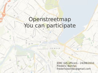
  • 1. Openstreetmap You can participate ICRC GIS officers - 24/08/2010 Frédéric Bonifas fredericbonifas@gmail.com
  • 3. Aerial imagery ● Lots of people from OSM are waiting for one thing : tracing over aerial imagery ! ● Identifiable data : roads, landuse, high structures, damaged buildings... ● Rather fast to get vector data from these images
  • 5. Field data ● People on the ground often needed for specific data : ● Landuse and roads ● Street names ● Points of interest (health facilities, education, infrastructures...) ● Formats : ● shapefile is the best ● other possibilities : kml, gpx, pictures, sketches by hand...
  • 7. Aerial imagery License agreement to allow data tracing for OSM Two methods : ● Public WMS, available for anyone to use (eg Haiti) ● Private WMS, available on request for people interested in tracing (eg Kyrgyzstan, Gaza)
  • 8. Points of interest ● Personal knowledge of the reality ● Public domain data ● No licensed data like copyrighted paper maps or Google Maps ● Example : you collect data with a GPS and then share it with OSM
  • 10. Scenario You want a map You have a map ! No vector data OSM shapefiles available available You share your data Data integration OSM creates data
  • 11. Conclusion OSM has dozens of people who waiting for one thing : mapping. We have a lot of potential data sources. So please ask, even now, if vector data is needed for an area !