
Recomendados
Más contenido relacionado
La actualidad más candente
La actualidad más candente (20)
Similar a CCSoc3º Tema 3- El Continente Europeo
Similar a CCSoc3º Tema 3- El Continente Europeo (20)
Más de Julio César
Último
Último (20)
CCSoc3º Tema 3- El Continente Europeo
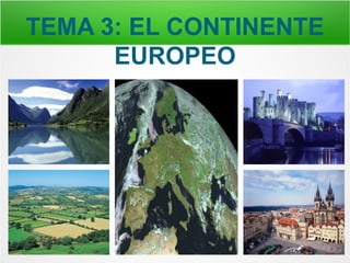
- 1. TEMA 3: EL CONTINENTE EUROPEO
- 3. Situación Europa está situada en el hemisferio norte. Límites: Norte → Océano Glacial Ártico. Sur → Mar Mediterráneo. Este → Montes Urales. Oeste → Océano Atlántico.
- 4. Llanuras y Montañas - Gran Llanura Europea. - Llanura de Europa Oriental. - Montañas, sobre todo en el sur.
- 16. La Selva Negra (Alemania)
- 17. La Selva Negra (Alemania)
- 18. La Selva Negra (Alemania)
- 19. La Selva Negra (Alemania)
- 20. La Selva Negra (Alemania)
- 21. La Selva Negra (Alemania)
- 22. La Selva Negra (Alemania)
- 23. La Selva Negra (Alemania)
- 24. La Selva Negra (Alemania)
- 25. La Selva Negra (Alemania)
- 26. Sistemas Montañosos: Las montañas más altas de Europa se concentran en el sur → Los Pirineos, Los Alpes, los Cárpatos, los Balcanes y el Cáucaso. Además los Montes Escandinavos y los Montes Urales.
- 27. Los Pirineos (España y Francia)
- 28. Los Pirineos (España y Francia)
- 29. Los Pirineos (España y Francia)
- 30. Los Pirineos (España y Francia)
- 31. Los Alpes
- 32. Los Alpes
- 33. Los Alpes
- 34. Los Alpes
- 35. Los Alpes
- 36. Los Alpes
- 37. Mont Blanc (4807 m.)
- 38. Los Cárpatos
- 39. Los Cárpatos
- 44. Castillo de Drácula en Los Cárpatos (Rumanía)
- 45. Los Balcanes
- 46. Los Balcanes
- 50. Los Balcanes
- 51. El Cáucaso
- 52. El Cáucaso
- 53. El Cáucaso
- 54. El Cáucaso
- 55. Monte Elbrus (5642 m.)
- 61. Los Montes Urales (Rusia)
- 63. Penínsulas Las más grandes: Escandinava, Ibérica, Itálica, Balcánica.
- 72. Península de los Balcanes
- 73. Península de los Balcanes
- 76. Golfos
- 77. Bothnia, Vizcaya, León, Génova.
- 78. Golfo de Vizcaya
- 79. Golfo de León
- 80. Cabos
- 81. Del Norte, Finisterre, San Vicente, Matapán.
- 82. Cabo del Norte
- 83. Cabo del Norte (Noruega)
- 84. Cabo del Norte (Noruega)
- 85. Cabo del Norte (Noruega)
- 87. Cabo de Finisterre (Fisterra)
- 88. Cabo de Finisterre (España)
- 89. Cabo de San Vicente
- 90. Cabo de San Vicente
- 91. Cabo de San Vicente (Portugal)
- 92. Cabo de San Vicente (Portugal)
- 93. Islas
- 94. Islandia, Gran Bretaña e Irlanda, Islas Baleares, Córcega, Cerdeña, Sicilia, Malta, Creta y Chipre.
- 95. Islandia
- 96. Gran Bretaña e Irlanda
- 97. Gran Bretaña e Irlanda
- 98. Islas Baleares
- 99. Islas Baleares
- 100. Córcega y Cerdeña
- 101. Córcega y Cerdeña
- 102. Sicilia
- 103. Sicilia
- 104. Malta
- 105. Creta
- 106. Creta
- 107. Chipre
- 108. Chipre
- 109. LOS RÍOS Y LOS LAGOS DE EUROPA
- 110. Ríos - Ríos que desembocan en el Océano Glacial Ártico. - Ríos que desembocan en el Océano Atlántico. - Ríos que desembocan en el Mar Mediterráneo. - Ríos que desembocan en el Mar Negro o Caspio.
- 111. Vertiente Ártica Son caudalosos y se hielan en invierno. Pechora y Dvina Septentrional.
- 112. Río Pechora
- 113. Río Dvina Septentrional en Arkhangelsk (Rusia)
- 114. Vertiente Atlántica Son caudalosos. Dvina Occidental, Vístula, Óder, Elba, Rin, Sena, Loira y Tajo.
- 115. Río Dvina Occidental en Riga (Letonia)
- 116. Río Vístula en Cracovia (Polonia)
- 117. Parque Nacional del Río Óder (Polonia)
- 118. Río Elba en Hamburgo (Alemania)
- 119. Río Rin en Basilea (Suiza)
- 120. Río Sena en París (Francia)
- 121. Río Loira en Nantes (Francia)
- 122. Río Tajo en Toledo (España)
- 123. Río Tajo en Talavera de la Reina (España)
- 124. Río Tajo en Lisboa (Portugal)
- 125. Vertiente Mediterránea Son cortos y poco caudalosos. Ebro, Ródano y Po.
- 126. Río Ebro en Zaragoza (España)
- 127. Río Ródano en Lyon (France)
- 128. Río Po en Turín (Italia)
- 129. Vertiente del Mar Negro Son caudalosos y largos. Danubio, Dniéster y Dniéper.
- 130. Río Danubio en Budapest (Hungría)
- 132. Vertiente del Mar Caspio Son ríos largos y caudalosos. El Volga es el río más largo de Europa.
- 133. Puente sobre el Río Volga en Saratov (Russia)
- 135. Lagos del Norte
- 136. Lagos del Norte Onega y Ladoga en Rusia. Vanern en Suecia.
- 138. Lago Onega (Rusia)
- 139. Lago Ladoga (Rusia)
- 140. Lago Vanern (Suecia)
- 141. Lagos del Sur Albufera de Valencia (España)
- 143. Lagos de los Alpes
- 144. Lagos de los Alpes
- 145. Lago Maggiore (Lago Mayor) (Suiza e Italia)
- 146. Lago Como (Italia)
- 147. Lago Garda (Italia)
- 148. Lago Leman (Francia y Suiza)
- 149. Lago Genève (Suiza)
- 150. Lago Constanza (Suiza, Alemania y Austria)
- 151. 2º Trimestre: PAISAJES DE ESPAÑA
- 152. Spain’s Relief in Europe Most part of the Peninsula and island territories are very mountainous. The central part of the Peninsula is occupied by a large plateau surrounded, almost completely, by mountains.
- 153. The centre of the Iberian Peninsula is occupied by a large raised flatland: the Plateau. Inside it, there are two mountain chains: Toledo Mountains and the Central Chain.
- 154. Surrounding the Plateau we can find: Leon Mountains, Cantabrian Chain, Iberian Chain and Morena Range.
- 155. Separated from the Plateau we can find some other mountain chains. These are: Galician Massif, Basque Mountains, Pyrenees, Coastal-Catalonian Chain and Baetic Chain. This last is formed by the Sub-Baetic Chain and the Penibaetic Chain. In the Penibaetic Chain we can find the highest peak in the Iberian Peninsula: Mulhacén (3.478 m.).
- 156. These are two lowlands areas formed in the valleys of two rivers: Ebro depression and Guadalquivir depression.
- 157. The relief in the Balearic islands is, in general, mountainous. Its coasts are full of cliffs, with some bays and many coves.
- 158. The Canary islands have a relief of volcanic origin and very mountainous. In the island of Tenerife we can find the Teide volcano, which is the highest peak in Spain with 3.717 meters. Coasts are, on average, full of cliffs and not very sharp.
- 159. Spain’s Climates in Europe
- 160. Spain’s Rivers in Europe The Iberian Peninsula has three hydrographic watersheds: the Cantabrian, the Atlantic and the Mediterranean.
- 161. Cantabrian Watershed The main rivers of this watershed are: Bidasoa, Nervión, Besaya, Nalón, Navia and Eo. They are commonly very short (about 50 km. long, approximately) and very plentiful.
- 162. Atlantic Watershed The main rivers of the Atlantic watershed are: Miño, Duero, Tajo, Guadiana and Guadalquivir. These are long rivers because, except for the Miño, all of them are longer than 650 km. This is due to the fact that they are born in mountain ranges which are far away from the sea.
- 163. Mediterranean Watershed The main rivers of the Mediterranean watershed are: Guadalhorce, Segura, Júcar, Turia, Ebro, Llobregat and Ter. Except for the Ebro, which is 930 km. long, most of them are not very long, because they have an average length of 200 km.
- 164. LOS PAÍSES DE EUROPA
- 165. Grandes Capitales
- 166. Madrid (España)
- 167. París (Francia)
- 169. Roma (Italia)
- 170. Berlín (Alemania)
- 171. Bucarest (Rumanía)
- 172. Kiev (Ucrania)
- 173. Moscú (Rusia)