NMR water exploration & presentation of water project technology

The technology will be able to remotely detect and assess groundwater accumulation and flows anywhere on Earth to a depth of 5 km directly. At a time of deep recession in the global industry and staff reduction, only NMR technology will allow companies to maintain their exploration and prospecting programs scheduled for 2020 at a symbolic price. ( NMR technology provides acquisition of absolute field data with efficiency 2.5-3.0 times higher than indirect seismic data and at a price ten times lower than 2D/3D seismic data). And most importantly, we are operating remotely, we are not afraid of the coronavirus pandemic all over the world!!! We will search for reserves and water flows remotely with high accuracy anywhere in the world: - the identification and contouring of accumulations and flows of underground fresh water, - mapping the contours; - obtaining the number of horizons and the depth of their occurrence; - determining thickness aquifers and reservoir rocks, - Determination of promising drilling points. The NMR technology is based on the phenomenon of resonance, which allows direct detection and contouring of accumulations and flows, like the MRI scanning in medicine, which allows seeing human body problems at once.

Recomendados
Recomendados
Más contenido relacionado
La actualidad más candente
La actualidad más candente (20)
Similar a NMR water exploration & presentation of water project technology
Similar a NMR water exploration & presentation of water project technology (20)
Más de Fands-llc
Más de Fands-llc (20)
Último
Último (20)
NMR water exploration & presentation of water project technology
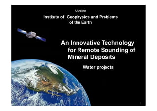
- 1. 1 Ukraine Institute of Geophysics and Problems of the Earth An Innovative Technology for Remote Sounding of Mineral Deposits Water projects
- 2. General ProvisionsGeneral Provisions Water supply problems in the world is getting more acute. This problem is especially relevant for countries with arid climate and deserts who occupy large areas. Relevant is the development and application of accurate, rapid and inexpensive methods to search for underground fresh water in large areas. The scientists of our company developed and successfully applied the technology of remote search for underground water resources, based on the effect of nuclear magnetic resonance. The use of technology in your country lets you quickly inspect large and hardly accessible areas, identify underground fresh water and to determine the optimal drilling point. Confidence in the success is based on three main principles: 1. The development and availability of a scientific approach to the genesis of groundwater, 2. Successfully completed projects on search fresh waters, carried out in different countries. 3. The presence of highly effective technology groundwater exploration, 1. The development and availability of a scientific approach to the genesis of groundwater, 2. Successfully completed projects on search fresh waters, carried out in different countries. 3. The presence of highly effective technology groundwater exploration,
- 3. 1. Our scheme of formation of underground fresh water near of magma chambers 3 Streamsoffreshwater Freshwater lakes Underground freshwater lakes Sea Vaporization zone The flow of sea water boiling zone geothermal water magma chamber 1. Mechanism of formation of underground waters is that sea water along tectonic fractures comes to the magma chamber (2000 ÷ 3000 m depth), where the water boils. 2. The resulting vapor flows under pressure into the upper water permeable rocks by tectonic fractures (at a depth of 400 ÷ 1000m) condenses and forms an underground lake. Of these lakes along the faults expire streams of fresh water. 3. From boiling zone by tectonic fractures expires geothermal salt water (at a depth of 2000 ÷ 2500 m).
- 4. Research results. The formation of large water flows in different regions of the globe In all cases, groundwater flow is discharged into the seas and oceans (wedge out in the lake) through hundreds of kilometers at certain depths and distances from the shoreline. Typically, in these places tend to have higher catches of marine and freshwater fish. Along the way, the flow of fresh water is branching into smaller streams, which cover large areas. In all cases, groundwater flow is discharged into the seas and oceans (wedge out in the lake) through hundreds of kilometers at certain depths and distances from the shoreline. Typically, in these places tend to have higher catches of marine and freshwater fish. Along the way, the flow of fresh water is branching into smaller streams, which cover large areas. Wehaveidentified anumberofmajorsourcesof groundwater indifferentcountries:
- 5. Asimplifieddiagramoftheundergroundwaterflow(point 14) Fresh water Presaltedwater For example: In the magma chamber number 14 in the south of Iran sea water comes from the Arabian Gulf. As a result forming two flow of geothermal water at depths of 2 and 3 km. Is also formed a large flow of fresh water that crosses Arabian Peninsula. A powerful stream of fresh water crosses the UAE at a depth of 280m - 350m. North you will flow of salt water which has a smaller depth.
- 6. A few more examples of powerful natural sources of fresh water in Africa In all cases, groundwater flow is discharged into the seas and oceans (wedge out in the lake) through hundreds of kilometers at certain depths and distances from the shoreline. Typically, in these places tend to have higher catches of marine and freshwater fish. Along the way, the flow of fresh water is branching into smaller streams, which cover large areas. Publications by our scientists on this subject 1. G.A. Bielawski, NI Kovalev. New technologies in remote environmental monitoring of underground and underwater objects / / "Environment and Resources", vol. Number 9, Kiev, 2004., P.7. 2.N.I.Kovalev, etc. Investigation of the mechanism of formation of underground fresh water near the magma chambers extinguished volcanoes. International Conference «Space technologies in geophysics» //C.P. Russia, 2013. 3. N.I. Kovalev, etc. On the mechanism of formation of underground fresh water near magma chambers. - The book Scientific works of СНУЯЭиП, vol. 2(46), 2013. 1. G.A. Bielawski, NI Kovalev. New technologies in remote environmental monitoring of underground and underwater objects / / "Environment and Resources", vol. Number 9, Kiev, 2004., P.7. 2.N.I.Kovalev, etc. Investigation of the mechanism of formation of underground fresh water near the magma chambers extinguished volcanoes. International Conference «Space technologies in geophysics» //C.P. Russia, 2013. 3. N.I. Kovalev, etc. On the mechanism of formation of underground fresh water near magma chambers. - The book Scientific works of СНУЯЭиП, vol. 2(46), 2013. Parameters Рoint number 6 Mauritania Рoint number 7 Namibia Point number 8 Egypt Point number 9 Mozambique Receipt of salt water. Тhe flow width Atlantic Ocean. 3 km Atlantic Ocean. 10 km Mediterranean Sea. 8 km Indian Ocean. 10 km Geothermal water Geothermal salty streams. The depth of ~ 2000 m Geothermal salty streams. The depth of ~ 2300 m Geothermal salty streams. The depth of ~ 2500 m Geothermal salty streams. The depth of ~ 2300 m Freshwaters 3 flow. Depth 70m -128m Multipe streams of fresh water. Depth ≥ 180m Multipe streams of fresh water. Depth ≥ 200m Multipe streams of fresh water. Depth ≥ 150m
- 7. 2. Some of the work performed (groundwater) 2. Some of the work performed (groundwater) 22000011г.г. MMAAUURRITITAANNIAIA DDeeteteccteteddaannddththeennooppeenneeddththeeflfolowwooff frferesshhwwaateterrininththeeddeesseertr.t.RReessuultlsts:: TThheeddeeppththooff7755mm--115500mm SSppoouutitninggwwaateterrwwitihthththeeddeebbititooff9900 totonnssppeerrhhoouurr((2255liltieterrssppeerrsseeccoonndd.!.)!.). TThheewwoorkrkwwaassccoommmmisisssioionneeddbbyyththee DDeeppaartrmtmeennttooffGGeeoolologgyyooffththeeMMininisistrtryy ooffEEnneergrgyyooffMMaauurirtiatanniaia(C(Chhieieff GGeeoolologgisisttLLaamminineeIbIbrarahhimim)) InInitiitaialllylyreremmootetesseeaarcrchhfafacciliiltiiteiesswweerree ssuurvrveeyyeedd22,5,50000kkmmssqquuaarere..TThheenn,,ththee mmoobbilieleeeqquuipipmmeennttoonnththeeteterrraraininwweerere rerefifnineeddppaarraammeeteterrssooffooccccuurrrerenncceeooff wwaateterraannddddrirlillilninggppooinintsts
- 8. Experience of work performed (groundwater)Experience of work performed (groundwater) 2008 г. MONGOLIA (Gobi) Detected and then opened the flow of fresh water in the Gobi Desert. Results: 6 wells were drilled with a diameter 67 mm, all successful. Depth of 290m - 320m, For all wells debit of water from 20 to 25 tons per hour (5 - 7 liters per second). The work was commissioned by the Mongolian-Ukrainian company "Mon- Zim-International". Remote search tools have been surveyed more than 1,600 sq km. Then, with the help of mobile devices, on the terrain were refined data streams of water, and drilling points
- 9. Comparison of our data with drilling Publications by our scientists on this subject 1. N.I. Kovalev, etc. Remote defining the contours of underground fresh water in the Gobi Desert in Mongolia / / Scientific report "Gobi" SNUNEI, Sevastopol, 2008., P.65. 2. N.I. Kovalev. Алсын удирдлагын аргаар ашигт маомалын хайгуул хийк ажлын ур дунгийн унэгээ. Mongolian University of Science and Technology. Scientific transaction, 4/106 – Ulanbaatar, 2009. p. 187-192. 3. Kudric I.D, Kovalev N.I., Bielawski S.G. Environmental monitoring. / / Cherkassky CSTEI, 2013. P.258. Country Area remote Coordinate survey that drilling The depth, m Тype of water Our data / drilling results Our data / drilling results Mauritania, city of Atar 2500 sq. km. N 20032' E 13002'30" 130 ÷ 150 125 ÷ 150 Fresh / fresh Mongolia, Gobi Desert 1600 sq. km. N 44001'40" E 108029'00" 270 ÷ 320 275 ÷ 320 Fresh / fresh Cyprus, cityof Limassol 400 sq. km. N 34042'00" E 33001'20" 180 ÷ 200 195 ÷ 205 Fresh / fresh Ukraine, Sevastopol Simferopol 1600 sq. km. More than 100 wells From 50 to 150 Error 1 ÷ 10% Fresh / fresh (two errors)
- 10. 3. About Innovative Technology3. About Innovative Technology Classification Up to 10 000 sq. km and more 1 – 1000 sq. km Patented processing of satellite images In the deposit area Point sounding Direct method of remote sounding of Mineral DepositsDirect method of remote sounding of Mineral Deposits Nuclear magnetic resonanceNuclear magnetic resonance Use of aerospace photographUse of aerospace photograph Work on siteWork on site Diagnostic s of large territory 2 – 3 months Diagnostic s of large territory 2 – 3 months Expedition to location 2 – 3 months Expedition to location 2 – 3 months Search and survey of deposits 2 – 3 months Search and survey of deposits 2 – 3 months The combination of the different stages of technology allows us to solve various problems of research - from control points selected for drilling - to survey difficult areas on land and offshore in all climatic conditions The combination of the different stages of technology allows us to solve various problems of research - from control points selected for drilling - to survey difficult areas on land and offshore in all climatic conditions
- 11. The Innovative Technology is patentedThe Innovative Technology is patented 2.Patent u № 55916 “The process for the search for natural resources”, 2010 3.The positive decision to the International application РСТ/UA2011/000033 "The system of remote exploration of mineral resources" 2011. 4.The positive decision to the International application РСТ/UA2013/000036 "System for remote exploration of mineral deposits " 2013. 2.Patent u № 55916 “The process for the search for natural resources”, 2010 3.The positive decision to the International application РСТ/UA2011/000033 "The system of remote exploration of mineral resources" 2011. 4.The positive decision to the International application РСТ/UA2013/000036 "System for remote exploration of mineral deposits " 2013. Ukraine PATENT4 Name of useful model: METHOD OF SEARCH FOR MINERAL DEPOSITS Serial number: u 35122 Inventors: Eduard Bakai (UA), Pavlo Ivashchenko (UA), Mykola Kovalyov (UA) Date : 26.08.2008 Formula of useful model: 1. Method of search for mineral deposits, which includes processing of an space photograph, which differs due to the fact that a black-and-white negative is used as an space photograph which was obtained in an infrared range of frequencies, and processing of an space photograph is conducted after a package was preliminary formed which consists of a negative of space photograph, test wafer and X- ray film, the formed package is treated with γ-rays, X-ray film is separated, the latter being chemically processed and placed in an alternating electric field of high pressure of a camera of gas-discharge visualisation and visualise an obtained image on a PC screen. Ukraine PATENT4 Name of useful model: METHOD OF SEARCH FOR MINERAL DEPOSITS Serial number: u 35122 Inventors: Eduard Bakai (UA), Pavlo Ivashchenko (UA), Mykola Kovalyov (UA) Date : 26.08.2008 Formula of useful model: 1. Method of search for mineral deposits, which includes processing of an space photograph, which differs due to the fact that a black-and-white negative is used as an space photograph which was obtained in an infrared range of frequencies, and processing of an space photograph is conducted after a package was preliminary formed which consists of a negative of space photograph, test wafer and X- ray film, the formed package is treated with γ-rays, X-ray film is separated, the latter being chemically processed and placed in an alternating electric field of high pressure of a camera of gas-discharge visualisation and visualise an obtained image on a PC screen.
- 12. Equipment for work with analogue satellite imagesEquipment for work with analogue satellite images Research is conducted in Ukraine in a certified laboratory Ukraine CERTIFICATE OF ATTESTATION RI-038/13 5tthh July, 2013 This certificate certifies that the Group of analytic surveys of the research laboratory of nuclear, chemical and radiation technologies and technical control COMPLIES WITH CRITERIA OF ATTESTATION AND CERTIFIED TO THE RIGHT OF DEPTH MEASUREMENTS OF MINERALS
- 13. Capabilities of the TechnologyCapabilities of the Technology Services are provided in the following format: 1.V.A. Puhliy, N.I. Kovalev, V.A. Puhliy "Nuclear Magnetic Resonance, Theory and Applications" Sevastopol University Press | ru | 671 pages ISBN |. 2010. 2.V.A. Puhliy, N.I. Kovalev, Resonances in physics. Vol.1, Quantum Mechanics and Magnetism" | Kiev Znannya publishing house | ru | | 581 pages | ISBN. 2011 3. N.I. Kovalev, etc. Lasers.Theory and ApplWeicatiworkons. Chewith:rkassky CSTI. | 532 pages | 2008. 4. N.I. Kovalev, etc. Thehuysdrocae of gerobon-holosg,raphundeic trewchnateriqueaccumfor remuolatetdionetecsti, oonthoferminerals. Ecology and atomic energy, volmin. Numbeeralsr 1in, 64lar-g67epandagess, m20a0l9.l territories, on land, on shelf 5. E. Bakai, P. Ivashchenko. Innovative Technologies.//Business Panorama №3, Ukraine |67 pages| 2012 6. Kudric I.D, Kovalev N.I., Bielawski S.G. Environmental monitoring. / / Cherkassky CSTI, 2013. P.25813 Territorial applicability – no limitations (any in-land or shelf area) Total size of the territory – practically without limitations Sounding depth – 0-5 km underground Detectable minerals – water, oil, gas, different metals in ore beds Success ratio – for hydrocarbons and water reserves > 90% Duration – typically 2 months Safety – the method is environmentally friendly and completely safe for people Territorial applicability – no limitations (any in-land or shelf area) Total size of the territory – practically without limitations Sounding depth Detectable minerals Success ratio Duration Safety – 0-5 km underground – water, oil, gas, different metals in ore beds – for hydrocarbons and water reserves > 90% – typically 2 months – the method is environmentally friendly and completely safe for people 1.V.A. Puhliy, N.I. Kovalev, V.A. Puhliy "Nuclear Magnetic Resonance, Theory and Applications" Sevastopol University Press | ru | 671 pages ISBN |. 2010. 2.V.A. Puhliy, N.I. Kovalev, Resonances in physics. Vol.1, Quantum Mechanics and Magnetism" | Kiev Znannya publishing house | ru | | 581 pages | ISBN. 2011 3. N.I. Kovalev, etc. Lasers.Theory and Applications. Cherkassky CSTI. | 532 pages | 2008. 4.N.I. Kovalev, etc. The use of geo-holographic technique for remote detection of minerals. Ecology and atomic energy, vol. Number 1, 64 -67 pages, 2009. 5. E. Bakai, P. Ivashchenko. Innovative Technologies.//Business Panorama №3, Ukraine |67 pages| 2012 6. Kudric I.D, Kovalev N.I., Bielawski S.G. Environmental monitoring. / / Cherkassky CSTI, 2013. P.258
- 14. Technology is tested in the USATechnology is tested in the USA Testing and practical demonstration of innovative geophysical technology of search and survey of minerals was conducted in 2009 on territory of state of Utah, USA: 3600sq.km, 5 wells Тhe results: Effectiveness = 100%, Accuracy of depth = 98% Testing in Indonesia Testing in the Gulf of Guinea We examined 2 sections onshore and 3 sections offshore with a total area of Brantas block - 3050 km2, a total of 30 wells. The boundaries of identified prospective oil and gas anomalies practically fully coincided with the boundaries of the previously uncovered drilling anomalies or with promising geological structures, including and marine. Testing remote results of 2 Wells off shore 1.Presence of oil inflows in wells – 100 % 2. Horizon occurrence depths - 75 % tо 84 % 3. Useful capacity of oil horizons - no less 70 % The measurements were made with a patented radiation-chemical processing of analog satellite images without going to the the area
- 15. Work with aerospace photographsWork with aerospace photographs Remote Sensing using digital satellite images Prospective geological By interpretation of digital multichannel satellite imagery specialists reveal the geological structures, in which basins of hydrocarbons or other minerals can be located Diagnosis of territories with the help of our patented method We conduct radiation-chemical processing of analogue infrared satellite images of territories according to the patent. Diagnosis is a simplified version of the technology allowing to quickly detect and delineate the oil fields (and other minerals) in large areas. Also, we determine the number of horizons and the possible depth. Several minerals can be surveyed at the same time. After that we can prospect and explore deposits in a localized oil field. Oil field Gas field Water flow A large area of research to 10,000sq. km andmore structures Onshore Offshore
- 16. Remote prospecting and exploration of depositsRemote prospecting and exploration of deposits Deposits Drilling location Remote survey of drilling point Information necessary for work: -coordinates of drilling point - the desired mineral and, if possible, a sample from a well in the region. Results of the survey: -Presence or absence of mineral deposits in the drilling point, - Number of horizons, estimated depth of the horizon, thickness of horizons. N°, E° Using the patented technology processing of satellite images we can identify and investigate in detail the deposits onshore and offshore Thus we have: - Surface contours of the deposit, - The number of horizons, - The depth of the horizons, - Thickness of horizons, - Calculation of extractable reserves. To100sq.kmandmore
- 17. Theprocedureformeasuringthedepthofoccurrence ofdeposits usinganalogsatelliteimages Theprocedureformeasuringthedepthofoccurrenceofdeposits usinganalogsatelliteimages h α β а 1 2 1 2 3DepositDeposit 1.Use space images the investigated area obtained at different elevation angles α and β from the satellites 1 and 2. Obtain ground mapping point 3 in two different positions, "1" for the first satellite and "2" for the second. 2. We calculate coordinates of points 1 and 2, calculated by different images. 3. Determine the amount of displacement "and" between them on the ground. 4.In the triangle 1-2-3 side a and the adjacent interior angles α and β are known. Such a triangle is called a solution.After the evaluation is determined by the depth of the deposit h. 1.Use space images the investigated area obtained at different elevation angles α and β from the satellites 1 and 2. Obtain ground mapping point 3 in two different positions, "1" for the first satellite and "2" for the second. 2. We calculate coordinates of points 1 and 2, calculated by different images. 3. Determine the amount of displacement "and" between them on the ground. 4.In the triangle 1-2-3 side a and the adjacent interior angles α and β are known. Such a triangle is called a solution.After the evaluation is determined by the depth of the deposit h.
- 18. Operating sequenceOperating sequence 7 Preparationofreport andproviding theCustomer withit Analytical dataprocessingobtainment ofcoordinatesofbedsandpreliminarycalculationof supplies 6 Object’sfixation– definition ofits size,formandlocationontheareaaccordingtothe photograph. 5 4 Photogrammetric calibration ofcomputer imageoftheobject(geographicconnectionofthe image’spointsandthearea). Contourobject deciphering Visualizationofobjectcontoursandalsoincomingandoutgoingtorrents withthehelpof Kirlian-camera. Obtainingofcomputerimagewiththehelpofdigital cameraconnectedtoKirlian-camera. 3 Object identification Radiativeprocessingofaerospacephotographsonresearchnuclearreactorwithtest wafersofthesought-for substanceandsensitiveX-rayfilm. Chemical processingofnegativesthat haveundergoneradiativeandenergoinformational impactinthenuclearreactor. 2 Preparatoryworks Orderandobtainingofaerospacephotographs oftheinvestigatedterritory. Orderandobtainingofultra-pure chemicalreagents. Laboratorymanufactureoftest gel-wafers. Recordingofelectromagneticspectrumofthesought-for substanceontestwafers. 1 list ofworksofremotedetectionandinvestigation ofdeposits№ 2weeks2weeks 2weeks2weeks 1week1week 1week1week 2weeks2weeks Total = 2 monthsTotal = 2 months
- 19. ExpeditionExpedition The general idea Nuclear magnetic resonance is widely used in science and technology. In medicine – it is magnetic resonance imaging As well as in MRI, our technology uses a constant magnetic field (Earth's magnetic field), RF exciting signal and the scanner (receiver of reradiated signals). Instead of patient in our case it is the researched area of land we received an "Open system." Due to resonance which we aroused in the desired substances we "see" mineral deposits underground and pointwisely define their parameters
- 20. How we work on siteHow we work on site During the expedition specified parameters deposits, determined by the effectiv power horizons. Selects the optimum drilling location. For these points, we are building a deep column. The figure shows the transmission part of the complex of mobile equipment Work on the ground is absolutely harmless to humans and the environmentWork on the ground is absolutely harmless to humans and the environment
- 21. Comparative analysis of technologiesComparative analysis of technologies Anomaly 11 22 33 TTrraannssmmiitttteerr sshhoocckkiimmppaaccttss The receivers of acoustic waves The receivers of acoustic waves Seismography 1 Seeking mineral Studies of mineral deposits based on the excitation of the desired material of nuclear magnetic resonance 1 TTrraannssmmiitttteerrooff rreessoonnaanncceessppeeccttrraa TThheerreecceeiivveerroofftthheeLLaarrmmoorr ffrreeqquueennccyy Resonance method To excite vibrations applied explosions, vibration or shock effect on the rocks. Effectiveness - about 30% There are restrictions on the character terrain, The relatively high cost of the work, The long duration of work and data processing, Unfavorable to the environment. To excite vibrations applied explosions, vibration or shock effect on the rocks. Effectiveness - about 30% There are restrictions on the character terrain, The relatively high cost of the work, The long duration of work and data processing, Unfavorable to the environment. Investigation of the Earth's crust, based on the study of artificially excited elastic waves To excite resonance applies the signal spectrum corresponding to the desired substances Effectiveness - 90% There are no restrictions on the character terrain, The relatively low cost of the work, The short duration of work and data processing, It has no effect on humans and the environment. To excite resonance applies the signal spectrum corresponding to the desired substances Effectiveness - 90% There are no restrictions on the character terrain, The relatively low cost of the work, The short duration of work and data processing, It has no effect on humans and the environment.
- 23. Diagram of Measurement of Deposit ParametersDiagram of Measurement of Deposit Parameters Response signal ℓ2 ℓ1 1st horizon 2nd horizon Modulation signal α h1 h2 Measuring ribbonTest wafer In measuring point the modulated laser beam is directed towards deposit under α angle. Modulated signal spreads under ground from test wafer. Оperator moves along the measuring ribbon with receiver. Response signal is registered at distance from ℓ1 tо ℓ2. Occurrence depths of a horizon are calculated with the help of the following formulae h1 = ℓ1 . tg α, h2 = ℓ2 . tg α. Horizon thickness ∆h = h2 - h1 = (ℓ2 - ℓ1) . tg α
- 24. TECHNOLOGY DEVELOPMENTTECHNOLOGY DEVELOPMENT During development and creation of innovative geophysical technology of remote search and survey of mineral deposits we set the followings tasks: 1. Provide remote sounding of terrain and shelf at depths of up to 5 km 2. Reach high efficiency and accuracy of sounding results 3. Decrease survey time to the maximum, especially of large territories 4. Reach relatively small expenses on work execution Theoretical Basics In our survey we mainly relied on two geophysical methods: - method of nuclear magnetic logging (1978, “Schlumberger”) - radiowave method of underground surveys (1923, USSR) - as well as MRT in medicine. Theoretical Basics
- 25. Problems of deep sounding from the surface or the Earth 1. Sharp increase of capacity of transmitters for creation of useful signal 2. Considerable absorption of radiowaves in the ground Direct method of geophysical surveys based on NMR Direct method of geophysical surveys based on NMR Method of nuclear magnetic logging Nuclear magnetic resonance Utilization of magnetic field of the Earth Method of nuclear magnetic logging Nuclear magnetic resonance Utilization of magnetic field of the Earth Radiowave method of underground surveys Underground radiowave propagation Calculation of energy of underground routes Radiowave method of underground surveys Underground radiowave propagation Calculation of energy of underground routes Receivers Transmitter h=0,05-0,2m f =0,6–1,2MHz В0=0,1-3Т Р=50-300 W h=400-600m f =0,1-150kHz Р=2–90W
- 26. Increase of Radiating PowerIncrease of Radiating Power Рrad = ηА .GA .Рtr GA = S1/SA = 4π .R2 / SA With R = 1m and SA = 10-6m we receive increase of power of superdirective antenna GA = 4π .106 ~ 12 . 106 For dipole Gd ~ 4 2. Decrease of interpulse period of transmitter This is an important aspect We transfer to another principle of measurement: not relaxation time, but registration fact of the response signal from deposit. Average radiation power Рav = Рrad/Q, Q ~ 10 At Q → 1 (constant radiation) Рrad = 10.Рav Prad у Superdirective antennaDipole х R 1. Application of superdirective antenna
- 27. Reduction of Radiowave Absorption in the GroundReduction of Radiowave Absorption in the Ground In order to reach this goal we use the effect of ‘chemical shift’ in NMR Proton in constant magnetic field has a fixed absorption frequency F = γВ00/2π Grouping of atoms into molecules causes complex absorption spectrum, which is an ‘individual address’ of each molecule If it were possible to form spectrum of oil frequencies and use this signal for its actuation, we would be able to considerably reduce absorption of signal energy in other substances. Since oil is a mixture of molecules of complex hydrocarbons (in any oil sample there are more than thousand of various compoundings) it is almost impossible to generate such complex vibrations with the help of traditional methods. We decided to solve this task by recording spectra of sample signals onto special test wafers and use them for modulation of frequency of the master generator Spectrum of ethyl alcohol H3C-CH2-OH
- 28. two compounds: longitudinal Мll that matches with vector direction Вe, and transverse М ╧, perpendicular to Вe. 3. Principle of superposition of magnetic fields: magnetic field that is created by several moving charges or currents is equal to vector sum of magnetic fields that are created by each charge or current separately. According to Gauss’s law for magnetic field div B = 0 we receive superposition of fields Вe and М║, i.e. the magnetic field of the Earth ‘ extract’s resonance response of molecules to the surface. Reception of Response Signal on the Surface of the EarthReception of Response Signal on the Surface of the Earth М╧ S 1. We will use natural magnetic field of the Earth as a source of constant magnetic field with intensity Вe = 0,34-0,66 E As to shape the main magnetic field of the Earth up to distance of less than three radii close to field of the equivalent magnetic dipole 2.Vector of nuclear magnetization М in N Вe ММ║ relation to Вe can be decomposed into
- 29. IMPLEMENTATIONIMPLEMENTATION Diagram of reception of resonance signal from deposit OilOil Reprinter Reprinter Test wafer Oil 3. Superdirective Antenna 1. Spectral Modulator 2. Generator Receiver 4 Receiver 4 Вe + М║ For resonance actuation of oil molecules in a deposit and registration of response signal we use a transmitter containing: - spectral modulator 1, - master generator 2, - superdirective antenna 3, as well as - superregenerative receiver 4 Characteristics of various oil types are recorded from samples onto test wafers. Тest wafers as spectrum carriers are used for modulation of semiconductive laser (positive decision on international application РСТ/UA2011/000033) (laser aiming device) laser: Рrraadd = 0,2 W, beam diameter = A . 6 As integrated with antenna high frequency generator we use red gallium-arsenide 1,1mm, G = 13 10 relative to point-lightA . 6 isotrope emitter
- 30. Radiation-chemical treatment of analogue aerospace photographs Radiation-chemical treatment of analogue aerospace photographs
- 31. Basic idea Radiation-chemical treatment of analogue aerospace photographs Radiation-chemical treatment of analogue aerospace photographs Оptical Filters lens Рhotographic film 30 кГц 200 ТГц 400 ТГц 800 ТГц 30 000 ТГц Рhotographic film Radio waves Ultraviolet radiation Optical Range (visible light) Infrared range (natural frequencies of the molecules) Оptical Filters ResonanceResonance VisualizationVisualization Satellite Radio waves Infrared range (natural frequencies of the molecules) Optical Range (visible light) Ultraviolet radiation
- 32. TechnologyTechnology Оbtaining of space photographs Оbtaining of space photographs Recording of electromagnetic spectrum of the mineral on test wafers Recording of electromagnetic spectrum of the mineral on test wafers Оbtaining of mineral samples Оbtaining of mineral samples Radiation-chemical treatment of analogue aerospace photographs of the inspected territory Radiation-chemical treatment of analogue aerospace photographs of the inspected territory Preparation of report Visualization of object contours Visualization of object contours Laboratory manufacture of test gel-wafers Laboratory manufacture of test gel-wafers Kirlian-camera, Digital Camera, РС Kirlian-camera, Digital Camera, РС Geographic connection of the image’s points and the area Geographic connection of the image’s points and the area Object’s fixation аnd the analytical processing of data Object’s fixation аnd the analytical processing of data Preparatory works Preparatory works Object identification Object identification Photo- grammetric calibration Photo- grammetric calibration Visualization of object contours Visualization of object contours Object’s fixation Object’s fixation Тechnological scheme The general scheme
- 33. How it is doneHow it is done α + γ radiation Aerospace picture Testplate X-rayphotographytape Mapoflocality Radiation-chemical treatment of analogue aerospace photographs Visualization of latent image with Kirlian effect Results
- 34. Radiation-chemical treatment of analogue aerospace photographs of the inspected territory Underlying physical effects - Nuclear magnetic resonance - Energy-information transfer of sample radiation to the test substance -Chemical and electronic (Kirlian effect) visualization of latent image What is used - Special chemical laboratory - Isotropic sources of α and γ radiations - Space photographs of the surveyed territory obtained in the underbody of infrared range of frequency - High purity chemical reagents and gel wafers - High speed X-ray photo plates Technology ImplementationTechnology Implementation
- 35. We believe that application of the Technology will have a significant economic impact which can be achieved within very short time! Thank you for your attention