
Recomendados
Recomendados
Más contenido relacionado
Destacado
Similar a Ectel nods v2
Similar a Ectel nods v2 (20)
Ectel nods v2
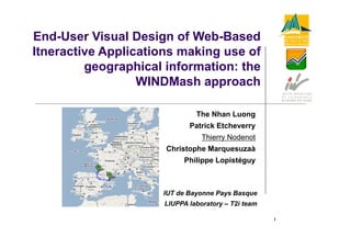
- 1. End User End-User Visual Design of Web-Based Web Based Itneractive Applications making use of geographical information: the WINDMash approach The Nhan Luong Patrick Etcheverry P t i k Et h Thierry Nodenot Christophe Marquesuzaà p q Philippe Lopistéguy IUT de Bayonne Pays Basque LIUPPA laboratory – T2i team 1
- 2. Outline of my talk 1- Mashups for TEL : • Current trends • Why did we go that way? 2- WindMash : •S Specifications and sample applications ifi ti d l li ti • Principles and Technology used • Demo and current works 3- Synthesis 2
- 3. Mashups for TEL: Current Trends (1) • Mashup Environments for designers (Teachers, Instructional Designers) : Limsee3 [Guerraz et al., 2007], … • Mashup Environments for learners : Plef [Chatti et al. 2009], ReMashed [Drachsler et al., 2009], … Personal Learning Environments 3
- 4. Mashups for TEL: Current Trends (2) • Mashups by aggregation / Mashups by integration [Chatti et al., 2009] • Data Mashups, Logic Mashups, and Presentation Mashups [Albinola et al., 2009] 4
- 5. Mashups for TEL: why did we go that way (1) ? 2001 >2006 2001->2006 : Focus on the design of PBL situations Static / Dynamic models of the learning scenario TEL Design, Authoring Computer science Learning sciences (visual) Static models Formalisms Activity theory Usability Dynamic models Human problem Human-problem solving theory Model transformation Evaluation Formal models, Validation executabilty y cf. Educational Modeling Languages (IMS-LD) 5 cf. CPM language and Tools cf. Cognitive Tutors Authoring Tools (CMU : Aleven, Koedinger)
- 6. Mashups for TEL: why did we g that p y go way (2) ? A PBL activity dedicated to the Active Reading of a travel narrative Area for the instructions Micro-world where the learner’s cognitive activity takes place Area for the answers 6 Tutor area There are no tools to easily design such microworlds from an educational perspective. We decided (2008) to focus on TEL applications making use of geographical information
- 7. Specifications of WindMash (1) WindMash, a Mashup environment to design microworlds taking advantage of the geographical information embedded in texts: • Interactions should be designed from the geographical information extracted from texts • The environment should provide designers with functionality to specify which S ti l / T hi h Spatial Temporal / Th l Thematic i f ti information should b automatically ti h ld be t ti ll captured • Designers should be able to decide which visual components (viewers) the learners will be provided with (textual components, map components, calendar components, …) • Designers should be able to specify functionality offered by each viewer. g p y y y • Among these functionality, learners should be provided with annotation facilities, if needed. 7
- 8. Specifications of WindMash (2) C_ πR ti Code C d Wind … Design generation Applications tj C_GeoStream C GeoStream Wind API WindMash Environment Wind Applications: -> Map viewer example p p -> Viewers integration example Connectors: -> C_GeoStream example 8 -> C_ πR example
- 9. Specifications of WindMash (3) WindMash versus TEL Mashups current trends: • A Mashup Environment for designers, particularly pedagogues (with no designers computer science skills) • WindMash combines : • Data Mashups (Semantic Mashups!) • Presentation Mashups • Integration Mashups • WindMash is a Web tool built on top of a flexible, usable and lightweight framework: WIND API 9
- 10. WindMash: Principles and Technology p gy used (1) 10
- 11. WindMash: Principles and Technology p gy used (2) - Web Services Technology, Ajax, JSON, Wire-It, … - WIND API
- 12. WindMash: the Data facet It enables th d i bl the designer t create a processing chain i which to t i h i in hi h the input of text may be processed by dedicated modules. Available modules can be parameterized by the designer to reach a specific goal: to normalize plain texts into the WIND format; to extract places (C_GeoStream), itineraries (C_ πR), etc; to intersect or to join previous results; to visualize design results with dedicated viewers to check the design process g p 12
- 13. WindMash: the Interface facet The interface facet enables the designers (teachers) to organize the interface (cf viewers) of the generated g ( ) g application. The interface facet takes advantage of the different SensibleParts: geographical information (TextPart) of a TextViewer is automatically tagged by the Service modules of the data facet. MapParts of a MapViewer are automatically marked as geometries on the map layer. A point represents a location, a place; a line represents a route, a river, an itinerary; a polygon represents a region, a city, etc. CalendarParts of a CalendarViewer may also be tagged and 13 displayed.
- 14. WindMash: the Interaction facet The interaction facet sho ld allo the designers (teachers) should allow to design the interactions between the viewers (visual components) displayed in the application application. The formalism that we advocate is based on an extension of UML sequence didiagrams ( (work i progress). k in ) Currently, by default, we automatically offer some interactions between the TextViewer, the MapViewer and the CalendarViewer. 14
- 15. WINDMash: some demos Design of ECTEL application Preview of the result …15 Design of another application (Mupple V2) …
- 16. Synthesis (1) WindMash is a prototype. We worked on its functionality, we still need to improve it. But we also need to assess and to improve it usability. i its bilit Experiments of the WINDMash environment are conducted f with both pedagogues and learners. 16
- 17. Synthesis (2) WindMash 17
- 18. Thank you for your attention! Thierry Nodenot 18