Kll workshop 2015 08-09 OpenStreetMap response, 2015 Nepal earthquake
•Descargar como ODP, PDF•
3 recomendaciones•1,253 vistas

Timeline / Statistics / Observations, Lessons learned

Recomendados
Recomendados
Más contenido relacionado
La actualidad más candente
La actualidad más candente (20)
Destacado
Destacado (16)
Similar a Kll workshop 2015 08-09 OpenStreetMap response, 2015 Nepal earthquake
Similar a Kll workshop 2015 08-09 OpenStreetMap response, 2015 Nepal earthquake (20)
Último
Último (18)
Kll workshop 2015 08-09 OpenStreetMap response, 2015 Nepal earthquake
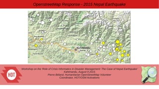
- 1. Workshop on the ‘Role of Crisis Informatics in Disaster Management: The Case of Nepal Earthquake’ Kahtmandu, August 9 2015 Pierre Béland, Humanitarian OpenStreetMap Volunteer Coordinator, HOT/OSM Activations OpenstreetMap Response - 2015 Nepal Earthquake
- 2. OpenstreetMap Response - 2015 Nepal Earthquake The role of HOT in Disaster Management ● Interface between the OSM community and the humanitarian organizations ● Flexible coordination with the UN Agencies, international organizations and GIS teams - We adapt rapidly to the particularity of each region and disaster Quick response to support the first responders – The BaseMap (road network and villages outline) is the first priority ● Imagery Acquisition, Process Hosting : Support from Imagery providers and HOT volunteers ● Imports,Tutorials. Validations ● Define Tasks with partners, monitor progress Humanitarian OpenStreetMap Team
- 3. OpenstreetMap Response - 2015 Nepal Earthquake ● Coordination Room via Skype was effective a few hours after the earthquake – a few hundred participants ● Kathmandu Living Labs was operational in the second day of the Response The Nepal Earthquake Response
- 4. OpenstreetMap Response - 2015 Nepal Earthquake ● Humanitarian OpenStreetMap Team ● Kathmandu Living Labs ● UN agencies ● International organizations (MSF, Red Cross, etc) ● Digital Humanitarian Network ● Imagery providers ● Organizations involved in Post-Disaster Assessments - UNOSAT, DigitalGlobe ● Various specialists Coordination of the mapping response
- 5. OpenstreetMap Response - 2015 Nepal Earthquake ● Pre Disaster : Bing Imagery available for most of the area. HIU provided an image to complete the coverage ● Post-Disaster : Activation by the International Charter – Satellites re- oriented to quickly provide new images ● With the bad meteo of the first week, only images of Kathmandu valley were cloud free . OSM did quickly locate the informal camps from these images. ● Support from DigitalGlobe, AirBus Defence & Space, HIU (US State Department), MapBox, Google Imagery acquisition, process, hosting
- 6. OpenstreetMap Response - 2015 Nepal Earthquake Google CrisisMap to monitor imagery
- 7. OpenstreetMap Response - 2015 Nepal Earthquake Pre-Disaster Kathmandu valley was already traced by Kathmandu Living Labs ● Day 1 : Highway Network, mountain paths ● Day 4 : villages outline, buildings, Helico landing ● Day 7 : Place names Post-disaster ● Day 4 : IDP Camps Kathmandu valley (2 days) ● Day 11 : IDP camps, damaged villages outside Kathmandu (jobs progressed slowly and are not completed) Timeline of the response
- 8. OpenstreetMap Response - 2015 Nepal Earthquake ● KLL traced Kathmandu years prior to the earthquake ● 04-25 Pre-Disaster Trace roads ● 04-28 Post-Disaster Kathmandu + Banepa IDP Camps ● 04-28 Pre-Disaster Trace Buildings Gorkha, Sindhupalchowk, Dunche, Langtang, etc ● 05-01 Post-Disaster outside Kathmandu → Gorkha ● 05-01 Import place names Timeline
- 9. OpenstreetMap Response - 2015 Nepal Earthquake ● Map and route navigation on the web ● Map and route navigation Offline on Small Mobile devices ● Edit tools on the Web, Offline, Mobile devices ● Poster Paper maps to plan activities ● Data exports for GIS analysis ● Hourly updates of data ● Local support plus training by Kathmandu living labs Free OSM Products & Services available from the first day
- 10. OpenstreetMap Response - 2015 Nepal Earthquake The OSM BaseMap + map styles integrated in various products QuakeMap Kathmandu Living Labs USGS Earthquakes Map OSMAnd offline on mobile devices
- 11. OpenstreetMap Response - 2015 Nepal Earthquake Communications HOT Email list ● Partners and OSM community from around the world follow and discuss, join-in to contribute
- 12. OpenstreetMap Response - 2015 Nepal Earthquake http://wiki.openstreetmap.org/wiki/2015_Nepal_earthquake Wiki – Inform the partners and coordinate mappers actions General Info, contacts, coordination, etc Maps & Services available - Exports : Hourly update How to contribute Medias updates
- 13. OpenstreetMap Response - 2015 Nepal Earthquake Objects traced by OSM contributors - gray : previous mapping by KLL of Kathmandu and the major highways - green : contributions from april 25 Source: http://osm.cquest.org/nepal/#11/27.6832/85.3528
- 14. OpenstreetMap Response - 2015 Nepal Earthquake Statistics of OSM Contributions For the first week, an average of 1 million objects edited / day and 1,000 contributors daily In comparison, 1 million objects for the first month in Haiti, jan. 2010
- 15. OpenstreetMap Response - 2015 Nepal Earthquake Long tail of contribution The first 500 contributors contributed to 75% of the edits
- 16. OpenstreetMap Response - 2015 Nepal Earthquake % of Objects % of Contributors 0 0.1 0.2 0.3 0.4 0.5 0.6 0.7 0.8 0.1 0.68 0.08 0.16 0.21 0.12 0.61 0.04 OSM Nepal Response, 2015-04-25 to 06-08 Profile of contributors and Objects by days of contribution (%) 1 2 3-7 8+ OSMContributorStatsOSM Nepal Response, 2015-04-25 to 06-08 Days of contribution Users Objects Objects / User 1 372 2 3-7 855 8+ 266 Total 4 850 1 804 667 1 154 1 342 976 1 164 3 574 414 4 181 10 637 950 39 992 7 125 17 360 007 Source : Pierre Béland OSMContributorStats 4,850 contributors (68% of contributors) participated only one day. They contributed to 10% of objects edited.
- 17. OpenstreetMap Response - 2015 Nepal Earthquake Map of contributors classified by experience (nb of changesets) – Snapshot first week of activation Source : Pascal Neis http://www.resultmaps.neis- one.org/oooc
- 18. OpenstreetMap Response - 2015 Nepal Earthquake The people that contribute 1-2 days are the less experienced, with often less then 10 changesets (nb of OSM edit sessions) Experience (Nb of edit changesets) : Classification similar to Pascal Neis but with less categories
- 19. OpenstreetMap Response - 2015 Nepal Earthquake Source : OSMPlanetStats, Pierre Béland Prior to the earthquake, the Nepal OSM community added 48,000 km of roads. From Apr.25, the international OSM community and various support groups contributed adding an other 60,000 km to trace unclassified roads, tracks and paths in the remote areas.
- 20. OpenstreetMap Response - 2015 Nepal Earthquake ● Imagery providers reacted quickly and delivered post- disaster imagery daily. But Weather conditions limited access to images of quality ● OSM Maps & Services – A complete solution is available instantly to respond to emergencies ● The HOT Tasking Manager let's coordinate simultaneous contribution of hundred of people ● 17 millions objects edited in 6 weeks – more then for one year of Ebola response Observations / Lessons learned
- 21. OpenstreetMap Response - 2015 Nepal Earthquake ● Media coverage and organization of various mapathon brought an unprecedented number of new / unexperienced contributors ● Imagery / Tasks monitoring tools should be enhanced to support major Responses ● Validation problems where often mentionned. Follow-up of Mapathons and Adapted Learning material to develop ● OSM priority is to provide the BaseMap and the Map & Services necessary for the various field teams and GIS specialists. ● A workflow should be developped with the Post-assessment agencies for more complementarity, OSM supporting them primarily with the basemap needed for assessments comparisons. Observations / Lessons learned
- 22. OpenstreetMap Response - 2015 Nepal Earthquake Thanks for all the contributions to this OpenStreetMap Response Free Imagery, processing, hosting, monitoring ● Bing, International Charter, Space and Major Disasters, DigitalGlobe, AirBus Defence & Space, Humanitarian Information Unit, US State Department , MapBox, Google ● HOT coordination team volunteers ● The OSM developpers and Export Service providers ● The thousand of OSM contributors
Notas del editor
- Haiti, Congo, Mali, Central African Republic, South Sudan, Philippines, Ebola, Nepal Mostly remotely with the international organizations and local OSM communities to assure the follow-up with the field teams. More and more GIS field teams are familiar with OSM. - Haiti 2010 – Training UN Teams in Haiti - Dr Congo 2012 – A volunteer assures the interface with OCHA in Kinshasa - Philippines 2013 – OSM Philippines assures the interface with the Philippines Gov and the field teams - Ebola 2014 – CartONG GIS specialists assure the interface in the field with MSF - Nepal 2015 – Kathmandu Livig Labs interfaces with the Nepal Gov and the field teams, orgainzes Training sessions
- 04-28 TM1008 Kathmandu IDP Camps 04-28 T1010 Banepa IDP Camps TM1009 Ghorka buildings buildings TM1014 Sindhupalchowk buildings 05 TM1018 Second run, trace buildings areas around Kathmand 05-01 TM1019 Import Place names (Private job) 05-01 TM1024 Gorkha DigitalGlobe, 2015-04-29 Damage villages + IDP Camps 05-02 TM1023 Helico landing