SlideShare una empresa de Scribd logo
1 de 11
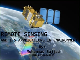
By:
Muhammad Sajjad
  PH# 03346544625
Contents
 Remote Sensing?
     History
 Remote Sensing Sensors
     Active Remote Sensing Sensors
     Passive Remote Sensing Sensors
 Platforms used for Remote Sensing
     Ground Based
     Airborne
     Space borne
 Applications of Remote sensing
 Software used for analyses
 Remote Sensing in Pakistan
Remote Sensing?
   Remote sensing is defined as the technique
    of obtaining information about objects
    through the analysis of data collected by
    special instruments that are not in physical
    contact with the objects of investigation.
   Collection of information about an object
    without coming into physical contact.
   The information needs a physical carrier to
    travel from the objects/events to the sensors
    through an intervening medium.
    The electromagnetic radiation is normally
    used as an information carrier in remote
    sensing.
   The output of a remote sensing system is
    usually an image representing the scene
    being observed.
History
   The technology of modern remote sensing
    began with the invention of the camera
    more than 150 years ago.
   The idea and practice of looking down at
    the Earth's surface emerged in the 1840s
    when pictures were taken from cameras
    secured to tethered balloons for purposes
    of topographic mapping.
   Satellite remote sensing can be traced to
    the early days of the space age (both
    Russian and American programs) and
    actually began as a dual approach to
    imaging surfaces using several types of
    sensors from spacecraft.                    One of the earlier camera
   The term "remote sensing," first used in
    the United States in the 1950s by Ms.
    Evelyn Pruitt of the U.S.
Remote Sensing Sensors
 Active Remote Sensors
       These provide their own energy source for illumination. The sensor
  emits radiation which is directed toward the target to be investigated. The
  radiation reflected from that target is detected and measured by the
  sensor.

  Examples:
        LIDAR (Light Detection And Ranging)
        RADAR (Radio Detection And Ranging)

 Passive Remote Sensors
       Remote sensing systems which measure energy that is naturally
  available are called passive sensors.

  Examples :
        Passive microwave radiometer that detects naturally emitted microwave energy.
        Radiometers that measure reflected (or backscattered) sun light from the atmosphere and ocean.
Platforms used for Remote
Sensing
 Ground-based platforms: ground, vehicles and/or towers
    => up to 50 m

 Airborne platforms: airplanes, helicopters, high-altitude
    aircrafts, balloons => up to 50 km

 Space borne: rockets, satellites, shuttle => from about 100
    km to 36000 km
               Space shuttle: 250-300 km
               Space station: 300-400 km
               Low-level satellites: 700-1500 km
               High-level satellites: about 36000 km
Applications of Remote sensing
 Meteorology
       Profiling of atmospheric temp. and water vapor
       Measuring wind velocity
 Oceanography
       Measurements of sea surface temperature
       Mapping ocean currents
 Glaciology
       Mapping motion of sea ice and ice sheets
       Determining the navigability of the sea
 Geology
       Identification of rock types
       Location of geological faults and anomalies
 Agriculture
       Monitoring the extend and type of vegetation
       Mapping soil types
 Hydrology
       Assessing water resources
       Forecasting melt water run-off from snow
 Disaster control
       Warning of sand and dust storms, flooding
       Monitoring of pollution
Software used for analyses
   Remote Sensing data is processed and analyzed with computer software,
    known as a remote sensing application.

   According to an NOAA Sponsored Research by Global Marketing
    Insights, Including the most used applications among Asian academic
    groups involved in remote sensing are as follows:
     ERDAS 36%
     ESRI 30%
     ITT Visual Information Solutions ENVI 17%
     MapInfo 17%
   Among Western Academic respondents as follows
       ESRI 39%
       ERDAS IMAGINE 27%
       MapInfo 9%
       Autodesk 7%
       I TT Visual Information Solutions ENVI 17%.
Remote Sensing in Pakistan
 The Pakistan Remote Sensing Satellite (PRSS) or RSSS is being
  developed as a dual purpose Earth observational and optical satellite
  which was scheduled to launch by the end year of 2011 for the
  replacement of BADR-II satellite. The satellite is manufactured
  indigenously in Lahore SUPARCO center. The satellite is equipped
  with very high resolution radio meter and a SAR.(Synthetic Aperture
  RADAR)
 Remote-sensing-based climate and flood warning technology is to
  upgrade flood management of Pakistan. The project will help build
  the capacity of Pakistan Meteorological Department and other
  agencies responsible for flood forecasting, early warning and
  management at the national, provincial and district levels. UNESCO,
  with the financial assistance of Japan, is introducing the system at a
  cost of 3.5 million dollar. The system is expected to be completed by
  2013.
Pakistan Remote Sensing
Satellite (PRSS)
Operator
Space and Upper Atmosphere Research Commission

Major contractors
SUPARCO, Pakistan

Mission type
Oceanography
Weather satellite
Earth observation satellite
Geographic information system
constellation of Optical
Global navigation satellite system
Optical satellite system
References
 http://earthobservatory.nasa.gov/Features/RemoteSensing
 http://www.suparco.gov.pk/pages/rsss.asp

 http://jan.ucc.nau.edu/~geog-p/geog/RemoteSensing/

 http://www.crisp.nus.edu.sg/~research/tutorial/intro.htm

 http://www.nrcan.gc.ca/earth-sciences/geography-
  boundary/remote-sensing/fundamentals/1212

 http://www.hydrology.nl/ihpnews/300-pakistan-remote-
  sensing-to-forecast-floods.html

Más contenido relacionado

La actualidad más candente

Application of remote sensing
Application of remote sensingApplication of remote sensing
Application of remote sensingAnurag Kumar
 
Remote sensing concept, history and principles
Remote sensing  concept, history and principlesRemote sensing  concept, history and principles
Remote sensing concept, history and principlesAjay Singh Lodhi
 
Remote sensing and gis ppt
Remote sensing and gis pptRemote sensing and gis ppt
Remote sensing and gis pptpreeti patil
 
Multispectral remote sensing
Multispectral remote sensingMultispectral remote sensing
Multispectral remote sensingDharmendera Meena
 
Chapter 1 (Introduction to remote sensing)
Chapter 1 (Introduction to remote sensing)Chapter 1 (Introduction to remote sensing)
Chapter 1 (Introduction to remote sensing)Shankar Gangaju
 
Principles of remote sensing
Principles of remote sensingPrinciples of remote sensing
Principles of remote sensingPramoda Raj
 
Spectral signatures
Spectral signaturesSpectral signatures
Spectral signaturesKunal Rathod
 
Remote sensing
Remote sensingRemote sensing
Remote sensingKU Leuven
 
Components of gis
Components of gisComponents of gis
Components of gisPramoda Raj
 
Indian remote sensing satellites
Indian  remote  sensing  satellitesIndian  remote  sensing  satellites
Indian remote sensing satellitesPramoda Raj
 
Remote Sensing Platforms and Sensors
Remote Sensing Platforms and SensorsRemote Sensing Platforms and Sensors
Remote Sensing Platforms and SensorsUday kumar Devalla
 
Remote sensing concept and applications
Remote sensing   concept and applicationsRemote sensing   concept and applications
Remote sensing concept and applicationsMegha Majoe
 
Ems interaction with the atmosphere
Ems  interaction with the atmosphereEms  interaction with the atmosphere
Ems interaction with the atmosphereSk Abdullah
 
Remote sensing application in agriculture & forestry_Dr Menon A R R (The Kera...
Remote sensing application in agriculture & forestry_Dr Menon A R R (The Kera...Remote sensing application in agriculture & forestry_Dr Menon A R R (The Kera...
Remote sensing application in agriculture & forestry_Dr Menon A R R (The Kera...India Water Portal
 
Application of GIS (Geographical information system)
Application of GIS (Geographical information system)Application of GIS (Geographical information system)
Application of GIS (Geographical information system)Fayaz Ahamed A P
 
Basic Concepts of Remote Sensing
Basic Concepts of Remote Sensing Basic Concepts of Remote Sensing
Basic Concepts of Remote Sensing Somenath Goswami
 
History of remote sensing
History of remote sensingHistory of remote sensing
History of remote sensingSumant Diwakar
 

La actualidad más candente (20)

Application of remote sensing
Application of remote sensingApplication of remote sensing
Application of remote sensing
 
Remote sensing concept, history and principles
Remote sensing  concept, history and principlesRemote sensing  concept, history and principles
Remote sensing concept, history and principles
 
Remote sensing and gis ppt
Remote sensing and gis pptRemote sensing and gis ppt
Remote sensing and gis ppt
 
Multispectral remote sensing
Multispectral remote sensingMultispectral remote sensing
Multispectral remote sensing
 
Chapter 1 (Introduction to remote sensing)
Chapter 1 (Introduction to remote sensing)Chapter 1 (Introduction to remote sensing)
Chapter 1 (Introduction to remote sensing)
 
Principles of remote sensing
Principles of remote sensingPrinciples of remote sensing
Principles of remote sensing
 
Spectral signatures
Spectral signaturesSpectral signatures
Spectral signatures
 
Remote sensing
Remote sensingRemote sensing
Remote sensing
 
Components of gis
Components of gisComponents of gis
Components of gis
 
Remote sensing and aerial photography
Remote sensing and aerial photographyRemote sensing and aerial photography
Remote sensing and aerial photography
 
Energy budget of earth
Energy budget of earthEnergy budget of earth
Energy budget of earth
 
Indian remote sensing satellites
Indian  remote  sensing  satellitesIndian  remote  sensing  satellites
Indian remote sensing satellites
 
Remote Sensing Platforms and Sensors
Remote Sensing Platforms and SensorsRemote Sensing Platforms and Sensors
Remote Sensing Platforms and Sensors
 
Remote sensing concept and applications
Remote sensing   concept and applicationsRemote sensing   concept and applications
Remote sensing concept and applications
 
Ems interaction with the atmosphere
Ems  interaction with the atmosphereEms  interaction with the atmosphere
Ems interaction with the atmosphere
 
Introduction to Remote Sensing
Introduction to Remote SensingIntroduction to Remote Sensing
Introduction to Remote Sensing
 
Remote sensing application in agriculture & forestry_Dr Menon A R R (The Kera...
Remote sensing application in agriculture & forestry_Dr Menon A R R (The Kera...Remote sensing application in agriculture & forestry_Dr Menon A R R (The Kera...
Remote sensing application in agriculture & forestry_Dr Menon A R R (The Kera...
 
Application of GIS (Geographical information system)
Application of GIS (Geographical information system)Application of GIS (Geographical information system)
Application of GIS (Geographical information system)
 
Basic Concepts of Remote Sensing
Basic Concepts of Remote Sensing Basic Concepts of Remote Sensing
Basic Concepts of Remote Sensing
 
History of remote sensing
History of remote sensingHistory of remote sensing
History of remote sensing
 

Destacado

Ppt on remote sensing system
Ppt on remote sensing systemPpt on remote sensing system
Ppt on remote sensing systemAlisha Korpal
 
Application of Remote Sensing in Agriculture
Application of Remote Sensing in AgricultureApplication of Remote Sensing in Agriculture
Application of Remote Sensing in AgricultureUTTAM KUMAR
 
Remote sensing in agriculture
Remote sensing in agricultureRemote sensing in agriculture
Remote sensing in agricultureChitra Nair
 
Application of remote sensing in agriculture
Application of remote sensing in agricultureApplication of remote sensing in agriculture
Application of remote sensing in agriculturevajinder kalra
 
Intro to GIS and Remote Sensing
Intro to GIS and Remote SensingIntro to GIS and Remote Sensing
Intro to GIS and Remote SensingJohn Reiser
 
GIS presentation
GIS presentationGIS presentation
GIS presentationarniontech
 
Geomorphological Mapping Using Remote Sensing and GIS A Tool for Land Use Pla...
Geomorphological Mapping Using Remote Sensing and GIS A Tool for Land Use Pla...Geomorphological Mapping Using Remote Sensing and GIS A Tool for Land Use Pla...
Geomorphological Mapping Using Remote Sensing and GIS A Tool for Land Use Pla...IOSR Journals
 
Remote sensing of biophysical parameters: linking field, airborne and contine...
Remote sensing of biophysical parameters: linking field, airborne and contine...Remote sensing of biophysical parameters: linking field, airborne and contine...
Remote sensing of biophysical parameters: linking field, airborne and contine...TERN Australia
 
groundtruth collection for remotesensing support
groundtruth collection for remotesensing supportgroundtruth collection for remotesensing support
groundtruth collection for remotesensing supportThiruvengadam .
 
hyperspectral remote sensing and its geological applications
hyperspectral remote sensing and its geological applicationshyperspectral remote sensing and its geological applications
hyperspectral remote sensing and its geological applicationsabhijeet_banerjee
 
Microwave remote sensing
Microwave remote sensingMicrowave remote sensing
Microwave remote sensingRohit Kumar
 
Remote Sensing And GIS Application In Mineral , Oil , Ground Water MappingMin...
Remote Sensing And GIS Application In Mineral , Oil , Ground Water MappingMin...Remote Sensing And GIS Application In Mineral , Oil , Ground Water MappingMin...
Remote Sensing And GIS Application In Mineral , Oil , Ground Water MappingMin...Swetha A
 
Application of gis and remote sensing in agriculture
Application of gis and remote sensing in agricultureApplication of gis and remote sensing in agriculture
Application of gis and remote sensing in agricultureRehana Qureshi
 
What is GIS
What is GISWhat is GIS
What is GISEsri
 
Radiographic exposure and image quality
Radiographic exposure and image qualityRadiographic exposure and image quality
Radiographic exposure and image qualityRad Tech
 
REMOTE SENSING
REMOTE SENSINGREMOTE SENSING
REMOTE SENSINGKANNAN
 
Basic of Remote Sensing
Basic of Remote SensingBasic of Remote Sensing
Basic of Remote Sensinggueste5cfed
 
Gis (geographic information system)
Gis (geographic information system)Gis (geographic information system)
Gis (geographic information system)Saad Bare
 

Destacado (20)

Ppt on remote sensing system
Ppt on remote sensing systemPpt on remote sensing system
Ppt on remote sensing system
 
Application of Remote Sensing in Agriculture
Application of Remote Sensing in AgricultureApplication of Remote Sensing in Agriculture
Application of Remote Sensing in Agriculture
 
Remote sensing in agriculture
Remote sensing in agricultureRemote sensing in agriculture
Remote sensing in agriculture
 
Application of remote sensing in agriculture
Application of remote sensing in agricultureApplication of remote sensing in agriculture
Application of remote sensing in agriculture
 
Intro to GIS and Remote Sensing
Intro to GIS and Remote SensingIntro to GIS and Remote Sensing
Intro to GIS and Remote Sensing
 
GIS presentation
GIS presentationGIS presentation
GIS presentation
 
Geomorphological Mapping Using Remote Sensing and GIS A Tool for Land Use Pla...
Geomorphological Mapping Using Remote Sensing and GIS A Tool for Land Use Pla...Geomorphological Mapping Using Remote Sensing and GIS A Tool for Land Use Pla...
Geomorphological Mapping Using Remote Sensing and GIS A Tool for Land Use Pla...
 
Remote sensing of biophysical parameters: linking field, airborne and contine...
Remote sensing of biophysical parameters: linking field, airborne and contine...Remote sensing of biophysical parameters: linking field, airborne and contine...
Remote sensing of biophysical parameters: linking field, airborne and contine...
 
groundtruth collection for remotesensing support
groundtruth collection for remotesensing supportgroundtruth collection for remotesensing support
groundtruth collection for remotesensing support
 
RoccoPancieraMesiano sept25 2013
RoccoPancieraMesiano sept25 2013RoccoPancieraMesiano sept25 2013
RoccoPancieraMesiano sept25 2013
 
hyperspectral remote sensing and its geological applications
hyperspectral remote sensing and its geological applicationshyperspectral remote sensing and its geological applications
hyperspectral remote sensing and its geological applications
 
Microwave remote sensing
Microwave remote sensingMicrowave remote sensing
Microwave remote sensing
 
Remote sensing
Remote sensing Remote sensing
Remote sensing
 
Remote Sensing And GIS Application In Mineral , Oil , Ground Water MappingMin...
Remote Sensing And GIS Application In Mineral , Oil , Ground Water MappingMin...Remote Sensing And GIS Application In Mineral , Oil , Ground Water MappingMin...
Remote Sensing And GIS Application In Mineral , Oil , Ground Water MappingMin...
 
Application of gis and remote sensing in agriculture
Application of gis and remote sensing in agricultureApplication of gis and remote sensing in agriculture
Application of gis and remote sensing in agriculture
 
What is GIS
What is GISWhat is GIS
What is GIS
 
Radiographic exposure and image quality
Radiographic exposure and image qualityRadiographic exposure and image quality
Radiographic exposure and image quality
 
REMOTE SENSING
REMOTE SENSINGREMOTE SENSING
REMOTE SENSING
 
Basic of Remote Sensing
Basic of Remote SensingBasic of Remote Sensing
Basic of Remote Sensing
 
Gis (geographic information system)
Gis (geographic information system)Gis (geographic information system)
Gis (geographic information system)
 

Similar a Remote sensing and its applications in environment

Remote sensing by Priyanshu kumar, 9608684800
Remote sensing by Priyanshu kumar, 9608684800Remote sensing by Priyanshu kumar, 9608684800
Remote sensing by Priyanshu kumar, 9608684800PRIYANSHU KUMAR
 
Module 5 Remote Sensing in Civil Engineering.pptx
Module 5 Remote Sensing in Civil Engineering.pptxModule 5 Remote Sensing in Civil Engineering.pptx
Module 5 Remote Sensing in Civil Engineering.pptxsurekha1287
 
remote senseppt
remote sensepptremote senseppt
remote sensepptSiva Kumar
 
remote sensing
remote sensingremote sensing
remote sensing78harshith
 
Ppt on remote sensing system
Ppt on remote sensing systemPpt on remote sensing system
Ppt on remote sensing systemAlisha Korpal
 
A Brief Introduction to Remote Sensing Satellites
A Brief Introduction to Remote Sensing Satellites A Brief Introduction to Remote Sensing Satellites
A Brief Introduction to Remote Sensing Satellites Alireza Rahimzadeganasl
 
rsgis-unitii-160731062950.pdf
rsgis-unitii-160731062950.pdfrsgis-unitii-160731062950.pdf
rsgis-unitii-160731062950.pdfBSuresh26
 
Remote sensing by priyanshu kumar,9608684800
Remote sensing by priyanshu kumar,9608684800Remote sensing by priyanshu kumar,9608684800
Remote sensing by priyanshu kumar,9608684800PRIYANSHU KUMAR
 
REMOTE SENSING
REMOTE SENSINGREMOTE SENSING
REMOTE SENSINGijsrd.com
 
REMOTE SENSING A VERY USEFUL TECHNOLOGY TO MANKIND
REMOTE SENSING A VERY USEFUL TECHNOLOGY TO MANKINDREMOTE SENSING A VERY USEFUL TECHNOLOGY TO MANKIND
REMOTE SENSING A VERY USEFUL TECHNOLOGY TO MANKINDkaushikakumar
 
Remote Sensing - by Ashwini
Remote Sensing - by AshwiniRemote Sensing - by Ashwini
Remote Sensing - by AshwiniSanthosh Sundar
 
Basic Understanding of Remote Sensing.pdf
Basic Understanding of Remote Sensing.pdfBasic Understanding of Remote Sensing.pdf
Basic Understanding of Remote Sensing.pdfrupalibgisnetra
 
449879014-Remote-Sensing-Ppt.pptx
449879014-Remote-Sensing-Ppt.pptx449879014-Remote-Sensing-Ppt.pptx
449879014-Remote-Sensing-Ppt.pptxRoopa Santosh
 

Similar a Remote sensing and its applications in environment (20)

Remote sensing by Priyanshu kumar, 9608684800
Remote sensing by Priyanshu kumar, 9608684800Remote sensing by Priyanshu kumar, 9608684800
Remote sensing by Priyanshu kumar, 9608684800
 
Module 5 Remote Sensing in Civil Engineering.pptx
Module 5 Remote Sensing in Civil Engineering.pptxModule 5 Remote Sensing in Civil Engineering.pptx
Module 5 Remote Sensing in Civil Engineering.pptx
 
remote sensing
remote sensingremote sensing
remote sensing
 
Report
ReportReport
Report
 
remote senseppt
remote sensepptremote senseppt
remote senseppt
 
remote sensing
remote sensingremote sensing
remote sensing
 
Ppt on remote sensing system
Ppt on remote sensing systemPpt on remote sensing system
Ppt on remote sensing system
 
A Brief Introduction to Remote Sensing Satellites
A Brief Introduction to Remote Sensing Satellites A Brief Introduction to Remote Sensing Satellites
A Brief Introduction to Remote Sensing Satellites
 
rsgis-unitii-160731062950.pdf
rsgis-unitii-160731062950.pdfrsgis-unitii-160731062950.pdf
rsgis-unitii-160731062950.pdf
 
Remote sensing
Remote sensingRemote sensing
Remote sensing
 
Remote sensing by priyanshu kumar,9608684800
Remote sensing by priyanshu kumar,9608684800Remote sensing by priyanshu kumar,9608684800
Remote sensing by priyanshu kumar,9608684800
 
REMOTE SENSING
REMOTE SENSINGREMOTE SENSING
REMOTE SENSING
 
REMOTE SENSING A VERY USEFUL TECHNOLOGY TO MANKIND
REMOTE SENSING A VERY USEFUL TECHNOLOGY TO MANKINDREMOTE SENSING A VERY USEFUL TECHNOLOGY TO MANKIND
REMOTE SENSING A VERY USEFUL TECHNOLOGY TO MANKIND
 
Remote Sensing - by Ashwini
Remote Sensing - by AshwiniRemote Sensing - by Ashwini
Remote Sensing - by Ashwini
 
Remote sensing
Remote sensingRemote sensing
Remote sensing
 
Remote sensing
Remote sensingRemote sensing
Remote sensing
 
Basic Understanding of Remote Sensing.pdf
Basic Understanding of Remote Sensing.pdfBasic Understanding of Remote Sensing.pdf
Basic Understanding of Remote Sensing.pdf
 
449879014-Remote-Sensing-Ppt.pptx
449879014-Remote-Sensing-Ppt.pptx449879014-Remote-Sensing-Ppt.pptx
449879014-Remote-Sensing-Ppt.pptx
 
Concept of remote sensing
Concept of remote sensingConcept of remote sensing
Concept of remote sensing
 
Remote sensing
Remote sensingRemote sensing
Remote sensing
 

Más de Muhammad Sajjad

Application of gis in natural disaster management
Application of gis in natural disaster managementApplication of gis in natural disaster management
Application of gis in natural disaster managementMuhammad Sajjad
 
Earth the burrning planat
Earth the burrning planatEarth the burrning planat
Earth the burrning planatMuhammad Sajjad
 
Earth the burrning planat
Earth the burrning planatEarth the burrning planat
Earth the burrning planatMuhammad Sajjad
 
Assignment of geographic thoughts
Assignment of geographic thoughtsAssignment of geographic thoughts
Assignment of geographic thoughtsMuhammad Sajjad
 
Presentation of geomorphology corrected
Presentation of geomorphology correctedPresentation of geomorphology corrected
Presentation of geomorphology correctedMuhammad Sajjad
 
Soil profile and conservation
Soil profile and conservationSoil profile and conservation
Soil profile and conservationMuhammad Sajjad
 
Time zones and international date line (idl
Time zones and international date line (idlTime zones and international date line (idl
Time zones and international date line (idlMuhammad Sajjad
 

Más de Muhammad Sajjad (12)

Application of gis in natural disaster management
Application of gis in natural disaster managementApplication of gis in natural disaster management
Application of gis in natural disaster management
 
Tides
TidesTides
Tides
 
Thoughts
ThoughtsThoughts
Thoughts
 
Coral reef presentation
Coral reef presentationCoral reef presentation
Coral reef presentation
 
Earth the burrning planat
Earth the burrning planatEarth the burrning planat
Earth the burrning planat
 
Economic systems
Economic systemsEconomic systems
Economic systems
 
Earth the burrning planat
Earth the burrning planatEarth the burrning planat
Earth the burrning planat
 
Assignment of geographic thoughts
Assignment of geographic thoughtsAssignment of geographic thoughts
Assignment of geographic thoughts
 
Presentation of geomorphology corrected
Presentation of geomorphology correctedPresentation of geomorphology corrected
Presentation of geomorphology corrected
 
Water Pollution
Water Pollution Water Pollution
Water Pollution
 
Soil profile and conservation
Soil profile and conservationSoil profile and conservation
Soil profile and conservation
 
Time zones and international date line (idl
Time zones and international date line (idlTime zones and international date line (idl
Time zones and international date line (idl
 

Último

fourth grading exam for kindergarten in writing
fourth grading exam for kindergarten in writingfourth grading exam for kindergarten in writing
fourth grading exam for kindergarten in writingTeacherCyreneCayanan
 
Unit-IV- Pharma. Marketing Channels.pptx
Unit-IV- Pharma. Marketing Channels.pptxUnit-IV- Pharma. Marketing Channels.pptx
Unit-IV- Pharma. Marketing Channels.pptxVishalSingh1417
 
Nutritional Needs Presentation - HLTH 104
Nutritional Needs Presentation - HLTH 104Nutritional Needs Presentation - HLTH 104
Nutritional Needs Presentation - HLTH 104misteraugie
 
social pharmacy d-pharm 1st year by Pragati K. Mahajan
social pharmacy d-pharm 1st year by Pragati K. Mahajansocial pharmacy d-pharm 1st year by Pragati K. Mahajan
social pharmacy d-pharm 1st year by Pragati K. Mahajanpragatimahajan3
 
9548086042 for call girls in Indira Nagar with room service
9548086042  for call girls in Indira Nagar  with room service9548086042  for call girls in Indira Nagar  with room service
9548086042 for call girls in Indira Nagar with room servicediscovermytutordmt
 
Disha NEET Physics Guide for classes 11 and 12.pdf
Disha NEET Physics Guide for classes 11 and 12.pdfDisha NEET Physics Guide for classes 11 and 12.pdf
Disha NEET Physics Guide for classes 11 and 12.pdfchloefrazer622
 
The basics of sentences session 2pptx copy.pptx
The basics of sentences session 2pptx copy.pptxThe basics of sentences session 2pptx copy.pptx
The basics of sentences session 2pptx copy.pptxheathfieldcps1
 
Introduction to Nonprofit Accounting: The Basics
Introduction to Nonprofit Accounting: The BasicsIntroduction to Nonprofit Accounting: The Basics
Introduction to Nonprofit Accounting: The BasicsTechSoup
 
BAG TECHNIQUE Bag technique-a tool making use of public health bag through wh...
BAG TECHNIQUE Bag technique-a tool making use of public health bag through wh...BAG TECHNIQUE Bag technique-a tool making use of public health bag through wh...
BAG TECHNIQUE Bag technique-a tool making use of public health bag through wh...Sapna Thakur
 
APM Welcome, APM North West Network Conference, Synergies Across Sectors
APM Welcome, APM North West Network Conference, Synergies Across SectorsAPM Welcome, APM North West Network Conference, Synergies Across Sectors
APM Welcome, APM North West Network Conference, Synergies Across SectorsAssociation for Project Management
 
Software Engineering Methodologies (overview)
Software Engineering Methodologies (overview)Software Engineering Methodologies (overview)
Software Engineering Methodologies (overview)eniolaolutunde
 
Grant Readiness 101 TechSoup and Remy Consulting
Grant Readiness 101 TechSoup and Remy ConsultingGrant Readiness 101 TechSoup and Remy Consulting
Grant Readiness 101 TechSoup and Remy ConsultingTechSoup
 
Measures of Central Tendency: Mean, Median and Mode
Measures of Central Tendency: Mean, Median and ModeMeasures of Central Tendency: Mean, Median and Mode
Measures of Central Tendency: Mean, Median and ModeThiyagu K
 
Interactive Powerpoint_How to Master effective communication
Interactive Powerpoint_How to Master effective communicationInteractive Powerpoint_How to Master effective communication
Interactive Powerpoint_How to Master effective communicationnomboosow
 
Arihant handbook biology for class 11 .pdf
Arihant handbook biology for class 11 .pdfArihant handbook biology for class 11 .pdf
Arihant handbook biology for class 11 .pdfchloefrazer622
 
1029 - Danh muc Sach Giao Khoa 10 . pdf
1029 -  Danh muc Sach Giao Khoa 10 . pdf1029 -  Danh muc Sach Giao Khoa 10 . pdf
1029 - Danh muc Sach Giao Khoa 10 . pdfQucHHunhnh
 
The Most Excellent Way | 1 Corinthians 13
The Most Excellent Way | 1 Corinthians 13The Most Excellent Way | 1 Corinthians 13
The Most Excellent Way | 1 Corinthians 13Steve Thomason
 
Presentation by Andreas Schleicher Tackling the School Absenteeism Crisis 30 ...
Presentation by Andreas Schleicher Tackling the School Absenteeism Crisis 30 ...Presentation by Andreas Schleicher Tackling the School Absenteeism Crisis 30 ...
Presentation by Andreas Schleicher Tackling the School Absenteeism Crisis 30 ...EduSkills OECD
 
Explore beautiful and ugly buildings. Mathematics helps us create beautiful d...
Explore beautiful and ugly buildings. Mathematics helps us create beautiful d...Explore beautiful and ugly buildings. Mathematics helps us create beautiful d...
Explore beautiful and ugly buildings. Mathematics helps us create beautiful d...christianmathematics
 

Último (20)

fourth grading exam for kindergarten in writing
fourth grading exam for kindergarten in writingfourth grading exam for kindergarten in writing
fourth grading exam for kindergarten in writing
 
Unit-IV- Pharma. Marketing Channels.pptx
Unit-IV- Pharma. Marketing Channels.pptxUnit-IV- Pharma. Marketing Channels.pptx
Unit-IV- Pharma. Marketing Channels.pptx
 
Nutritional Needs Presentation - HLTH 104
Nutritional Needs Presentation - HLTH 104Nutritional Needs Presentation - HLTH 104
Nutritional Needs Presentation - HLTH 104
 
social pharmacy d-pharm 1st year by Pragati K. Mahajan
social pharmacy d-pharm 1st year by Pragati K. Mahajansocial pharmacy d-pharm 1st year by Pragati K. Mahajan
social pharmacy d-pharm 1st year by Pragati K. Mahajan
 
9548086042 for call girls in Indira Nagar with room service
9548086042  for call girls in Indira Nagar  with room service9548086042  for call girls in Indira Nagar  with room service
9548086042 for call girls in Indira Nagar with room service
 
Disha NEET Physics Guide for classes 11 and 12.pdf
Disha NEET Physics Guide for classes 11 and 12.pdfDisha NEET Physics Guide for classes 11 and 12.pdf
Disha NEET Physics Guide for classes 11 and 12.pdf
 
The basics of sentences session 2pptx copy.pptx
The basics of sentences session 2pptx copy.pptxThe basics of sentences session 2pptx copy.pptx
The basics of sentences session 2pptx copy.pptx
 
Introduction to Nonprofit Accounting: The Basics
Introduction to Nonprofit Accounting: The BasicsIntroduction to Nonprofit Accounting: The Basics
Introduction to Nonprofit Accounting: The Basics
 
BAG TECHNIQUE Bag technique-a tool making use of public health bag through wh...
BAG TECHNIQUE Bag technique-a tool making use of public health bag through wh...BAG TECHNIQUE Bag technique-a tool making use of public health bag through wh...
BAG TECHNIQUE Bag technique-a tool making use of public health bag through wh...
 
APM Welcome, APM North West Network Conference, Synergies Across Sectors
APM Welcome, APM North West Network Conference, Synergies Across SectorsAPM Welcome, APM North West Network Conference, Synergies Across Sectors
APM Welcome, APM North West Network Conference, Synergies Across Sectors
 
Software Engineering Methodologies (overview)
Software Engineering Methodologies (overview)Software Engineering Methodologies (overview)
Software Engineering Methodologies (overview)
 
Grant Readiness 101 TechSoup and Remy Consulting
Grant Readiness 101 TechSoup and Remy ConsultingGrant Readiness 101 TechSoup and Remy Consulting
Grant Readiness 101 TechSoup and Remy Consulting
 
Measures of Central Tendency: Mean, Median and Mode
Measures of Central Tendency: Mean, Median and ModeMeasures of Central Tendency: Mean, Median and Mode
Measures of Central Tendency: Mean, Median and Mode
 
Interactive Powerpoint_How to Master effective communication
Interactive Powerpoint_How to Master effective communicationInteractive Powerpoint_How to Master effective communication
Interactive Powerpoint_How to Master effective communication
 
Arihant handbook biology for class 11 .pdf
Arihant handbook biology for class 11 .pdfArihant handbook biology for class 11 .pdf
Arihant handbook biology for class 11 .pdf
 
INDIA QUIZ 2024 RLAC DELHI UNIVERSITY.pptx
INDIA QUIZ 2024 RLAC DELHI UNIVERSITY.pptxINDIA QUIZ 2024 RLAC DELHI UNIVERSITY.pptx
INDIA QUIZ 2024 RLAC DELHI UNIVERSITY.pptx
 
1029 - Danh muc Sach Giao Khoa 10 . pdf
1029 -  Danh muc Sach Giao Khoa 10 . pdf1029 -  Danh muc Sach Giao Khoa 10 . pdf
1029 - Danh muc Sach Giao Khoa 10 . pdf
 
The Most Excellent Way | 1 Corinthians 13
The Most Excellent Way | 1 Corinthians 13The Most Excellent Way | 1 Corinthians 13
The Most Excellent Way | 1 Corinthians 13
 
Presentation by Andreas Schleicher Tackling the School Absenteeism Crisis 30 ...
Presentation by Andreas Schleicher Tackling the School Absenteeism Crisis 30 ...Presentation by Andreas Schleicher Tackling the School Absenteeism Crisis 30 ...
Presentation by Andreas Schleicher Tackling the School Absenteeism Crisis 30 ...
 
Explore beautiful and ugly buildings. Mathematics helps us create beautiful d...
Explore beautiful and ugly buildings. Mathematics helps us create beautiful d...Explore beautiful and ugly buildings. Mathematics helps us create beautiful d...
Explore beautiful and ugly buildings. Mathematics helps us create beautiful d...
 

Remote sensing and its applications in environment

  • 1. By: Muhammad Sajjad PH# 03346544625
  • 2. Contents  Remote Sensing?  History  Remote Sensing Sensors  Active Remote Sensing Sensors  Passive Remote Sensing Sensors  Platforms used for Remote Sensing  Ground Based  Airborne  Space borne  Applications of Remote sensing  Software used for analyses  Remote Sensing in Pakistan
  • 3. Remote Sensing?  Remote sensing is defined as the technique of obtaining information about objects through the analysis of data collected by special instruments that are not in physical contact with the objects of investigation.  Collection of information about an object without coming into physical contact.  The information needs a physical carrier to travel from the objects/events to the sensors through an intervening medium.  The electromagnetic radiation is normally used as an information carrier in remote sensing.  The output of a remote sensing system is usually an image representing the scene being observed.
  • 4. History  The technology of modern remote sensing began with the invention of the camera more than 150 years ago.  The idea and practice of looking down at the Earth's surface emerged in the 1840s when pictures were taken from cameras secured to tethered balloons for purposes of topographic mapping.  Satellite remote sensing can be traced to the early days of the space age (both Russian and American programs) and actually began as a dual approach to imaging surfaces using several types of sensors from spacecraft. One of the earlier camera  The term "remote sensing," first used in the United States in the 1950s by Ms. Evelyn Pruitt of the U.S.
  • 5. Remote Sensing Sensors  Active Remote Sensors These provide their own energy source for illumination. The sensor emits radiation which is directed toward the target to be investigated. The radiation reflected from that target is detected and measured by the sensor. Examples:  LIDAR (Light Detection And Ranging)  RADAR (Radio Detection And Ranging)  Passive Remote Sensors Remote sensing systems which measure energy that is naturally available are called passive sensors. Examples :  Passive microwave radiometer that detects naturally emitted microwave energy.  Radiometers that measure reflected (or backscattered) sun light from the atmosphere and ocean.
  • 6. Platforms used for Remote Sensing  Ground-based platforms: ground, vehicles and/or towers => up to 50 m  Airborne platforms: airplanes, helicopters, high-altitude aircrafts, balloons => up to 50 km  Space borne: rockets, satellites, shuttle => from about 100 km to 36000 km  Space shuttle: 250-300 km  Space station: 300-400 km  Low-level satellites: 700-1500 km  High-level satellites: about 36000 km
  • 7. Applications of Remote sensing  Meteorology  Profiling of atmospheric temp. and water vapor  Measuring wind velocity  Oceanography  Measurements of sea surface temperature  Mapping ocean currents  Glaciology  Mapping motion of sea ice and ice sheets  Determining the navigability of the sea  Geology  Identification of rock types  Location of geological faults and anomalies  Agriculture  Monitoring the extend and type of vegetation  Mapping soil types  Hydrology  Assessing water resources  Forecasting melt water run-off from snow  Disaster control  Warning of sand and dust storms, flooding  Monitoring of pollution
  • 8. Software used for analyses  Remote Sensing data is processed and analyzed with computer software, known as a remote sensing application.  According to an NOAA Sponsored Research by Global Marketing Insights, Including the most used applications among Asian academic groups involved in remote sensing are as follows:  ERDAS 36%  ESRI 30%  ITT Visual Information Solutions ENVI 17%  MapInfo 17%  Among Western Academic respondents as follows  ESRI 39%  ERDAS IMAGINE 27%  MapInfo 9%  Autodesk 7%  I TT Visual Information Solutions ENVI 17%.
  • 9. Remote Sensing in Pakistan  The Pakistan Remote Sensing Satellite (PRSS) or RSSS is being developed as a dual purpose Earth observational and optical satellite which was scheduled to launch by the end year of 2011 for the replacement of BADR-II satellite. The satellite is manufactured indigenously in Lahore SUPARCO center. The satellite is equipped with very high resolution radio meter and a SAR.(Synthetic Aperture RADAR)  Remote-sensing-based climate and flood warning technology is to upgrade flood management of Pakistan. The project will help build the capacity of Pakistan Meteorological Department and other agencies responsible for flood forecasting, early warning and management at the national, provincial and district levels. UNESCO, with the financial assistance of Japan, is introducing the system at a cost of 3.5 million dollar. The system is expected to be completed by 2013.
  • 10. Pakistan Remote Sensing Satellite (PRSS) Operator Space and Upper Atmosphere Research Commission Major contractors SUPARCO, Pakistan Mission type Oceanography Weather satellite Earth observation satellite Geographic information system constellation of Optical Global navigation satellite system Optical satellite system
  • 11. References  http://earthobservatory.nasa.gov/Features/RemoteSensing  http://www.suparco.gov.pk/pages/rsss.asp  http://jan.ucc.nau.edu/~geog-p/geog/RemoteSensing/  http://www.crisp.nus.edu.sg/~research/tutorial/intro.htm  http://www.nrcan.gc.ca/earth-sciences/geography- boundary/remote-sensing/fundamentals/1212  http://www.hydrology.nl/ihpnews/300-pakistan-remote- sensing-to-forecast-floods.html