SlideShare una empresa de Scribd logo
1 de 26
Descargar para leer sin conexión
Evaluating Scarcity and Abundance of
groundwater under Climatic ExtremeS
in Valle del Cauca,
Colombia
ESCACES
Valle del Cauca
Study Area
Study Area
Study Area
Cauca River:
250m3/s
Study Area
Intensive use of groundwater
Population and economic growth
Climate variability and climate change
Project Motivation and Context
Legislation, guidelines, etc.
Objective:
Guarantee the sustainability of water resources in terms
of quantity and quality
Project Motivation and Context
• Improve the knowledge of the groundwater system
in the Valle del Cauca
• Validate their conceptual model
• Develop tools to support groundwater management
• Study the groundwater-surface water interactions in
wetlands
Project Goals
Conceptual hydrogeological model and
tools
Inventario de
información
existente
Organización de la
información
Digitalización del
información
Datos
Climatológicos
Datos
Hidrológicos
Datos
Geológicos
Identificación de los
términos del
balance hídrico
Cálculo de la
recarga difusa para
todo el Valle
Reuniones con los
actores del Valle
(principalmente
CENICAÑA)
Análisis de la
información
Modelo conceptual
Desarrollo de los
cortes
hidrogeológicos
Definición de la
morfología de las
Unidades
Hidrogeológicas
Datos
Hidroquími
cos
Modelo numérico
Herramienta de
apoyo a la gestión
Asignación de
propiedades
hidráulicas
Definición de las
zonas de recarga y
descarga del
acuífero
Validación del
modelo conceptual
Cálculo de
indicadores
Balance hídrico
Propuesta red de
monitoreo
Hydrogeological model
Water balance and recharge areas
• Calculated at daily time step for cells of
250x250m
• Input maps
• Land use
• Root depth
• Soil type and soil texture
• Phreatic groundwater level
• Interpolated maps of precipitation and
evaporation at daily time step
(Elevation dependent due to monthly
normals)
• Calculation of runoff & infitration
• Calculation of recharge based on water
balance in soil column
Groundwater recharge due to precipitation
Hydrogeological model
Groundwater recharge through rivers
Groundwater recharge areas
Hydro-
meteorological Data
(P & ET)
Groundwater &
river level and
discharge data
Model development & Calibration Decision Support
Piezometric levels &
well discharges
(GeoCVC)
Topographical &
Geological Data
Lithological
columns of wells
(GeoCVC)
Exploring climatic
scenarios (extreme
wet & dry)
Modelled
piezometric
levels,
groundwater
flows
piezometric
levels,
groundwater
flows, Indicators
Regulation of
new & existing
wells
iMOD iMOD & FEWS
Cali
Palmira
Depth of Groundwater
FEWS ESCACES
Cali
Palmira
Depth of Groundwater
FEWS ESCACES
Piezometric levels
Impacts of requested wells
Exploring climate variability
Scenarios 2015-2025 – conditional on g/w levels & pumping 2015
SPI at Alfonso Bonilla Airport
ENSO Climate Indices: SOI & MEI
Synthetic climate series
- K-Nearest neighbour sampling (1974-2015)
- 1000 bootstraps
- Selection of extreme climate sequences
based on SPI of resampled series
- Forcing IMOD with rearranged recharge series
Exploring climate variability
Scenarios 2015-2025 – conditional on g/w levels & pumping 2015
Steps to understand how the system works
Inventario de
información
existente
Organización de la
información
Digitalización del
información
Datos
Climatológicos
Datos
Hidrológicos
Datos
Geológicos
Identificación de los
términos del
balance hídrico
Cálculo de la
recarga difusa para
todo el Valle
Reuniones con los
actores del Valle
(principalmente
CENICAÑA)
Análisis de la
información
Modelo conceptual
Desarrollo de los
cortes
hidrogeológicos
Definición de la
morfología de las
Unidades
Hidrogeológicas
Datos
Hidroquími
cos
Modelo numérico
Herramienta de
apoyo a la gestión
Asignación de
propiedades
hidráulicas
Definición de las
zonas de recarga y
descarga del
acuífero
Validación del
modelo conceptual
Cálculo de
indicadores
Balance hídrico
Propuesta red de
monitoreo
Data Analysis
Conceptual
Model
Numerical
Model
DSS
Data
Acknowledgements

Más contenido relacionado

Destacado

DSD-INT 2016 Interactive Pathline Simulation IPS and PLUGIN tools - Vermeulen
DSD-INT 2016 Interactive Pathline Simulation IPS and PLUGIN tools - VermeulenDSD-INT 2016 Interactive Pathline Simulation IPS and PLUGIN tools - Vermeulen
DSD-INT 2016 Interactive Pathline Simulation IPS and PLUGIN tools - VermeulenDeltares
 
DSD-INT 2016 Groundwater model Visp - Christe
DSD-INT 2016 Groundwater model Visp - ChristeDSD-INT 2016 Groundwater model Visp - Christe
DSD-INT 2016 Groundwater model Visp - ChristeDeltares
 
DSD-INT 2016 Effects of Extraction and Open Pit Mining on Rode Beek Saeffele...
DSD-INT 2016 Effects of Extraction and Open Pit Mining on Rode Beek  Saeffele...DSD-INT 2016 Effects of Extraction and Open Pit Mining on Rode Beek  Saeffele...
DSD-INT 2016 Effects of Extraction and Open Pit Mining on Rode Beek Saeffele...Deltares
 
DSD-INT 2016 Regional groundwater flow systems in the Kenya Rift Valley - Mur...
DSD-INT 2016 Regional groundwater flow systems in the Kenya Rift Valley - Mur...DSD-INT 2016 Regional groundwater flow systems in the Kenya Rift Valley - Mur...
DSD-INT 2016 Regional groundwater flow systems in the Kenya Rift Valley - Mur...Deltares
 
DSD-INT 2016 The new parallel Krylov Solver package - Verkaik
DSD-INT 2016 The new parallel Krylov Solver package - VerkaikDSD-INT 2016 The new parallel Krylov Solver package - Verkaik
DSD-INT 2016 The new parallel Krylov Solver package - VerkaikDeltares
 
DSD-INT 2016 Chautauqua; the Alberta groundwater information system using Del...
DSD-INT 2016 Chautauqua; the Alberta groundwater information system using Del...DSD-INT 2016 Chautauqua; the Alberta groundwater information system using Del...
DSD-INT 2016 Chautauqua; the Alberta groundwater information system using Del...Deltares
 
DSD-INT 2016 SUB-CR: an improved subsidence package - Erkens, Kooi
DSD-INT 2016 SUB-CR: an improved subsidence package - Erkens, KooiDSD-INT 2016 SUB-CR: an improved subsidence package - Erkens, Kooi
DSD-INT 2016 SUB-CR: an improved subsidence package - Erkens, KooiDeltares
 
DSD-INT 2016 Building a 3D model of the subsurface on a local scale - Hijma
DSD-INT 2016 Building a 3D model of the subsurface on a local scale - HijmaDSD-INT 2016 Building a 3D model of the subsurface on a local scale - Hijma
DSD-INT 2016 Building a 3D model of the subsurface on a local scale - HijmaDeltares
 
DSD-INT 2016 Geo-modelling with iMOD at the geological survey of the Netherla...
DSD-INT 2016 Geo-modelling with iMOD at the geological survey of the Netherla...DSD-INT 2016 Geo-modelling with iMOD at the geological survey of the Netherla...
DSD-INT 2016 Geo-modelling with iMOD at the geological survey of the Netherla...Deltares
 
DSD-INT 2016 iMOD-SEAWAT for groundwater in the coastal zone - Oude Essink
DSD-INT 2016 iMOD-SEAWAT for groundwater in the coastal zone - Oude EssinkDSD-INT 2016 iMOD-SEAWAT for groundwater in the coastal zone - Oude Essink
DSD-INT 2016 iMOD-SEAWAT for groundwater in the coastal zone - Oude EssinkDeltares
 
DSD-INT 2016 Local effects of the reshape of the Niers - Walter
DSD-INT 2016 Local effects of the reshape of the Niers - WalterDSD-INT 2016 Local effects of the reshape of the Niers - Walter
DSD-INT 2016 Local effects of the reshape of the Niers - WalterDeltares
 
DSD-INT 2016 From regional model to local iMOD model and back - Panteleit
DSD-INT 2016 From regional model to local iMOD model and back - PanteleitDSD-INT 2016 From regional model to local iMOD model and back - Panteleit
DSD-INT 2016 From regional model to local iMOD model and back - PanteleitDeltares
 
DSD-INT 2016 The unsaturated zone MetaSWAP-package - Van Walsum
DSD-INT 2016 The unsaturated zone MetaSWAP-package - Van WalsumDSD-INT 2016 The unsaturated zone MetaSWAP-package - Van Walsum
DSD-INT 2016 The unsaturated zone MetaSWAP-package - Van WalsumDeltares
 
DSD-INT 2016 Regional to local modeling for dyke stability -The Schoonhovense...
DSD-INT 2016 Regional to local modeling for dyke stability -The Schoonhovense...DSD-INT 2016 Regional to local modeling for dyke stability -The Schoonhovense...
DSD-INT 2016 Regional to local modeling for dyke stability -The Schoonhovense...Deltares
 
DSD-INT 2016 What triggered the development of iMOD - Minnema
DSD-INT 2016 What triggered the development of iMOD - MinnemaDSD-INT 2016 What triggered the development of iMOD - Minnema
DSD-INT 2016 What triggered the development of iMOD - MinnemaDeltares
 
DSD-INT 2016 Subsurface modelling in iMOD - Jurong Island, Singapore - Vermeulen
DSD-INT 2016 Subsurface modelling in iMOD - Jurong Island, Singapore - VermeulenDSD-INT 2016 Subsurface modelling in iMOD - Jurong Island, Singapore - Vermeulen
DSD-INT 2016 Subsurface modelling in iMOD - Jurong Island, Singapore - VermeulenDeltares
 
DSD-INT 2016 Maximizing productivity with iMOD batch functions - Burgering
DSD-INT 2016 Maximizing productivity with iMOD batch functions - BurgeringDSD-INT 2016 Maximizing productivity with iMOD batch functions - Burgering
DSD-INT 2016 Maximizing productivity with iMOD batch functions - BurgeringDeltares
 
DSD-INT 2016 India Ganges Basin modelling - Stuurman
DSD-INT 2016 India Ganges Basin modelling - StuurmanDSD-INT 2016 India Ganges Basin modelling - Stuurman
DSD-INT 2016 India Ganges Basin modelling - StuurmanDeltares
 
DSD-INT 2016 The SFR-package in iMOD to support large-scale groundwater flow ...
DSD-INT 2016 The SFR-package in iMOD to support large-scale groundwater flow ...DSD-INT 2016 The SFR-package in iMOD to support large-scale groundwater flow ...
DSD-INT 2016 The SFR-package in iMOD to support large-scale groundwater flow ...Deltares
 
DSD-INT 2016 OpenDA new release - Hummel
DSD-INT 2016 OpenDA new release - HummelDSD-INT 2016 OpenDA new release - Hummel
DSD-INT 2016 OpenDA new release - HummelDeltares
 

Destacado (20)

DSD-INT 2016 Interactive Pathline Simulation IPS and PLUGIN tools - Vermeulen
DSD-INT 2016 Interactive Pathline Simulation IPS and PLUGIN tools - VermeulenDSD-INT 2016 Interactive Pathline Simulation IPS and PLUGIN tools - Vermeulen
DSD-INT 2016 Interactive Pathline Simulation IPS and PLUGIN tools - Vermeulen
 
DSD-INT 2016 Groundwater model Visp - Christe
DSD-INT 2016 Groundwater model Visp - ChristeDSD-INT 2016 Groundwater model Visp - Christe
DSD-INT 2016 Groundwater model Visp - Christe
 
DSD-INT 2016 Effects of Extraction and Open Pit Mining on Rode Beek Saeffele...
DSD-INT 2016 Effects of Extraction and Open Pit Mining on Rode Beek  Saeffele...DSD-INT 2016 Effects of Extraction and Open Pit Mining on Rode Beek  Saeffele...
DSD-INT 2016 Effects of Extraction and Open Pit Mining on Rode Beek Saeffele...
 
DSD-INT 2016 Regional groundwater flow systems in the Kenya Rift Valley - Mur...
DSD-INT 2016 Regional groundwater flow systems in the Kenya Rift Valley - Mur...DSD-INT 2016 Regional groundwater flow systems in the Kenya Rift Valley - Mur...
DSD-INT 2016 Regional groundwater flow systems in the Kenya Rift Valley - Mur...
 
DSD-INT 2016 The new parallel Krylov Solver package - Verkaik
DSD-INT 2016 The new parallel Krylov Solver package - VerkaikDSD-INT 2016 The new parallel Krylov Solver package - Verkaik
DSD-INT 2016 The new parallel Krylov Solver package - Verkaik
 
DSD-INT 2016 Chautauqua; the Alberta groundwater information system using Del...
DSD-INT 2016 Chautauqua; the Alberta groundwater information system using Del...DSD-INT 2016 Chautauqua; the Alberta groundwater information system using Del...
DSD-INT 2016 Chautauqua; the Alberta groundwater information system using Del...
 
DSD-INT 2016 SUB-CR: an improved subsidence package - Erkens, Kooi
DSD-INT 2016 SUB-CR: an improved subsidence package - Erkens, KooiDSD-INT 2016 SUB-CR: an improved subsidence package - Erkens, Kooi
DSD-INT 2016 SUB-CR: an improved subsidence package - Erkens, Kooi
 
DSD-INT 2016 Building a 3D model of the subsurface on a local scale - Hijma
DSD-INT 2016 Building a 3D model of the subsurface on a local scale - HijmaDSD-INT 2016 Building a 3D model of the subsurface on a local scale - Hijma
DSD-INT 2016 Building a 3D model of the subsurface on a local scale - Hijma
 
DSD-INT 2016 Geo-modelling with iMOD at the geological survey of the Netherla...
DSD-INT 2016 Geo-modelling with iMOD at the geological survey of the Netherla...DSD-INT 2016 Geo-modelling with iMOD at the geological survey of the Netherla...
DSD-INT 2016 Geo-modelling with iMOD at the geological survey of the Netherla...
 
DSD-INT 2016 iMOD-SEAWAT for groundwater in the coastal zone - Oude Essink
DSD-INT 2016 iMOD-SEAWAT for groundwater in the coastal zone - Oude EssinkDSD-INT 2016 iMOD-SEAWAT for groundwater in the coastal zone - Oude Essink
DSD-INT 2016 iMOD-SEAWAT for groundwater in the coastal zone - Oude Essink
 
DSD-INT 2016 Local effects of the reshape of the Niers - Walter
DSD-INT 2016 Local effects of the reshape of the Niers - WalterDSD-INT 2016 Local effects of the reshape of the Niers - Walter
DSD-INT 2016 Local effects of the reshape of the Niers - Walter
 
DSD-INT 2016 From regional model to local iMOD model and back - Panteleit
DSD-INT 2016 From regional model to local iMOD model and back - PanteleitDSD-INT 2016 From regional model to local iMOD model and back - Panteleit
DSD-INT 2016 From regional model to local iMOD model and back - Panteleit
 
DSD-INT 2016 The unsaturated zone MetaSWAP-package - Van Walsum
DSD-INT 2016 The unsaturated zone MetaSWAP-package - Van WalsumDSD-INT 2016 The unsaturated zone MetaSWAP-package - Van Walsum
DSD-INT 2016 The unsaturated zone MetaSWAP-package - Van Walsum
 
DSD-INT 2016 Regional to local modeling for dyke stability -The Schoonhovense...
DSD-INT 2016 Regional to local modeling for dyke stability -The Schoonhovense...DSD-INT 2016 Regional to local modeling for dyke stability -The Schoonhovense...
DSD-INT 2016 Regional to local modeling for dyke stability -The Schoonhovense...
 
DSD-INT 2016 What triggered the development of iMOD - Minnema
DSD-INT 2016 What triggered the development of iMOD - MinnemaDSD-INT 2016 What triggered the development of iMOD - Minnema
DSD-INT 2016 What triggered the development of iMOD - Minnema
 
DSD-INT 2016 Subsurface modelling in iMOD - Jurong Island, Singapore - Vermeulen
DSD-INT 2016 Subsurface modelling in iMOD - Jurong Island, Singapore - VermeulenDSD-INT 2016 Subsurface modelling in iMOD - Jurong Island, Singapore - Vermeulen
DSD-INT 2016 Subsurface modelling in iMOD - Jurong Island, Singapore - Vermeulen
 
DSD-INT 2016 Maximizing productivity with iMOD batch functions - Burgering
DSD-INT 2016 Maximizing productivity with iMOD batch functions - BurgeringDSD-INT 2016 Maximizing productivity with iMOD batch functions - Burgering
DSD-INT 2016 Maximizing productivity with iMOD batch functions - Burgering
 
DSD-INT 2016 India Ganges Basin modelling - Stuurman
DSD-INT 2016 India Ganges Basin modelling - StuurmanDSD-INT 2016 India Ganges Basin modelling - Stuurman
DSD-INT 2016 India Ganges Basin modelling - Stuurman
 
DSD-INT 2016 The SFR-package in iMOD to support large-scale groundwater flow ...
DSD-INT 2016 The SFR-package in iMOD to support large-scale groundwater flow ...DSD-INT 2016 The SFR-package in iMOD to support large-scale groundwater flow ...
DSD-INT 2016 The SFR-package in iMOD to support large-scale groundwater flow ...
 
DSD-INT 2016 OpenDA new release - Hummel
DSD-INT 2016 OpenDA new release - HummelDSD-INT 2016 OpenDA new release - Hummel
DSD-INT 2016 OpenDA new release - Hummel
 

Similar a Evaluating groundwater in Valle del Cauca

Estudios hidrologicos y metereológicos
Estudios hidrologicos y metereológicosEstudios hidrologicos y metereológicos
Estudios hidrologicos y metereológicosJulioCesarSanchezMez
 
DIAGNOSTICO Y PLANIFICACION DEL RECURSO HIDRICO EN COSTA RICA: HACIA UNA GEST...
DIAGNOSTICO Y PLANIFICACION DEL RECURSO HIDRICO EN COSTA RICA: HACIA UNA GEST...DIAGNOSTICO Y PLANIFICACION DEL RECURSO HIDRICO EN COSTA RICA: HACIA UNA GEST...
DIAGNOSTICO Y PLANIFICACION DEL RECURSO HIDRICO EN COSTA RICA: HACIA UNA GEST...KatherineCp3
 
DIAPOSTIVAS EXPOSICION TESIS DUCTO CAJÓN
DIAPOSTIVAS EXPOSICION TESIS DUCTO CAJÓNDIAPOSTIVAS EXPOSICION TESIS DUCTO CAJÓN
DIAPOSTIVAS EXPOSICION TESIS DUCTO CAJÓNDiegoCotto1
 
USACH - Balance Hídrico (2022).pdf
USACH - Balance Hídrico (2022).pdfUSACH - Balance Hídrico (2022).pdf
USACH - Balance Hídrico (2022).pdfAlexDamian25
 
Estudio hidrologico minas
Estudio hidrologico minasEstudio hidrologico minas
Estudio hidrologico minasmiguel lopez
 
AplicacióN Del íNdice De Calidad De Agua
AplicacióN Del íNdice De Calidad De AguaAplicacióN Del íNdice De Calidad De Agua
AplicacióN Del íNdice De Calidad De Aguaguest920b7
 
Capitulo i hidrologia parametros geomorfologicos de la cuenca.
Capitulo i hidrologia parametros geomorfologicos de la cuenca.Capitulo i hidrologia parametros geomorfologicos de la cuenca.
Capitulo i hidrologia parametros geomorfologicos de la cuenca.Josue Pucllas Quispe
 
Proyecto proceda presentaciòn españa version 2
Proyecto proceda presentaciòn españa version 2Proyecto proceda presentaciòn españa version 2
Proyecto proceda presentaciòn españa version 2judyfer
 
1 estudio hidrologico
1 estudio hidrologico1 estudio hidrologico
1 estudio hidrologicoFátima Lds
 
MODELACIÓN DINÁMICA INTEGRADA DEL CANAL DEL DIQUE Y SU SISTEMA LAGUNAR
MODELACIÓN DINÁMICA INTEGRADA DEL CANAL DEL DIQUE Y SU SISTEMA LAGUNAR MODELACIÓN DINÁMICA INTEGRADA DEL CANAL DEL DIQUE Y SU SISTEMA LAGUNAR
MODELACIÓN DINÁMICA INTEGRADA DEL CANAL DEL DIQUE Y SU SISTEMA LAGUNAR alexa842003
 
avance modelación hidrologia.pptx
avance modelación hidrologia.pptxavance modelación hidrologia.pptx
avance modelación hidrologia.pptxAndrsRG4
 
EXPO_ESTUDIO PRELIMINAER EN CARRETERAS (HIDROLOGIA ).pptx
EXPO_ESTUDIO PRELIMINAER EN CARRETERAS (HIDROLOGIA ).pptxEXPO_ESTUDIO PRELIMINAER EN CARRETERAS (HIDROLOGIA ).pptx
EXPO_ESTUDIO PRELIMINAER EN CARRETERAS (HIDROLOGIA ).pptxcarlosgabrielcastrof
 
Acumar - IV Congreso Nacional de Sistemas de Gestión y Mejora Continua
Acumar - IV Congreso Nacional de Sistemas de Gestión y Mejora ContinuaAcumar - IV Congreso Nacional de Sistemas de Gestión y Mejora Continua
Acumar - IV Congreso Nacional de Sistemas de Gestión y Mejora ContinuaGestión de la Calidad de UTN BA
 

Similar a Evaluating groundwater in Valle del Cauca (20)

Estudios hidrologicos y metereológicos
Estudios hidrologicos y metereológicosEstudios hidrologicos y metereológicos
Estudios hidrologicos y metereológicos
 
DIAGNOSTICO Y PLANIFICACION DEL RECURSO HIDRICO EN COSTA RICA: HACIA UNA GEST...
DIAGNOSTICO Y PLANIFICACION DEL RECURSO HIDRICO EN COSTA RICA: HACIA UNA GEST...DIAGNOSTICO Y PLANIFICACION DEL RECURSO HIDRICO EN COSTA RICA: HACIA UNA GEST...
DIAGNOSTICO Y PLANIFICACION DEL RECURSO HIDRICO EN COSTA RICA: HACIA UNA GEST...
 
Articulo oswaldo ortiz
Articulo oswaldo ortizArticulo oswaldo ortiz
Articulo oswaldo ortiz
 
Trasposicion
TrasposicionTrasposicion
Trasposicion
 
DIAPOSTIVAS EXPOSICION TESIS DUCTO CAJÓN
DIAPOSTIVAS EXPOSICION TESIS DUCTO CAJÓNDIAPOSTIVAS EXPOSICION TESIS DUCTO CAJÓN
DIAPOSTIVAS EXPOSICION TESIS DUCTO CAJÓN
 
USACH - Balance Hídrico (2022).pdf
USACH - Balance Hídrico (2022).pdfUSACH - Balance Hídrico (2022).pdf
USACH - Balance Hídrico (2022).pdf
 
1 gomezh
1 gomezh1 gomezh
1 gomezh
 
Estudio hidrologico minas
Estudio hidrologico minasEstudio hidrologico minas
Estudio hidrologico minas
 
AplicacióN Del íNdice De Calidad De Agua
AplicacióN Del íNdice De Calidad De AguaAplicacióN Del íNdice De Calidad De Agua
AplicacióN Del íNdice De Calidad De Agua
 
Capitulo i hidrologia parametros geomorfologicos de la cuenca.
Capitulo i hidrologia parametros geomorfologicos de la cuenca.Capitulo i hidrologia parametros geomorfologicos de la cuenca.
Capitulo i hidrologia parametros geomorfologicos de la cuenca.
 
Proyecto proceda presentaciòn españa version 2
Proyecto proceda presentaciòn españa version 2Proyecto proceda presentaciòn españa version 2
Proyecto proceda presentaciòn españa version 2
 
Huella hídrica
Huella hídricaHuella hídrica
Huella hídrica
 
rió la leche
rió la leche rió la leche
rió la leche
 
1 estudio hidrologico
1 estudio hidrologico1 estudio hidrologico
1 estudio hidrologico
 
MODELACIÓN DINÁMICA INTEGRADA DEL CANAL DEL DIQUE Y SU SISTEMA LAGUNAR
MODELACIÓN DINÁMICA INTEGRADA DEL CANAL DEL DIQUE Y SU SISTEMA LAGUNAR MODELACIÓN DINÁMICA INTEGRADA DEL CANAL DEL DIQUE Y SU SISTEMA LAGUNAR
MODELACIÓN DINÁMICA INTEGRADA DEL CANAL DEL DIQUE Y SU SISTEMA LAGUNAR
 
Herramientas para la gestión de inundaciones II. Sistemas de apoyo a la toma ...
Herramientas para la gestión de inundaciones II. Sistemas de apoyo a la toma ...Herramientas para la gestión de inundaciones II. Sistemas de apoyo a la toma ...
Herramientas para la gestión de inundaciones II. Sistemas de apoyo a la toma ...
 
VULNERABILIDAD DEL ACUIFERO "VALLE DE TOLUCA"
VULNERABILIDAD DEL ACUIFERO "VALLE DE TOLUCA"VULNERABILIDAD DEL ACUIFERO "VALLE DE TOLUCA"
VULNERABILIDAD DEL ACUIFERO "VALLE DE TOLUCA"
 
avance modelación hidrologia.pptx
avance modelación hidrologia.pptxavance modelación hidrologia.pptx
avance modelación hidrologia.pptx
 
EXPO_ESTUDIO PRELIMINAER EN CARRETERAS (HIDROLOGIA ).pptx
EXPO_ESTUDIO PRELIMINAER EN CARRETERAS (HIDROLOGIA ).pptxEXPO_ESTUDIO PRELIMINAER EN CARRETERAS (HIDROLOGIA ).pptx
EXPO_ESTUDIO PRELIMINAER EN CARRETERAS (HIDROLOGIA ).pptx
 
Acumar - IV Congreso Nacional de Sistemas de Gestión y Mejora Continua
Acumar - IV Congreso Nacional de Sistemas de Gestión y Mejora ContinuaAcumar - IV Congreso Nacional de Sistemas de Gestión y Mejora Continua
Acumar - IV Congreso Nacional de Sistemas de Gestión y Mejora Continua
 

Más de Deltares

DSD-INT 2023 Hydrology User Days - Intro - Day 3 - Kroon
DSD-INT 2023 Hydrology User Days - Intro - Day 3 - KroonDSD-INT 2023 Hydrology User Days - Intro - Day 3 - Kroon
DSD-INT 2023 Hydrology User Days - Intro - Day 3 - KroonDeltares
 
DSD-INT 2023 Demo EPIC Response Assessment Methodology (ERAM) - Couvin Rodriguez
DSD-INT 2023 Demo EPIC Response Assessment Methodology (ERAM) - Couvin RodriguezDSD-INT 2023 Demo EPIC Response Assessment Methodology (ERAM) - Couvin Rodriguez
DSD-INT 2023 Demo EPIC Response Assessment Methodology (ERAM) - Couvin RodriguezDeltares
 
DSD-INT 2023 Demo Climate Stress Testing Tool (CST Tool) - Taner
DSD-INT 2023 Demo Climate Stress Testing Tool (CST Tool) - TanerDSD-INT 2023 Demo Climate Stress Testing Tool (CST Tool) - Taner
DSD-INT 2023 Demo Climate Stress Testing Tool (CST Tool) - TanerDeltares
 
DSD-INT 2023 Demo Climate Resilient Cities Tool (CRC Tool) - Rooze
DSD-INT 2023 Demo Climate Resilient Cities Tool (CRC Tool) - RoozeDSD-INT 2023 Demo Climate Resilient Cities Tool (CRC Tool) - Rooze
DSD-INT 2023 Demo Climate Resilient Cities Tool (CRC Tool) - RoozeDeltares
 
DSD-INT 2023 Approaches for assessing multi-hazard risk - Ward
DSD-INT 2023 Approaches for assessing multi-hazard risk - WardDSD-INT 2023 Approaches for assessing multi-hazard risk - Ward
DSD-INT 2023 Approaches for assessing multi-hazard risk - WardDeltares
 
DSD-INT 2023 Dynamic Adaptive Policy Pathways (DAPP) - Theory & Showcase - Wa...
DSD-INT 2023 Dynamic Adaptive Policy Pathways (DAPP) - Theory & Showcase - Wa...DSD-INT 2023 Dynamic Adaptive Policy Pathways (DAPP) - Theory & Showcase - Wa...
DSD-INT 2023 Dynamic Adaptive Policy Pathways (DAPP) - Theory & Showcase - Wa...Deltares
 
DSD-INT 2023 Global hydrological modelling to support worldwide water assessm...
DSD-INT 2023 Global hydrological modelling to support worldwide water assessm...DSD-INT 2023 Global hydrological modelling to support worldwide water assessm...
DSD-INT 2023 Global hydrological modelling to support worldwide water assessm...Deltares
 
DSD-INT 2023 Modelling implications - IPCC Working Group II - From AR6 to AR7...
DSD-INT 2023 Modelling implications - IPCC Working Group II - From AR6 to AR7...DSD-INT 2023 Modelling implications - IPCC Working Group II - From AR6 to AR7...
DSD-INT 2023 Modelling implications - IPCC Working Group II - From AR6 to AR7...Deltares
 
DSD-INT 2023 Knowledge and tools for Climate Adaptation - Jeuken
DSD-INT 2023 Knowledge and tools for Climate Adaptation - JeukenDSD-INT 2023 Knowledge and tools for Climate Adaptation - Jeuken
DSD-INT 2023 Knowledge and tools for Climate Adaptation - JeukenDeltares
 
DSD-INT 2023 Coupling RIBASIM to a MODFLOW groundwater model - Bootsma
DSD-INT 2023 Coupling RIBASIM to a MODFLOW groundwater model - BootsmaDSD-INT 2023 Coupling RIBASIM to a MODFLOW groundwater model - Bootsma
DSD-INT 2023 Coupling RIBASIM to a MODFLOW groundwater model - BootsmaDeltares
 
DSD-INT 2023 Create your own MODFLOW 6 sub-variant - Muller
DSD-INT 2023 Create your own MODFLOW 6 sub-variant - MullerDSD-INT 2023 Create your own MODFLOW 6 sub-variant - Muller
DSD-INT 2023 Create your own MODFLOW 6 sub-variant - MullerDeltares
 
DSD-INT 2023 Example of unstructured MODFLOW 6 modelling in California - Romero
DSD-INT 2023 Example of unstructured MODFLOW 6 modelling in California - RomeroDSD-INT 2023 Example of unstructured MODFLOW 6 modelling in California - Romero
DSD-INT 2023 Example of unstructured MODFLOW 6 modelling in California - RomeroDeltares
 
DSD-INT 2023 Challenges and developments in groundwater modeling - Bakker
DSD-INT 2023 Challenges and developments in groundwater modeling - BakkerDSD-INT 2023 Challenges and developments in groundwater modeling - Bakker
DSD-INT 2023 Challenges and developments in groundwater modeling - BakkerDeltares
 
DSD-INT 2023 Demo new features iMOD Suite - van Engelen
DSD-INT 2023 Demo new features iMOD Suite - van EngelenDSD-INT 2023 Demo new features iMOD Suite - van Engelen
DSD-INT 2023 Demo new features iMOD Suite - van EngelenDeltares
 
DSD-INT 2023 iMOD and new developments - Davids
DSD-INT 2023 iMOD and new developments - DavidsDSD-INT 2023 iMOD and new developments - Davids
DSD-INT 2023 iMOD and new developments - DavidsDeltares
 
DSD-INT 2023 Recent MODFLOW Developments - Langevin
DSD-INT 2023 Recent MODFLOW Developments - LangevinDSD-INT 2023 Recent MODFLOW Developments - Langevin
DSD-INT 2023 Recent MODFLOW Developments - LangevinDeltares
 
DSD-INT 2023 Hydrology User Days - Presentations - Day 2
DSD-INT 2023 Hydrology User Days - Presentations - Day 2DSD-INT 2023 Hydrology User Days - Presentations - Day 2
DSD-INT 2023 Hydrology User Days - Presentations - Day 2Deltares
 
DSD-INT 2023 Needs related to user interfaces - Snippen
DSD-INT 2023 Needs related to user interfaces - SnippenDSD-INT 2023 Needs related to user interfaces - Snippen
DSD-INT 2023 Needs related to user interfaces - SnippenDeltares
 
DSD-INT 2023 Coupling RIBASIM to a MODFLOW groundwater model - Bootsma
DSD-INT 2023 Coupling RIBASIM to a MODFLOW groundwater model - BootsmaDSD-INT 2023 Coupling RIBASIM to a MODFLOW groundwater model - Bootsma
DSD-INT 2023 Coupling RIBASIM to a MODFLOW groundwater model - BootsmaDeltares
 
DSD-INT 2023 Parameterization of a RIBASIM model and the network lumping appr...
DSD-INT 2023 Parameterization of a RIBASIM model and the network lumping appr...DSD-INT 2023 Parameterization of a RIBASIM model and the network lumping appr...
DSD-INT 2023 Parameterization of a RIBASIM model and the network lumping appr...Deltares
 

Más de Deltares (20)

DSD-INT 2023 Hydrology User Days - Intro - Day 3 - Kroon
DSD-INT 2023 Hydrology User Days - Intro - Day 3 - KroonDSD-INT 2023 Hydrology User Days - Intro - Day 3 - Kroon
DSD-INT 2023 Hydrology User Days - Intro - Day 3 - Kroon
 
DSD-INT 2023 Demo EPIC Response Assessment Methodology (ERAM) - Couvin Rodriguez
DSD-INT 2023 Demo EPIC Response Assessment Methodology (ERAM) - Couvin RodriguezDSD-INT 2023 Demo EPIC Response Assessment Methodology (ERAM) - Couvin Rodriguez
DSD-INT 2023 Demo EPIC Response Assessment Methodology (ERAM) - Couvin Rodriguez
 
DSD-INT 2023 Demo Climate Stress Testing Tool (CST Tool) - Taner
DSD-INT 2023 Demo Climate Stress Testing Tool (CST Tool) - TanerDSD-INT 2023 Demo Climate Stress Testing Tool (CST Tool) - Taner
DSD-INT 2023 Demo Climate Stress Testing Tool (CST Tool) - Taner
 
DSD-INT 2023 Demo Climate Resilient Cities Tool (CRC Tool) - Rooze
DSD-INT 2023 Demo Climate Resilient Cities Tool (CRC Tool) - RoozeDSD-INT 2023 Demo Climate Resilient Cities Tool (CRC Tool) - Rooze
DSD-INT 2023 Demo Climate Resilient Cities Tool (CRC Tool) - Rooze
 
DSD-INT 2023 Approaches for assessing multi-hazard risk - Ward
DSD-INT 2023 Approaches for assessing multi-hazard risk - WardDSD-INT 2023 Approaches for assessing multi-hazard risk - Ward
DSD-INT 2023 Approaches for assessing multi-hazard risk - Ward
 
DSD-INT 2023 Dynamic Adaptive Policy Pathways (DAPP) - Theory & Showcase - Wa...
DSD-INT 2023 Dynamic Adaptive Policy Pathways (DAPP) - Theory & Showcase - Wa...DSD-INT 2023 Dynamic Adaptive Policy Pathways (DAPP) - Theory & Showcase - Wa...
DSD-INT 2023 Dynamic Adaptive Policy Pathways (DAPP) - Theory & Showcase - Wa...
 
DSD-INT 2023 Global hydrological modelling to support worldwide water assessm...
DSD-INT 2023 Global hydrological modelling to support worldwide water assessm...DSD-INT 2023 Global hydrological modelling to support worldwide water assessm...
DSD-INT 2023 Global hydrological modelling to support worldwide water assessm...
 
DSD-INT 2023 Modelling implications - IPCC Working Group II - From AR6 to AR7...
DSD-INT 2023 Modelling implications - IPCC Working Group II - From AR6 to AR7...DSD-INT 2023 Modelling implications - IPCC Working Group II - From AR6 to AR7...
DSD-INT 2023 Modelling implications - IPCC Working Group II - From AR6 to AR7...
 
DSD-INT 2023 Knowledge and tools for Climate Adaptation - Jeuken
DSD-INT 2023 Knowledge and tools for Climate Adaptation - JeukenDSD-INT 2023 Knowledge and tools for Climate Adaptation - Jeuken
DSD-INT 2023 Knowledge and tools for Climate Adaptation - Jeuken
 
DSD-INT 2023 Coupling RIBASIM to a MODFLOW groundwater model - Bootsma
DSD-INT 2023 Coupling RIBASIM to a MODFLOW groundwater model - BootsmaDSD-INT 2023 Coupling RIBASIM to a MODFLOW groundwater model - Bootsma
DSD-INT 2023 Coupling RIBASIM to a MODFLOW groundwater model - Bootsma
 
DSD-INT 2023 Create your own MODFLOW 6 sub-variant - Muller
DSD-INT 2023 Create your own MODFLOW 6 sub-variant - MullerDSD-INT 2023 Create your own MODFLOW 6 sub-variant - Muller
DSD-INT 2023 Create your own MODFLOW 6 sub-variant - Muller
 
DSD-INT 2023 Example of unstructured MODFLOW 6 modelling in California - Romero
DSD-INT 2023 Example of unstructured MODFLOW 6 modelling in California - RomeroDSD-INT 2023 Example of unstructured MODFLOW 6 modelling in California - Romero
DSD-INT 2023 Example of unstructured MODFLOW 6 modelling in California - Romero
 
DSD-INT 2023 Challenges and developments in groundwater modeling - Bakker
DSD-INT 2023 Challenges and developments in groundwater modeling - BakkerDSD-INT 2023 Challenges and developments in groundwater modeling - Bakker
DSD-INT 2023 Challenges and developments in groundwater modeling - Bakker
 
DSD-INT 2023 Demo new features iMOD Suite - van Engelen
DSD-INT 2023 Demo new features iMOD Suite - van EngelenDSD-INT 2023 Demo new features iMOD Suite - van Engelen
DSD-INT 2023 Demo new features iMOD Suite - van Engelen
 
DSD-INT 2023 iMOD and new developments - Davids
DSD-INT 2023 iMOD and new developments - DavidsDSD-INT 2023 iMOD and new developments - Davids
DSD-INT 2023 iMOD and new developments - Davids
 
DSD-INT 2023 Recent MODFLOW Developments - Langevin
DSD-INT 2023 Recent MODFLOW Developments - LangevinDSD-INT 2023 Recent MODFLOW Developments - Langevin
DSD-INT 2023 Recent MODFLOW Developments - Langevin
 
DSD-INT 2023 Hydrology User Days - Presentations - Day 2
DSD-INT 2023 Hydrology User Days - Presentations - Day 2DSD-INT 2023 Hydrology User Days - Presentations - Day 2
DSD-INT 2023 Hydrology User Days - Presentations - Day 2
 
DSD-INT 2023 Needs related to user interfaces - Snippen
DSD-INT 2023 Needs related to user interfaces - SnippenDSD-INT 2023 Needs related to user interfaces - Snippen
DSD-INT 2023 Needs related to user interfaces - Snippen
 
DSD-INT 2023 Coupling RIBASIM to a MODFLOW groundwater model - Bootsma
DSD-INT 2023 Coupling RIBASIM to a MODFLOW groundwater model - BootsmaDSD-INT 2023 Coupling RIBASIM to a MODFLOW groundwater model - Bootsma
DSD-INT 2023 Coupling RIBASIM to a MODFLOW groundwater model - Bootsma
 
DSD-INT 2023 Parameterization of a RIBASIM model and the network lumping appr...
DSD-INT 2023 Parameterization of a RIBASIM model and the network lumping appr...DSD-INT 2023 Parameterization of a RIBASIM model and the network lumping appr...
DSD-INT 2023 Parameterization of a RIBASIM model and the network lumping appr...
 

Último

Manual de Usuario APPs_AppInventor-2023.pdf
Manual de Usuario APPs_AppInventor-2023.pdfManual de Usuario APPs_AppInventor-2023.pdf
Manual de Usuario APPs_AppInventor-2023.pdfmasogeis
 
Segmentacion Segmantica_Modelos UNET and DEEPLABV3
Segmentacion Segmantica_Modelos UNET and DEEPLABV3Segmentacion Segmantica_Modelos UNET and DEEPLABV3
Segmentacion Segmantica_Modelos UNET and DEEPLABV3AlexysCaytanoMelndez1
 
Caso de éxito de Hervian con el ERP Sage 200
Caso de éxito de Hervian con el ERP Sage 200Caso de éxito de Hervian con el ERP Sage 200
Caso de éxito de Hervian con el ERP Sage 200Opentix
 
Unidad_3_T1_AutomatasFinitos presentacion
Unidad_3_T1_AutomatasFinitos presentacionUnidad_3_T1_AutomatasFinitos presentacion
Unidad_3_T1_AutomatasFinitos presentacionarmando_cardenas
 
BREEAM ES Urbanismo como herramienta para un planeamiento sostenible - Miguel...
BREEAM ES Urbanismo como herramienta para un planeamiento sostenible - Miguel...BREEAM ES Urbanismo como herramienta para un planeamiento sostenible - Miguel...
BREEAM ES Urbanismo como herramienta para un planeamiento sostenible - Miguel...ITeC Instituto Tecnología Construcción
 
PARTES DEL TECLADO Y SUS FUNCIONES - EJEMPLO
PARTES DEL TECLADO Y SUS FUNCIONES - EJEMPLOPARTES DEL TECLADO Y SUS FUNCIONES - EJEMPLO
PARTES DEL TECLADO Y SUS FUNCIONES - EJEMPLOSelenaCoronadoHuaman
 
Introducción a Funciones LENGUAJE DART FLUTTER
Introducción a Funciones LENGUAJE DART FLUTTERIntroducción a Funciones LENGUAJE DART FLUTTER
Introducción a Funciones LENGUAJE DART FLUTTEREMMAFLORESCARMONA
 

Último (7)

Manual de Usuario APPs_AppInventor-2023.pdf
Manual de Usuario APPs_AppInventor-2023.pdfManual de Usuario APPs_AppInventor-2023.pdf
Manual de Usuario APPs_AppInventor-2023.pdf
 
Segmentacion Segmantica_Modelos UNET and DEEPLABV3
Segmentacion Segmantica_Modelos UNET and DEEPLABV3Segmentacion Segmantica_Modelos UNET and DEEPLABV3
Segmentacion Segmantica_Modelos UNET and DEEPLABV3
 
Caso de éxito de Hervian con el ERP Sage 200
Caso de éxito de Hervian con el ERP Sage 200Caso de éxito de Hervian con el ERP Sage 200
Caso de éxito de Hervian con el ERP Sage 200
 
Unidad_3_T1_AutomatasFinitos presentacion
Unidad_3_T1_AutomatasFinitos presentacionUnidad_3_T1_AutomatasFinitos presentacion
Unidad_3_T1_AutomatasFinitos presentacion
 
BREEAM ES Urbanismo como herramienta para un planeamiento sostenible - Miguel...
BREEAM ES Urbanismo como herramienta para un planeamiento sostenible - Miguel...BREEAM ES Urbanismo como herramienta para un planeamiento sostenible - Miguel...
BREEAM ES Urbanismo como herramienta para un planeamiento sostenible - Miguel...
 
PARTES DEL TECLADO Y SUS FUNCIONES - EJEMPLO
PARTES DEL TECLADO Y SUS FUNCIONES - EJEMPLOPARTES DEL TECLADO Y SUS FUNCIONES - EJEMPLO
PARTES DEL TECLADO Y SUS FUNCIONES - EJEMPLO
 
Introducción a Funciones LENGUAJE DART FLUTTER
Introducción a Funciones LENGUAJE DART FLUTTERIntroducción a Funciones LENGUAJE DART FLUTTER
Introducción a Funciones LENGUAJE DART FLUTTER
 

Evaluating groundwater in Valle del Cauca

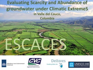
  • 1. Evaluating Scarcity and Abundance of groundwater under Climatic ExtremeS in Valle del Cauca, Colombia ESCACES
  • 7.
  • 8. Intensive use of groundwater Population and economic growth Climate variability and climate change Project Motivation and Context
  • 9. Legislation, guidelines, etc. Objective: Guarantee the sustainability of water resources in terms of quantity and quality Project Motivation and Context
  • 10. • Improve the knowledge of the groundwater system in the Valle del Cauca • Validate their conceptual model • Develop tools to support groundwater management • Study the groundwater-surface water interactions in wetlands Project Goals
  • 11. Conceptual hydrogeological model and tools Inventario de información existente Organización de la información Digitalización del información Datos Climatológicos Datos Hidrológicos Datos Geológicos Identificación de los términos del balance hídrico Cálculo de la recarga difusa para todo el Valle Reuniones con los actores del Valle (principalmente CENICAÑA) Análisis de la información Modelo conceptual Desarrollo de los cortes hidrogeológicos Definición de la morfología de las Unidades Hidrogeológicas Datos Hidroquími cos Modelo numérico Herramienta de apoyo a la gestión Asignación de propiedades hidráulicas Definición de las zonas de recarga y descarga del acuífero Validación del modelo conceptual Cálculo de indicadores Balance hídrico Propuesta red de monitoreo
  • 13. Water balance and recharge areas
  • 14. • Calculated at daily time step for cells of 250x250m • Input maps • Land use • Root depth • Soil type and soil texture • Phreatic groundwater level • Interpolated maps of precipitation and evaporation at daily time step (Elevation dependent due to monthly normals) • Calculation of runoff & infitration • Calculation of recharge based on water balance in soil column Groundwater recharge due to precipitation
  • 18. Hydro- meteorological Data (P & ET) Groundwater & river level and discharge data Model development & Calibration Decision Support Piezometric levels & well discharges (GeoCVC) Topographical & Geological Data Lithological columns of wells (GeoCVC) Exploring climatic scenarios (extreme wet & dry) Modelled piezometric levels, groundwater flows piezometric levels, groundwater flows, Indicators Regulation of new & existing wells iMOD iMOD & FEWS
  • 20. Cali Palmira Depth of Groundwater FEWS ESCACES Piezometric levels
  • 22. Exploring climate variability Scenarios 2015-2025 – conditional on g/w levels & pumping 2015 SPI at Alfonso Bonilla Airport ENSO Climate Indices: SOI & MEI Synthetic climate series - K-Nearest neighbour sampling (1974-2015) - 1000 bootstraps - Selection of extreme climate sequences based on SPI of resampled series - Forcing IMOD with rearranged recharge series
  • 23. Exploring climate variability Scenarios 2015-2025 – conditional on g/w levels & pumping 2015
  • 24. Steps to understand how the system works Inventario de información existente Organización de la información Digitalización del información Datos Climatológicos Datos Hidrológicos Datos Geológicos Identificación de los términos del balance hídrico Cálculo de la recarga difusa para todo el Valle Reuniones con los actores del Valle (principalmente CENICAÑA) Análisis de la información Modelo conceptual Desarrollo de los cortes hidrogeológicos Definición de la morfología de las Unidades Hidrogeológicas Datos Hidroquími cos Modelo numérico Herramienta de apoyo a la gestión Asignación de propiedades hidráulicas Definición de las zonas de recarga y descarga del acuífero Validación del modelo conceptual Cálculo de indicadores Balance hídrico Propuesta red de monitoreo Data Analysis Conceptual Model Numerical Model DSS Data
  • 25.