SlideShare una empresa de Scribd logo
1 de 20
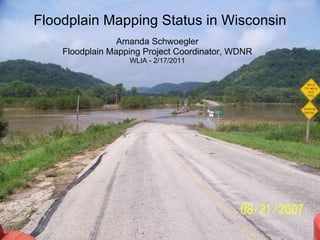
Floodplain Mapping Status in Wisconsin Amanda Schwoegler Floodplain Mapping Project Coordinator, WDNR WLIA - 2/17/2011
[object Object],[object Object],[object Object],[object Object],[object Object],[object Object],[object Object],[object Object],[object Object],Some Statistics From Recent Events
 
 
From Map Mod to Risk MAP 2003 – 2008 Map Modernization Program ,[object Object],2009 Transition Year ,[object Object],[object Object],2010 - ? Risk MAP Mapping, Assessment  and Planning ,[object Object],[object Object]
Countywide Watershed Geographic Approach
Program Goals and Measures
Risk MAP Lifecycle Focus on Better Risk Communication  Transfer Risk Reduce Risk Map Risk Data Risk MAP REDUCE LOSS OF LIFE & PROPERTY Goal – Measure  Quantifiable Risk  Reduction Assess Present & Future Risks Plan for Risk 2 Assess Risk 3 Communicate Risk 4 Mitigate Risk 1 Identify  Risk
Traditional products are regulatory and subject to statutory due-process requirements Risk MAP products are non-regulatory and are not subject to statutory due-process requirements Traditional Regulatory Products Non-Regulatory Products Risk MAP Program Product Comparisons
Data Fields Include Example Data Values Old Study Date e.g. 1985 Old Model Type(s) e.g. HEC-1 / HEC-2 Old Zone Type e.g. Zone A Old Topography e.g. USGS 10-ft New Study Info/Methods Dates, Models, etc. New Study Zone e.g. Zone AE New Topography e.g. LiDAR 2-ft New Study Engineering Factors / Changes e.g. new structures, gages, topo, landuse, etc. Estimated Structures e.g. 9 Estimated Population e.g. 27 Enhanced
Flood Risk Database  ( red  = enhanced) ,[object Object],[object Object],[object Object],[object Object],[object Object],[object Object],[object Object],[object Object],[object Object],[object Object],[object Object],[object Object],[object Object],[object Object],[object Object],[object Object],[object Object]
Flood Risk Report Content Overview ,[object Object],[object Object],[object Object],[object Object],[object Object],[object Object],[object Object],[object Object],[object Object],[object Object],[object Object]
[object Object],[object Object],[object Object]
WHERE ARE WE NOW? Nationwide KPI 1: 92% of Nation’s Population with Digital GIS Flood Data KPI 2: 87% of Population with Adopted Maps that Meet Quality Standards by end of FFY11. Wisconsin 50 counties will have Digital GIS Flood Data by end of 2011 11 counties will have Digital GIS Flood Data by end of 2013 New studies throughout the Upper and Lower Rock Watersheds


[object Object],[object Object],[object Object],[object Object],[object Object],[object Object],[object Object]
Mellen (Ashland Co.) 1946 Darlington (Lafayette Co.) 1990 Gays Mills (Crawford Co.) 2007  QUESTIONS???

Más contenido relacionado

La actualidad más candente

Drought monitoring and early warning in the MENA region: The ICBA contributio...
Drought monitoring and early warning in the MENA region: The ICBA contributio...Drought monitoring and early warning in the MENA region: The ICBA contributio...
Drought monitoring and early warning in the MENA region: The ICBA contributio...NENAwaterscarcity
 
NIDIS Upper Colorado River Basin Early Warning System, Lessons Learned and Pl...
NIDIS Upper Colorado River Basin Early Warning System, Lessons Learned and Pl...NIDIS Upper Colorado River Basin Early Warning System, Lessons Learned and Pl...
NIDIS Upper Colorado River Basin Early Warning System, Lessons Learned and Pl...DRIscience
 
18 06 entso-e ieee pan european system adequacy
18 06 entso-e ieee pan european system adequacy18 06 entso-e ieee pan european system adequacy
18 06 entso-e ieee pan european system adequacyLaurent Schmitt
 
Thackway_MAY_presentation
Thackway_MAY_presentationThackway_MAY_presentation
Thackway_MAY_presentationTERN Australia
 
Session 1.1.2. Climate Monitoring
Session 1.1.2. Climate MonitoringSession 1.1.2. Climate Monitoring
Session 1.1.2. Climate MonitoringNAP Events
 
NOAA California Drought Service Assessment - Kevin Werner, Western Regional C...
NOAA California Drought Service Assessment - Kevin Werner, Western Regional C...NOAA California Drought Service Assessment - Kevin Werner, Western Regional C...
NOAA California Drought Service Assessment - Kevin Werner, Western Regional C...DRIscience
 
Day 1 - filipe lucio_wmo, arrcc-carissa workshop
Day 1 - filipe lucio_wmo, arrcc-carissa workshopDay 1 - filipe lucio_wmo, arrcc-carissa workshop
Day 1 - filipe lucio_wmo, arrcc-carissa workshopICIMOD
 
Data Fed Fire Apps
Data Fed Fire AppsData Fed Fire Apps
Data Fed Fire AppsRudolf Husar
 
Building Resiliency in Great Lakes Communities
Building Resiliency in Great Lakes CommunitiesBuilding Resiliency in Great Lakes Communities
Building Resiliency in Great Lakes CommunitiesCDM Smith
 
Using Novel Geospatial Tools and Approaches for Identifying Critical Nutrient...
Using Novel Geospatial Tools and Approaches for Identifying Critical Nutrient...Using Novel Geospatial Tools and Approaches for Identifying Critical Nutrient...
Using Novel Geospatial Tools and Approaches for Identifying Critical Nutrient...Soil and Water Conservation Society
 
System for Land-Based Emissions Estimation in Kenya
System for Land-Based Emissions Estimation in KenyaSystem for Land-Based Emissions Estimation in Kenya
System for Land-Based Emissions Estimation in Kenyaipcc-media
 
Day 1 9 rupa kumar kolli, wmo, arrcc-carissa workshop
Day 1 9 rupa kumar kolli, wmo, arrcc-carissa workshopDay 1 9 rupa kumar kolli, wmo, arrcc-carissa workshop
Day 1 9 rupa kumar kolli, wmo, arrcc-carissa workshopICIMOD
 
ADOpresentation.lv20150714
ADOpresentation.lv20150714ADOpresentation.lv20150714
ADOpresentation.lv20150714Luana Valentini
 
Outdoor is where it’s at – Maximizing Outdoor Water Savings by Using ET Weath...
Outdoor is where it’s at – Maximizing Outdoor Water Savings by Using ET Weath...Outdoor is where it’s at – Maximizing Outdoor Water Savings by Using ET Weath...
Outdoor is where it’s at – Maximizing Outdoor Water Savings by Using ET Weath...Texas Living Waters Project
 
Quick Drought Response Index
Quick Drought Response IndexQuick Drought Response Index
Quick Drought Response IndexDRIscience
 
Fastnet Aq Conference
Fastnet Aq ConferenceFastnet Aq Conference
Fastnet Aq ConferenceRudolf Husar
 

La actualidad más candente (20)

Aero
AeroAero
Aero
 
Drought monitoring and early warning in the MENA region: The ICBA contributio...
Drought monitoring and early warning in the MENA region: The ICBA contributio...Drought monitoring and early warning in the MENA region: The ICBA contributio...
Drought monitoring and early warning in the MENA region: The ICBA contributio...
 
Cbp Component A
Cbp Component ACbp Component A
Cbp Component A
 
NIDIS Upper Colorado River Basin Early Warning System, Lessons Learned and Pl...
NIDIS Upper Colorado River Basin Early Warning System, Lessons Learned and Pl...NIDIS Upper Colorado River Basin Early Warning System, Lessons Learned and Pl...
NIDIS Upper Colorado River Basin Early Warning System, Lessons Learned and Pl...
 
18 06 entso-e ieee pan european system adequacy
18 06 entso-e ieee pan european system adequacy18 06 entso-e ieee pan european system adequacy
18 06 entso-e ieee pan european system adequacy
 
Thackway_MAY_presentation
Thackway_MAY_presentationThackway_MAY_presentation
Thackway_MAY_presentation
 
Session 1.1.2. Climate Monitoring
Session 1.1.2. Climate MonitoringSession 1.1.2. Climate Monitoring
Session 1.1.2. Climate Monitoring
 
NOAA California Drought Service Assessment - Kevin Werner, Western Regional C...
NOAA California Drought Service Assessment - Kevin Werner, Western Regional C...NOAA California Drought Service Assessment - Kevin Werner, Western Regional C...
NOAA California Drought Service Assessment - Kevin Werner, Western Regional C...
 
Day 1 - filipe lucio_wmo, arrcc-carissa workshop
Day 1 - filipe lucio_wmo, arrcc-carissa workshopDay 1 - filipe lucio_wmo, arrcc-carissa workshop
Day 1 - filipe lucio_wmo, arrcc-carissa workshop
 
Data Fed Fire Apps
Data Fed Fire AppsData Fed Fire Apps
Data Fed Fire Apps
 
14a Conferenza Nazionale di Statistica
14a Conferenza Nazionale di Statistica14a Conferenza Nazionale di Statistica
14a Conferenza Nazionale di Statistica
 
Building Resiliency in Great Lakes Communities
Building Resiliency in Great Lakes CommunitiesBuilding Resiliency in Great Lakes Communities
Building Resiliency in Great Lakes Communities
 
Using Novel Geospatial Tools and Approaches for Identifying Critical Nutrient...
Using Novel Geospatial Tools and Approaches for Identifying Critical Nutrient...Using Novel Geospatial Tools and Approaches for Identifying Critical Nutrient...
Using Novel Geospatial Tools and Approaches for Identifying Critical Nutrient...
 
System for Land-Based Emissions Estimation in Kenya
System for Land-Based Emissions Estimation in KenyaSystem for Land-Based Emissions Estimation in Kenya
System for Land-Based Emissions Estimation in Kenya
 
NTT
NTTNTT
NTT
 
Day 1 9 rupa kumar kolli, wmo, arrcc-carissa workshop
Day 1 9 rupa kumar kolli, wmo, arrcc-carissa workshopDay 1 9 rupa kumar kolli, wmo, arrcc-carissa workshop
Day 1 9 rupa kumar kolli, wmo, arrcc-carissa workshop
 
ADOpresentation.lv20150714
ADOpresentation.lv20150714ADOpresentation.lv20150714
ADOpresentation.lv20150714
 
Outdoor is where it’s at – Maximizing Outdoor Water Savings by Using ET Weath...
Outdoor is where it’s at – Maximizing Outdoor Water Savings by Using ET Weath...Outdoor is where it’s at – Maximizing Outdoor Water Savings by Using ET Weath...
Outdoor is where it’s at – Maximizing Outdoor Water Savings by Using ET Weath...
 
Quick Drought Response Index
Quick Drought Response IndexQuick Drought Response Index
Quick Drought Response Index
 
Fastnet Aq Conference
Fastnet Aq ConferenceFastnet Aq Conference
Fastnet Aq Conference
 

Similar a Floodplain Mapping Status in Wisconsin

United States Geological Survey, Dr. William Guertal
United States Geological Survey, Dr. William GuertalUnited States Geological Survey, Dr. William Guertal
United States Geological Survey, Dr. William GuertalTWCA
 
Hanson.GIS.DHS_FinalReport.Revised.04.20.2016 (1)
Hanson.GIS.DHS_FinalReport.Revised.04.20.2016 (1)Hanson.GIS.DHS_FinalReport.Revised.04.20.2016 (1)
Hanson.GIS.DHS_FinalReport.Revised.04.20.2016 (1)Angelina Hanson
 
Risk Analysis Of Cultural Resource4th June2
Risk Analysis Of Cultural Resource4th June2Risk Analysis Of Cultural Resource4th June2
Risk Analysis Of Cultural Resource4th June2Shweta Bhatia Gupta
 
Risk Analysis Of Cultural Resource4th June2
Risk Analysis Of Cultural Resource4th June2Risk Analysis Of Cultural Resource4th June2
Risk Analysis Of Cultural Resource4th June2guesta56b77
 
An Integrative Decision Support System for Managing Water Resources under Inc...
An Integrative Decision Support System for Managing Water Resources under Inc...An Integrative Decision Support System for Managing Water Resources under Inc...
An Integrative Decision Support System for Managing Water Resources under Inc...National Institute of Food and Agriculture
 
National Geospatial Program Presentation - IMIA Asia Pacific Conference
National Geospatial Program Presentation - IMIA Asia Pacific ConferenceNational Geospatial Program Presentation - IMIA Asia Pacific Conference
National Geospatial Program Presentation - IMIA Asia Pacific ConferenceInternational Map Industry Association
 
The Future of Water in New York
The Future of Water in New YorkThe Future of Water in New York
The Future of Water in New YorkCarter Craft
 
Lombardi_EPA_NARS_Proposal_Final
Lombardi_EPA_NARS_Proposal_FinalLombardi_EPA_NARS_Proposal_Final
Lombardi_EPA_NARS_Proposal_FinalJohn Lombardi
 
Santillan assessing the-impacts_of_flooding_caused_by_extreme_rainfall_events...
Santillan assessing the-impacts_of_flooding_caused_by_extreme_rainfall_events...Santillan assessing the-impacts_of_flooding_caused_by_extreme_rainfall_events...
Santillan assessing the-impacts_of_flooding_caused_by_extreme_rainfall_events...Vanrosco
 
Sea level rise and storm surge tools and datasets supporting Municipal Resili...
Sea level rise and storm surge tools and datasets supporting Municipal Resili...Sea level rise and storm surge tools and datasets supporting Municipal Resili...
Sea level rise and storm surge tools and datasets supporting Municipal Resili...GrowSmart Maine
 
Birr - Identifying Critical Portions of the Landscape
Birr - Identifying Critical Portions of the LandscapeBirr - Identifying Critical Portions of the Landscape
Birr - Identifying Critical Portions of the LandscapeJose A. Hernandez
 
Flood risk assessment using remote sensing and gis.pptx
Flood risk assessment using remote sensing and gis.pptxFlood risk assessment using remote sensing and gis.pptx
Flood risk assessment using remote sensing and gis.pptxLuckyChauhan48
 

Similar a Floodplain Mapping Status in Wisconsin (20)

United States Geological Survey, Dr. William Guertal
United States Geological Survey, Dr. William GuertalUnited States Geological Survey, Dr. William Guertal
United States Geological Survey, Dr. William Guertal
 
Inamine Final Sess4 102709
Inamine Final Sess4 102709Inamine Final Sess4 102709
Inamine Final Sess4 102709
 
Hanson.GIS.DHS_FinalReport.Revised.04.20.2016 (1)
Hanson.GIS.DHS_FinalReport.Revised.04.20.2016 (1)Hanson.GIS.DHS_FinalReport.Revised.04.20.2016 (1)
Hanson.GIS.DHS_FinalReport.Revised.04.20.2016 (1)
 
Risk Analysis Of Cultural Resource4th June2
Risk Analysis Of Cultural Resource4th June2Risk Analysis Of Cultural Resource4th June2
Risk Analysis Of Cultural Resource4th June2
 
Risk Analysis Of Cultural Resource4th June2
Risk Analysis Of Cultural Resource4th June2Risk Analysis Of Cultural Resource4th June2
Risk Analysis Of Cultural Resource4th June2
 
Science tools to help get the right measure in the right place
Science tools to help get the right measure in the right placeScience tools to help get the right measure in the right place
Science tools to help get the right measure in the right place
 
Terwilliger june 2013 nctc meeting tuesday 1 pm
Terwilliger june 2013 nctc meeting tuesday 1 pmTerwilliger june 2013 nctc meeting tuesday 1 pm
Terwilliger june 2013 nctc meeting tuesday 1 pm
 
An Integrative Decision Support System for Managing Water Resources under Inc...
An Integrative Decision Support System for Managing Water Resources under Inc...An Integrative Decision Support System for Managing Water Resources under Inc...
An Integrative Decision Support System for Managing Water Resources under Inc...
 
Water and Productivity Impacts for the NBDC
Water and Productivity Impacts for the NBDCWater and Productivity Impacts for the NBDC
Water and Productivity Impacts for the NBDC
 
FLOOD MAP MODERNIZATION
FLOOD MAP MODERNIZATION FLOOD MAP MODERNIZATION
FLOOD MAP MODERNIZATION
 
National Geospatial Program Presentation - IMIA Asia Pacific Conference
National Geospatial Program Presentation - IMIA Asia Pacific ConferenceNational Geospatial Program Presentation - IMIA Asia Pacific Conference
National Geospatial Program Presentation - IMIA Asia Pacific Conference
 
National Hydrography Dataset (EPAN 2010)
National Hydrography Dataset (EPAN 2010)National Hydrography Dataset (EPAN 2010)
National Hydrography Dataset (EPAN 2010)
 
2 - Characterising Catchments - a shared approach. Jenny Deakin
2 - Characterising Catchments - a shared approach. Jenny Deakin2 - Characterising Catchments - a shared approach. Jenny Deakin
2 - Characterising Catchments - a shared approach. Jenny Deakin
 
The Future of Water in New York
The Future of Water in New YorkThe Future of Water in New York
The Future of Water in New York
 
Lombardi_EPA_NARS_Proposal_Final
Lombardi_EPA_NARS_Proposal_FinalLombardi_EPA_NARS_Proposal_Final
Lombardi_EPA_NARS_Proposal_Final
 
BFP Andes-Project Plans
BFP Andes-Project PlansBFP Andes-Project Plans
BFP Andes-Project Plans
 
Santillan assessing the-impacts_of_flooding_caused_by_extreme_rainfall_events...
Santillan assessing the-impacts_of_flooding_caused_by_extreme_rainfall_events...Santillan assessing the-impacts_of_flooding_caused_by_extreme_rainfall_events...
Santillan assessing the-impacts_of_flooding_caused_by_extreme_rainfall_events...
 
Sea level rise and storm surge tools and datasets supporting Municipal Resili...
Sea level rise and storm surge tools and datasets supporting Municipal Resili...Sea level rise and storm surge tools and datasets supporting Municipal Resili...
Sea level rise and storm surge tools and datasets supporting Municipal Resili...
 
Birr - Identifying Critical Portions of the Landscape
Birr - Identifying Critical Portions of the LandscapeBirr - Identifying Critical Portions of the Landscape
Birr - Identifying Critical Portions of the Landscape
 
Flood risk assessment using remote sensing and gis.pptx
Flood risk assessment using remote sensing and gis.pptxFlood risk assessment using remote sensing and gis.pptx
Flood risk assessment using remote sensing and gis.pptx
 

Más de Wisconsin Land Information Association

Workshop using open source software for mobile data collection workshop - a...
Workshop   using open source software for mobile data collection workshop - a...Workshop   using open source software for mobile data collection workshop - a...
Workshop using open source software for mobile data collection workshop - a...Wisconsin Land Information Association
 
Mapping spatial patterns of whai finder usage to measure community outreach e...
Mapping spatial patterns of whai finder usage to measure community outreach e...Mapping spatial patterns of whai finder usage to measure community outreach e...
Mapping spatial patterns of whai finder usage to measure community outreach e...Wisconsin Land Information Association
 
Lakesheds and riverscapes extending wisconsin's hydro database with landsca...
Lakesheds and riverscapes   extending wisconsin's hydro database with landsca...Lakesheds and riverscapes   extending wisconsin's hydro database with landsca...
Lakesheds and riverscapes extending wisconsin's hydro database with landsca...Wisconsin Land Information Association
 
Lake habitat mapping with side scan sonar in nine wisconsin lakes - christine...
Lake habitat mapping with side scan sonar in nine wisconsin lakes - christine...Lake habitat mapping with side scan sonar in nine wisconsin lakes - christine...
Lake habitat mapping with side scan sonar in nine wisconsin lakes - christine...Wisconsin Land Information Association
 
Integrating sanitary televising data with utility gis data within the city of...
Integrating sanitary televising data with utility gis data within the city of...Integrating sanitary televising data with utility gis data within the city of...
Integrating sanitary televising data with utility gis data within the city of...Wisconsin Land Information Association
 
Integrating high accuracy gps with esri's arc gis for windows mobile field so...
Integrating high accuracy gps with esri's arc gis for windows mobile field so...Integrating high accuracy gps with esri's arc gis for windows mobile field so...
Integrating high accuracy gps with esri's arc gis for windows mobile field so...Wisconsin Land Information Association
 
Implementing arc gis 10.1 for the wisconsin dnr nhi portal levi felling
Implementing arc gis 10.1 for the wisconsin dnr nhi portal   levi fellingImplementing arc gis 10.1 for the wisconsin dnr nhi portal   levi felling
Implementing arc gis 10.1 for the wisconsin dnr nhi portal levi fellingWisconsin Land Information Association
 

Más de Wisconsin Land Information Association (20)

Airphoto anomilies
Airphoto anomiliesAirphoto anomilies
Airphoto anomilies
 
A wikimap of landscape values in the bad river watershed carl sack
A wikimap of landscape values in the bad river watershed   carl sackA wikimap of landscape values in the bad river watershed   carl sack
A wikimap of landscape values in the bad river watershed carl sack
 
Workshop using open source software for mobile data collection workshop - a...
Workshop   using open source software for mobile data collection workshop - a...Workshop   using open source software for mobile data collection workshop - a...
Workshop using open source software for mobile data collection workshop - a...
 
Wigicc's role in wisconsin jon schwitchtenberg
Wigicc's role in wisconsin   jon schwitchtenbergWigicc's role in wisconsin   jon schwitchtenberg
Wigicc's role in wisconsin jon schwitchtenberg
 
Wi 590 nutrient management web application lisa morrison
Wi 590 nutrient management web application   lisa morrisonWi 590 nutrient management web application   lisa morrison
Wi 590 nutrient management web application lisa morrison
 
Surveying and land records management dean roth
Surveying and land records management   dean rothSurveying and land records management   dean roth
Surveying and land records management dean roth
 
Mapping spatial patterns of whai finder usage to measure community outreach e...
Mapping spatial patterns of whai finder usage to measure community outreach e...Mapping spatial patterns of whai finder usage to measure community outreach e...
Mapping spatial patterns of whai finder usage to measure community outreach e...
 
Local gis in the statewide voter registration system sarah whitt
Local gis in the statewide voter registration system   sarah whittLocal gis in the statewide voter registration system   sarah whitt
Local gis in the statewide voter registration system sarah whitt
 
Li dar quality control a client's perspective - tyler grosshuesch
Li dar quality control   a client's perspective - tyler grosshueschLi dar quality control   a client's perspective - tyler grosshuesch
Li dar quality control a client's perspective - tyler grosshuesch
 
Li dar meets wisconsinview jc nelson
Li dar meets wisconsinview   jc nelsonLi dar meets wisconsinview   jc nelson
Li dar meets wisconsinview jc nelson
 
Lakesheds and riverscapes extending wisconsin's hydro database with landsca...
Lakesheds and riverscapes   extending wisconsin's hydro database with landsca...Lakesheds and riverscapes   extending wisconsin's hydro database with landsca...
Lakesheds and riverscapes extending wisconsin's hydro database with landsca...
 
Lake habitat mapping with side scan sonar in nine wisconsin lakes - christine...
Lake habitat mapping with side scan sonar in nine wisconsin lakes - christine...Lake habitat mapping with side scan sonar in nine wisconsin lakes - christine...
Lake habitat mapping with side scan sonar in nine wisconsin lakes - christine...
 
Integrative mapping strategies jeremy bixby
Integrative mapping strategies   jeremy bixbyIntegrative mapping strategies   jeremy bixby
Integrative mapping strategies jeremy bixby
 
Integrating sanitary televising data with utility gis data within the city of...
Integrating sanitary televising data with utility gis data within the city of...Integrating sanitary televising data with utility gis data within the city of...
Integrating sanitary televising data with utility gis data within the city of...
 
Integrating high accuracy gps with esri's arc gis for windows mobile field so...
Integrating high accuracy gps with esri's arc gis for windows mobile field so...Integrating high accuracy gps with esri's arc gis for windows mobile field so...
Integrating high accuracy gps with esri's arc gis for windows mobile field so...
 
Implementing arc gis 10.1 for the wisconsin dnr nhi portal levi felling
Implementing arc gis 10.1 for the wisconsin dnr nhi portal   levi fellingImplementing arc gis 10.1 for the wisconsin dnr nhi portal   levi felling
Implementing arc gis 10.1 for the wisconsin dnr nhi portal levi felling
 
Gis in parks and recreation the proragis website - trish nau
Gis in parks and recreation   the proragis website - trish nauGis in parks and recreation   the proragis website - trish nau
Gis in parks and recreation the proragis website - trish nau
 
Geo moose project update brian fischer
Geo moose project update   brian fischerGeo moose project update   brian fischer
Geo moose project update brian fischer
 
Elevation hydrology tools kent pena
Elevation hydrology tools   kent penaElevation hydrology tools   kent pena
Elevation hydrology tools kent pena
 
Developing mobile apps pick your poison - levi felling
Developing mobile apps   pick your poison - levi fellingDeveloping mobile apps   pick your poison - levi felling
Developing mobile apps pick your poison - levi felling
 

Último

When Quality Assurance Meets Innovation in Higher Education - Report launch w...
When Quality Assurance Meets Innovation in Higher Education - Report launch w...When Quality Assurance Meets Innovation in Higher Education - Report launch w...
When Quality Assurance Meets Innovation in Higher Education - Report launch w...Gary Wood
 
Exploring Gemini AI and Integration with MuleSoft | MuleSoft Mysore Meetup #45
Exploring Gemini AI and Integration with MuleSoft | MuleSoft Mysore Meetup #45Exploring Gemini AI and Integration with MuleSoft | MuleSoft Mysore Meetup #45
Exploring Gemini AI and Integration with MuleSoft | MuleSoft Mysore Meetup #45MysoreMuleSoftMeetup
 
Improved Approval Flow in Odoo 17 Studio App
Improved Approval Flow in Odoo 17 Studio AppImproved Approval Flow in Odoo 17 Studio App
Improved Approval Flow in Odoo 17 Studio AppCeline George
 
Basic Civil Engineering notes on Transportation Engineering, Modes of Transpo...
Basic Civil Engineering notes on Transportation Engineering, Modes of Transpo...Basic Civil Engineering notes on Transportation Engineering, Modes of Transpo...
Basic Civil Engineering notes on Transportation Engineering, Modes of Transpo...Denish Jangid
 
e-Sealing at EADTU by Kamakshi Rajagopal
e-Sealing at EADTU by Kamakshi Rajagopale-Sealing at EADTU by Kamakshi Rajagopal
e-Sealing at EADTU by Kamakshi RajagopalEADTU
 
Spring gala 2024 photo slideshow - Celebrating School-Community Partnerships
Spring gala 2024 photo slideshow - Celebrating School-Community PartnershipsSpring gala 2024 photo slideshow - Celebrating School-Community Partnerships
Spring gala 2024 photo slideshow - Celebrating School-Community Partnershipsexpandedwebsite
 
Graduate Outcomes Presentation Slides - English (v3).pptx
Graduate Outcomes Presentation Slides - English (v3).pptxGraduate Outcomes Presentation Slides - English (v3).pptx
Graduate Outcomes Presentation Slides - English (v3).pptxneillewis46
 
How to Manage Closest Location in Odoo 17 Inventory
How to Manage Closest Location in Odoo 17 InventoryHow to Manage Closest Location in Odoo 17 Inventory
How to Manage Closest Location in Odoo 17 InventoryCeline George
 
Major project report on Tata Motors and its marketing strategies
Major project report on Tata Motors and its marketing strategiesMajor project report on Tata Motors and its marketing strategies
Major project report on Tata Motors and its marketing strategiesAmanpreetKaur157993
 
An Overview of the Odoo 17 Knowledge App
An Overview of the Odoo 17 Knowledge AppAn Overview of the Odoo 17 Knowledge App
An Overview of the Odoo 17 Knowledge AppCeline George
 
philosophy and it's principles based on the life
philosophy and it's principles based on the lifephilosophy and it's principles based on the life
philosophy and it's principles based on the lifeNitinDeodare
 
24 ĐỀ THAM KHẢO KÌ THI TUYỂN SINH VÀO LỚP 10 MÔN TIẾNG ANH SỞ GIÁO DỤC HẢI DƯ...
24 ĐỀ THAM KHẢO KÌ THI TUYỂN SINH VÀO LỚP 10 MÔN TIẾNG ANH SỞ GIÁO DỤC HẢI DƯ...24 ĐỀ THAM KHẢO KÌ THI TUYỂN SINH VÀO LỚP 10 MÔN TIẾNG ANH SỞ GIÁO DỤC HẢI DƯ...
24 ĐỀ THAM KHẢO KÌ THI TUYỂN SINH VÀO LỚP 10 MÔN TIẾNG ANH SỞ GIÁO DỤC HẢI DƯ...Nguyen Thanh Tu Collection
 
DEMONSTRATION LESSON IN ENGLISH 4 MATATAG CURRICULUM
DEMONSTRATION LESSON IN ENGLISH 4 MATATAG CURRICULUMDEMONSTRATION LESSON IN ENGLISH 4 MATATAG CURRICULUM
DEMONSTRATION LESSON IN ENGLISH 4 MATATAG CURRICULUMELOISARIVERA8
 
會考英文會考英文會考英文會考英文會考英文會考英文會考英文會考英文會考英文會考英文會考英文
會考英文會考英文會考英文會考英文會考英文會考英文會考英文會考英文會考英文會考英文會考英文會考英文會考英文會考英文會考英文會考英文會考英文會考英文會考英文會考英文會考英文會考英文
會考英文會考英文會考英文會考英文會考英文會考英文會考英文會考英文會考英文會考英文會考英文中 央社
 
8 Tips for Effective Working Capital Management
8 Tips for Effective Working Capital Management8 Tips for Effective Working Capital Management
8 Tips for Effective Working Capital ManagementMBA Assignment Experts
 
TỔNG HỢP HƠN 100 ĐỀ THI THỬ TỐT NGHIỆP THPT TOÁN 2024 - TỪ CÁC TRƯỜNG, TRƯỜNG...
TỔNG HỢP HƠN 100 ĐỀ THI THỬ TỐT NGHIỆP THPT TOÁN 2024 - TỪ CÁC TRƯỜNG, TRƯỜNG...TỔNG HỢP HƠN 100 ĐỀ THI THỬ TỐT NGHIỆP THPT TOÁN 2024 - TỪ CÁC TRƯỜNG, TRƯỜNG...
TỔNG HỢP HƠN 100 ĐỀ THI THỬ TỐT NGHIỆP THPT TOÁN 2024 - TỪ CÁC TRƯỜNG, TRƯỜNG...Nguyen Thanh Tu Collection
 
How to Analyse Profit of a Sales Order in Odoo 17
How to Analyse Profit of a Sales Order in Odoo 17How to Analyse Profit of a Sales Order in Odoo 17
How to Analyse Profit of a Sales Order in Odoo 17Celine George
 

Último (20)

When Quality Assurance Meets Innovation in Higher Education - Report launch w...
When Quality Assurance Meets Innovation in Higher Education - Report launch w...When Quality Assurance Meets Innovation in Higher Education - Report launch w...
When Quality Assurance Meets Innovation in Higher Education - Report launch w...
 
Exploring Gemini AI and Integration with MuleSoft | MuleSoft Mysore Meetup #45
Exploring Gemini AI and Integration with MuleSoft | MuleSoft Mysore Meetup #45Exploring Gemini AI and Integration with MuleSoft | MuleSoft Mysore Meetup #45
Exploring Gemini AI and Integration with MuleSoft | MuleSoft Mysore Meetup #45
 
Mattingly "AI and Prompt Design: LLMs with Text Classification and Open Source"
Mattingly "AI and Prompt Design: LLMs with Text Classification and Open Source"Mattingly "AI and Prompt Design: LLMs with Text Classification and Open Source"
Mattingly "AI and Prompt Design: LLMs with Text Classification and Open Source"
 
Improved Approval Flow in Odoo 17 Studio App
Improved Approval Flow in Odoo 17 Studio AppImproved Approval Flow in Odoo 17 Studio App
Improved Approval Flow in Odoo 17 Studio App
 
Mattingly "AI & Prompt Design: Named Entity Recognition"
Mattingly "AI & Prompt Design: Named Entity Recognition"Mattingly "AI & Prompt Design: Named Entity Recognition"
Mattingly "AI & Prompt Design: Named Entity Recognition"
 
Basic Civil Engineering notes on Transportation Engineering, Modes of Transpo...
Basic Civil Engineering notes on Transportation Engineering, Modes of Transpo...Basic Civil Engineering notes on Transportation Engineering, Modes of Transpo...
Basic Civil Engineering notes on Transportation Engineering, Modes of Transpo...
 
e-Sealing at EADTU by Kamakshi Rajagopal
e-Sealing at EADTU by Kamakshi Rajagopale-Sealing at EADTU by Kamakshi Rajagopal
e-Sealing at EADTU by Kamakshi Rajagopal
 
Spring gala 2024 photo slideshow - Celebrating School-Community Partnerships
Spring gala 2024 photo slideshow - Celebrating School-Community PartnershipsSpring gala 2024 photo slideshow - Celebrating School-Community Partnerships
Spring gala 2024 photo slideshow - Celebrating School-Community Partnerships
 
Graduate Outcomes Presentation Slides - English (v3).pptx
Graduate Outcomes Presentation Slides - English (v3).pptxGraduate Outcomes Presentation Slides - English (v3).pptx
Graduate Outcomes Presentation Slides - English (v3).pptx
 
How to Manage Closest Location in Odoo 17 Inventory
How to Manage Closest Location in Odoo 17 InventoryHow to Manage Closest Location in Odoo 17 Inventory
How to Manage Closest Location in Odoo 17 Inventory
 
Major project report on Tata Motors and its marketing strategies
Major project report on Tata Motors and its marketing strategiesMajor project report on Tata Motors and its marketing strategies
Major project report on Tata Motors and its marketing strategies
 
An Overview of the Odoo 17 Knowledge App
An Overview of the Odoo 17 Knowledge AppAn Overview of the Odoo 17 Knowledge App
An Overview of the Odoo 17 Knowledge App
 
philosophy and it's principles based on the life
philosophy and it's principles based on the lifephilosophy and it's principles based on the life
philosophy and it's principles based on the life
 
24 ĐỀ THAM KHẢO KÌ THI TUYỂN SINH VÀO LỚP 10 MÔN TIẾNG ANH SỞ GIÁO DỤC HẢI DƯ...
24 ĐỀ THAM KHẢO KÌ THI TUYỂN SINH VÀO LỚP 10 MÔN TIẾNG ANH SỞ GIÁO DỤC HẢI DƯ...24 ĐỀ THAM KHẢO KÌ THI TUYỂN SINH VÀO LỚP 10 MÔN TIẾNG ANH SỞ GIÁO DỤC HẢI DƯ...
24 ĐỀ THAM KHẢO KÌ THI TUYỂN SINH VÀO LỚP 10 MÔN TIẾNG ANH SỞ GIÁO DỤC HẢI DƯ...
 
“O BEIJO” EM ARTE .
“O BEIJO” EM ARTE                       .“O BEIJO” EM ARTE                       .
“O BEIJO” EM ARTE .
 
DEMONSTRATION LESSON IN ENGLISH 4 MATATAG CURRICULUM
DEMONSTRATION LESSON IN ENGLISH 4 MATATAG CURRICULUMDEMONSTRATION LESSON IN ENGLISH 4 MATATAG CURRICULUM
DEMONSTRATION LESSON IN ENGLISH 4 MATATAG CURRICULUM
 
會考英文會考英文會考英文會考英文會考英文會考英文會考英文會考英文會考英文會考英文會考英文
會考英文會考英文會考英文會考英文會考英文會考英文會考英文會考英文會考英文會考英文會考英文會考英文會考英文會考英文會考英文會考英文會考英文會考英文會考英文會考英文會考英文會考英文
會考英文會考英文會考英文會考英文會考英文會考英文會考英文會考英文會考英文會考英文會考英文
 
8 Tips for Effective Working Capital Management
8 Tips for Effective Working Capital Management8 Tips for Effective Working Capital Management
8 Tips for Effective Working Capital Management
 
TỔNG HỢP HƠN 100 ĐỀ THI THỬ TỐT NGHIỆP THPT TOÁN 2024 - TỪ CÁC TRƯỜNG, TRƯỜNG...
TỔNG HỢP HƠN 100 ĐỀ THI THỬ TỐT NGHIỆP THPT TOÁN 2024 - TỪ CÁC TRƯỜNG, TRƯỜNG...TỔNG HỢP HƠN 100 ĐỀ THI THỬ TỐT NGHIỆP THPT TOÁN 2024 - TỪ CÁC TRƯỜNG, TRƯỜNG...
TỔNG HỢP HƠN 100 ĐỀ THI THỬ TỐT NGHIỆP THPT TOÁN 2024 - TỪ CÁC TRƯỜNG, TRƯỜNG...
 
How to Analyse Profit of a Sales Order in Odoo 17
How to Analyse Profit of a Sales Order in Odoo 17How to Analyse Profit of a Sales Order in Odoo 17
How to Analyse Profit of a Sales Order in Odoo 17
 

Floodplain Mapping Status in Wisconsin

  • 1. Floodplain Mapping Status in Wisconsin Amanda Schwoegler Floodplain Mapping Project Coordinator, WDNR WLIA - 2/17/2011
  • 2.
  • 3.  
  • 4.  
  • 5.
  • 7. Program Goals and Measures
  • 8. Risk MAP Lifecycle Focus on Better Risk Communication Transfer Risk Reduce Risk Map Risk Data Risk MAP REDUCE LOSS OF LIFE & PROPERTY Goal – Measure Quantifiable Risk Reduction Assess Present & Future Risks Plan for Risk 2 Assess Risk 3 Communicate Risk 4 Mitigate Risk 1 Identify Risk
  • 9. Traditional products are regulatory and subject to statutory due-process requirements Risk MAP products are non-regulatory and are not subject to statutory due-process requirements Traditional Regulatory Products Non-Regulatory Products Risk MAP Program Product Comparisons
  • 10.
  • 11. Data Fields Include Example Data Values Old Study Date e.g. 1985 Old Model Type(s) e.g. HEC-1 / HEC-2 Old Zone Type e.g. Zone A Old Topography e.g. USGS 10-ft New Study Info/Methods Dates, Models, etc. New Study Zone e.g. Zone AE New Topography e.g. LiDAR 2-ft New Study Engineering Factors / Changes e.g. new structures, gages, topo, landuse, etc. Estimated Structures e.g. 9 Estimated Population e.g. 27 Enhanced
  • 12.
  • 13.
  • 14.
  • 15. WHERE ARE WE NOW? Nationwide KPI 1: 92% of Nation’s Population with Digital GIS Flood Data KPI 2: 87% of Population with Adopted Maps that Meet Quality Standards by end of FFY11. Wisconsin 50 counties will have Digital GIS Flood Data by end of 2011 11 counties will have Digital GIS Flood Data by end of 2013 New studies throughout the Upper and Lower Rock Watersheds
  • 16.  
  • 17.  
  • 18.  
  • 19.
  • 20. Mellen (Ashland Co.) 1946 Darlington (Lafayette Co.) 1990 Gays Mills (Crawford Co.) 2007 QUESTIONS???

Notas del editor

  1. This is the RiskMAP Lifecycle. I’ll go through each portion in more detail.
  2. Changes Since Last Map – green = areas where SFHA has decreased; yellow = areas where SFHA has increased 1) Helps highlight areas where zone designation has changed, increased/decreased: 2) stores rationale for change including a) whether new engineering was performed and b) or if updated topo since last map was applied (redelineation). 3) Allows communities to estimate number of a) population and b) structure counts for each area of change. 4) Helps w/ outreach 5) Helps identify areas that are at risk that were previously unidentified
  3. As a companion to the changes since last map dataset, the Engineering Factors attributes will provide additional modeling and engineering information to the end users of the maps with possible explanations as to why the floodplain has changed. – WHEN YOU MAKE THIS POINT, YOU NEED TO CLARIFY HOW THE FACTORS RELATE TO EACH POLYGON. MEANING, THEY DON’T GET INTO THE DETAILS OF WHICH FACTOR REPRESENTS A PARTICULAR AMOUNT OF THAT CHANGE. ANOTHER WAY OF SAYING IT IS THAT, IT WOULD GIVE YOU A HIGH-LEVEL IDEA OF THE “POTENTIAL” FACTORS BASED ON THE NEW STUDY ALONG THAT STRECTCH OF STREAM. “ For example, upstream of where a new bridge went in that wasn’t shown or accounted for in the effective study, you would expect to see an attribute highlighting that fact in the change polygons upstream (and possibly even downstream) of that bridge.  In areas where new topography was used for the modeling and/or boundary delineation, you would expect to see an attribute indicating that new topography was used for that area.  For a reach of stream where the hydrology significantly changed as compared to the effective study, you might expect to see something in the change polygons along that stream indicating that the methodology changed, or that a new stream gage is now available for that stream, etc.  Because we are capturing the information collected through the CNMS process, we will be able to report on what methodologies and conditions were in place at the time of the effective study, along with the engineering information for the new studies, such that a user will be able to see the engineering side of “what changed” from a simple investigation of the information within the attribute tables.” Was a new culvert included in the model? Or was a levee or dam taken into account? Make reference to tables as depicting “CONTRIBUTING ENGINEERING FACTORS”. Make reference the ‘intentional’ similarity and alignment to CNMS validation. Results all partners to engage in that important conversation of “Why is the floodplain changing”.
  4. Summary of standard vs. enhanced data within the database Early Demonstration Projects may reveal that some of these datasets should move from the enhanced to the base list in future years, or that there are other datasets that should be offered