Geolocated Foursquare data: where we are
•
1 recomendación•5,428 vistas

Case studies and relative research protocols for projects that use geolocated foursquare data for add value, identify patterns and help social cooperation

Recomendados
Más contenido relacionado
Destacado
Destacado (16)
Similar a Geolocated Foursquare data: where we are
Similar a Geolocated Foursquare data: where we are (20)
Último
Último (20)
Geolocated Foursquare data: where we are
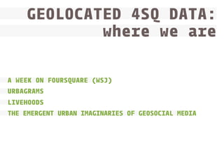
- 1. GEOLOCATED 4SQ DATA: where we are www.densitydesign.org A WEEK ON FOURSQUARE (WSJ) URBAGRAMS LIVEHOODS THE EMERGENT URBAN IMAGINARIES OF GEOSOCIAL MEDIA
- 2. A WEEK ON FOURSQUARE (WSJ) www.densitydesign.org To learn about where people go and what they do on Foursquare, Digits collected every check-in on the service for a week earlier this year (starting at noon Eastern on Friday, Jan. 21 until noon on Friday Jan. 28), via the Foursquare “firehose” aiming to see where people checked in around New York City and San Francisco over the course of the week. New York City and San Francisco were among the first cities where people start- ed using Foursquare, and the company’s founders say it’s because the service spread first among their own friends. Through geolocated check-ins’ and official categorization of Foursquare’s venues analysis, two kind of data were compared aiming to highlights common elements and differences who caracterize: - activities in both territories (New York City and San Francisco Bay area) - habits and preferences of genders
- 3. A WEEK ON FOURSQUARE (WSJ) www.densitydesign.org 3 READING LEVELS global (timeline) glocal (geolocated view) local (hot spots + focus on categories and venues) GEOLOCALIZATION CATEGORIZATION TIMELINES
- 4. A WEEK ON FOURSQUARE (WSJ) www.densitydesign.org
- 5. A WEEK ON FOURSQUARE (WSJ) www.densitydesign.org
- 6. A WEEK ON FOURSQUARE (WSJ) www.densitydesign.org
- 7. A WEEK ON FOURSQUARE (WSJ) ELABORATION VISUALIZATION www.densitydesign.org SF NYC Venues properties 4SQ COLLECTION name categories n. check-ins lat/lon ► user start date end date frequency gender 01/21/2011 01/28/2011 per hour h14 h11 source analysis output algorythm/method geolocalization categorization time none
- 8. A WEEK ON FOURSQUARE (WSJ) COLLECTION ELABORATION VISUALIZATION www.densitydesign.org SF NYC Venues properties 4SQ venues analysis name categories n. check-ins lat/lon ► user start date end date frequency bar charts check-ins/hour gender 01/21/2011 01/28/2011 per hour heatmaps check-ins/hour h14 h11 source analysis output algorythm/method geolocalization categorization time none
- 9. A WEEK ON FOURSQUARE (WSJ) COLLECTION ELABORATION venues analysis www.densitydesign.org VISUALIZATION ranks Most checked-in venues overall SF NYC Venues properties 4SQ timeline Most checked-in venue name categories analysis categories n. check-ins lat/lon ► user start date end date frequency bar charts check-ins/hour gender 01/21/2011 01/28/2011 per hour heatmaps check-ins/hour h14 h11 source analysis output algorythm/method geolocalization categorization time none
- 10. A WEEK ON FOURSQUARE (WSJ) COLLECTION ELABORATION ranks Most checked-in venues overall Top venues/category NYC Venues properties 4SQ venues analysis NYC/SF comparison SF name www.densitydesign.org VISUALIZATION timeline Most checked-in venue categories analysis categories n. check-ins lat/lon ► user start date end date frequency bar charts check-ins/hour gender 01/21/2011 01/28/2011 per hour heatmaps check-ins/hour h14 h11 source analysis output algorythm/method geolocalization categorization time none
- 11. A WEEK ON FOURSQUARE (WSJ) COLLECTION ELABORATION ranks Most checked-in venues overall Top venues/category Top venues NYC & SF Top venues NYC & SF/categ. NYC Venues properties 4SQ venues analysis NYC/SF comparison SF name categories analysis categories lat/lon start date end date frequency gender comparison gender 01/21/2011 01/28/2011 per hour timeline Most checked-in venue interactive plots/scatterplots NYC & SF check-ins/top 80 categ. bar charts venues’ check-ins/week check-ins/category n. check-ins ► user www.densitydesign.org VISUALIZATION bar charts check-ins/hour heatmaps check-ins/hour h14 h11 source analysis output algorythm/method geolocalization categorization time none
- 12. A WEEK ON FOURSQUARE (WSJ) COLLECTION ELABORATION ranks Most checked-in venues overall Top venues/category Top venues NYC & SF Top venues NYC & SF/categ. NYC Venues properties 4SQ venues analysis NYC/SF comparison SF name categories analysis categories lat/lon start date end date frequency gender comparison gender 01/21/2011 01/28/2011 per hour timeline Most checked-in venue interactive plots/scatterplots NYC & SF check-ins/top 80 categ. Male/fem. check-ins/top 80 categ. Male/fem. check-ins/Popul. venues bar charts venues’ check-ins/week check-ins/category check-ins worldwide n. check-ins ► user www.densitydesign.org VISUALIZATION bar charts check-ins/hour heatmaps check-ins/hour h14 h11 others male/fem. check-ins/categ. source analysis output algorythm/method geolocalization categorization time none
- 13. A WEEK ON FOURSQUARE (WSJ) COLLECTION ELABORATION ranks Most checked-in venues overall Top venues/category Top venues NYC & SF Top venues NYC & SF/categ. NYC/SF comparison NYC name Venues properties 4SQ venues analysis SF categories analysis categories lat/lon start date end date frequency gender comparison gender 01/21/2011 01/28/2011 per hour timeline Most checked-in venue interactive plots/scatterplots NYC & SF check-ins/top 80 categ. Male/fem. check-ins/top 80 categ. Male/fem. check-ins/Popul. venues bar charts venues’ check-ins/week check-ins/category check-ins worldwide n. check-ins ► user www.densitydesign.org VISUALIZATION bar charts check-ins/hour heatmaps check-ins/hour h14 h11 others male/fem. check-ins/categ. source analysis output algorythm/method geolocalization categorization time none
- 14. URBAGRAMS www.densitydesign.org A spatial analysis of the aggregate activity generated by such networks can show us how social activity in a city is distributed, revealing fine-grained spatial patterns evident in the social life of cities. Large-scale data from one such network is analysed across three cities in order to produce an inter-urban analysis. Hubs are identified from activity distributions, and measures of polycentricity, fragmentation and centralisation are examined with respect to levels of social interaction. Spatial clustering tendencies are analysed to determine the characteristic logics of agglomeration in urban social activity. These comparative measures are used to discuss the spatial structure of the three cities in question. ‘Networked urbanism’ (Graham and Marvin, 2001a) has contained the promise that “the city itself is turning into a constellation of computers” (Batty, 1997) for over a decade now.
- 15. URBAGRAMS www.densitydesign.org COMPARING URBAN SOCIETIES New York City Paris London GEOLOCALIZATION Spatial clusterization (activity fingerprints) Policentrucuty (functional and morphological aspects) Fragmentation/agglomeration CHARTS Social hubs analysis CATEGORIZATION
- 19. URBAGRAMS COLLECTION ELABORATION 4SQ Venues properties PARIS www.densitydesign.org “walkable” cells grid (400x400mt) LONDON NYC VISUALIZATION name categories n. check-ins lat/lon start date end date frequency 03/2009 07/2010 cumulative source analysis output algorythm/method geolocalization categorization time none
- 20. URBAGRAMS COLLECTION ELABORATION “walkable” cells grid (400x400mt) PARIS Venues properties 4SQ LONDON NYC VISUALIZATION www.densitydesign.org areas comparison DBScan name categories n. check-ins lat/lon start date end date frequency 03/2009 07/2010 cumulative categories comparison source analysis output algorythm/method geolocalization categorization time none
- 21. URBAGRAMS COLLECTION ELABORATION “walkable” cells grid (400x400mt) NYC PARIS Venues properties 4SQ LONDON areas comparison grid maps Activities’ “fingerprints” DBScan name www.densitydesign.org VISUALIZATION geolocated maps Social activities by categories categories n. check-ins ranks (with bar charts) Top Walkable Cells lat/lon start date end date frequency 03/2009 07/2010 cumulative categories comparison others Venues social activity grid/category venues comparison source analysis output algorythm/method geolocalization categorization time none
- 22. URBAGRAMS COLLECTION ELABORATION “walkable” cells grid (400x400mt) NYC PARIS Venues properties 4SQ LONDON areas comparison grid maps Activities’ “fingerprints” DBScan name categories www.densitydesign.org VISUALIZATION cities comparison geolocated maps Social activities by categories Social activities by venue n. check-ins ranks (with bar charts) Top Walkable Cells lat/lon start date end date frequency 03/2009 07/2010 cumulative categories comparison plots/scatterplots Urban-scale Moran others Venues social activity grid/category venues comparison source analysis output algorythm/method geolocalization categorization time none
- 23. URBAGRAMS COLLECTION ELABORATION “walkable” cells grid (400x400mt) NYC PARIS Venues properties 4SQ LONDON areas comparison grid maps Activities’ “fingerprints” DBScan name categories www.densitydesign.org VISUALIZATION cities comparison geolocated maps Social activities by categories Social activities by venue n. check-ins cluster maps Fragmentation of social activity lat/lon ranks (with bar charts) Top Walkable Cells start date end date frequency 03/2009 07/2010 cumulative categories comparison plots/scatterplots Urban-scale Moran Rank-size plots for venues’ check-ins others Venues social activity grid/category venues comparison source analysis output algorythm/method geolocalization categorization time none
- 24. LIVEHOODS www.densitydesign.org Unlike the boundaries of traditional municipal organizational units such as neighborhoods, which do not always reflect the character of life in these areas, the Livehoods’ clusters,are representations of the dynamic areas that comprise the city. The data comes from two sources. Approximately 11 million foursquare check-ins from the dataset of Chen et al. (2011) were combined with a dataset of 7 million checkins that were downloaded between June and Decem- ber of 2011. Foursquare check-ins are by default not publicly visible, however users may elect to share their check-ins publicly on social networks such as Twitter. These 18 million check-ins were all collected from the Twitter public timeline, then were aligned with venue information from the foursquare API. One of the main contributions is the design of an affinity matrix between check-in venues that effectively blends spatial affinity and social affinity.
- 25. LIVEHOODS www.densitydesign.org DATA MERGING Creation of meaning (4SQ + Twitter) GEOLOCALIZATION Environment perception (real/perceived boundaries) Habits and spatial relation of whom live the city CLUSTERIZATION CATEGORIZATION RANKING TIMELINES
- 29. LIVEHOODS ELABORATION COLLECTION VISUALIZATION www.densitydesign.org PITTSBURG MONTREAL PORTLAND spatial affinity name venues 4SQ NY CITY SEATTLE lat/lon category SF BAY date 2011 VANCOUVER PITTSBURG NY CITY PORTLAND SEATTLE check-ins Twitter MONTREAL SF BAY ► user ID ► time ► name date 2011 personal PITTSBURG space Interviews VANCOUVER ► age (23-62) ► education ► background ► boundaries start date end date sample 11/17/2011 12/17/2011 27 people source analysis output algorythm/method geolocalization categorization time none
- 30. LIVEHOODS ELABORATION COLLECTION VISUALIZATION www.densitydesign.org PITTSBURG MONTREAL PORTLAND spatial affinity name venues 4SQ NY CITY SEATTLE lat/lon category SF BAY date 2011 VANCOUVER social affinity PITTSBURG NY CITY PORTLAND SEATTLE check-ins Twitter MONTREAL SF BAY ► user ID ► time ► name date 2011 personal PITTSBURG space Interviews VANCOUVER ► age (23-62) ► education ► background ► boundaries start date end date sample 11/17/2011 12/17/2011 27 people source analysis output algorythm/method geolocalization categorization time none
- 31. LIVEHOODS ELABORATION COLLECTION VISUALIZATION www.densitydesign.org PITTSBURG MONTREAL PORTLAND spatial affinity name venues 4SQ NY CITY SEATTLE lat/lon venues activity category SF BAY date 2011 VANCOUVER social affinity PITTSBURG NY CITY PORTLAND SEATTLE check-ins Twitter MONTREAL SF BAY ► user ID ► time ► name date 2011 personal PITTSBURG space Interviews VANCOUVER ► age (23-62) ► education ► background ► boundaries start date end date sample 11/17/2011 12/17/2011 27 people source analysis output algorythm/method geolocalization categorization time none
- 32. LIVEHOODS ELABORATION COLLECTION VISUALIZATION www.densitydesign.org PITTSBURG MONTREAL PORTLAND spatial affinity name venues 4SQ NY CITY SEATTLE lat/lon SF BAY date 2011 VANCOUVER social affinity PITTSBURG PORTLAND SEATTLE check-ins Twitter MONTREAL NY CITY venues activity category SF BAY ► user ID affinity matrix ► time ► name date 2011 personal PITTSBURG space Interviews VANCOUVER ► age (23-62) ► education ► background ► boundaries start date end date sample 11/17/2011 12/17/2011 27 people source analysis output algorythm/method geolocalization categorization time none
- 33. LIVEHOODS ELABORATION COLLECTION VISUALIZATION www.densitydesign.org PITTSBURG MONTREAL PORTLAND spatial affinity name venues 4SQ NY CITY SEATTLE lat/lon SF BAY date 2011 VANCOUVER social affinity PITTSBURG PORTLAND SEATTLE check-ins Twitter MONTREAL NY CITY venues activity category SF BAY ► user ID affinity matrix ► time ► name date livehoods 2011 personal PITTSBURG space Interviews VANCOUVER ► age (23-62) ► education ► background ► boundaries start date end date sample 11/17/2011 12/17/2011 27 people source analysis output algorythm/method geolocalization categorization time none
- 34. LIVEHOODS ELABORATION COLLECTION www.densitydesign.org VISUALIZATION PITTSBURG MONTREAL PORTLAND spatial affinity name venues 4SQ NY CITY SEATTLE lat/lon SF BAY date 2011 VANCOUVER social affinity PITTSBURG PORTLAND SEATTLE check-ins Twitter MONTREAL NY CITY SF BAY ► user ID ► name date ranks Character Related affinity matrix bar charts Stats Daily pulse Hourly pulse livehoods 2011 personal validate space Interviews geolocated maps Cluster map of livehoods ► time VANCOUVER PITTSBURG venues activity category ► age (23-62) campus sostenibile ► education ► background ► boundaries start date end date sample 11/17/2011 12/17/2011 27 people source analysis output algorythm/method geolocalization categorization time none
- 35. LIVEHOODS ELABORATION COLLECTION www.densitydesign.org VISUALIZATION PITTSBURG MONTREAL PORTLAND spatial affinity name venues 4SQ NY CITY SEATTLE lat/lon SF BAY date 2011 VANCOUVER social affinity PITTSBURG PORTLAND SEATTLE check-ins Twitter MONTREAL NY CITY SF BAY ► user ID ► name date ranks Character Related affinity matrix bar charts Stats Daily pulse Hourly pulse livehoods 2011 personal validate space Interviews geolocated maps Cluster map of livehoods ► time VANCOUVER PITTSBURG venues activity category ► age (23-62) campus sostenibile ► education ► background ► boundaries start date end date sample 11/17/2011 12/17/2011 27 people source analysis output algorythm/method geolocalization categorization time none
- 36. THE EMERGENT URBAN IMAGINARIES OF GEOSOCIAL MEDIA www.densitydesign.org Geosocial databases inhabit the virtual space in which geosocial media are produced, and the information that they contain is both archival and generative meaning that not only does it provide historical context to a place, but it also gives access to the contemporary pulse of the ways that geosocial users perceive, experience and interact in places. These data can be assembled to speak to the imaginaries of sub-city scale communities blendind urban place-frames and the geoweb to show how we per- ceive and understand urban imaginaries as well as how the geoweb is an evermore integral element of daily life. Imaginaries are not simply passive representations of sociocultural reality, but are instead active elements in the structuring of individual social, cultural and spatial practice. The imaginaries would be sociospatial meaning that data generated by individuals about space via Foursquare would tend to broadcast personal perceptions about how spaces are used and/or experienced.
- 37. THE EMERGENT URBAN IMAGINARIES OF GEOSOCIAL MEDIA www.densitydesign.org DATA MERGING Mapping the research area (census + checkinmania.com) QUALITATIVE ANALYSIS Tips text analysis (classification code) GEOLOCALIZATION CODIFICATION
- 38. THE EMERGENT URBAN IMAGINARIES OF GEOSOCIAL MEDIA www.densitydesign.org
- 39. THE EMERGENT URBAN IMAGINARIES OF GEOSOCIAL MEDIA www.densitydesign.org
- 40. THE EMERGENT URBAN IMAGINARIES OF GEOSOCIAL MEDIA www.densitydesign.org
- 41. THE EMERGENT URBAN IMAGINARIES OF GEOSOCIAL MEDIA www.densitydesign.org
- 42. THE EMERGENT URBAN IMAGINARIES OF GEOSOCIAL MEDIA www.densitydesign.org Socio-economically distressed areas (1,143 total tips) Code1 Code2 Code3 Tacoma 1 (24 total tips, 5per sq.mile) Tacoma 2 (152 total tips, 33 per sq. mile) Tacoma 3 (29 total tips, 5 per sq. mile) Seattle 1 (782 total tips, 74 per sq. mile) Seattle 2 (51 total tips, 44 per sq. mile) Seattle 3 (84 total tips, 33 per sq. mile) Seattle 4 (21 total tips, 19 per sq. mile) Mean (30 per sq. mile) Standard deviation 0.125 0.171 0.172 0.263 0.314 0.202 0.333 0.245 0.073 0.042 0.125 0.035 0.115 0.373 0.214 0.000 0.130 0.120 0.167 0.099 0.138 0.067 0.039 0.060 0.190 0.080 0.050 Socio-economically advantaged areas (1,358 total tips) Code1 Code2 Code3 Seattle A (48 total tips, 31per sq.mile) Seattle B (214 total tips, 54 per sq. mile) Seattle C (588 total tips, 127 per sq. mile) Seattle D (242 total tips, 36 per sq. mile) Seattle E (80 total tips, 94 per sq. mile) Seattle F (186 total tips, 26 per sq. mile) Mean Standard deviation Composite mean (45 per sq. mile) Composite standard deviation 0.292 0.266 0.226 0.401 0.263 0.307 0.280 0.055 0.264 0.073 0.354 0.117 0.119 0.136 0.100 0.140 0.132 0.187 0.131 0.107 0.021 0.042 0.039 0.062 0.088 0.059 0.049 0.021 0.061 0.050
- 43. THE EMERGENT URBAN IMAGINARIES OF GEOSOCIAL MEDIA www.densitydesign.org VISUALIZATION SEATTLE tips TACOMA venues checkinmania.com (4SQ) ELABORATION SEATTLE census COLLECTION name lat/lon user ID text string date 2011 people ► poverty ► education area selection ► income land TACOMA geolocated maps Land use in S&W Seattle Population density S&W Seattle ► land use ► density date source analysis output algorythm/method 2011 geolocalization categorization time none
- 44. THE EMERGENT URBAN IMAGINARIES OF GEOSOCIAL MEDIA COLLECTION ELABORATION VISUALIZATION www.densitydesign.org SEATTLE tips TACOMA venues checkinmania.com (4SQ) SEATTLE census text analysis name lat/lon user ID text string date 2011 people ► poverty ► education area selection ► income land TACOMA geolocated maps Land use in S&W Seattle Population density S&W Seattle Cluster analysis Output S&W Seattle ► land use ► density date source analysis output algorythm/method 2011 geolocalization categorization time none
- 45. THE EMERGENT URBAN IMAGINARIES OF GEOSOCIAL MEDIA COLLECTION ELABORATION tips venues SEATTLE TACOMA www.densitydesign.org code 1: social engagment code 2: attachment to place code 3: fear and avoidance name lat/lon user ID geolocated maps Land use in S&W Seattle Population density S&W Seattle Cluster analysis Output S&W Seattle text string date 2011 area definition SEATTLE ► poverty people TACOMA ► education area selection ► income land census checkinmania.com (4SQ) text analysis VISUALIZATION ► land use ► density date source analysis output algorythm/method 2011 geolocalization categorization time none
- 46. THE EMERGENT URBAN IMAGINARIES OF GEOSOCIAL MEDIA COLLECTION ELABORATION tips venues SEATTLE TACOMA www.densitydesign.org code 1: social engagment code 2: attachment to place code 3: fear and avoidance name lat/lon tip analysis user ID text string date 2011 geolocated maps Land use in S&W Seattle Population density S&W Seattle Cluster analysis Output S&W Seattle Study areas (block group cluster) area definition SEATTLE ► poverty people TACOMA ► education area selection ► income land census checkinmania.com (4SQ) text analysis VISUALIZATION ► land use ► density date source analysis output algorythm/method 2011 geolocalization categorization time none
- 47. THE EMERGENT URBAN IMAGINARIES OF GEOSOCIAL MEDIA COLLECTION ELABORATION tips venues SEATTLE TACOMA www.densitydesign.org code 1: social engagment code 2: attachment to place code 3: fear and avoidance name lat/lon tip analysis user ID text string date 2011 area definition geolocated maps Land use in S&W Seattle Population density S&W Seattle Cluster analysis Output S&W Seattle Study areas (block group cluster) tabs Content analysis of check-in tips SEATTLE ► poverty people TACOMA ► education area selection ► income land census checkinmania.com (4SQ) text analysis VISUALIZATION ► land use ► density date source analysis output algorythm/method 2011 geolocalization categorization time none
- 48. THE EMERGENT URBAN IMAGINARIES OF GEOSOCIAL MEDIA COLLECTION ELABORATION tips venues SEATTLE TACOMA www.densitydesign.org code 1: social engagment code 2: attachment to place code 3: fear and avoidance name lat/lon tip analysis user ID text string date 2011 area definition geolocated maps Land use in S&W Seattle Population density S&W Seattle Cluster analysis Output S&W Seattle Study areas (block group cluster) tabs Content analysis of check-in tips SEATTLE ► poverty people TACOMA ► education area selection ► income land census checkinmania.com (4SQ) text analysis VISUALIZATION ► land use ► density date source analysis output algorythm/method 2011 geolocalization categorization time none
- 49. REPRESENTATIVENESS: meaning of data www.densitydesign.org ESTIMATING PEOPLE PERCEPTION OF INTIMACY FAR FROM THE EYES, CLOSE ON THE WEB
- 50. ESTIMATING PEOPLE PERCEPTION OF INTIMACY www.densitydesign.org How does the intimacy relate to privacy? The main scope of the research is to estimate people intimacy to detect when information about the users’ context can be collected and shared in order to develop applications that automatically control how events and notifications to the users (receiving a message, a call, an email, a request of approval etc.) are handled by his/ her smartphone or other devices in the environment, for example assuming that when the user is intimate the alerts shall be less intrusive. Analizing raw data of “Mobile Data Challenge“ collected from 38 selected participants using smartphones in their daily life and use and elaborating informations using an algorithm, the researchers derived the users’ level of intimacy in particular places and intervals of time. The research uses an “Intimacy Estimation Algorithm” that compute data from the devices.
- 51. ESTIMATING PEOPLE PERCEPTION OF INTIMACY www.densitydesign.org For the “observers” category: For the “safe-place” category: BLUETOOTH --> number of devices around the user can reveal the number of people opbserving him; CHARGING STATUS --> if the phone is charging it can indicate that the user is currently in a trusted place; RING STATUS --> representing the willingness of the user to share the events of the device with other; RING STATUS --> is related to “how much” the user wants to be disturbed by external events; OUTGOING CALLS --> the duration of a call made by the user and the relation with the called person can give a hint about how the user feels about speaking on the phone at that moment; INDOOR/OUTDOOR --> there is a high probability that if the user is outdoor, he may not be in a safe place. OUTGOING SMS --> if a user is exchanging many SMS with a family member or a friend it may indicate that is in company of people that are not supposed to know the content of the conversation;
- 52. ESTIMATING PEOPLE PERCEPTION OF INTIMACY ELABORATION FEATURES SCOPE www.densitydesign.org observers bluetooth ring status outgoing call outgoing SMS safe-places mobile data (MDC) COLLECTION charging status ring status indoor/Outdoor date 2010 source analysis output algorythm/method
- 53. ESTIMATING PEOPLE PERCEPTION OF INTIMACY ELABORATION FEATURES SCOPE www.densitydesign.org observers bluetooth ring status outgoing call outgoing SMS safe-places mobile data (MDC) COLLECTION Intimacy Estimation Algorithm charging status ring status indoor/Outdoor date 2010 source analysis output algorythm/method
- 54. ESTIMATING PEOPLE PERCEPTION OF INTIMACY ELABORATION FEATURES observers bluetooth outgoing call SCOPE www.densitydesign.org observers and safe places ring status outgoing SMS safe-places mobile data (MDC) COLLECTION Intimacy Estimation Algorithm intimacy level charging status ring status demographic analisys indoor/Outdoor date 2010 source analysis output algorythm/method
- 55. ESTIMATING PEOPLE PERCEPTION OF INTIMACY ELABORATION FEATURES observers bluetooth outgoing call SCOPE www.densitydesign.org observers and safe places ring status outgoing SMS safe-places mobile data (MDC) COLLECTION Intimacy Estimation Algorithm intimacy level develop application charging status ring status demographic analisys indoor/Outdoor date 2010 source analysis output algorythm/method
- 56. ESTIMATING PEOPLE PERCEPTION OF INTIMACY ELABORATION FEATURES observers bluetooth outgoing call SCOPE www.densitydesign.org observers and safe places ring status outgoing SMS safe-places mobile data (MDC) COLLECTION Intimacy Estimation Algorithm intimacy level develop application charging status ring status demographic analisys indoor/Outdoor date 2010 source analysis output algorythm/method
- 57. FAR FROM THE EYES, CLOSE ON THE WEB www.densitydesign.org Analising a large dataset of anonymised snapshot of Tuenti’s friendship connections, that includes about 9.8 million registered users, more than 580 million friendship links, about 500 million interactions during a 3 month period and the user’s the self-reported city residence, this research aims to study how social interactions is related to users’ geographic locations. While spatial prooximity greatly affects how users establish their connections on online platforms, the researchers found that social interactions are only weakly affected by distance: this suggest that once social connection are established other factors may influence how users send messages to their friends. On the other hand, more active users tend to preferentially interact over short-range connections. This observation is crucial for architectures that optimise distributed storage of data related to online social platforms based on users’ geographic locations. Similarly, it is important for system that exploit geographic locality of interest to serve content items requested through online social network services. The findings also likely to help other domains such as link predition, tie strengh interference and user profiling: the observed spatiual patterns can me also included in security mechanism to detect malicious and spam accounts.
- 58. FAR FROM THE EYES, CLOSE ON THE WEB www.densitydesign.org Geographi properties: Interaction analysis: Analizing the spatial properties of the Tuenti social network, may be assumed that users tend to preferentially connect to closer users (as found in many other online social network). About 60% of social links between users are at a distance of 10km or less, while only 10% of all distances between users are below 100 km. There a re two process taking place. One process, strongly affected by geographic distance, influences how users connect to each other, i.e. their frienship links; another process impacts the level of interaction among connected users and appears unrelated to spatial proximity.
- 59. FAR FROM THE EYES, CLOSE ON THE WEB FRIENDSHIP ELABORATION user’s connections tuenti COLLECTION SCOPE www.densitydesign.org friendship links wall comments date 2010 source analysis output algorythm/method
- 60. FAR FROM THE EYES, CLOSE ON THE WEB FRIENDSHIP ELABORATION user’s connections tuenti COLLECTION SCOPE www.densitydesign.org friendship links wall comments geographic properties date 2010 source analysis output algorythm/method
- 61. FAR FROM THE EYES, CLOSE ON THE WEB FRIENDSHIP ELABORATION user’s connections tuenti COLLECTION SCOPE www.densitydesign.org friendship links wall comments geographic properties date 2010 interaction analysis source analysis output algorythm/method
- 62. FAR FROM THE EYES, CLOSE ON THE WEB COLLECTION ELABORATION www.densitydesign.org SCOPE FRIENDSHIP user’s connections tuenti geo-related data storage architectures friendship links wall comments geographic properties date 2010 interaction analysis source analysis output algorythm/method
- 63. FAR FROM THE EYES, CLOSE ON THE WEB COLLECTION ELABORATION www.densitydesign.org SCOPE FRIENDSHIP user’s connections tuenti geo-related data storage architectures friendship links link prediction wall comments geographic properties date 2010 interaction analysis source analysis output algorythm/method
- 64. FAR FROM THE EYES, CLOSE ON THE WEB COLLECTION ELABORATION www.densitydesign.org SCOPE FRIENDSHIP user’s connections tuenti geo-related data storage architectures friendship links link prediction wall comments geographic properties date 2010 interaction analysis tie strengh interference source analysis output algorythm/method
- 65. FAR FROM THE EYES, CLOSE ON THE WEB COLLECTION ELABORATION www.densitydesign.org SCOPE FRIENDSHIP user’s connections tuenti geo-related data storage architectures friendship links link prediction wall comments geographic properties date 2010 interaction analysis tie strengh interference user profiling source analysis output algorythm/method
- 66. FAR FROM THE EYES, CLOSE ON THE WEB COLLECTION ELABORATION www.densitydesign.org SCOPE FRIENDSHIP user’s connections tuenti geo-related data storage architectures friendship links link prediction wall comments geographic properties date 2010 interaction analysis tie strengh interference user profiling security mechanisms source analysis output algorythm/method
- 67. FAR FROM THE EYES, CLOSE ON THE WEB COLLECTION ELABORATION www.densitydesign.org SCOPE FRIENDSHIP user’s connections tuenti geo-related data storage architectures friendship links link prediction wall comments geographic properties date 2010 interaction analysis tie strengh interference user profiling security mechanisms source analysis output algorythm/method
- 68. BIBLIOGRAPHY www.densitydesign.org A WEEK ON FOURSQUARE (WSJ) Where the Young and Tech-Savvy Go A. Sun - J. Valentino-DeVries - Z. Seward May 19, 2011 [http://graphicsweb.wsj.com/documents/FOURSQUAREWEEK1104/] URBAGRAMS Sensing the urban: using locationbased social network data in urban analysis A. Bawa-Cavia 2011 [http://urbagram.net/media/SensingTheUrbanWP.pdf] Archipelago A. Bawa-Cavia 2010 [http://www.urbagram.net/archipelago/] LIVEHOODS The Livehoods Project: Utilizing Social Media to Understand the Dynamics of a City J. Cranshaw - R. Schwartz - J. I. Hong N. Sadeh School of Computer Science, Carnegie Mellon University, Pittsburgh 2011 [http://livehoods.org/maps/nyc#] [http://livehoods.org/research] THE EMERGENT URBAN IMAGINARIES OF GEOSOCIAL MEDIA The emergent urban imaginaries of geosocial media M. James Kelley Springer Science+Business Media B.V. 2011 [http://www.springerlink.com/content/ u56612253r57257h/fulltext.pdf] PERCEPTION OF INTIMACY Estimating People Perception of Intimacy in Daily Life from Context Data Collected with Their Mobile Phone M. Gustarini - K. Wac 2010 [research.nokia.com] FAR FROM THE EYES, CLOSE ON THE WEB Far from the eyes, close on the Web: impact of geographic distance on online social interactions A. Kaltenbrunner - S. Scellato - Y. Volkovich - D. Laniado - D. Currie - E. J. Jutemar - C. Mascolo In ACM SIGCOMM Workshop on Online Social Networks (WOSN 2012) - Helsinki, Finland August 2012 [http://www.cl.cam.ac.uk/~cm542/papers/wosn12-kaltenbrunner.pdf]