Pedestrian corridors and bike lanes to recover public realm in mexico city
•
3 recomendaciones•1,528 vistas

Creating bike lanes and corridors could help Mexico City in fighting air pollution, congestion, noise, and climate change at a fraction of the cost of infrastructure for private cars.

Recomendados
Recomendados
Más contenido relacionado
Más de CO2 Standard - Trading & financial structures
Más de CO2 Standard - Trading & financial structures (20)
Último
Último (20)
Pedestrian corridors and bike lanes to recover public realm in mexico city
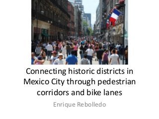
- 1. Connecting historic districts in Mexico City through pedestrian corridors and bike lanes Enrique Rebolledo
- 2. Mexico City: A country within a country Traffic in Mexico City IBM. 2011. Commuter Pain Index Subway lines are limited, as well as public transit • Mexico City Metropolitan Area lacks enough public transit, which has impacted quality of life, investments and job creation. Travel mode is 70% transit, 30% private cars. • Despite its large population (+21 M), it is not that spread out. Mexico City is 1495 km2 (576 sq miles). • There is a tremendous opportunity to recover the public realm by creating and strengthening local/historic communities and landmarks within the city. • Historic and traditional buildings abound around the city. Instead of using them as unique «community building hot-spot» they are decaying and isolated.
- 3. Denser areas to reduce travel distance We could densify the urban core! Source: The evolving urban form: the valley of Mexico. 2011. New Geography. Source: Florida, Richard. 2013. Density vs. Livability in the World's Biggest Cities. Published on Atlantic Cities. Available at: http://goo.gl/nAXpG One proposal, two components: • Recover the public realm in historic districts / landmarks, including infrastucture (parking lots, toilets, playgrounds), security (cameras, police), connectivity (internet, transit) and private services (coffeeshops, local business, etc.). • Provide «complete» streets to connect these historic districts, with emphasis on bike lanes and pedestrian corridors. Results: Reduced travel time, improved districts, business opportunities, investment, and value for public (and private) money.
- 4. Create more micro-local areas with historic districts • Instead of having only a few business /cultural districts, requiring private cars and few transit options… • We could support the recovery of the public realm by connecting districts through walking corridors and bike lanes. • Crossing the denser part of the city is only 22km/13.7 miles on a straight line (red line). • Walking and bike lanes (3 km/1.8m lenght / blue lines) could help to connect microlocal areas, reducing congestion, noise, and air pollution. • Car average is 13 km/h (8.1m/h) • Bike lanes speed at 12 km/h (7.5 m/h). • Travel reduced to 15 min on bike.
- 6. Affordable and easy to mantain infrastructure Benefits • Little public works, such as parking meters, bike lanes, and walking corridors can catalyze local investment and improve life quality, and revitalize historic districts. • Return of investment is higher than investing on car infrastructure. Costs • Pedestrian infrastructure is minimal, compared to those of cars. • Bike lanes are easy to mantain. • Requires less infrastructure (less capital and operation expenditures) than those associated with private cars. • Requires law enforcement. Evaluation • Districts become affordable and accesible to all (bikes, walking, wheelchairs, strollers (baby and elderly, etc.) • Complete streets help to recover the public realm, at a very competitive value for money, improving quality of life.
- 7. From congestion To better living conditions