SlideShare una empresa de Scribd logo
1 de 68
LOS ESTRECHOS MÁS IMPORTANTES
THE MOST IMPORTANT STRAITS
ESTRECHO DE GIBRALTAR
STRAIT OF GIBRALTAR
Separa Europa de África, España de
Marruecos. Menos de 15 km
separan las puntas de Oliveros y
Cires. Aquí convergen el Mar
Mediterráneo con el Océano
Atlántico.
It separates Europe from Africa,
Spain from Morocco. Less than 15
km separate the tips of Oliveros
and Cires. Here the Mediterranean
Sea joins the Atlantic Ocean.
El Estrecho de Gibraltar desde Ceuta.
El Estrecho desde Sierra Bermeja. Enfrente el Peñón. Al
fondo África.
The strait from Sierra Bermeja. In front, Gibraltar and
África.
ESTRECHO DE MAGALLANES
STRAIT OF MAGELLAN
Conecta el Océano Atlántico
con el Pacífico a través de la
Tierra del Fuego de Argentina
y Chile.
The strait connects the
Atlantic Ocean to the Pacific
through the Tierra del Fuego in
Argentina and Chile.
Fernando de Magallanes
Estrecho de Magallanes
ESTRECHO DE BERING
STRAIT OF BERING
Separa Siberia de Alaska con una
distancia de 64 km. En el centro,
las islas Diómedes que marcan el
cambio de fecha. Se sabe que el ser
humano migró desde Asia a
América cuando esta zona estaba
cubierta de hielo en la última
glaciación.
It Separates Siberia from Alaska
with a distance of 64 km. In the
center, the Diomede islands that
mark the change of date. It is
known that humans migrated from
Asia to America when this area
was covered by ice during the last
glaciation.
Rusia
Alaska
Vitus Jonassen Bering , marino danés
que trabajó para Rusia y navegó
desde Kamchatka hasta la costa
norteamericana.
Vitus Jonassen Bering, a Danish
sailor who worked for Russia and
sailed from Kamchatka to the North
American coast.
Islas Diomedes. La grande pertenece a Rusia y la
pequeña a Estados Unidos.
Diomede Islands. The larger belongs to Russia and
the smaller to The United States.
ESTRECHO DE LOS DARDANELOS
DARDANELLES STRAIT
El antiguo Helesponto griego.
Comunica el Mar Egeo con el Mar
de Mármara. Mide 71 Km. Fue
uno de los escenarios de la
famosa Guerra de Troya y de la
batalla de Gallipoli en la I Guerra
Mundial.
The ancient Greek Hellespont.
Connects the Aegean Sea with the
Sea of Marmara. It is 71​​
kilometers and was one of the
famous scenes of the Trojan War
and the Battle of Gallipoli in the
First World War.
Una de las a orillas de los Dardanelos.
One of the shores of the Dardanelles.
Cueva de Anzac. Gallipoli.
Anzac Cave. Gallipoli.
ESTRECHO DEL BÓSFORO
BOSPHORUS STRAIT
Comunica el Mar de Mármara con el
Mar Negro, el antiguo Ponto Euxino.
A ambos lados del estrecho se sitúa
la ciudad de Estambul, la antigua
Constantinopla.
It connects the Sea of Marmara with​​
the Black Sea, the ancient Pontus
Euxine. The city of Istanbul, the
former Constantinople, is situated
on both sides of the Strait.
Estrecho del Bósforo y la ciudad de Estambul.
Bosphorus strait and the city of Istambul.
Mar de Mármara
Estambul
Ciudad vieja
Mar Negro
Bahía de Istinye
Istinye Bay.
Salida del Bósforo al Mar Negro al
fondo.
Mouth into the Black Sea in front.
ESTRECHO DE BONIFACIO
STRAIT OF BONIFACIO
Separa las islas de Córcega y Cerdeña en
el Mar Tirreno.
It’s between Corsica and Sardinia in the
Tyrrhenian Sea.
Acantilados de Bonifacio en Córcega.
Bonifaccio Cliffs in Corsica
Pueblo de Bonifacio. Córcega. Francia
Bonifacio village. Corsica. France.
Vista aérea del Estrecho de Bonifacio.
Aereal view of the Strait.
ESTRECHO DE MESINA
STRAIT OF MESSINA
Situado entre Calabria, en la Península
Itálica y la isla de Sicilia.
Existen proyectos para construir un
puente que una ambas costas, pero es
una zona sísmica.
Located between Calabria in the Italian
Peninsula and the island of Sicily.
There are plans to build a bridge linking
both coasts, but it is an earthquake zone.
Vista del Estrecho desde Reggio di Calabria. Al fondo Sicilia y el volcán Etna.
The Strait seen from Reggio di Calabria. In the distance Sicily and Etna Volcano.
CANAL DE LA MANCHA
ENGLISH CHANNEL
Su punto más estrecho, el
paso de Calais a Dover, de
32,5 km, separa Francia de
Gran Bretaña.
Its narrowest point, the
passage from Calais to
Dover, 32.5 km, separates
France from Britain.
Acantilados blancos de Beachy Head en
Gran Bretaña, formados por rocas calizas
que siguen erosionándose por las olas.
White cliffs of Beachy Head in Britain,
formed by limestone rocks, that are
eroded by waves.
Desde 1994 se puede cruzar el canal por el Eurotunnel, de
50,5 Km, desde Folkestone hasta Calais-Coquelles, en
35minutos.
The Channel tunner is a 50.5Km rail that links Folkestone
with Calais-Coquelles in 35 minutes. It was opened in
1994.
ESTRECHO DE FLORIDA
STRAIT OF FLORIDA
Separa la Península de Florida, en los
Estados Unidos, de la isla de Cuba.
Tiene una anchura mínima de 160
km.
Separates the Peninsula of Florida, in
the United States, from the island of
Cuba. It has a minimum width of 160
km.
Florida
Bahamas
Cuba
Gulf of Mexico
Sandspur Beach.
Key West.
Cayo Oeste.
La tormenta tropical Isaac se acerca a los cayos.
Tropical Storm Isaac is approaching the Keys.
ESTRECHO DE YUCATÁN
STRAIT OF YUCATAN
E.Yucatán
Se le conoce también como Canal
de Yucatán. Con una anchura de
217 Km, separa la Península del
Yucatán, en México, de la isla de
Cuba. Une el Mar Caribe con el
Golfo de México.
Yucatan Strait, known as Yucatan
Channel, 217 km wide, is between
Mexico and Cuba. It connects the
Caribbean Sea with the Gulf of
Mexico.
En esta zona se forman tormentas tropicales que
afectan a Cuba, México y Estados Unidos. En la
imagen la tormenta Karen, en octubre de 2013.
In this area, tropical storms affecting Cuba, Mexico
and the United States are formed. Photo: Storm
Karen in October 2013.
ESTRECHO DE DINAMARCA
DENMARK STRAIT
Separa Groenlandia de Islandia y conecta
el Mar de Groenlandia con el Océano
Atlántico. Tiene 480 km de largo y 290 km
de ancho. La corriente marina pasa a
través del estrecho transportando
icebergs al océano Atlántico.
It’s between Greenland and Iceland and
connects the Greenland Sea with the
Atlantic Ocean. It stretches 300 miles
(480 km) long and 180 miles (290 km)
miles wide. The cold current passes
through the strait and carries icebergs
south into the North Atlantic.
En mayo de 1941, durante la Segunda
Guerra Mundial, un acorazado del ejército
alemán de nombre Bismark, hundiría al
crucero militar británico Hood.
In May 1941, during The World War II, a
German battleship, called Bismark, sank
the British cruiser Hood.
ESTRECHO DE HUDSON
HUDSON STRAIT
Conecta el océano Atlántico con la
bahía de Hudson. Se encuentra entre la
Península de Ungava (Labrador) y la
Tierra de Baffin. El estrecho de Hudson
es navegable sólo a finales del verano.
Hudson Strait links the Atlantic Ocean
to Hudson Bay in Canada. This strait
lies between Baffin Island and the
northern coast of Quebec. Hudson
Strait is navigable only in late summer.
Not official portrait of Henry
Hudson (1565-1611)
ESTRECHO DE DAVIS
DAVIS STRAIT
Separa Groenlandia de la Isla de Baffin.
Tiene una anchura de entre 338 a 664
km. El primer europeo que realmente
navegó y reconoció el estrecho fue
John Davis en 1583, buscando un paso
hacia el Noroeste. Hacia 1650 se
cazaban ballenas en sus aguas.
It lies between mid-western Greenland
and Nunavut, Canada's Baffin Island. To
the north is Baffin Bay. The strait was
named for the English explorer John
Davis, who explored the area while
seeking a Northwest Passage. By the
1650s it was used for whale hunting.
John Davis, explorador
del siglo XVI.
Desembocadura de un
fiordo de la isla de Baffin
en el Estrecho de Davis, al
fondo.
Mouth of a fjord of Baffin
Island in the Davis Strait,
in the distance.
ESTRECHO DE COOK
COOK STRAIT
Separa la Isla Norte de la Isla
Sur de Nueva Zelanda. Tiene
una anchura mínima de 25
Km. Es muy peligroso debido
a sus mareas y tormentas.
Recibe el nombre del marino
inglés James Cook.
Cook Strait is between the
North and South Islands of
New Zealand. It is 25 km
(14 miles) wide at its
narrowest point, and is
considered very dangerous
because of its tides and
storms. It’s named after the
British sailor James Cook.
El Estrecho de
Cook desde lo alto
del Monte Victoria
junto a la ciudad
de Wellington,
Nueva Zelanda.
A view of Cook
Strait from the top
of Mount Victoria,
near Wellington,
New Zealand.
James Cook, explorador y navegante inglés
del siglo XVIII, que realizó tres viajes al
Océano Pacífico.
James Cook, British explorer and navigator,
18th century, who made three voyages to the
Pacific Ocean.
ESTRECHO DE ORMUZ
STRAIT OF HORMUZ
Es un estrecho situado
entre el Golfo de Omán y
el Golfo Pérsico, con una
anchura de 39 a 100 km.
Es un punto estratégico
debido al comercio del
petróleo.
The Strait of Hormuz is
between the Gulf of
Oman and the Persian
Gulf. It is from 39 to 100
km wide, and it is one of
the world's most
strategically important
choke points due to
petroleum trade.
Vista del Golfo Pérsico desde el puesto
de mando del castillo portugués en
Ormuz.
Persian Gulf viewed from the
commander seat of Portuguese
Hormoz castle.
Khezr Beach, Hormoz Island, Persian Gulf, Iran
Los continuos conflictos con Irán han provocado la construcción de oleoductos a través de la
Península Arábiga para evitar el paso de los barcos por el Estrecho de Ormuz.
The continuing conflicts with Iran have caused the construction of pipelines through the
Arabian Peninsula to prevent passage of vessels through the Strait of Hormuz.
ESTRECHO DE MALACA
STRAIT OF MALACCA
Estrecho
de
M
alaca
E.Singapur
Separa Malasia de la isla de Sumatra
en Indonesia. Es una de las vías de
navegación más importante del
mundo. Comunica también con el
Estrecho de Singapur.
It’s between the Malay Peninsula and
the Indonesian island of Sumatra. It’s
one of the most important shipping
channels. It links with the Strait of
Singapore too.
Singapur, puerta de entrada al Estrecho del Malaca desde el
de Singapur.
Singapore, gate way to the Strait of Malacca. Barcas atracadas en el puerto de
Kelang.
Boats moored at Port Kelang harbour.
CANAL DE MOZAMBIQUE
MOZAMBIQUE CHANNEL
Es un brazo del Océano Índico
localizado entre Madagascar y
Mozambique. Mide unos 460 Km.
The Mozambique Channel is an arm
of the Indian Ocean located
between Madagascar and
Mozambique. The channel is
approximately 460 km (286 miles).
Archipiélago de Barazuto en el
Canal de Mozambique.
Magaruque Island.
ESTRECHO DE COREA
KOREA STRAIT
Separa la Península de Corea de las
islas de Kyushu and Honshu en Japón.
Mide unos 200 km de ancho. Las islas
Tsushima dividen el estrecho en dos
zonas, oriental y occidental.
The strait separates the Korean
Peninsula from the islands of Kyushu
and Honshu in Japan. It is about 200 km
wide. The Tsushima islands divide the
strait into two areas, East and West.
Korea Strait
Isla volcánica de Jeju, en Corea del Sur.
Canal Manzekisto en la isla de Tsushima
en el centro del Estrecho de Corea.
Cabo /Cape Tsutsuzaki en Tsushima.
Tsushima leopard cat
ESTRECHO JUAN DE FUCA
JUAN DE FUCA STRAIT
Es un estrecho marino que bordea
la isla de Vancouver por el sur,
conectándola con el Océano
Pacífico.
It is a sea strait bordering
Vancouver Island to the south,
connecting it with the Pacific
Ocean.
Monte Olimpia desde el Estrecho de Juan de Fuca.
PASO DRAKE
DRAKE PASSAGE
Separa América del sur de la Antártida.
Llamado también Mar de Hoces, por el
explorador español que lo descubrió.
Francis Drake fue arrastrado por las
corrientes hacia el sur desde el
Estrecho de Magallanes.
Drake Passage separates South
America from Antarctica. Also called
Hoces Sea, after the Spanish explorer
who discovered it half a century before
Francis Drake was swept by currents
southward from the Strait of Magellan.
El Cabo de Hornos desde el Paso de Drake
Carabela San Lesmes, con la que Francisco de
Hoces descubrió el mar que lleva su nombre.
Caravel San Lesmes. Francisco de Hoces sailed
on her when he discovered the sea that bears
his name.
ESTRECHO DE SKAGERRAK
SKAGERRAK STRAIT
Skagerrak conecta el Mar del
Norte con el área de Kattegat
hacia el Mar Báltico entre
Noruega y Dinamarca.
Skagerrak connects the Norh
Sea with the Kattegat sea area
that leads to the Baltic Sea
between Norway and Denmark.
Skagen. El cabo más al norte de la
Península de Jutlandia, Dinamarca.
The northernmost point of Denmark is
called Grenen (The Branch)
Risor, Norway
Costa de Skagerrak, Noruega.
ESTRECHO DE ORESUND
ORESUND STRAIT
Separa la isla danesa Selandia de
Escania provincia del sur de Suecia.
El puente, inaugurado en el año
2000, conecta Copenhague con la
ciudad sueca de Malmö.
The strait separates de Danish
island Zeeland from Skane,
province in the south of Sweeden.
The bridge, opened in the year
2000, connects Copenhagen and
the Sweedish city of Malmö.
Puente y túnel de Oresund.
Bridge and tunnel of Oresund.
Malmö, Sweeden
Un puente de 20 Km une Dinamarca con Suecia.
A 20Km bridge links Denmark and Sweden.
Copenhague con el canal de Nyhavn y al fondo
Oresund.
CANAL DEL NORTE
NORTH CHANNEL
Conocido también como Mar de
Moyle, separa el este de Irlanda
del Norte del suroeste de Escocia
y conecta el mar de Irlanda con el
océano Atlántico.
Known as Sea of Moyle, separates
north-eastern Ireland from south-
western Scotland. And connects
the Irish Sea with the Atlantic
Ocean.
Esta presentación tiene únicamente una finalidad cultural, sin ánimo de lucro.
Only cultural purpose. Non profit.
All rights reserved.
Música: Serenity. Eternal ocean
wave.
Images and maps from the web.
(Todas las imágenes son propiedad de sus autores.) All images belong to their
authors)
Ciencias Soci@les
Realización: Carmen Madruga
https://csociales.wordpress.com/
http://www.slideshare.net/carmadruga/
http://www.authorstream.com/Presentation/carm
adruga-2119498-los-estrechos-importantes-del-
mundo/

Más contenido relacionado

La actualidad más candente

Power regimen laboral constitucion uladech piura-ayala tandazo eduardo
Power regimen laboral constitucion  uladech piura-ayala tandazo eduardoPower regimen laboral constitucion  uladech piura-ayala tandazo eduardo
Power regimen laboral constitucion uladech piura-ayala tandazo eduardo
JOSÉ EDUARDO AYALA TANDAZO
 
El decubriento de america triptico
El decubriento de america tripticoEl decubriento de america triptico
El decubriento de america triptico
dafne arreola
 
El comienzo de la Revolución Oriental
El comienzo de la Revolución OrientalEl comienzo de la Revolución Oriental
El comienzo de la Revolución Oriental
josecalvete91
 

La actualidad más candente (12)

Totto tú
Totto túTotto tú
Totto tú
 
Descubrimiento, exploración y colonización de América del Norte
Descubrimiento, exploración y colonización de América del NorteDescubrimiento, exploración y colonización de América del Norte
Descubrimiento, exploración y colonización de América del Norte
 
La Guerra de malvinas
La Guerra de malvinasLa Guerra de malvinas
La Guerra de malvinas
 
Marco Legal Chile
Marco Legal ChileMarco Legal Chile
Marco Legal Chile
 
Power regimen laboral constitucion uladech piura-ayala tandazo eduardo
Power regimen laboral constitucion  uladech piura-ayala tandazo eduardoPower regimen laboral constitucion  uladech piura-ayala tandazo eduardo
Power regimen laboral constitucion uladech piura-ayala tandazo eduardo
 
Cristobal colón, Biografia
Cristobal colón, BiografiaCristobal colón, Biografia
Cristobal colón, Biografia
 
Cadena de suministros Pasta Dental Colgate
Cadena de suministros Pasta Dental ColgateCadena de suministros Pasta Dental Colgate
Cadena de suministros Pasta Dental Colgate
 
Presentación veteranos de la guerra de malvinas (por david ibañez)
Presentación veteranos de la guerra de malvinas (por david ibañez)Presentación veteranos de la guerra de malvinas (por david ibañez)
Presentación veteranos de la guerra de malvinas (por david ibañez)
 
Ecopetrol
EcopetrolEcopetrol
Ecopetrol
 
El decubriento de america triptico
El decubriento de america tripticoEl decubriento de america triptico
El decubriento de america triptico
 
Presidencias Historicas.pptx
Presidencias Historicas.pptxPresidencias Historicas.pptx
Presidencias Historicas.pptx
 
El comienzo de la Revolución Oriental
El comienzo de la Revolución OrientalEl comienzo de la Revolución Oriental
El comienzo de la Revolución Oriental
 

Destacado (7)

THE MOST IMPORTANT CANALS IN THE WORLD
THE MOST IMPORTANT CANALS IN THE WORLD THE MOST IMPORTANT CANALS IN THE WORLD
THE MOST IMPORTANT CANALS IN THE WORLD
 
PASADO Y PRESENTE DE MADRID
PASADO Y PRESENTE DE MADRIDPASADO Y PRESENTE DE MADRID
PASADO Y PRESENTE DE MADRID
 
PASADO Y PRESENTE DE MADRID-2
PASADO Y PRESENTE DE MADRID-2PASADO Y PRESENTE DE MADRID-2
PASADO Y PRESENTE DE MADRID-2
 
GUERREROS DE XI' AN
GUERREROS DE XI' ANGUERREROS DE XI' AN
GUERREROS DE XI' AN
 
THE LONGEST RIVERS
THE LONGEST RIVERS   THE LONGEST RIVERS
THE LONGEST RIVERS
 
BASÍLICA DE SAN ISIDORO DE LEÓN
BASÍLICA DE SAN ISIDORO DE LEÓN BASÍLICA DE SAN ISIDORO DE LEÓN
BASÍLICA DE SAN ISIDORO DE LEÓN
 
Art in Detail: Muses of Greek Mythology (Paintings)
Art in Detail: Muses of Greek Mythology (Paintings)Art in Detail: Muses of Greek Mythology (Paintings)
Art in Detail: Muses of Greek Mythology (Paintings)
 

Similar a LOS ESTRECHOS MÁS IMPORTANTES

Los cabos de españa samuel y matías
Los cabos de españa  samuel y matíasLos cabos de españa  samuel y matías
Los cabos de españa samuel y matías
chikichulos
 
LA MANGA DEL MAR MENOR - MURCIA
LA MANGA DEL MAR MENOR - MURCIALA MANGA DEL MAR MENOR - MURCIA
LA MANGA DEL MAR MENOR - MURCIA
Manel Cantos
 
Cabos de la Peninsula Ibérica - Alex y David
Cabos de la Peninsula Ibérica - Alex y DavidCabos de la Peninsula Ibérica - Alex y David
Cabos de la Peninsula Ibérica - Alex y David
chikichulos
 
Plataforma continental copy
Plataforma continental copyPlataforma continental copy
Plataforma continental copy
Elena Tapias
 

Similar a LOS ESTRECHOS MÁS IMPORTANTES (20)

Los cabos de españa samuel y matías
Los cabos de españa  samuel y matíasLos cabos de españa  samuel y matías
Los cabos de españa samuel y matías
 
Guia de nivelación 05 (geografía)
Guia de nivelación 05 (geografía)Guia de nivelación 05 (geografía)
Guia de nivelación 05 (geografía)
 
Paisaje de costa
Paisaje de costa Paisaje de costa
Paisaje de costa
 
Océano Atlántico, geología,oceanografía, diversidad y economía.
Océano Atlántico, geología,oceanografía, diversidad y economía.Océano Atlántico, geología,oceanografía, diversidad y economía.
Océano Atlántico, geología,oceanografía, diversidad y economía.
 
Océanos
OcéanosOcéanos
Océanos
 
El viaje por las costas
El viaje por las costasEl viaje por las costas
El viaje por las costas
 
Tema 3. El relieve de América. 1ºESO. Curso 2017/2018
Tema 3. El relieve de América. 1ºESO. Curso 2017/2018Tema 3. El relieve de América. 1ºESO. Curso 2017/2018
Tema 3. El relieve de América. 1ºESO. Curso 2017/2018
 
Tema 3 1ºESO El relieve de América. Curso 2015/2016
Tema 3 1ºESO El relieve de América. Curso 2015/2016Tema 3 1ºESO El relieve de América. Curso 2015/2016
Tema 3 1ºESO El relieve de América. Curso 2015/2016
 
Tema 3 1ºESO. El relieve de América.Curso 2015/2016
Tema 3 1ºESO.  El relieve de América.Curso 2015/2016Tema 3 1ºESO.  El relieve de América.Curso 2015/2016
Tema 3 1ºESO. El relieve de América.Curso 2015/2016
 
Tema3 1ºe so américa africa2017
Tema3 1ºe so américa africa2017Tema3 1ºe so américa africa2017
Tema3 1ºe so américa africa2017
 
LA MANGA DEL MAR MENOR - MURCIA
LA MANGA DEL MAR MENOR - MURCIALA MANGA DEL MAR MENOR - MURCIA
LA MANGA DEL MAR MENOR - MURCIA
 
Tema 3. 1º ESO. El relieve de América.
Tema 3. 1º ESO. El relieve de América. Tema 3. 1º ESO. El relieve de América.
Tema 3. 1º ESO. El relieve de América.
 
Tema 3. el relieve de españa notas de apoyo GEOGRAFIA 2º BACHILLERATO
Tema 3. el relieve de españa   notas de apoyo GEOGRAFIA 2º BACHILLERATOTema 3. el relieve de españa   notas de apoyo GEOGRAFIA 2º BACHILLERATO
Tema 3. el relieve de españa notas de apoyo GEOGRAFIA 2º BACHILLERATO
 
GEOGRAFÍA DEL ECUADOR.pptx
GEOGRAFÍA DEL ECUADOR.pptxGEOGRAFÍA DEL ECUADOR.pptx
GEOGRAFÍA DEL ECUADOR.pptx
 
Cabos de la Peninsula Ibérica - Alex y David
Cabos de la Peninsula Ibérica - Alex y DavidCabos de la Peninsula Ibérica - Alex y David
Cabos de la Peninsula Ibérica - Alex y David
 
Plataforma continental copy
Plataforma continental copyPlataforma continental copy
Plataforma continental copy
 
EL OCÉANO
EL OCÉANO EL OCÉANO
EL OCÉANO
 
presentacion puerto deseado
presentacion puerto deseadopresentacion puerto deseado
presentacion puerto deseado
 
Alba n1 a
Alba n1 aAlba n1 a
Alba n1 a
 
Relievedelterritorioperuano 101007194116-phpapp02
Relievedelterritorioperuano 101007194116-phpapp02Relievedelterritorioperuano 101007194116-phpapp02
Relievedelterritorioperuano 101007194116-phpapp02
 

Más de Carmen Madruga

Más de Carmen Madruga (20)

El origen del hombre
El origen del hombreEl origen del hombre
El origen del hombre
 
Convento de San Marcos, León.
Convento de San Marcos, León.Convento de San Marcos, León.
Convento de San Marcos, León.
 
Belenes del mundo
Belenes del mundoBelenes del mundo
Belenes del mundo
 
MONASTERIO DE SAN JUAN DE ORTEGA
MONASTERIO DE SAN JUAN DE ORTEGAMONASTERIO DE SAN JUAN DE ORTEGA
MONASTERIO DE SAN JUAN DE ORTEGA
 
MUSEO DE LA CATEDRAL DE SANTO DOMINGO DE LA CALZADA
MUSEO DE LA CATEDRAL DE SANTO DOMINGO DE LA CALZADAMUSEO DE LA CATEDRAL DE SANTO DOMINGO DE LA CALZADA
MUSEO DE LA CATEDRAL DE SANTO DOMINGO DE LA CALZADA
 
CATEDRAL DE SANTO DOMINGO DE LA CALZADA
CATEDRAL DE SANTO DOMINGO DE LA CALZADACATEDRAL DE SANTO DOMINGO DE LA CALZADA
CATEDRAL DE SANTO DOMINGO DE LA CALZADA
 
MONASTERIO DE SANTA MARÍA LA REAL DE NÁJERA
MONASTERIO DE SANTA MARÍA LA REAL DE NÁJERAMONASTERIO DE SANTA MARÍA LA REAL DE NÁJERA
MONASTERIO DE SANTA MARÍA LA REAL DE NÁJERA
 
IGLESIA DE SANTO DOMINGO DE SORIA
IGLESIA DE SANTO DOMINGO DE SORIAIGLESIA DE SANTO DOMINGO DE SORIA
IGLESIA DE SANTO DOMINGO DE SORIA
 
MONASTERIO DE VALVANERA
MONASTERIO DE VALVANERAMONASTERIO DE VALVANERA
MONASTERIO DE VALVANERA
 
GREGORIO FERNÁNDEZ. ESCULTURA BARROCA
GREGORIO FERNÁNDEZ. ESCULTURA BARROCAGREGORIO FERNÁNDEZ. ESCULTURA BARROCA
GREGORIO FERNÁNDEZ. ESCULTURA BARROCA
 
OXFORD CHURCHES
OXFORD CHURCHESOXFORD CHURCHES
OXFORD CHURCHES
 
BELÉN BARROCO DE SALZILLO
BELÉN BARROCO DE SALZILLOBELÉN BARROCO DE SALZILLO
BELÉN BARROCO DE SALZILLO
 
OXFORD COLLEGES
OXFORD COLLEGESOXFORD COLLEGES
OXFORD COLLEGES
 
CARTUJA DE MIRAFLORES
CARTUJA DE MIRAFLORESCARTUJA DE MIRAFLORES
CARTUJA DE MIRAFLORES
 
CATEDRAL GÓTICA DE TARRAGONA
CATEDRAL GÓTICA DE TARRAGONACATEDRAL GÓTICA DE TARRAGONA
CATEDRAL GÓTICA DE TARRAGONA
 
TARRACO ROMANA 3
TARRACO ROMANA  3TARRACO ROMANA  3
TARRACO ROMANA 3
 
TARRACO ROMANA 2
TARRACO ROMANA 2TARRACO ROMANA 2
TARRACO ROMANA 2
 
TARRACO ROMANA
TARRACO ROMANATARRACO ROMANA
TARRACO ROMANA
 
MONASTERIO DE SAN JUAN DE LAS ABADESAS
MONASTERIO DE SAN JUAN DE LAS ABADESASMONASTERIO DE SAN JUAN DE LAS ABADESAS
MONASTERIO DE SAN JUAN DE LAS ABADESAS
 
BESALÚ, CIUDAD MEDIEVAL
BESALÚ, CIUDAD MEDIEVALBESALÚ, CIUDAD MEDIEVAL
BESALÚ, CIUDAD MEDIEVAL
 

Último

Proyecto de aprendizaje dia de la madre MINT.pdf
Proyecto de aprendizaje dia de la madre MINT.pdfProyecto de aprendizaje dia de la madre MINT.pdf
Proyecto de aprendizaje dia de la madre MINT.pdf
patriciaines1993
 
2 REGLAMENTO RM 0912-2024 DE MODALIDADES DE GRADUACIÓN_.pptx
2 REGLAMENTO RM 0912-2024 DE MODALIDADES DE GRADUACIÓN_.pptx2 REGLAMENTO RM 0912-2024 DE MODALIDADES DE GRADUACIÓN_.pptx
2 REGLAMENTO RM 0912-2024 DE MODALIDADES DE GRADUACIÓN_.pptx
RigoTito
 

Último (20)

Tema 19. Inmunología y el sistema inmunitario 2024
Tema 19. Inmunología y el sistema inmunitario 2024Tema 19. Inmunología y el sistema inmunitario 2024
Tema 19. Inmunología y el sistema inmunitario 2024
 
SEXTO SEGUNDO PERIODO EMPRENDIMIENTO.pptx
SEXTO SEGUNDO PERIODO EMPRENDIMIENTO.pptxSEXTO SEGUNDO PERIODO EMPRENDIMIENTO.pptx
SEXTO SEGUNDO PERIODO EMPRENDIMIENTO.pptx
 
Feliz Día de la Madre - 5 de Mayo, 2024.pdf
Feliz Día de la Madre - 5 de Mayo, 2024.pdfFeliz Día de la Madre - 5 de Mayo, 2024.pdf
Feliz Día de la Madre - 5 de Mayo, 2024.pdf
 
PINTURA DEL RENACIMIENTO EN ESPAÑA (SIGLO XVI).ppt
PINTURA DEL RENACIMIENTO EN ESPAÑA (SIGLO XVI).pptPINTURA DEL RENACIMIENTO EN ESPAÑA (SIGLO XVI).ppt
PINTURA DEL RENACIMIENTO EN ESPAÑA (SIGLO XVI).ppt
 
La Sostenibilidad Corporativa. Administración Ambiental
La Sostenibilidad Corporativa. Administración AmbientalLa Sostenibilidad Corporativa. Administración Ambiental
La Sostenibilidad Corporativa. Administración Ambiental
 
Procedimientos para la planificación en los Centros Educativos tipo V ( multi...
Procedimientos para la planificación en los Centros Educativos tipo V ( multi...Procedimientos para la planificación en los Centros Educativos tipo V ( multi...
Procedimientos para la planificación en los Centros Educativos tipo V ( multi...
 
Infografía EE con pie del 2023 (3)-1.pdf
Infografía EE con pie del 2023 (3)-1.pdfInfografía EE con pie del 2023 (3)-1.pdf
Infografía EE con pie del 2023 (3)-1.pdf
 
Tema 17. Biología de los microorganismos 2024
Tema 17. Biología de los microorganismos 2024Tema 17. Biología de los microorganismos 2024
Tema 17. Biología de los microorganismos 2024
 
LA LITERATURA DEL BARROCO 2023-2024pptx.pptx
LA LITERATURA DEL BARROCO 2023-2024pptx.pptxLA LITERATURA DEL BARROCO 2023-2024pptx.pptx
LA LITERATURA DEL BARROCO 2023-2024pptx.pptx
 
EL HABITO DEL AHORRO en tu idea emprendedora22-04-24.pptx
EL HABITO DEL AHORRO en tu idea emprendedora22-04-24.pptxEL HABITO DEL AHORRO en tu idea emprendedora22-04-24.pptx
EL HABITO DEL AHORRO en tu idea emprendedora22-04-24.pptx
 
Proyecto de aprendizaje dia de la madre MINT.pdf
Proyecto de aprendizaje dia de la madre MINT.pdfProyecto de aprendizaje dia de la madre MINT.pdf
Proyecto de aprendizaje dia de la madre MINT.pdf
 
FUERZA Y MOVIMIENTO ciencias cuarto basico.ppt
FUERZA Y MOVIMIENTO ciencias cuarto basico.pptFUERZA Y MOVIMIENTO ciencias cuarto basico.ppt
FUERZA Y MOVIMIENTO ciencias cuarto basico.ppt
 
SISTEMA RESPIRATORIO PARA NIÑOS PRIMARIA
SISTEMA RESPIRATORIO PARA NIÑOS PRIMARIASISTEMA RESPIRATORIO PARA NIÑOS PRIMARIA
SISTEMA RESPIRATORIO PARA NIÑOS PRIMARIA
 
2 REGLAMENTO RM 0912-2024 DE MODALIDADES DE GRADUACIÓN_.pptx
2 REGLAMENTO RM 0912-2024 DE MODALIDADES DE GRADUACIÓN_.pptx2 REGLAMENTO RM 0912-2024 DE MODALIDADES DE GRADUACIÓN_.pptx
2 REGLAMENTO RM 0912-2024 DE MODALIDADES DE GRADUACIÓN_.pptx
 
Supuestos_prácticos_funciones.docx
Supuestos_prácticos_funciones.docxSupuestos_prácticos_funciones.docx
Supuestos_prácticos_funciones.docx
 
Prueba de evaluación Geografía e Historia Comunidad de Madrid 4ºESO
Prueba de evaluación Geografía e Historia Comunidad de Madrid 4ºESOPrueba de evaluación Geografía e Historia Comunidad de Madrid 4ºESO
Prueba de evaluación Geografía e Historia Comunidad de Madrid 4ºESO
 
INSTRUCCION PREPARATORIA DE TIRO .pptx
INSTRUCCION PREPARATORIA DE TIRO   .pptxINSTRUCCION PREPARATORIA DE TIRO   .pptx
INSTRUCCION PREPARATORIA DE TIRO .pptx
 
Diapositivas de animales reptiles secundaria
Diapositivas de animales reptiles secundariaDiapositivas de animales reptiles secundaria
Diapositivas de animales reptiles secundaria
 
Power Point: Fe contra todo pronóstico.pptx
Power Point: Fe contra todo pronóstico.pptxPower Point: Fe contra todo pronóstico.pptx
Power Point: Fe contra todo pronóstico.pptx
 
CONCURSO NACIONAL JOSE MARIA ARGUEDAS.pptx
CONCURSO NACIONAL JOSE MARIA ARGUEDAS.pptxCONCURSO NACIONAL JOSE MARIA ARGUEDAS.pptx
CONCURSO NACIONAL JOSE MARIA ARGUEDAS.pptx
 

LOS ESTRECHOS MÁS IMPORTANTES

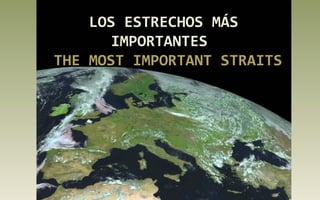
  • 1. LOS ESTRECHOS MÁS IMPORTANTES THE MOST IMPORTANT STRAITS
  • 2. ESTRECHO DE GIBRALTAR STRAIT OF GIBRALTAR Separa Europa de África, España de Marruecos. Menos de 15 km separan las puntas de Oliveros y Cires. Aquí convergen el Mar Mediterráneo con el Océano Atlántico. It separates Europe from Africa, Spain from Morocco. Less than 15 km separate the tips of Oliveros and Cires. Here the Mediterranean Sea joins the Atlantic Ocean.
  • 3. El Estrecho de Gibraltar desde Ceuta.
  • 4. El Estrecho desde Sierra Bermeja. Enfrente el Peñón. Al fondo África. The strait from Sierra Bermeja. In front, Gibraltar and África.
  • 5. ESTRECHO DE MAGALLANES STRAIT OF MAGELLAN Conecta el Océano Atlántico con el Pacífico a través de la Tierra del Fuego de Argentina y Chile. The strait connects the Atlantic Ocean to the Pacific through the Tierra del Fuego in Argentina and Chile.
  • 7.
  • 8.
  • 9. ESTRECHO DE BERING STRAIT OF BERING Separa Siberia de Alaska con una distancia de 64 km. En el centro, las islas Diómedes que marcan el cambio de fecha. Se sabe que el ser humano migró desde Asia a América cuando esta zona estaba cubierta de hielo en la última glaciación. It Separates Siberia from Alaska with a distance of 64 km. In the center, the Diomede islands that mark the change of date. It is known that humans migrated from Asia to America when this area was covered by ice during the last glaciation. Rusia Alaska
  • 10. Vitus Jonassen Bering , marino danés que trabajó para Rusia y navegó desde Kamchatka hasta la costa norteamericana. Vitus Jonassen Bering, a Danish sailor who worked for Russia and sailed from Kamchatka to the North American coast.
  • 11. Islas Diomedes. La grande pertenece a Rusia y la pequeña a Estados Unidos. Diomede Islands. The larger belongs to Russia and the smaller to The United States.
  • 12. ESTRECHO DE LOS DARDANELOS DARDANELLES STRAIT El antiguo Helesponto griego. Comunica el Mar Egeo con el Mar de Mármara. Mide 71 Km. Fue uno de los escenarios de la famosa Guerra de Troya y de la batalla de Gallipoli en la I Guerra Mundial. The ancient Greek Hellespont. Connects the Aegean Sea with the Sea of Marmara. It is 71​​ kilometers and was one of the famous scenes of the Trojan War and the Battle of Gallipoli in the First World War.
  • 13. Una de las a orillas de los Dardanelos. One of the shores of the Dardanelles. Cueva de Anzac. Gallipoli. Anzac Cave. Gallipoli.
  • 14. ESTRECHO DEL BÓSFORO BOSPHORUS STRAIT Comunica el Mar de Mármara con el Mar Negro, el antiguo Ponto Euxino. A ambos lados del estrecho se sitúa la ciudad de Estambul, la antigua Constantinopla. It connects the Sea of Marmara with​​ the Black Sea, the ancient Pontus Euxine. The city of Istanbul, the former Constantinople, is situated on both sides of the Strait.
  • 15. Estrecho del Bósforo y la ciudad de Estambul. Bosphorus strait and the city of Istambul. Mar de Mármara Estambul Ciudad vieja Mar Negro
  • 16. Bahía de Istinye Istinye Bay. Salida del Bósforo al Mar Negro al fondo. Mouth into the Black Sea in front.
  • 17. ESTRECHO DE BONIFACIO STRAIT OF BONIFACIO Separa las islas de Córcega y Cerdeña en el Mar Tirreno. It’s between Corsica and Sardinia in the Tyrrhenian Sea.
  • 18. Acantilados de Bonifacio en Córcega. Bonifaccio Cliffs in Corsica
  • 19. Pueblo de Bonifacio. Córcega. Francia Bonifacio village. Corsica. France. Vista aérea del Estrecho de Bonifacio. Aereal view of the Strait.
  • 20. ESTRECHO DE MESINA STRAIT OF MESSINA Situado entre Calabria, en la Península Itálica y la isla de Sicilia. Existen proyectos para construir un puente que una ambas costas, pero es una zona sísmica. Located between Calabria in the Italian Peninsula and the island of Sicily. There are plans to build a bridge linking both coasts, but it is an earthquake zone.
  • 21.
  • 22. Vista del Estrecho desde Reggio di Calabria. Al fondo Sicilia y el volcán Etna. The Strait seen from Reggio di Calabria. In the distance Sicily and Etna Volcano.
  • 23. CANAL DE LA MANCHA ENGLISH CHANNEL Su punto más estrecho, el paso de Calais a Dover, de 32,5 km, separa Francia de Gran Bretaña. Its narrowest point, the passage from Calais to Dover, 32.5 km, separates France from Britain.
  • 24. Acantilados blancos de Beachy Head en Gran Bretaña, formados por rocas calizas que siguen erosionándose por las olas. White cliffs of Beachy Head in Britain, formed by limestone rocks, that are eroded by waves.
  • 25. Desde 1994 se puede cruzar el canal por el Eurotunnel, de 50,5 Km, desde Folkestone hasta Calais-Coquelles, en 35minutos. The Channel tunner is a 50.5Km rail that links Folkestone with Calais-Coquelles in 35 minutes. It was opened in 1994.
  • 26. ESTRECHO DE FLORIDA STRAIT OF FLORIDA Separa la Península de Florida, en los Estados Unidos, de la isla de Cuba. Tiene una anchura mínima de 160 km. Separates the Peninsula of Florida, in the United States, from the island of Cuba. It has a minimum width of 160 km. Florida Bahamas Cuba Gulf of Mexico
  • 27.
  • 29. Key West. Cayo Oeste. La tormenta tropical Isaac se acerca a los cayos. Tropical Storm Isaac is approaching the Keys.
  • 30. ESTRECHO DE YUCATÁN STRAIT OF YUCATAN E.Yucatán Se le conoce también como Canal de Yucatán. Con una anchura de 217 Km, separa la Península del Yucatán, en México, de la isla de Cuba. Une el Mar Caribe con el Golfo de México. Yucatan Strait, known as Yucatan Channel, 217 km wide, is between Mexico and Cuba. It connects the Caribbean Sea with the Gulf of Mexico.
  • 31. En esta zona se forman tormentas tropicales que afectan a Cuba, México y Estados Unidos. En la imagen la tormenta Karen, en octubre de 2013. In this area, tropical storms affecting Cuba, Mexico and the United States are formed. Photo: Storm Karen in October 2013.
  • 32. ESTRECHO DE DINAMARCA DENMARK STRAIT Separa Groenlandia de Islandia y conecta el Mar de Groenlandia con el Océano Atlántico. Tiene 480 km de largo y 290 km de ancho. La corriente marina pasa a través del estrecho transportando icebergs al océano Atlántico. It’s between Greenland and Iceland and connects the Greenland Sea with the Atlantic Ocean. It stretches 300 miles (480 km) long and 180 miles (290 km) miles wide. The cold current passes through the strait and carries icebergs south into the North Atlantic.
  • 33. En mayo de 1941, durante la Segunda Guerra Mundial, un acorazado del ejército alemán de nombre Bismark, hundiría al crucero militar británico Hood. In May 1941, during The World War II, a German battleship, called Bismark, sank the British cruiser Hood.
  • 34. ESTRECHO DE HUDSON HUDSON STRAIT Conecta el océano Atlántico con la bahía de Hudson. Se encuentra entre la Península de Ungava (Labrador) y la Tierra de Baffin. El estrecho de Hudson es navegable sólo a finales del verano. Hudson Strait links the Atlantic Ocean to Hudson Bay in Canada. This strait lies between Baffin Island and the northern coast of Quebec. Hudson Strait is navigable only in late summer. Not official portrait of Henry Hudson (1565-1611)
  • 35.
  • 36. ESTRECHO DE DAVIS DAVIS STRAIT Separa Groenlandia de la Isla de Baffin. Tiene una anchura de entre 338 a 664 km. El primer europeo que realmente navegó y reconoció el estrecho fue John Davis en 1583, buscando un paso hacia el Noroeste. Hacia 1650 se cazaban ballenas en sus aguas. It lies between mid-western Greenland and Nunavut, Canada's Baffin Island. To the north is Baffin Bay. The strait was named for the English explorer John Davis, who explored the area while seeking a Northwest Passage. By the 1650s it was used for whale hunting.
  • 38. Desembocadura de un fiordo de la isla de Baffin en el Estrecho de Davis, al fondo. Mouth of a fjord of Baffin Island in the Davis Strait, in the distance.
  • 39. ESTRECHO DE COOK COOK STRAIT Separa la Isla Norte de la Isla Sur de Nueva Zelanda. Tiene una anchura mínima de 25 Km. Es muy peligroso debido a sus mareas y tormentas. Recibe el nombre del marino inglés James Cook. Cook Strait is between the North and South Islands of New Zealand. It is 25 km (14 miles) wide at its narrowest point, and is considered very dangerous because of its tides and storms. It’s named after the British sailor James Cook.
  • 40. El Estrecho de Cook desde lo alto del Monte Victoria junto a la ciudad de Wellington, Nueva Zelanda. A view of Cook Strait from the top of Mount Victoria, near Wellington, New Zealand.
  • 41. James Cook, explorador y navegante inglés del siglo XVIII, que realizó tres viajes al Océano Pacífico. James Cook, British explorer and navigator, 18th century, who made three voyages to the Pacific Ocean.
  • 42.
  • 43. ESTRECHO DE ORMUZ STRAIT OF HORMUZ Es un estrecho situado entre el Golfo de Omán y el Golfo Pérsico, con una anchura de 39 a 100 km. Es un punto estratégico debido al comercio del petróleo. The Strait of Hormuz is between the Gulf of Oman and the Persian Gulf. It is from 39 to 100 km wide, and it is one of the world's most strategically important choke points due to petroleum trade.
  • 44. Vista del Golfo Pérsico desde el puesto de mando del castillo portugués en Ormuz. Persian Gulf viewed from the commander seat of Portuguese Hormoz castle.
  • 45. Khezr Beach, Hormoz Island, Persian Gulf, Iran
  • 46. Los continuos conflictos con Irán han provocado la construcción de oleoductos a través de la Península Arábiga para evitar el paso de los barcos por el Estrecho de Ormuz. The continuing conflicts with Iran have caused the construction of pipelines through the Arabian Peninsula to prevent passage of vessels through the Strait of Hormuz.
  • 47. ESTRECHO DE MALACA STRAIT OF MALACCA Estrecho de M alaca E.Singapur Separa Malasia de la isla de Sumatra en Indonesia. Es una de las vías de navegación más importante del mundo. Comunica también con el Estrecho de Singapur. It’s between the Malay Peninsula and the Indonesian island of Sumatra. It’s one of the most important shipping channels. It links with the Strait of Singapore too.
  • 48. Singapur, puerta de entrada al Estrecho del Malaca desde el de Singapur. Singapore, gate way to the Strait of Malacca. Barcas atracadas en el puerto de Kelang. Boats moored at Port Kelang harbour.
  • 49. CANAL DE MOZAMBIQUE MOZAMBIQUE CHANNEL Es un brazo del Océano Índico localizado entre Madagascar y Mozambique. Mide unos 460 Km. The Mozambique Channel is an arm of the Indian Ocean located between Madagascar and Mozambique. The channel is approximately 460 km (286 miles).
  • 50. Archipiélago de Barazuto en el Canal de Mozambique. Magaruque Island.
  • 51. ESTRECHO DE COREA KOREA STRAIT Separa la Península de Corea de las islas de Kyushu and Honshu en Japón. Mide unos 200 km de ancho. Las islas Tsushima dividen el estrecho en dos zonas, oriental y occidental. The strait separates the Korean Peninsula from the islands of Kyushu and Honshu in Japan. It is about 200 km wide. The Tsushima islands divide the strait into two areas, East and West. Korea Strait
  • 52. Isla volcánica de Jeju, en Corea del Sur.
  • 53. Canal Manzekisto en la isla de Tsushima en el centro del Estrecho de Corea. Cabo /Cape Tsutsuzaki en Tsushima. Tsushima leopard cat
  • 54. ESTRECHO JUAN DE FUCA JUAN DE FUCA STRAIT Es un estrecho marino que bordea la isla de Vancouver por el sur, conectándola con el Océano Pacífico. It is a sea strait bordering Vancouver Island to the south, connecting it with the Pacific Ocean.
  • 55. Monte Olimpia desde el Estrecho de Juan de Fuca.
  • 56. PASO DRAKE DRAKE PASSAGE Separa América del sur de la Antártida. Llamado también Mar de Hoces, por el explorador español que lo descubrió. Francis Drake fue arrastrado por las corrientes hacia el sur desde el Estrecho de Magallanes. Drake Passage separates South America from Antarctica. Also called Hoces Sea, after the Spanish explorer who discovered it half a century before Francis Drake was swept by currents southward from the Strait of Magellan.
  • 57. El Cabo de Hornos desde el Paso de Drake
  • 58. Carabela San Lesmes, con la que Francisco de Hoces descubrió el mar que lleva su nombre. Caravel San Lesmes. Francisco de Hoces sailed on her when he discovered the sea that bears his name.
  • 59. ESTRECHO DE SKAGERRAK SKAGERRAK STRAIT Skagerrak conecta el Mar del Norte con el área de Kattegat hacia el Mar Báltico entre Noruega y Dinamarca. Skagerrak connects the Norh Sea with the Kattegat sea area that leads to the Baltic Sea between Norway and Denmark.
  • 60. Skagen. El cabo más al norte de la Península de Jutlandia, Dinamarca. The northernmost point of Denmark is called Grenen (The Branch)
  • 61. Risor, Norway Costa de Skagerrak, Noruega.
  • 62. ESTRECHO DE ORESUND ORESUND STRAIT Separa la isla danesa Selandia de Escania provincia del sur de Suecia. El puente, inaugurado en el año 2000, conecta Copenhague con la ciudad sueca de Malmö. The strait separates de Danish island Zeeland from Skane, province in the south of Sweeden. The bridge, opened in the year 2000, connects Copenhagen and the Sweedish city of Malmö.
  • 63. Puente y túnel de Oresund. Bridge and tunnel of Oresund. Malmö, Sweeden
  • 64. Un puente de 20 Km une Dinamarca con Suecia. A 20Km bridge links Denmark and Sweden.
  • 65. Copenhague con el canal de Nyhavn y al fondo Oresund.
  • 66. CANAL DEL NORTE NORTH CHANNEL Conocido también como Mar de Moyle, separa el este de Irlanda del Norte del suroeste de Escocia y conecta el mar de Irlanda con el océano Atlántico. Known as Sea of Moyle, separates north-eastern Ireland from south- western Scotland. And connects the Irish Sea with the Atlantic Ocean.
  • 67.
  • 68. Esta presentación tiene únicamente una finalidad cultural, sin ánimo de lucro. Only cultural purpose. Non profit. All rights reserved. Música: Serenity. Eternal ocean wave. Images and maps from the web. (Todas las imágenes son propiedad de sus autores.) All images belong to their authors) Ciencias Soci@les Realización: Carmen Madruga https://csociales.wordpress.com/ http://www.slideshare.net/carmadruga/ http://www.authorstream.com/Presentation/carm adruga-2119498-los-estrechos-importantes-del- mundo/