Recomendados

Recomendados
Más contenido relacionado
Similar a Dominio de l a estacion total topcon gt3000
Similar a Dominio de l a estacion total topcon gt3000 (7)
Último
Último (20)
Dominio de l a estacion total topcon gt3000
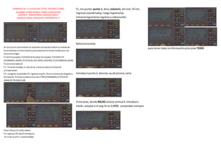
- 1. DOMINIO DE L A ESTACION TOTAL TOPCON GT3000 ALUMNO: PUMA ROQUE FRANZ GSNAYDHER DOCENTE: ARREDONDO CARRACO BERLY SENCICO ZONAL AREQUIPA TOPOGRAFÍA II Al colocar el instrumento en estaciónydespuésrealizar la nivelación Encendemos el instrumentoypresionamos la teclaestrella que nos muestra lo Sgte. F1 (brillopropio), FLECHASverticales( Contraste), FLECAHA HZ (PLOMADA LASER),F2 (VISUAL DEL NIVEL DIGITA)L,F3 (PLOMADA LASER) Funcionesespecial: F1: línea de trabajo, si solose va a visar puntos enforma de alineamiento F2: congelar la pantalla,F3: ingresar angHz, Para la lectura de ángulos y distancias. Primerovisamos el puntoY PRESIONAMOSLA TECLA DE IMAGEN TRIANGULAR Crear trbajo.f1.colect datos F1 ingresar,f2 lista,f3 introducir, En este casof1, nuevotrabajo f1, nro punto:punto 1, desc;estcion1, altinstr,f4 intr, ingresarcoordenadas,luegoregistrarlas, Volveráregistrarlasregistrarysobrescribir Referenciaatrás Introducirpunto2, descrip:va,alt prisma:varia Vistaatrás, desde NE/AZcolocar azimut0. Introducir, medir,aceptarsi el ang Hz es 0.0000. comprobarsiempre para tenertoda lainformaciónpresionarTODO