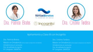
Tratamiento de Clase III con ortodoncia lingual Incógnito
•
0 recomendaciones•83,330 vistas
Tratamiento de Clase III dentaria con ortodoncia lingual Incógnito en la Clínica Ferrus & Bratos de Madrid.
Denunciar
Compartir
Denunciar
Compartir

Recomendados
Maloclusiones clase iii
Maloclusiones clase III
En esta presentación encontrara:
- Estudio diagnóstico
- Diagnóstico y plan de tratamineto
- Ortodoncia prequirúrgica
- Planificación de la cirugía ortognática
- Cirugía ortognática
- Ortodoncia post quirúrgica
En Clínica Birbe somos una clínica con dedicación exclusiva a la cirugía maxilofacial e implantología. Disponemos de un equipo humano a la vanguardia de nuestra especialidad y de unas instalaciones biotecnológicas de última generación.
www.birbe.org
The world of industry
The document discusses industry and industrial activity. It defines the secondary sector as including economic activities that transform raw materials into other products to meet human needs, such as industry, mining, energy production, and construction. It describes the evolution of industry from manual industry before the 18th century to modern industry driven by machines and new energy sources during the Industrial Revolutions. It also discusses the types of industries created, industrial spaces, industrial regions around the world, and the industrial areas of Europe.
Projections
Maps represent areas of land on a flat surface, but the Earth is spherical. Projections allow maps to display the globe on a flat surface, though they distort the surface to some degree. There are several types of projections, including planar, cylindrical and conic projections. Scale relates the size shown on a map to actual distances, which can be expressed numerically as a ratio or linearly with a divided line. A linear scale directly measures distances on a map.
An overview of geography
Geography is the oldest of the sciences, studying the Earth and its features, as well as human cultures and settlements. The word geography comes from the Greek words "geo," meaning Earth, and "graphy," meaning writing. Today geography is commonly divided into physical geography, which examines the natural world, and cultural geography, also called human geography, which studies human cultures and activities. Geographers study topics like languages, religions, populations, politics, agriculture, and urban areas to understand their impact on the planet. They provide important analysis for governments and other organizations on issues relating to the environment, development, and more.
The palace of El Escorial
The Palace of El Escorial is located near Madrid in central Spain. Construction began in 1563 at the request of King Philip II, who wanted to honor his father Emperor Charles V and serve as a royal burial site. The palace was completed in 1584 and designed by architects Juan Bautista de Toledo and Juan de Herrera in a unified Renaissance style. Important artists like El Greco contributed decorations and paintings that complemented the architecture.
Unit 6 The Catholic Monarchs and the Discovery of America
The document summarizes key events and developments during the reign of the Catholic Monarchs in Spain, including their domestic and foreign policies. It also discusses the discovery and conquest of America in the late 15th century. Some of the main points covered include:
- The Catholic Monarchs subjected the nobility and clergy to royal authority and created a permanent army and common laws across their territories.
- They conquered the Kingdom of Granada in 1492 and expelled the Jews, extending the Spanish Inquisition.
- Through strategic marriages, they formed alliances with other European powers and expanded Spanish territory in North Africa and the Mediterranean.
- They supported expeditions that led to Christopher Columbus' discovery of America in 1492
The political organisation of the world
Geopolitics examines how societies are organized in relation to geographic space. The basic unit of organization is the state, which has sovereignty over its economy, politics, and culture. Currently, states cede some sovereignty to supranational organizations like the EU and UN for reasons of unity, free market access, and cooperation. The world contains over 200 states with complex political and economic relationships. Powerful countries like the US dominate politically, while wealthy nations like those in the EU and North America form the economic center. Developing and least developed countries have different economic roles within the global system.
Unit 1 from prehistory to the middle ages
This document provides an overview of world history from prehistory through the Middle Ages. It covers the Stone Age and development of tools/art. The Metal Ages brought new technologies. Ancient civilizations like Mesopotamia, Egypt, Greece and Rome are examined. The Middle Ages saw three major civilizations: the Byzantine Empire, the Islamic Caliphate, and Christian Europe. Key developments include the rise of cities, trade routes, and artistic styles like Romanesque and Gothic architecture.
Primary sector
This document provides information about primary sector activities and traditional and modern agricultural landscapes. It discusses traditional farming methods like slash and burn agriculture, dry sedentary agriculture, and monsoon irrigation agriculture. It also describes developed agricultural landscapes in new world countries and Europe. Livestock farming systems like nomadic, transhumant, extensive, and intensive are explained. The document concludes with a section about fishing and fishing grounds.
Spain landscape and territorial organisation.
Spain has a diverse landscape and climate due to its location between Europe and Africa and between the Atlantic and Mediterranean seas. The central plateau covers much of the country at an average altitude of 660 meters. Mountain ranges surround the plateau and Spain has coastal regions along the Cantabrian Sea, Mediterranean, and Atlantic coasts. Rivers are grouped into three watersheds. Vegetation varies by climate, altitude, and distance from the sea in four main regions: the Mediterranean coast, central plateau, Atlantic coast, and Canary Islands. Spain is a parliamentary monarchy with political power divided between national and regional institutions.
Types of maps
The document discusses different types of maps. It begins by defining maps as pictures of Earth's surface that can depict both physical features and specific topics through the use of themes. The document then describes several common map types including political, physical, topographic, climate, economic, road, and thematic maps. It notes thematic maps began to develop in the 17th century once base maps became accurate enough, and provides some early examples of thematic maps created for navigation, meteorology, and analyzing cholera outbreaks.
Unit 0 the elements of a civilization
This document defines and discusses the key elements that characterize human civilizations, including chronology, geography, politics, economy, society, and culture. It notes that a civilization has a complex organization and is unique due to the specific nature and arrangement of these defining elements. The document provides examples and explanations of each element, such as how chronology establishes the order of important events through timelines, the different types of government like monarchy and republic, and how culture encompasses a society's beliefs, customs, and achievements.
The economic organisation of society
The document provides an overview of economic systems and economic activity. It discusses how economies work to satisfy people's needs through production, distribution, and consumption. The key factors that affect production are natural resources, labor, capital, and technology/expertise. Economic activity is divided into four sectors - primary, secondary, tertiary, and quaternary. The document also describes different types of economic systems including subsistence, capitalist, planned, and alternative economies.
Unit 8 Reformation, Humanism, Renaissance Art
This document provides an overview of humanism, the Protestant Reformation, the Counter-Reformation, and Renaissance art. It discusses key figures like Martin Luther who initiated the Protestant Reformation by rejecting the Pope's authority. It also describes the Counter-Reformation led by the Catholic Church in response to Protestantism through the Council of Trent. Additionally, it characterizes humanism as an intellectual movement that placed human beings at the center. Finally, it outlines the characteristics and major artists of the Renaissance in Italy, including figures like Brunelleschi, Ghiberti, Botticelli, Michelangelo, Raphael, and Leonardo da Vinci.
Unit 7 the spanish empire
The document provides an overview of the Spanish Empire during the 16th century, which was marked by the reign of the Habsburg monarchs Carlos I and Felipe II. It discusses their domestic and foreign policies, including Carlos I inheriting kingdoms across Europe and fighting wars against France and the Ottoman Empire, and Felipe II establishing Madrid as the capital and fighting conflicts in the Netherlands and against England. It also summarizes the conquest of the Aztec and Inca Empires in the Americas in the 1520s and 1530s, and the consequences of the discovery, such as Spain and Portugal becoming colonial empires and the introduction of new crops and livestock to Europe and America.
Unit 2 planet earth
This document provides information about the Earth's geography. It begins by describing the Earth's shape as a sphere and its rotation on an axis. It then defines key geographic terms like poles, hemispheres, and latitude and longitude. Subsequent sections explain concepts such as time zones, ocean currents, climate zones, and the composition of the Earth. Activities are included throughout to reinforce the material. The document serves as a comprehensive overview of basic Earth science concepts.
Selection of features maps
Este documento lista las principales características geográficas de España como cabos, montañas, sistemas montañosos, islas, golfos, depresiones y ríos. Incluye los nombres de las principales cadenas montañosas como los Picos de Europa, los Pirineos y los Sistemas Béticos, así como los principales ríos como el Miño, Ebro, Guadalquivir y Tajo junto con algunos de sus afluentes. También proporciona dos enlaces web para practicar la geografía española.
Tertiary sector
The tertiary sector includes economic activities that provide services rather than produce material goods, such as commerce, transportation, and leisure activities like tourism. Until the 20th century, tourism was limited to the wealthy, but it is now a major industry in developed countries. The tertiary sector accounts for a large share of GDP and employment in developed nations, where access to services is widespread, while in developing countries services are less developed and important.
Lesson plan resources vocabulary and images_the3economic sectors
Eko Stahl Ag is a steel company located in Germany. The document discusses three images that represent different economic sectors: cultural tourism in the tertiary sector shown through a tour guide explaining an old church to visitors; the construction industry's impact on the environment seen through the transformation of an undeveloped landscape into buildings and infrastructure; and agriculture in the primary sector depicted by farmers collecting rice in Southeast Asia using manual techniques.
Geographic features of the earth!
This document discusses various types of geographic features on Earth. It describes continental relief forms like plains, plateaus, mountains and depressions. It also explains coastal relief features such as capes, gulfs, peninsulas, estuaries, fjords and deltas. Additionally, it outlines submarine relief including mid-ocean ridges, abyssal plains, and marine trenches located on the ocean floor.
Renaissance art
The document provides an overview of Renaissance art, which originated in 15th century Italy in Florence and saw a rebirth of classical Greco-Roman artistic styles and techniques. Key characteristics included a focus on classicism, realism, perspective, and the human figure. Major artists from this period included Brunelleschi, Donatello, Michelangelo, Leonardo Da Vinci, and Raphael. The Renaissance then spread to other parts of Europe, including the development of oil painting techniques in Flanders by artists such as the Van Eyck brothers and Hieronymus Bosch.
Caso clínico: antes y después de ortodoncia con brackets de zafiro
¿Qué problemas corrige la ortodoncia con brackets de zafiro y qué ventajas tiene? Caso de estudio: antes y después de ortodoncia con brackets de zafiro en la clínica Ferrus & Bratos
Caso clínico: antes y después de ortodoncia con brackets linguales Incognito
¿Qué problemas corrige la ortodoncia con brackets linguales y qué ventajas tiene? Caso de estudio: antes y después de ortodoncia con brackets linguales Incognito en la clínica Ferrus & Bratos.
Caso clínico: antes y después de ortodoncia con brackets Damon de autoligado
¿Qué problemas corrige la ortodoncia autoligable y qué ventajas tiene? Caso de estudio: antes y después de ortodoncia con brackets Damon de autoligado en la clínica Ferrus & Bratos.
Casos de injerto de encía
El documento presenta la biografía del Dr. Jorge Ferrús, quien es máster en Periodoncia e Implantes por la Universidad Complutense de Madrid y profesor colaborador en ese mismo posgrado. Además, describe brevemente el procedimiento de injerto de encía, indicando que consiste en tomar tejido de la encía del paladar e insertarlo en la zona a tratar para cubrir la raíz del diente expuesta.
Casos de gingivectomía estética
La gingivectomía estética es una cirugía indicada para pacientes con mucha encía visible al sonreír. Consiste en contornear la forma de la encía con un bisturí eléctrico para mostrar más diente y mejorar estéticamente la sonrisa. También puede mejorar el ajuste de coronas o carillas.
Antes despues-invisalign
Un paciente con clase II división 2 presentaba incisivos laterales vestibulizados e incisivos centrales lingualizados, con apiñamiento en ambas arcadas. Tras 22 meses de tratamiento con Invisalign, se corrigió el apiñamiento y la posición de los incisivos, logrando una oclusión y estética dental óptimas.
Brackets zafiro-1
El paciente presentaba apiñamiento severo superior e inferior, sobremordida aumentada, incisivos laterales cruzados y premolares lingualizados. El tratamiento con brackets de zafiro durante 20 meses corrigió con éxito el apiñamiento y alineó los dientes.
Clase ii extracciones superiores
El paciente presentaba apiñamiento dental severo en la mandíbula superior e inferior, sobremordida aumentada, y caninos altos. Se realizó tratamiento ortodóncico durante 24 meses con brackets de zafiro, incluyendo la extracción de dos premolares superiores, lo que corrigió el apiñamiento y mejoró la oclusión.
Ortodoncia lingual antes y después
El paciente tenía una mordida abierta anterior, clase III dentaria y apiñamiento superior e inferior. Recibió ortodoncia lingual con Incógnito durante 18 meses, usando elásticos los últimos 3 meses. Esto corrigió el apiñamiento y las rotaciones individuales, mejorando su mordida y alineación dental.
Más contenido relacionado
Destacado
Primary sector
This document provides information about primary sector activities and traditional and modern agricultural landscapes. It discusses traditional farming methods like slash and burn agriculture, dry sedentary agriculture, and monsoon irrigation agriculture. It also describes developed agricultural landscapes in new world countries and Europe. Livestock farming systems like nomadic, transhumant, extensive, and intensive are explained. The document concludes with a section about fishing and fishing grounds.
Spain landscape and territorial organisation.
Spain has a diverse landscape and climate due to its location between Europe and Africa and between the Atlantic and Mediterranean seas. The central plateau covers much of the country at an average altitude of 660 meters. Mountain ranges surround the plateau and Spain has coastal regions along the Cantabrian Sea, Mediterranean, and Atlantic coasts. Rivers are grouped into three watersheds. Vegetation varies by climate, altitude, and distance from the sea in four main regions: the Mediterranean coast, central plateau, Atlantic coast, and Canary Islands. Spain is a parliamentary monarchy with political power divided between national and regional institutions.
Types of maps
The document discusses different types of maps. It begins by defining maps as pictures of Earth's surface that can depict both physical features and specific topics through the use of themes. The document then describes several common map types including political, physical, topographic, climate, economic, road, and thematic maps. It notes thematic maps began to develop in the 17th century once base maps became accurate enough, and provides some early examples of thematic maps created for navigation, meteorology, and analyzing cholera outbreaks.
Unit 0 the elements of a civilization
This document defines and discusses the key elements that characterize human civilizations, including chronology, geography, politics, economy, society, and culture. It notes that a civilization has a complex organization and is unique due to the specific nature and arrangement of these defining elements. The document provides examples and explanations of each element, such as how chronology establishes the order of important events through timelines, the different types of government like monarchy and republic, and how culture encompasses a society's beliefs, customs, and achievements.
The economic organisation of society
The document provides an overview of economic systems and economic activity. It discusses how economies work to satisfy people's needs through production, distribution, and consumption. The key factors that affect production are natural resources, labor, capital, and technology/expertise. Economic activity is divided into four sectors - primary, secondary, tertiary, and quaternary. The document also describes different types of economic systems including subsistence, capitalist, planned, and alternative economies.
Unit 8 Reformation, Humanism, Renaissance Art
This document provides an overview of humanism, the Protestant Reformation, the Counter-Reformation, and Renaissance art. It discusses key figures like Martin Luther who initiated the Protestant Reformation by rejecting the Pope's authority. It also describes the Counter-Reformation led by the Catholic Church in response to Protestantism through the Council of Trent. Additionally, it characterizes humanism as an intellectual movement that placed human beings at the center. Finally, it outlines the characteristics and major artists of the Renaissance in Italy, including figures like Brunelleschi, Ghiberti, Botticelli, Michelangelo, Raphael, and Leonardo da Vinci.
Unit 7 the spanish empire
The document provides an overview of the Spanish Empire during the 16th century, which was marked by the reign of the Habsburg monarchs Carlos I and Felipe II. It discusses their domestic and foreign policies, including Carlos I inheriting kingdoms across Europe and fighting wars against France and the Ottoman Empire, and Felipe II establishing Madrid as the capital and fighting conflicts in the Netherlands and against England. It also summarizes the conquest of the Aztec and Inca Empires in the Americas in the 1520s and 1530s, and the consequences of the discovery, such as Spain and Portugal becoming colonial empires and the introduction of new crops and livestock to Europe and America.
Unit 2 planet earth
This document provides information about the Earth's geography. It begins by describing the Earth's shape as a sphere and its rotation on an axis. It then defines key geographic terms like poles, hemispheres, and latitude and longitude. Subsequent sections explain concepts such as time zones, ocean currents, climate zones, and the composition of the Earth. Activities are included throughout to reinforce the material. The document serves as a comprehensive overview of basic Earth science concepts.
Selection of features maps
Este documento lista las principales características geográficas de España como cabos, montañas, sistemas montañosos, islas, golfos, depresiones y ríos. Incluye los nombres de las principales cadenas montañosas como los Picos de Europa, los Pirineos y los Sistemas Béticos, así como los principales ríos como el Miño, Ebro, Guadalquivir y Tajo junto con algunos de sus afluentes. También proporciona dos enlaces web para practicar la geografía española.
Tertiary sector
The tertiary sector includes economic activities that provide services rather than produce material goods, such as commerce, transportation, and leisure activities like tourism. Until the 20th century, tourism was limited to the wealthy, but it is now a major industry in developed countries. The tertiary sector accounts for a large share of GDP and employment in developed nations, where access to services is widespread, while in developing countries services are less developed and important.
Lesson plan resources vocabulary and images_the3economic sectors
Eko Stahl Ag is a steel company located in Germany. The document discusses three images that represent different economic sectors: cultural tourism in the tertiary sector shown through a tour guide explaining an old church to visitors; the construction industry's impact on the environment seen through the transformation of an undeveloped landscape into buildings and infrastructure; and agriculture in the primary sector depicted by farmers collecting rice in Southeast Asia using manual techniques.
Geographic features of the earth!
This document discusses various types of geographic features on Earth. It describes continental relief forms like plains, plateaus, mountains and depressions. It also explains coastal relief features such as capes, gulfs, peninsulas, estuaries, fjords and deltas. Additionally, it outlines submarine relief including mid-ocean ridges, abyssal plains, and marine trenches located on the ocean floor.
Renaissance art
The document provides an overview of Renaissance art, which originated in 15th century Italy in Florence and saw a rebirth of classical Greco-Roman artistic styles and techniques. Key characteristics included a focus on classicism, realism, perspective, and the human figure. Major artists from this period included Brunelleschi, Donatello, Michelangelo, Leonardo Da Vinci, and Raphael. The Renaissance then spread to other parts of Europe, including the development of oil painting techniques in Flanders by artists such as the Van Eyck brothers and Hieronymus Bosch.
Destacado (13)
Lesson plan resources vocabulary and images_the3economic sectors
Lesson plan resources vocabulary and images_the3economic sectors
Más de Clínica Ferrus & Bratos
Caso clínico: antes y después de ortodoncia con brackets de zafiro
¿Qué problemas corrige la ortodoncia con brackets de zafiro y qué ventajas tiene? Caso de estudio: antes y después de ortodoncia con brackets de zafiro en la clínica Ferrus & Bratos
Caso clínico: antes y después de ortodoncia con brackets linguales Incognito
¿Qué problemas corrige la ortodoncia con brackets linguales y qué ventajas tiene? Caso de estudio: antes y después de ortodoncia con brackets linguales Incognito en la clínica Ferrus & Bratos.
Caso clínico: antes y después de ortodoncia con brackets Damon de autoligado
¿Qué problemas corrige la ortodoncia autoligable y qué ventajas tiene? Caso de estudio: antes y después de ortodoncia con brackets Damon de autoligado en la clínica Ferrus & Bratos.
Casos de injerto de encía
El documento presenta la biografía del Dr. Jorge Ferrús, quien es máster en Periodoncia e Implantes por la Universidad Complutense de Madrid y profesor colaborador en ese mismo posgrado. Además, describe brevemente el procedimiento de injerto de encía, indicando que consiste en tomar tejido de la encía del paladar e insertarlo en la zona a tratar para cubrir la raíz del diente expuesta.
Casos de gingivectomía estética
La gingivectomía estética es una cirugía indicada para pacientes con mucha encía visible al sonreír. Consiste en contornear la forma de la encía con un bisturí eléctrico para mostrar más diente y mejorar estéticamente la sonrisa. También puede mejorar el ajuste de coronas o carillas.
Antes despues-invisalign
Un paciente con clase II división 2 presentaba incisivos laterales vestibulizados e incisivos centrales lingualizados, con apiñamiento en ambas arcadas. Tras 22 meses de tratamiento con Invisalign, se corrigió el apiñamiento y la posición de los incisivos, logrando una oclusión y estética dental óptimas.
Brackets zafiro-1
El paciente presentaba apiñamiento severo superior e inferior, sobremordida aumentada, incisivos laterales cruzados y premolares lingualizados. El tratamiento con brackets de zafiro durante 20 meses corrigió con éxito el apiñamiento y alineó los dientes.
Clase ii extracciones superiores
El paciente presentaba apiñamiento dental severo en la mandíbula superior e inferior, sobremordida aumentada, y caninos altos. Se realizó tratamiento ortodóncico durante 24 meses con brackets de zafiro, incluyendo la extracción de dos premolares superiores, lo que corrigió el apiñamiento y mejoró la oclusión.
Ortodoncia lingual antes y después
El paciente tenía una mordida abierta anterior, clase III dentaria y apiñamiento superior e inferior. Recibió ortodoncia lingual con Incógnito durante 18 meses, usando elásticos los últimos 3 meses. Esto corrigió el apiñamiento y las rotaciones individuales, mejorando su mordida y alineación dental.
Más de Clínica Ferrus & Bratos (9)
Caso clínico: antes y después de ortodoncia con brackets de zafiro
Caso clínico: antes y después de ortodoncia con brackets de zafiro
Caso clínico: antes y después de ortodoncia con brackets linguales Incognito
Caso clínico: antes y después de ortodoncia con brackets linguales Incognito
Caso clínico: antes y después de ortodoncia con brackets Damon de autoligado
Caso clínico: antes y después de ortodoncia con brackets Damon de autoligado
Último
Enfermedad de wilson - trabajo de informática 2024-I
La enfermedad de Wilson es un trastorno genético autosómico recesivo que impide la eliminación adecuada del cobre del cuerpo, causando su acumulación en órganos como el hígado y el cerebro. Esto provoca síntomas hepáticos (hepatitis, cirrosis), neurológicos (temblores, rigidez muscular) y psiquiátricos (depresión, cambios de comportamiento). Se diagnostica mediante análisis de sangre, orina, biopsia hepática y pruebas genéticas, y se trata con medicamentos quelantes de cobre, zinc, una dieta baja en cobre y, en casos graves, trasplante de hígado.
INFECCIONES RESPIRATORIAS AGUDAS EN NIÑOS DEL PERU.pdf
Aqui vemos conceptos relacionados a las infecciones respiratorias.
Terapia cinematográfica (6) Películas para entender los trastornos del neurod...
Terapia cinematográfica (6) Películas para entender los trastornos del neurod...JavierGonzalezdeDios
Los trastornos del neurodesarrollo comprenden un grupo heterogéneo de trastornos crónicos que se manifiestan en períodos tempranos de la niñez y que, en conjunto, comparten una alteración en la adquisición de habilidades cognitivas, motoras, del lenguaje y/o sociales que impactan significativamente en el funcionamiento personal, social y académico. Tienen su origen en la primera infancia o durante el proceso de desarrollo y comprende a heterogéneos procesos englobados bajo esta etiqueta.
El Manual diagnóstico y estadístico de los trastornos mentales en su quinta edición (DSM-V) incluye dentro los trastornos del neurodesarrollo los siguientes siete grupos: Discapacidad intelectual, Trastornos de la comunicación, Trastorno del espectro del autismo (TEA), Trastorno de atención con hiperactividad (TDAH), Trastornos específico del aprendizaje, Trastornos motores y Trastornos de tics. Es importante tener en cuenta que en una misma persona puede manifestarse más de un trastorno del neurodesarrollo. Y, dentro de todos los trastornos del neurodesarrollo, el autismo adquiere una especial importancia, por lo que será considerado en el próximo capítulo de la serie “Terapia cinematográfica” de forma particular.
Y esta gran diversidad también la ha reflejado en la gran pantalla y en las historias “de cine” que el séptimo arte nos ha regalado. Y hoy proponemos un recordatorio de la amplia variedad y complejidad de los trastornos del neurodesarrollo en la infancia a través de 7 películas argumentales. Estas películas son, por orden cronológico de estreno:
- El milagro de Ana Sullivan (The Miracle Worker, Arthur Penn, 1962) 6, para valorar el milagro de la palabra, el milagro del lenguaje y de los sentidos.
- Forrest Gump (Robert Zemeckis, 1994) 7, para comprender el valor de la lucha por encontrar cuál es la meta de cada uno, una mezcla de destino y sueños propios.
- Estrellas en la Tierra (Taare Zameen Par, Aamir Khan, 2007) 8, para confirmar que cada niño y niña es especial, incluso con sus potenciales deficiencias psíquicas, físicas y/o sensoriales.
- El primero de la clase (Front of the Class, Peter Werner, 2008) 9, para demostrar el valor de la superación y como, a pesar de nuestras dificultades, somos merecedores de oportunidades.
- Cromosoma 5 (María Ripoll, 2013) 10, para entender la soledad del corredor de fondo ante los trastornos del neurodesarrollo.
- Gabrielle (Louise Archambault, 2013) 11, para intentar normalizar las relaciones afectivas y amorosas entre dos personas con enfermedades mentales y discapacidad.
- Línea de meta (Paola García Costas, 2014) 12, para interiorizar que la carrera de la vida es especialmente difícil para algunos.
Siete películas argumentales que el séptimo arte nos presenta con protagonistas afectos con diferentes trastornos del neurodesarrollo durante su infancia, adolescencia y juventud y que nos ayudan a comprender que cada persona es especial, diversa y con capacidades diferenciales que hay que respetar y potenciar.
Hazte socio de la Sociedad Española de Cardiología
La Sociedad Española de Cardiología (SEC) es una organización científica sin ánimo de lucro con la misión de reducir el impacto adverso de las enfermedades cardiovasculares y promover una mejor salud cardiovascular en la ciudadanía.
ASFIXIA Y MANIOBRA DE HEIMLICH - UNIVERSIDAD
En esta presentación encontrarán información detallada sobre cómo realizar correctamente la maniobra de Heimlich y también información sobre lo que es la asfixia.
Pòster "Escara necrótica de aparición súbita en un lactante. Caso clínico".
Pòster "Escara necrótica de aparición súbita en un lactante. Caso clínico".Badalona Serveis Assistencials
Pòster presentat per la pediatra de BSA Sofía Benítez al 70 Congrés de la Sociedad Española de Pediatría, celebrat a Còrdoba del 6 al 8 de juny de 2024. herencia multifactorial, genetica clinica
La predisposición genética no garantiza que una persona desarrollará una enfermedad específica, sino que aumenta el riesgo en comparación con individuos que no tienen esa predisposición genética.
FARMACOLOGIA CLASIFICACION DE QUINOLONAS Y FLUOROQUINOLONAS
CLASIFICACION DE QUINOLONAS Y FLUOROQUINOLONAS, TIPOS MEDICAMENTOS, Y GENERACIONES POR MEDICAMENTOS
Último (20)
Enfermedad de wilson - trabajo de informática 2024-I
Enfermedad de wilson - trabajo de informática 2024-I
INFECCIONES RESPIRATORIAS AGUDAS EN NIÑOS DEL PERU.pdf
INFECCIONES RESPIRATORIAS AGUDAS EN NIÑOS DEL PERU.pdf
Mensuraciones y ponderaciones en la atención primaria
Mensuraciones y ponderaciones en la atención primaria
Terapia cinematográfica (6) Películas para entender los trastornos del neurod...
Terapia cinematográfica (6) Películas para entender los trastornos del neurod...
Hazte socio de la Sociedad Española de Cardiología
Hazte socio de la Sociedad Española de Cardiología
Los Ocho Brocados de Seda del Qi Gong: algunas observaciones
Los Ocho Brocados de Seda del Qi Gong: algunas observaciones
¿Qué entendemos por salud mental? ¿Cómo se construye?
¿Qué entendemos por salud mental? ¿Cómo se construye?
Pòster "Escara necrótica de aparición súbita en un lactante. Caso clínico".
Pòster "Escara necrótica de aparición súbita en un lactante. Caso clínico".
Lineamientos-primera-escucha-en-salud-mental-de-adolescentes-1.pdf
Lineamientos-primera-escucha-en-salud-mental-de-adolescentes-1.pdf
FARMACOLOGIA CLASIFICACION DE QUINOLONAS Y FLUOROQUINOLONAS
FARMACOLOGIA CLASIFICACION DE QUINOLONAS Y FLUOROQUINOLONAS